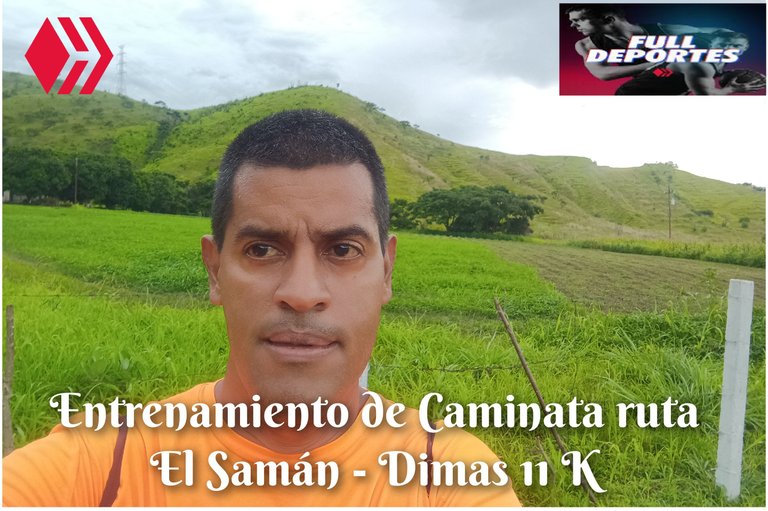
Entrenamiento de Caminata ruta El Samán - Dimas 11K
Greetings, friends of Hive and this community, today I'm going to share with you this walking workout I did today, Wednesday, on the El Samán - New Route - Dimas route, in the community of Villa de Cura, Zamora municipality, Aragua state.
Greetings, friends of Hive and @fulldeportes, today I'm going to share with you this walking workout I did today, Wednesday, on the El Samán trail - new route - Dimas, in the community of Villa de Cura, Zamora municipality, Aragua state.
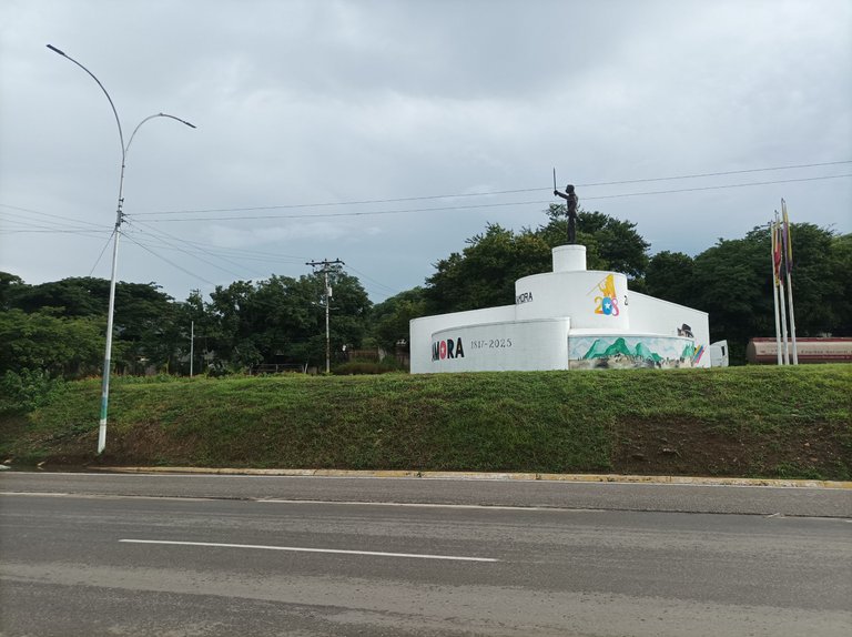
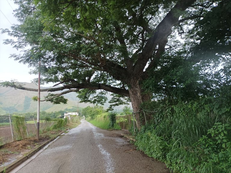
Hoy miércoles, estuve a punto de suspender este entrenamiento porque a las 2 de la tarde comenzó a llover y pensé que iba durar la lluvia varias horas, pero no fue así, porque después escampo. Inicié mi recorrido saliendo a las 4:30 de la tarde, desde la avenida Lisandro Hernández, activando la aplicación Strava para registrar como siempre el entrenamiento de hoy. El clima estaba fresco y parecía que la lluvia iba a continuar, al pasar por el monumento de Ezequiel Zamora, ya llevaba un tiempo de 21 minutos, con una distancia de 2 K.
Today, Wednesday, I was about to cancel this training session because it started raining at 2 p.m., and I thought it would last for several hours, but it didn't, because it cleared up later. I started my run at 4:30 p.m., leaving from Lisandro Hernández Avenue, activating the Strava app to record today's training as usual. The weather was cool, and it looked like the rain would continue. By the time I passed the Ezequiel Zamora monument, I had already clocked a time of 21 minutes, covering a distance of 2 km.
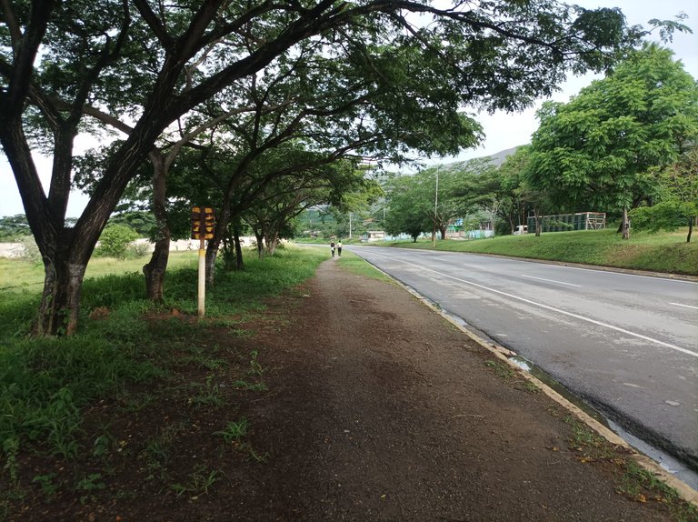
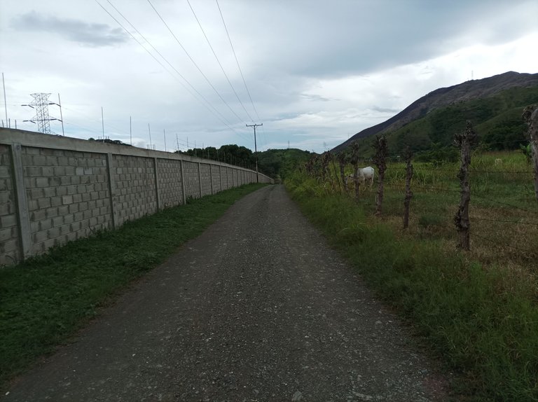
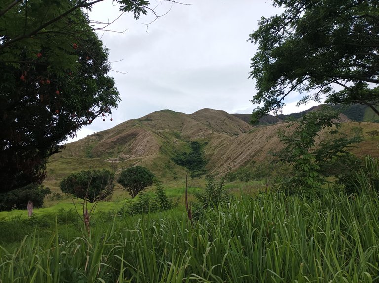
Después, continúe por toda la carretera nacional, a un ritmo de un 60%, la lluvia comenzó a caer nuevamente, pero no le preste mucha atención. Cuando la aplicación narco un distancia de 3 K, llevaba un tiempo de 29 minutos, adentrándome al asentamiento campesino de El Samán. Una vez que pasé toda la recta, me desvié por la segunda esquina para recorrer la carretera de tierra y llegar detrás de la montaña que está por el cerro Las Antenas, y llegué al final, para retornar y cruzar por la esquina para entrar nuevamente a El Samán.
Afterward, I continued along the national highway at a 60% pace. Rain began to fall again, but I paid little attention. When the app indicated a distance of 3 km, I was already 29 minutes in, entering the rural settlement of El Samán. Once I had completed the straight stretch, I turned off at the second corner to travel along the dirt road and get behind the mountain that lies behind Cerro Las Antenas. I reached the end, then turned back and crossed the corner to re-enter El Samán.
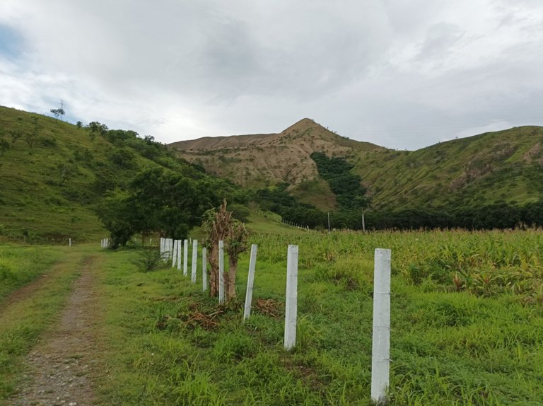
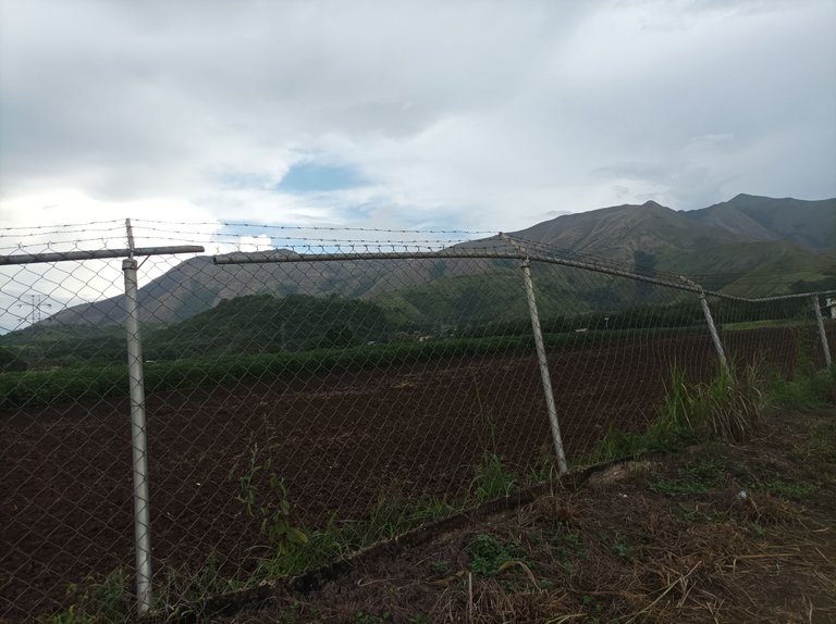
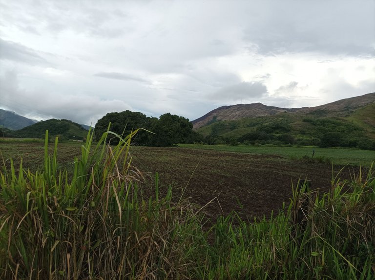
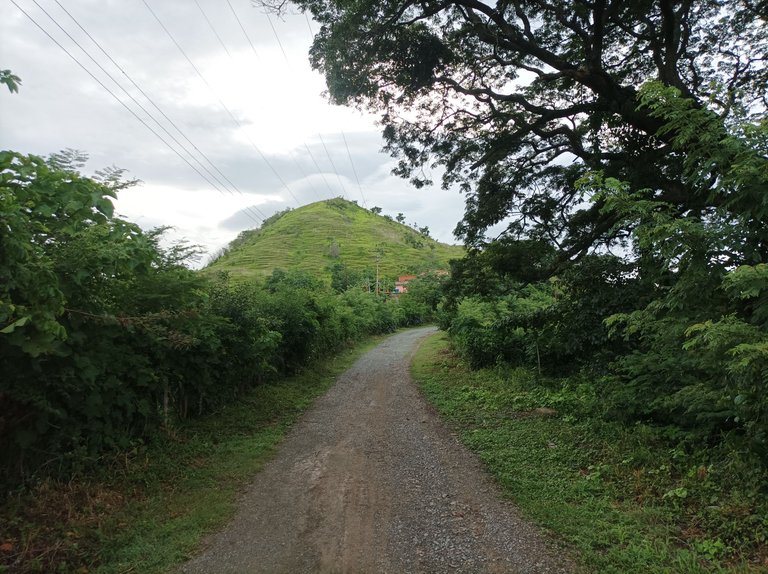
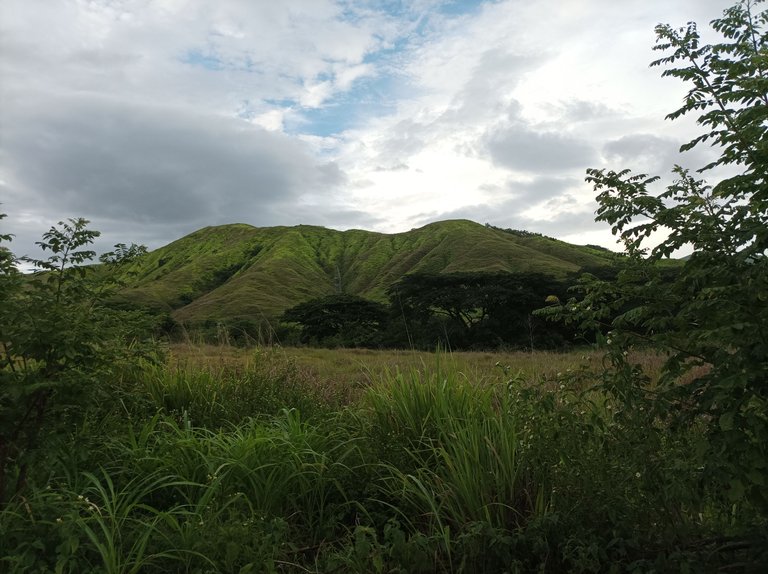
Cabe destacar que en esta recta, caminé como cien metros y subi hacia el sector Dimas, un recorrido de 1 K, donde podemos apreciar el verdor de la montaña. Pude apreciar que ya la cosecha de mango está finalizando, ya algunos árboles le quedan pocos frutos. Luego me devolví para después continuar por toda la recta de El Samán, hasta pasar por frente de las montaña. Después salí del asentamiento para subir y llegar al sector Santa Eduviges.
It's worth noting that on this stretch, I walked about 100 meters and climbed toward the Dimas sector, a 1-kilometer trail where we can appreciate the greenery of the mountains. I could see that the mango harvest was already ending, with some trees already bearing little fruit. I then turned back and continued along the entire El Samán straight stretch, passing in front of the mountains. Afterward, I left the settlement and climbed up to the Santa Eduviges sector.
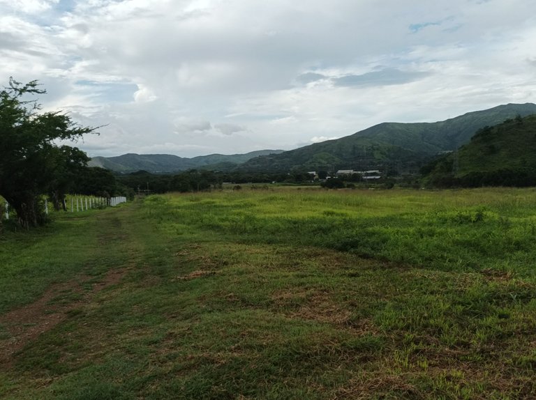
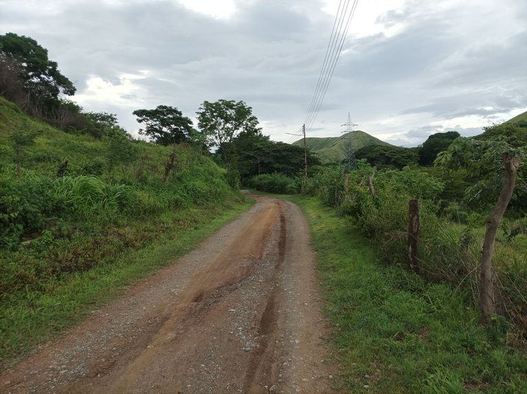
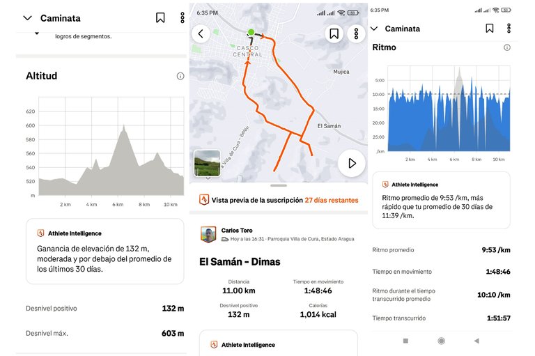
Finalmente, continúe avanzando para pasar por La Represa, y llegar al centro de la comunidad, para finalizar mi entrenamiento con una distancia de de 11 K, en un tiempo de 1 hora con 51 minutos, con un desnivel positivo 132 m y un desnivel máximo 603 m, registrado en la aplicación Strava.
Finally, I continued moving forward to pass through La Represa, and reach the center of the community, to finish my training with a distance of 11 K, in a time of 1 hour and 51 minutes, with a positive slope of 132 m and a maximum slope of 603 m, recorded in the Strava application.
Echa un vistazo a mi caminata en Strava: https://strava.app.link/rlzDq9W4uUb
Check out my hike on Strava: https://strava.app.link/rlzDq9W4uUb
Espero que les haya gustado, nos vemos en una próxima publicación.
I hope you liked it, see you in a next post.
Fotografías: Teléfono Redmi Note 10
Portada realizada en APP GridArt
Logos utilizados de Hive y de @fulldeportes
Traductor utilizado: Traductor de Google
Photos: Redmi Note 10 Phone
Cover made in The APP GridArte
Used logos of Hive and @fulldeportes
Translator used: Translator used: Google Translate

Vote la-colmena for witness By @ylich

Caminar después de llover, el clima se pone muy fresco, menos mal que seguiste a pesar de que estaba lloviendo un poco, lo bueno que pudiste cumplir con tu objetivo del día de ayer, andar por esos senderos con tanta maravillas, es una bendición, excelente recorrido, mis felicitaciones, saludos desde la distancia 🥰🤗
Gracias amiga, saludos.
Envidio esos paisajes que puedes recorrer en entrenamaiento, es sabroso entrenar y respirar aire puro, yo cuando corro casi siempre me toca algo de humo esa es la desventaja de tanta calle
.. Saludos Carlos
Saludos amiga, gracias
Maravilla, espero un día llegar a mi pensión en un lugar, así que me permita hacer senderos todos los días te dejo este concurso estamos dando 10hbd: https://peakd.com/hive-174680/@hive-174680/winners-of-the-week-second-week-of-the-10hbd-contest
Saludos amigo, Dios mediante, gracias por la información del concurso.
I love this route, bro, and you can tell it was a very cool day. The rain has made the area green and lush; it must be really nice to walk or run here. Thanks for sharing...
Saludos amigo, gracias por comentar.
Recientemente me enteré de un accidente cerca del monumento a la mujer profe, creo que está por esa ruta. Fue un accidente de moto d eun joven que aparentemente falleció en la ciudad de Maracay. Saludos profe.
Saludos amigo, que broma, gracias por comentar.
que lidnas fotos, de verdad que se nota que el paisaje estaba hermoso. Una caminata nunca esta demas, y se nota la experiencia, 11 kilometros como si nada jajaja, increible post
Hola, muchas gracias por comentar.
Agradezco ver fotografías de sus caminatas porque han mejorado en términos de captura de imagen, un montón.
Aprecio haya traído sus contenidos a nuestro feed.
Saludos profe..!
@tipu curate 9
Upvoted 👌 (Mana: 0/70) Liquid rewards.
Saludos amigo, gracias.
Hello cetb2008!
It's nice to let you know that your article will take 8th place.
Your post is among 15 Best articles voted 7 days ago by the @hive-lu | King Lucoin Curator by keithtaylor
You receive 🎖 1.2 unique LUBEST tokens as a reward. You can support Lu world and your curator, then he and you will receive 10x more of the winning token. There is a buyout offer waiting for him on the stock exchange. All you need to do is reblog Daily Report 707 with your winnings.
Buy Lu on the Hive-Engine exchange | World of Lu created by szejq
STOPor to resume write a wordSTART