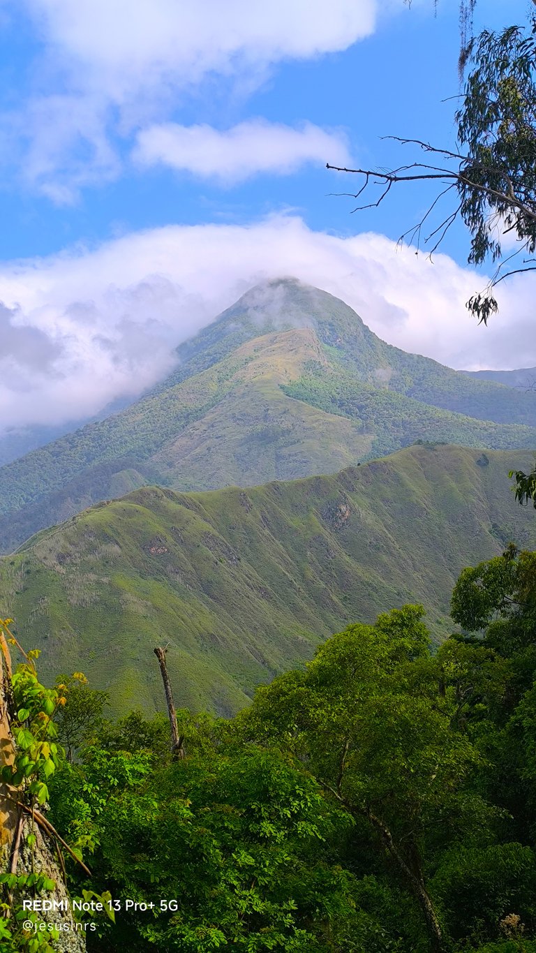
Dos Banderas
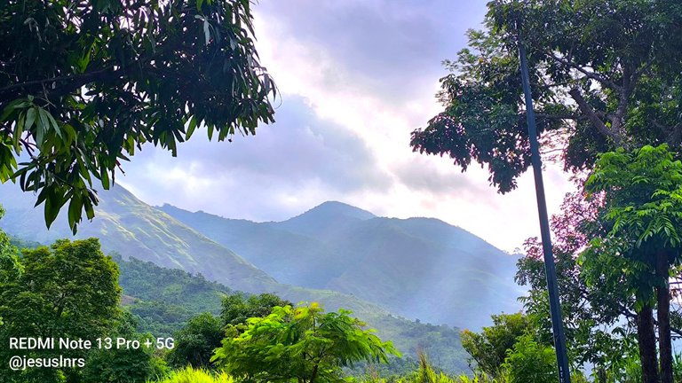
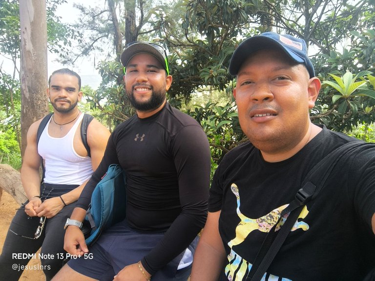
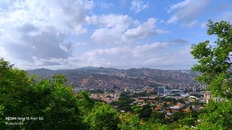
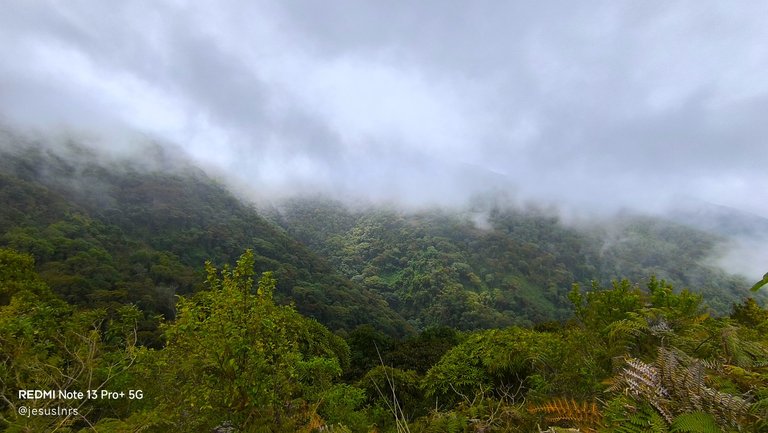
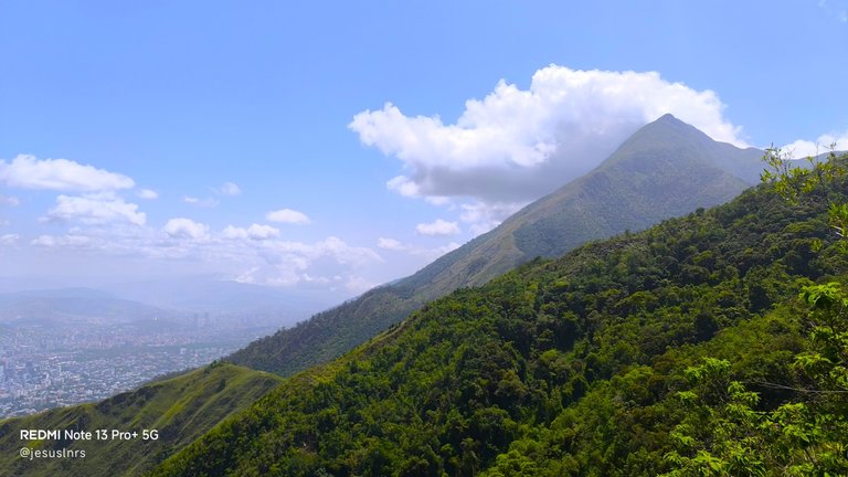
With great excitement, I greet the Hive travel community! This time, I want to share my experience of my first attempt to reach the summit of Ávila in Caracas. My friends and I planned to go to Pico Naiguatá, the highest peak of the mountain, but the idea was to make it a one-day trip. A big spoiler: I didn't make it. In fact, my friends didn't make it that day out of solidarity with me. But exploring this new place for the three of us was sensational, especially for the landscapes we saw along the way. The first photo I shared as the cover shows what would be our goal.
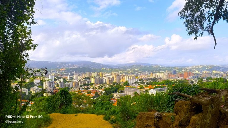
¡Con mucha emoción saludo a la comunidad de viajeros de Hive!. En esta ocasión quiero compartirles mi experiencia de mi primer intento para llegar a la cima del Ávila en Caracas. Junto a mis amigos planeamos ir al Pico Naiguatá, el más alto de todos, pero la idea era hacer un viaje de un solo día. Un pequeño gran spoiler, no lo logré, de hecho mis compañeros no lo lograron se día por ser solidarios conmigo, pero explorar este nuevo lugar para los tres fue sensacional, especialmente por los paisajes que pudimos apreciar en el camino. La primera foto que he compartido como portada muestra lo que sería nuestra meta.
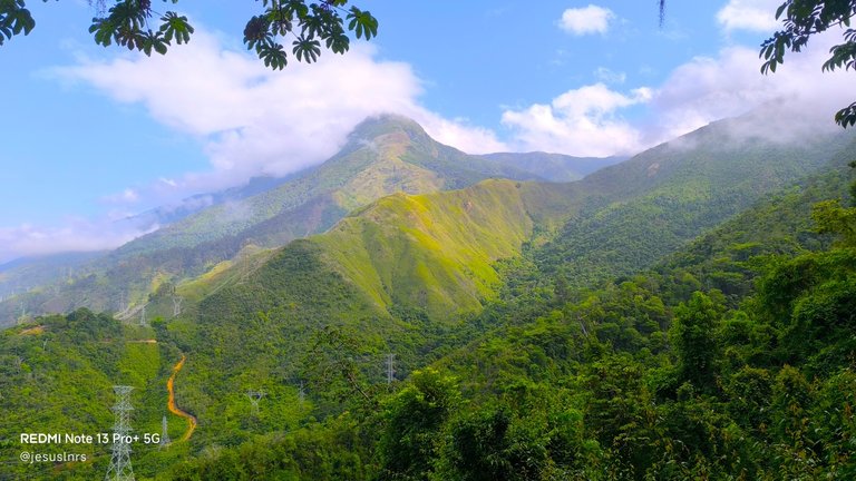
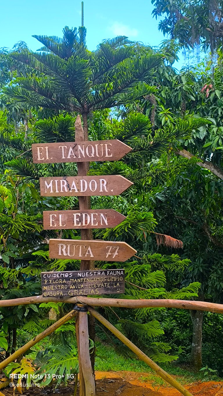
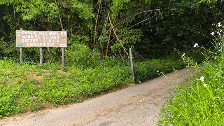
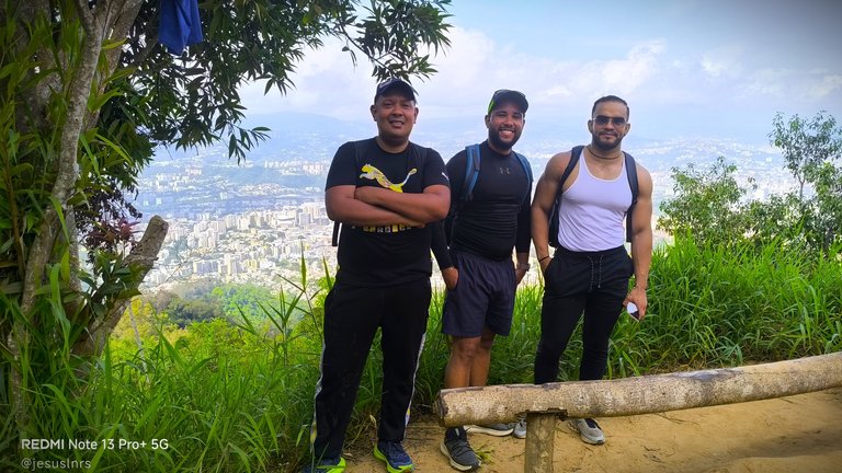
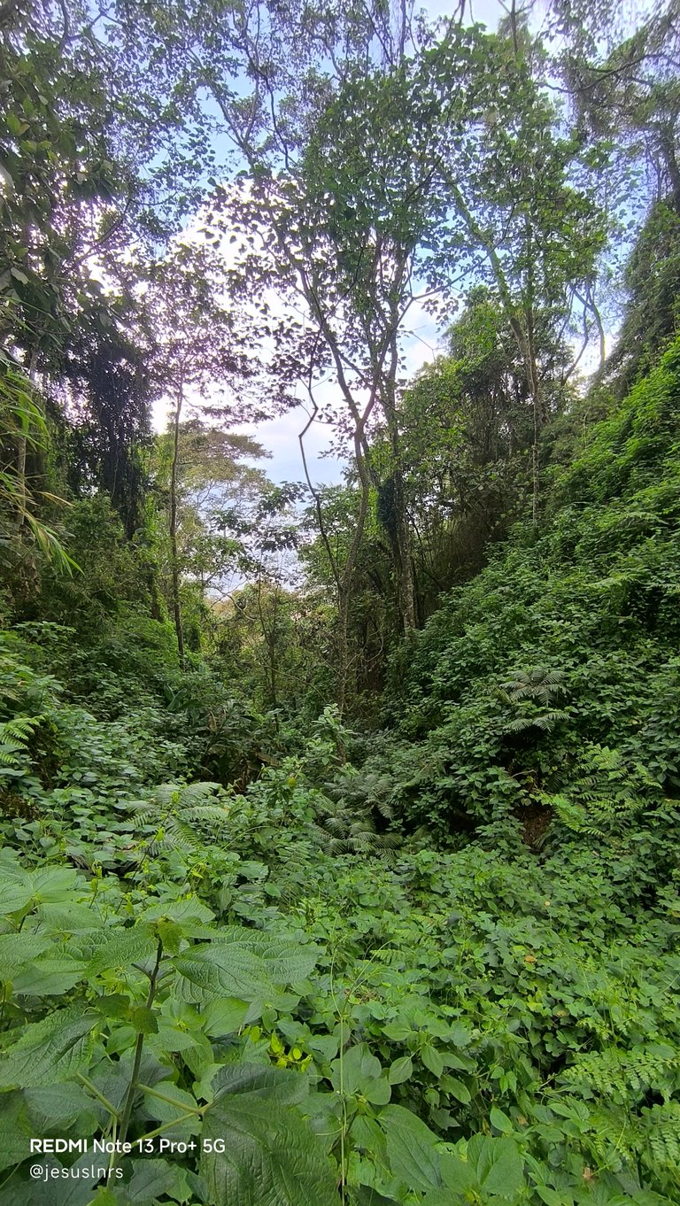
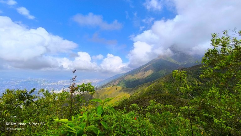
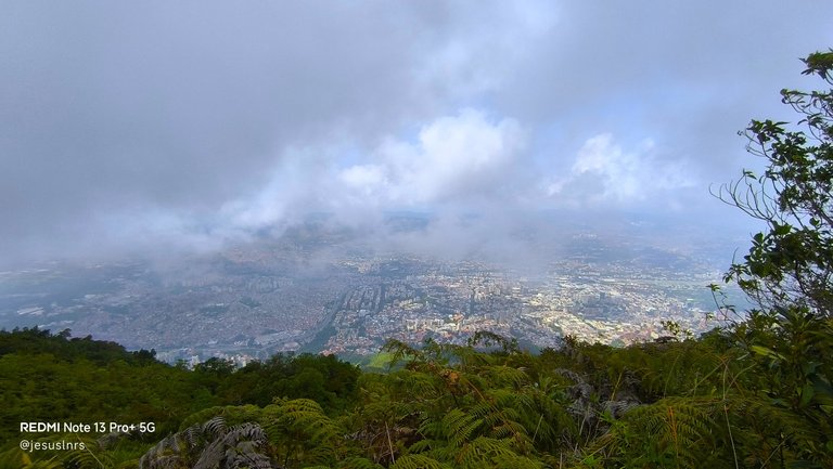
This trip begins in the La Julia sector, east of the city, and is one of the most difficult routes I've ever encountered in the mountains. The trail is very long, but it has many rest stops, viewpoints, and plenty of water to fill our thermoses along the way, which seemed ideal to me so we wouldn't have to carry extra weight. Our first stop was the La Julia Park Ranger Station, a wide space with many birds flitting among the people and the ranger station. From here, we access more distant locations, including El Tanque, Mirador El Edén, Route 77, Dos Banderas, Topo Galindo, and finally, Pico Naiguatá.
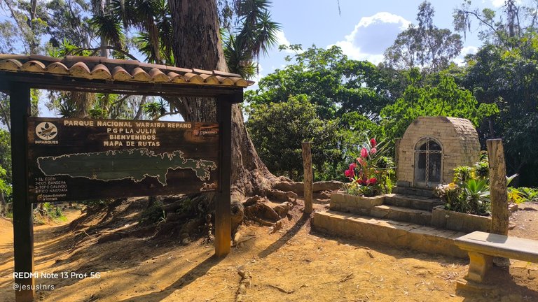
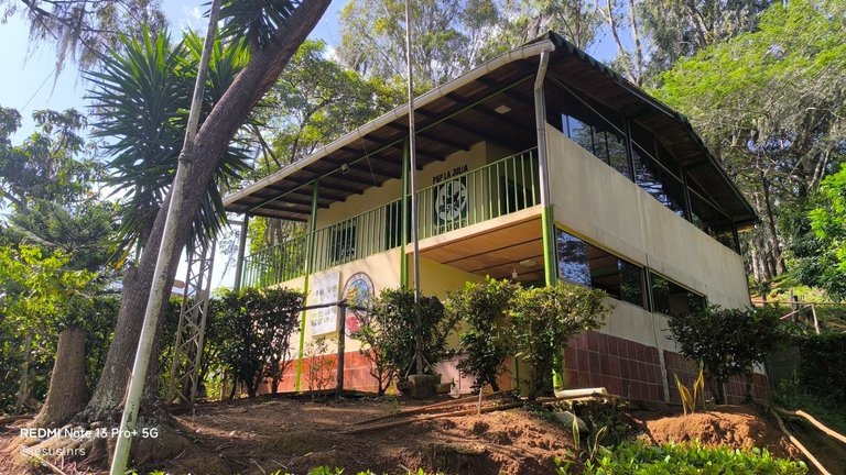
Este viaje comienza en el Sector La Julia, al este de la ciudad y es una de las rutas más difíciles que he conocido en la montaña. El camino es muy largo, pero tiene muchas paradas para descansar, miradores y mucha agua para llenar nuestros termos en el camino, algo que me pareció ideal para no tener que llevar más peso. Nuestra primera parada era precisamente el Punto de Guarda Parques La Julia, un espacio amplio, con muchas aves que se pasean entre las personas y el puesto de los guardias de la zona. Desde aquí es el acceso a lugares más distantes, los cuales serían El Tanque, el Mirador El Edén, la Ruta 77, Dos Banderas, Topo Galindo y finalmente el Pico Naiguatá.
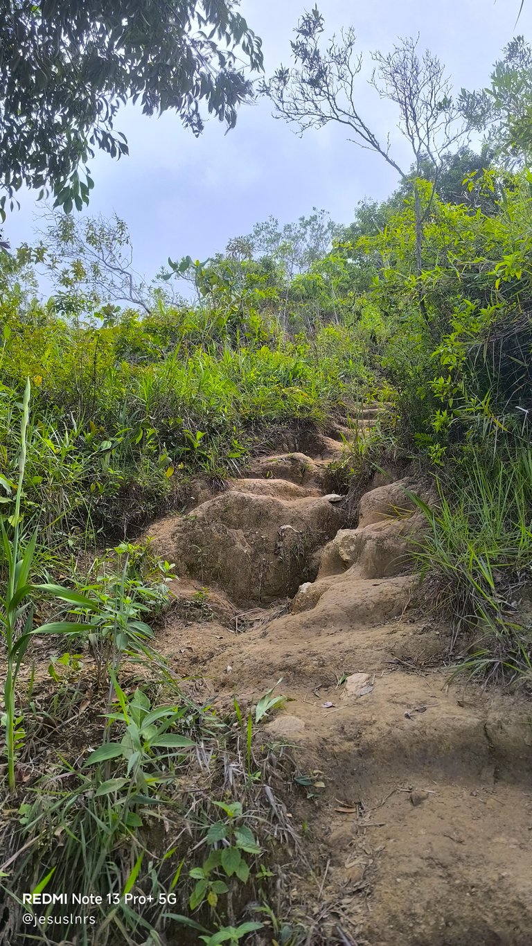
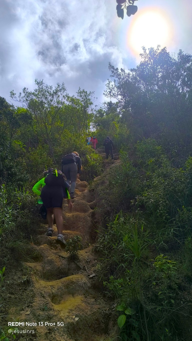
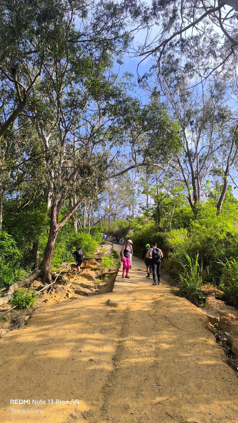
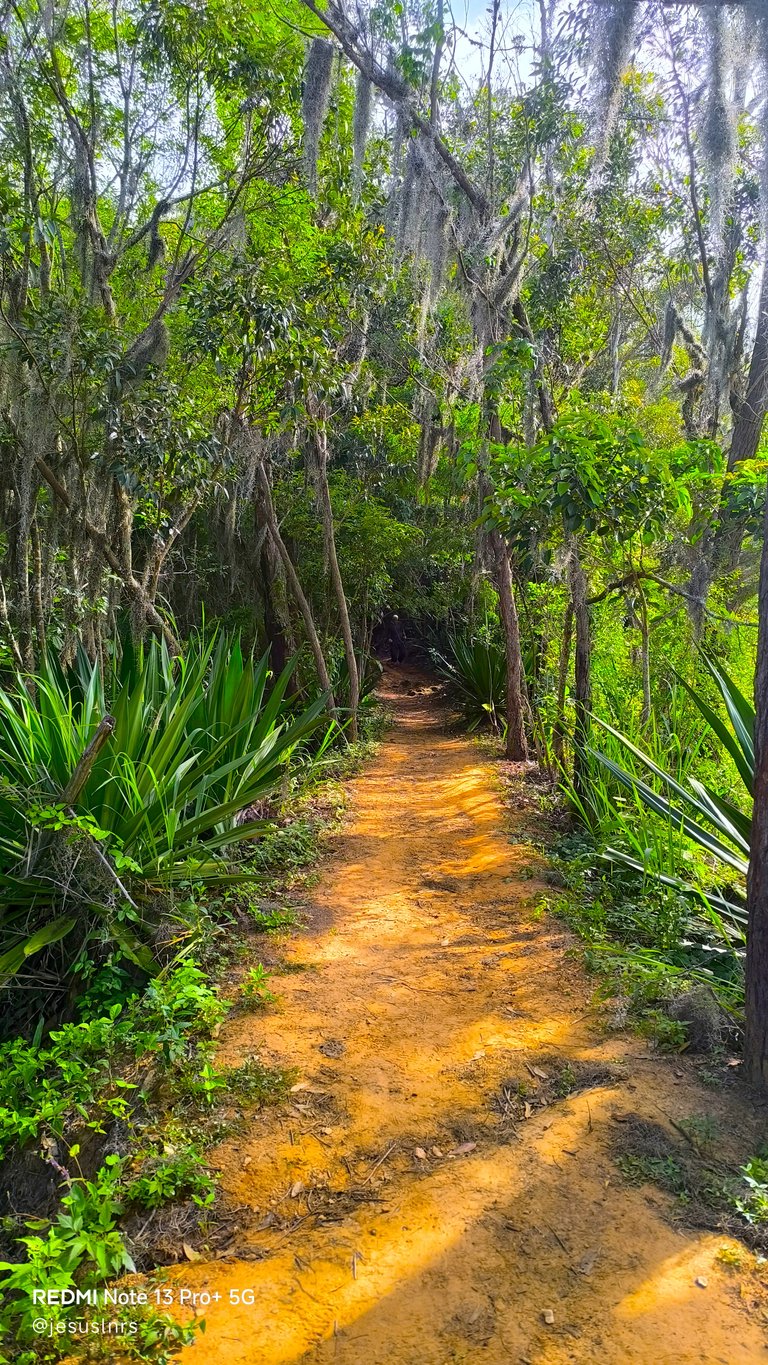
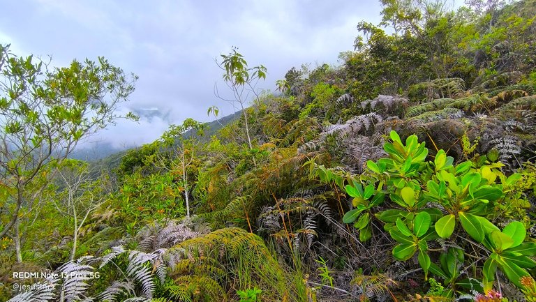
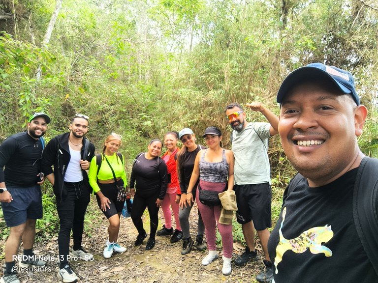
As we passed the park ranger's hut, I realized the trip was just beginning. I asked someone to take a photo of us at Mirador El Edén. It was a special place for that and a place to rest a bit, and I didn't know what awaited us. The next stop would be Dos Banderas, but getting there is very, very rough, especially for chubby people like me. The path was an endless staircase of rocks and roots that almost made me throw in the towel more than once. With no shade from the trees, I was on that journey for over an hour, and we generally started climbing at 9 a.m. and arrived at Dos Banderas around noon. It wasn't because of my friends, it was because of me that took us so long 😅
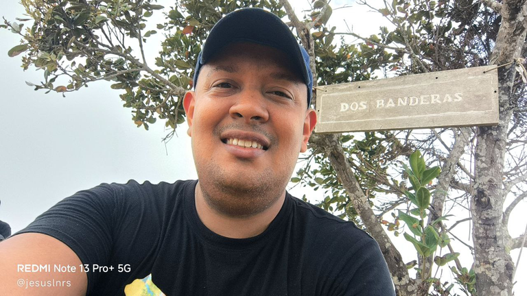
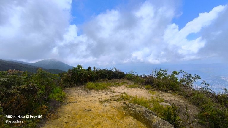
Al pasar de esa casita de los guardaparques me di cuenta que el viaje a penas estaba comenzando. Le pedí a una persona que nos tomara una foto en el Mirador El Edén, era un lugar especial para ello y para descansar un poco, además de que no sabía lo que nos esperaba. La siguiente parada sería Dos Banderas, pero llegar ahí es muy, muy rudo, especialmente para gorditos como yo. El camino era una escalera interminable de rocas y raíces que por poco me hace tirar la toalla más de una vez. Sin sombras de árboles, estuve en ese trayecto más de una hora, y en general comenzamos a subir a las 9 de la mañana y llegamos hasta Dos Banderas al medio día, solo que no fue por mis amigos, fue por mí que tardamos tanto 😅
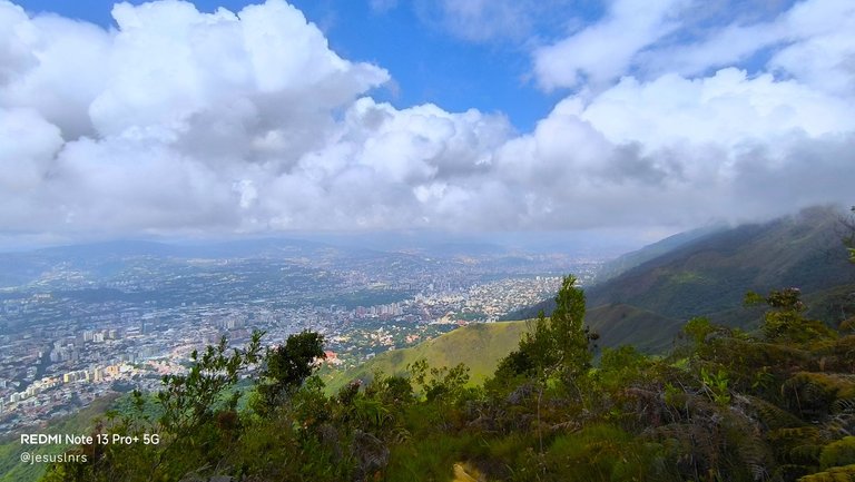
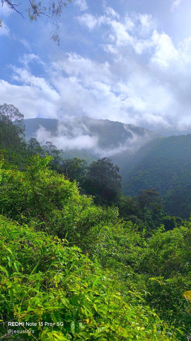
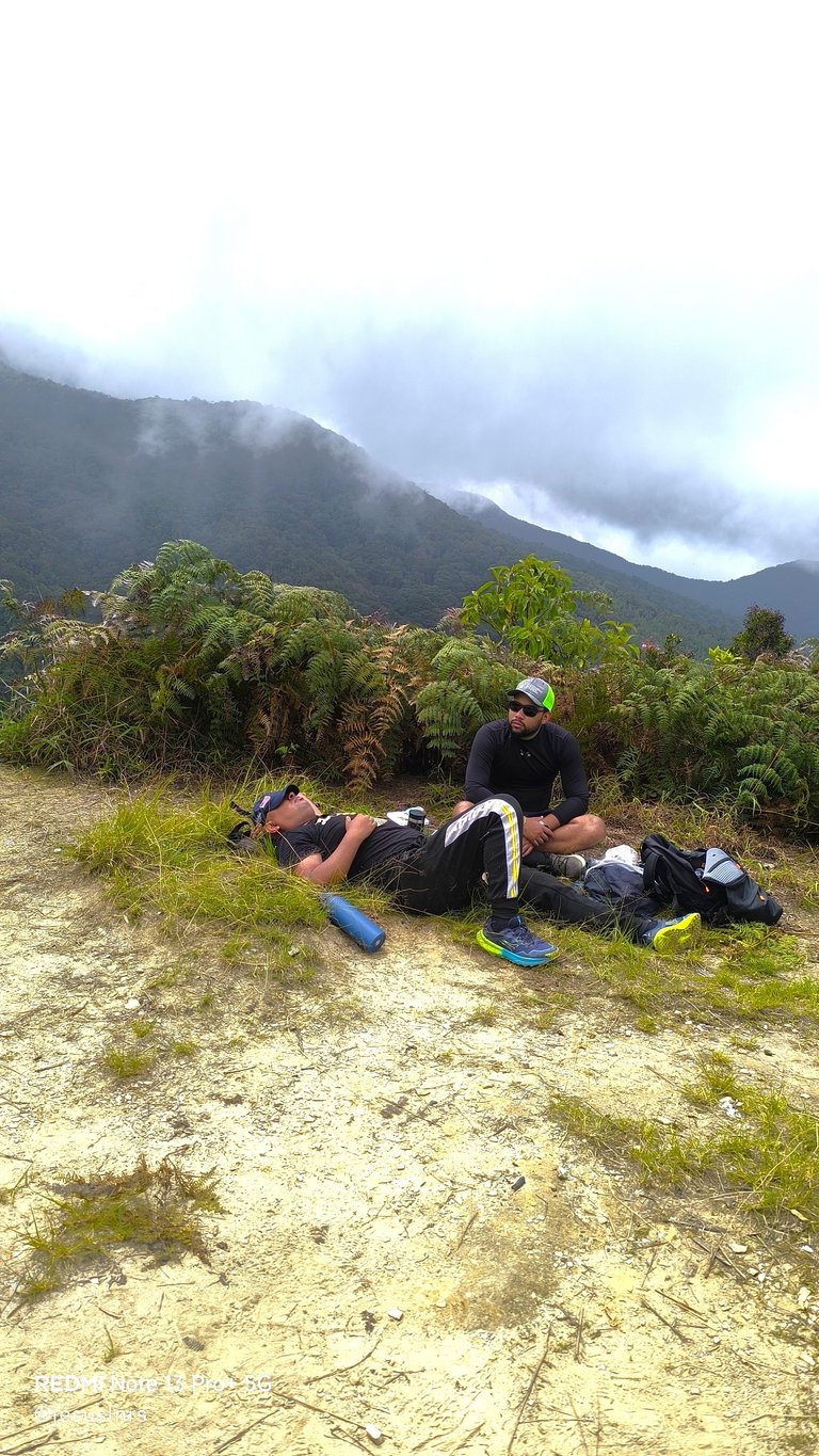
I was disappointed in myself for not continuing to the summit. The guys told me this wasn't even halfway there, but we didn't intend to camp, so I enjoyed the views and hope to return and try to go further. It's not an easy trail, and I need to train for more endurance. At Dos Banderas, it was already very cold despite it being midday; we were shrouded in fog, and because we were tired, we decided to take Route 77 with some other people who kindly offered to show us the way. We trusted them and went down together. It was longer, really much longer, but better for our knees. Still, it was about eight hours of connecting with nature, and it was all a pleasant adventure and a new goal for me...
Me decepcioné de mí mismo por no seguir hasta la cima. Los muchachos me dicen que esta no era ni la mitad del camino, pero no íbamos con la intención de acampar, así que disfruté de las vistas y espero regresar e intentar ir más allá, no es un camino tan fácil y tengo que entrenar para tener más resistencia. En Dos Banderas ya hacia mucho frío a pesar de ser medio día, estábamos envuelto entre neblina, y por el cansancio decidimos tomar la Ruta 77 con otras personas que amablemente se ofrecieron a enseñarnos el camino. Confiamos en ellos y bajamos juntos. Era más tiempo de recorrido, de verdad mucho más tiempo, pero mejor para nuestras rodillas. Aún así fueron aproximadamente ocho horas que estuvimos en conexión con la naturaleza y todo fue una grata aventura y una nueva meta para mí...

You can check out this post and your own profile on the map. Be part of the Worldmappin Community and join our Discord Channel to get in touch with other travelers, ask questions or just be updated on our latest features.
Thank you so much 🙏
Hey @jesuslnrs you are welcome.
Thanks for using @worldmappin 😘
Congratulations, your post has been added to the TravelFeed Map! 🎉🥳🌴
Did you know you have your own profile map?
And every post has their own map too!
Want to have your post on the map too?
- Go to TravelFeed Map
- Click the create pin button
- Drag the marker to where your post should be. Zoom in if needed or use the search bar (top right).
- Copy and paste the generated code in your post (any Hive frontend)
- Or login with Hive Keychain or Hivesigner and click "create post" to post to Hive directly from TravelFeed
- Congrats, your post is now on the map!
PS: You can import your previous Pinmapple posts to the TravelFeed map.Opt Out
Amazing my friends! Thank you so much ❤️
Amazing photography
Thank you!...
Welcome dear friend
No esta vez... pero sé con certeza que lo lograrás, insiste además esto me recuerda a un paraíso!!
Definitivamente es un paraiso, es muy impresionante ver la vista desde acá. Gracias Avesita!...
🤗😃
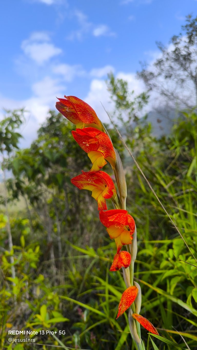
Wow very nice place. You have spent a very nice time with your friends. On your blog that brown flower is very beautiful and very familiar to me. May you spend your beautiful time and wish you well.
My friend thank you so much again. The truth is that this place is wonderful, and sooner or later I hope to achieve that goal. A big hug for you with lots of love!...
Welcome dear friend 🤝
Fue un nuevo logro para tí y eso es importante, aunque a veces no nos gusta admitirlo, no siempre podemos. Lo estás haciendo bien.
Gracias man, algún día llegaré a esa cima con ustedes 🙏
Congratulations @jesuslnrs! Your post brought a smile to the TravelFeed team so we have sent you a smiley. Keep up the good job. 🙂
Thanks for using TravelFeed!
@for91days (TravelFeed team)
PS: You can now read your favourite travel blogs on your phone. Plus, blogging on-the-go just got easier! Download our app on the Apple App Store or get it on Google Play.
This is amazing! Thank you so much TravelFeed 🙏
Hiya, @ybanezkim26 here, just swinging by to let you know that this post made it into our Honorable Mentions in Travel Digest #2637.
Your post has been manually curated by the @worldmappin team. If you like what we're doing, please drop by to check out all the rest of today's great posts and consider supporting other authors like yourself and us so we can keep the project going!
Become part of our travel community:
Thank you @ybanezkim26 and thank you Worldmappin Team ❤️
You are very welcome @jesuslnrs! it was well deserved. ☀️
We are already looking forward to reading more about your adventures!
I see these landscapes and they make me want to grab my backpack and travel, explore, and take on adventures.
!discovery 30
I hope you come to the eastern part of Ávila. There is a lot of material you can exploit with your talent, in addition to that beautiful feeling in your soul...
This post was shared and voted inside the discord by the curators team of discovery-it
Join our Community and follow our Curation Trail
Discovery-it is also a Witness, vote for us here
Delegate to us for passive income. Check our 80% fee-back Program
Thanks!.