E3 in western Slovakia - Day 43 ( Stage 5 )
In today's installment of notes from my travels along the long-distance European route E3, we will look at the vicinity of the High Tatras. As you will read further on, there was no shortage of adventure and of course views.
V dnešním díle zápisků z mých cest po dálkové Evropské trase E3 se podíváme do blízkosti Vysokých Tater. Jak se dále dočtete o dobrodružství nebyla nouze a o výhledy už vůbec ne.
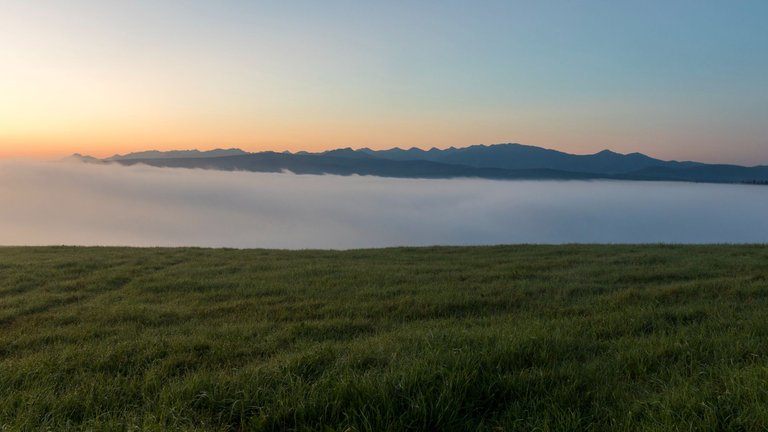
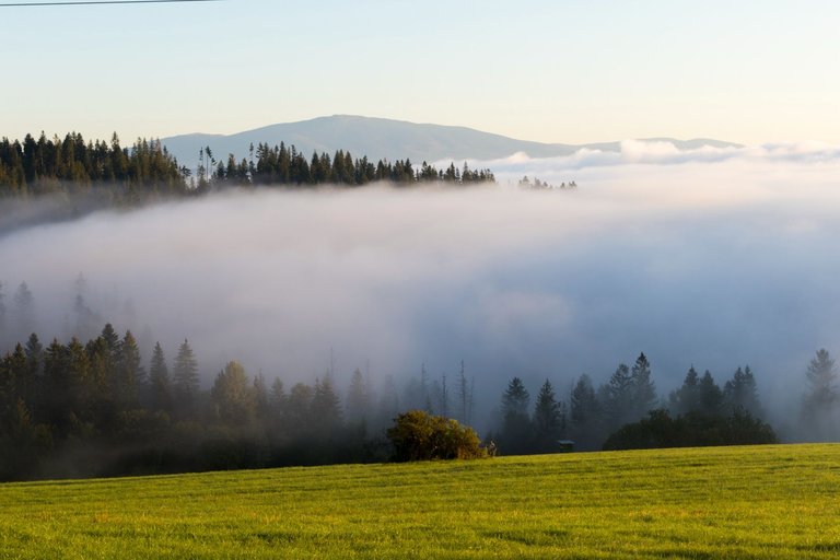
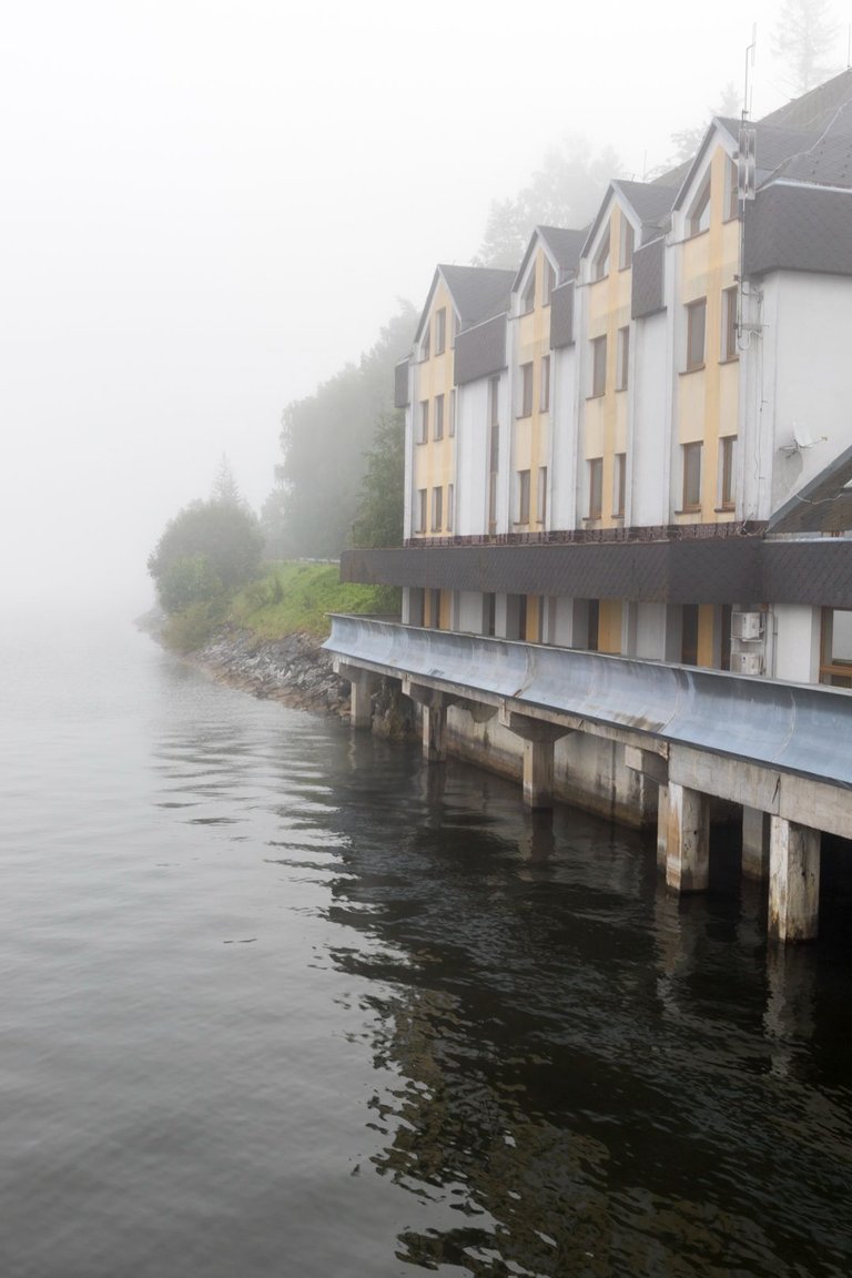
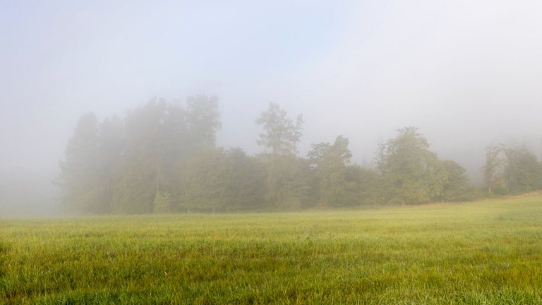
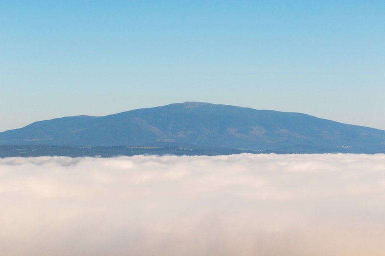
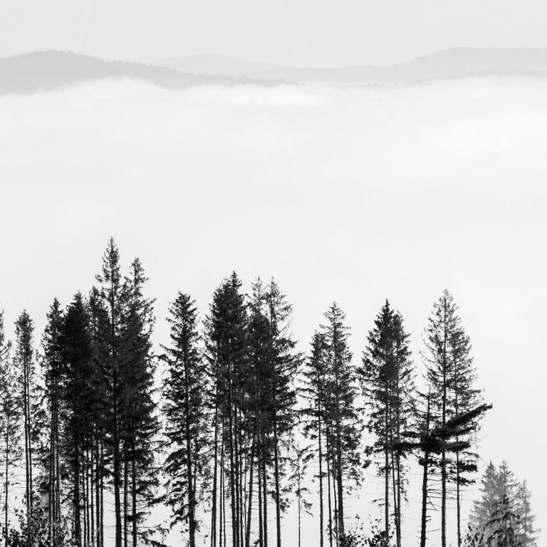
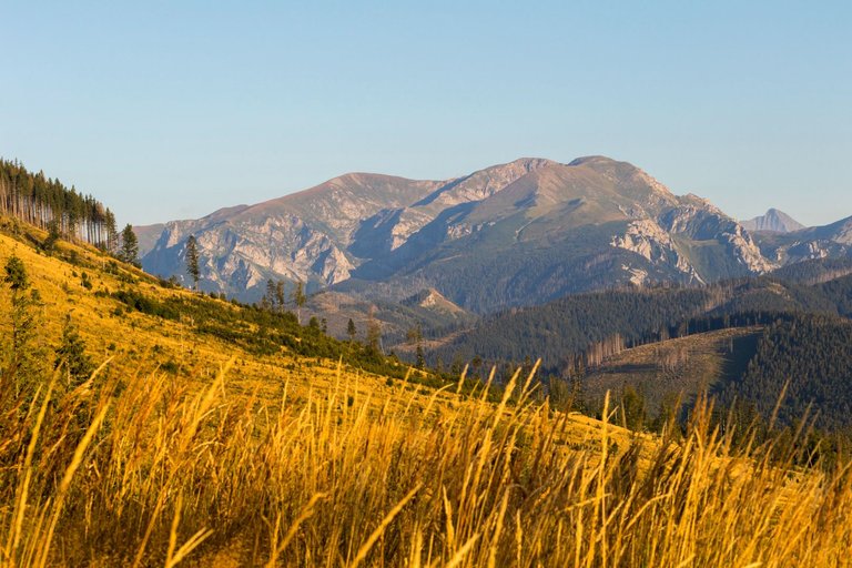
The place to sleep that I had chosen the previous day turned out to be perfect. Because I woke up above the edge of the fog created by Lake Orava.
Místo k přespání které jsem předchozí den vybral se nakonec ukázalo jako perfektní. Protože jsem se probudil nad hranou mlhy, kterou vytvořilo Oravské jezero.
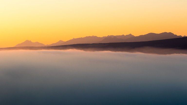
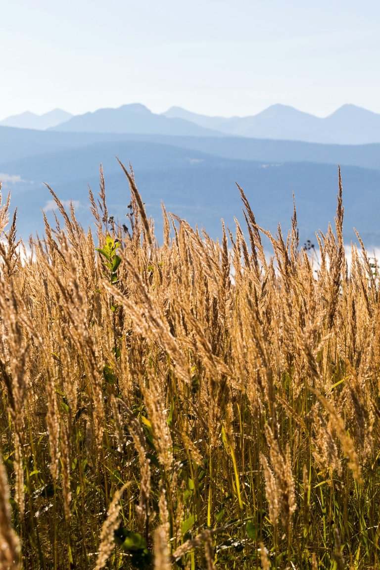
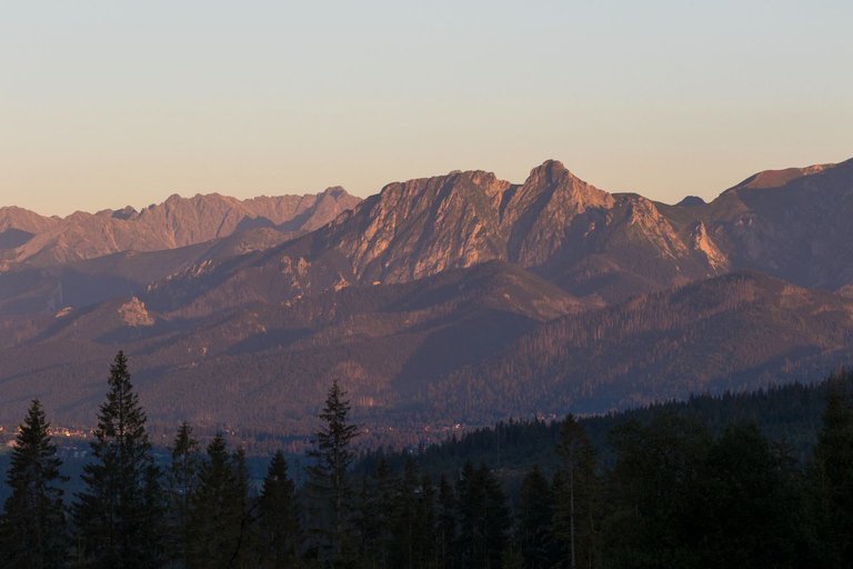
Absolutely perfect views were offered to me in almost all directions where I could see.
Naprosto dokonalé pohledy se mi nabízeli skoro všemi směry kam jsem mohl dohlédnout.
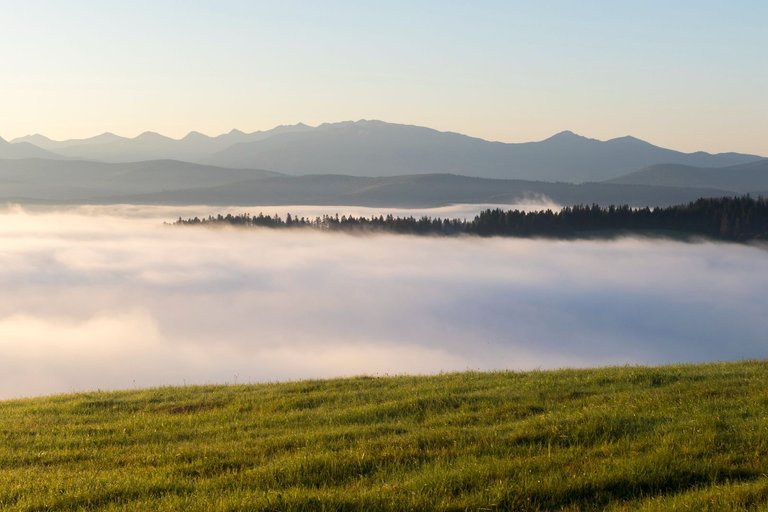
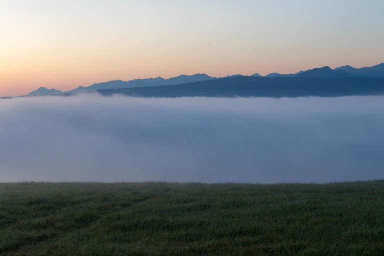
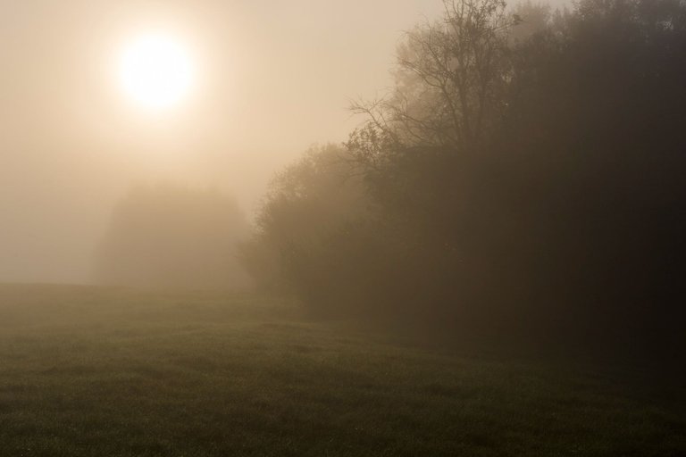
During the photo shoot, I was continuously packing so that I could head towards the foggy valley as soon as possible, because I didn't know how long the fog would last. As soon as the sun rose above the horizon, I set off.
Během focení jsem se průběžně balil, abych mohl co nejdříve vyrazit směr mlžné údolí, protože jsem nevěděl jak dlouho se mlha udrží. Jakmile slunce vylezlo nad horizont tak jsem vyrazil.
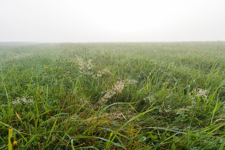
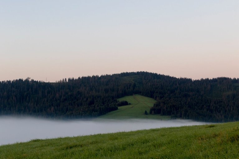
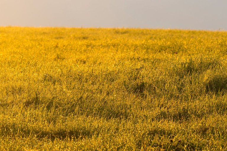
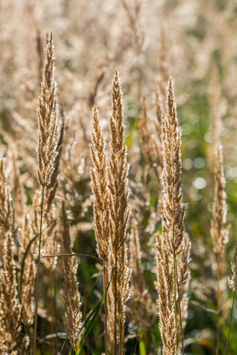
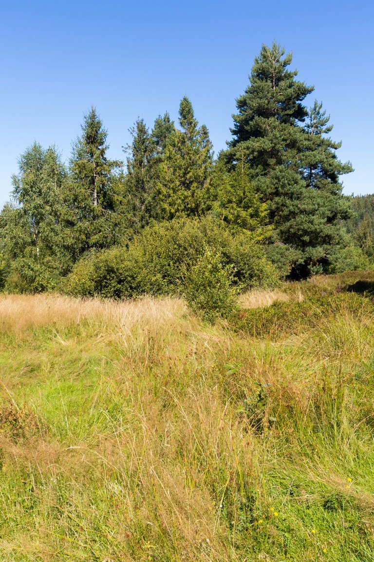
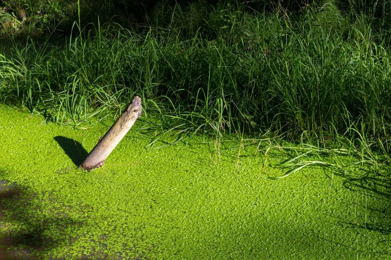
The path to the valley through misty meadows had its own charm, except for the grass that was completely soaked with water, which even my shoes caught. Fortunately, I wore waterproof socks that caught most of the moisture. So the legs were wet, but not as wet as without this gadget.
Cesta do údolí zamlženými loukami měla svoje kouzlo, až na totálně promočenou trávu vodou, kterou zachytávaly i moje boty. Naštěstí jsem se obul do nepromokavých ponožek, které většinu vlhkosti zachytily. Takže nohy byly sice v mokru, ale ne v takovém jako bez této vychytávky.
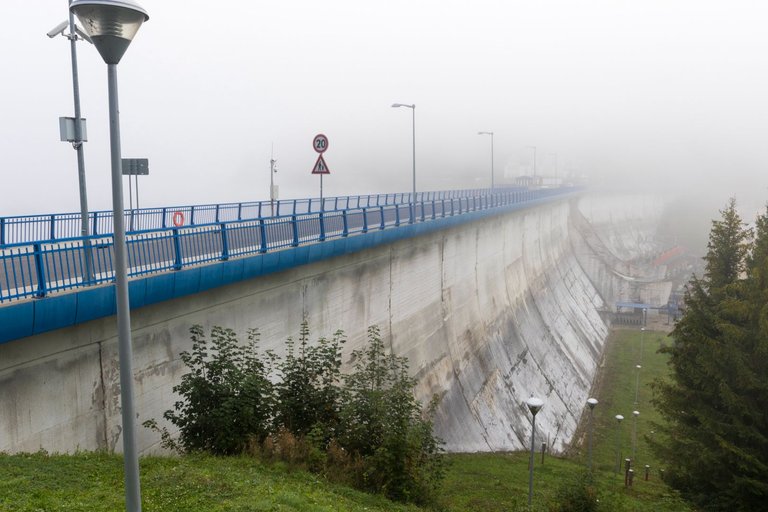
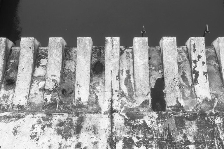
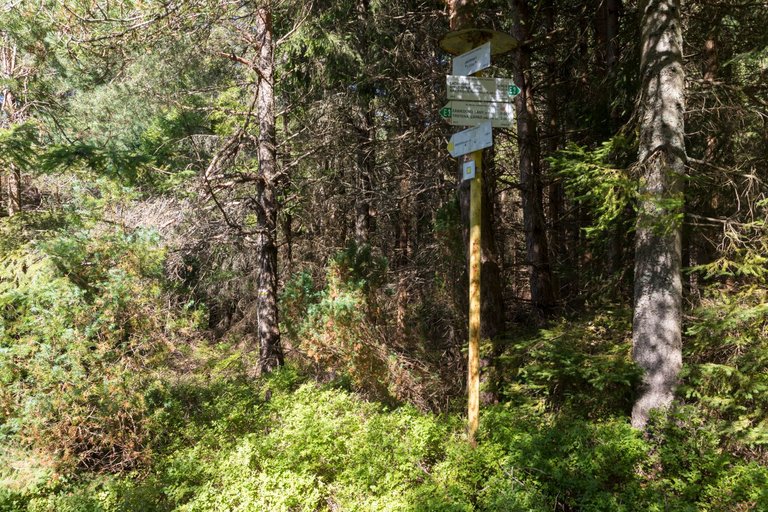
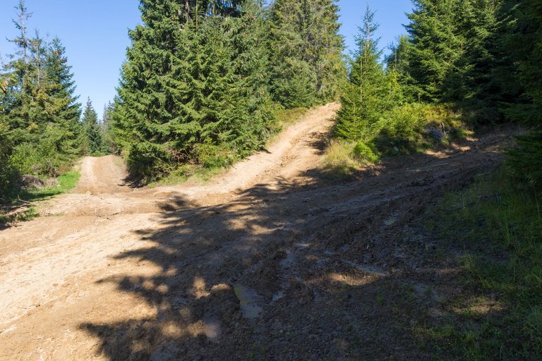
As soon as I reached the forest, I noticed that the path was not well-trodden and the markings were quite weak, but somehow I did not attach importance to it. And I preferred to have fun taking pictures. Like for example when I was crossing a dam.
Jakmile jsem došel do lesa všiml jsem si, že cesta není prošlapaná a i značení dosti pokulhávalo, ale nějak jsem tomu nepřikládal na důležitosti. A radši jsem se bavil focením. Jako například když jsem překonával přehradu.
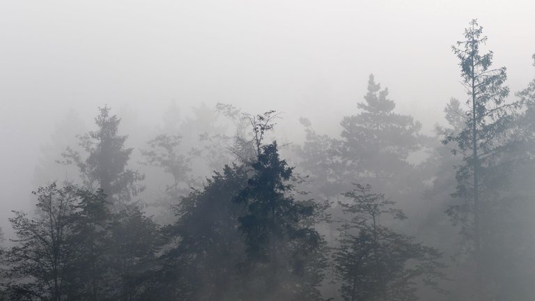
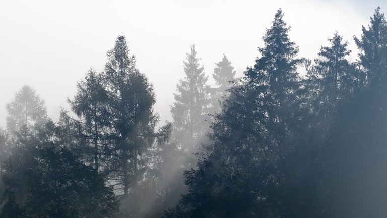
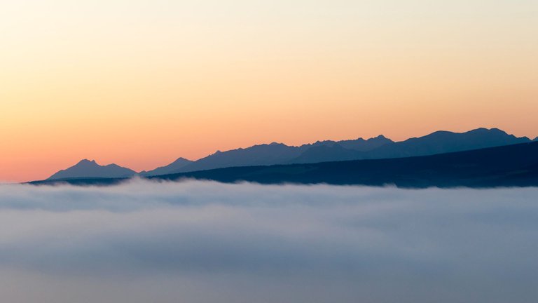
The lighting conditions were phenomenal and I could see photos almost everywhere I looked without reflecting the increasingly wet shoes.
Světelné podmínky byly fenomenální a já jsem viděl fotografie skoro všude kam jsem se podíval, aniž bych reflektoval stále mokřejší boty.
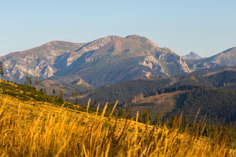
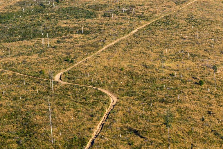
The first big hill of the day was the Uhlisko peak (860m), from the top of which you could only see because the forest had been cut down in the past. Here there were no trail markings at all, so I had to follow the map and look for a way to walk.
Prvním větším kopcem dne byl vrchol Uhlisko (860m), z jehož vrcholu bylo vidět jen díky tomu, že byl v minulosti vykácen les. Zde značení stezky vůbec nebylo a tak jsem se musel pohybovat podle mapy a hledat cestu kudy vůbec projít.
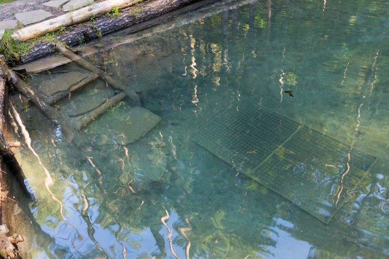
As I was running out of water, I looked at the map and found a well not far from the road. But it was not easy to get to her along the forgotten road passed by Lakatoš, where water stood in the deep ruts. In the end, the well turned out to be a forest spa.
Jelikož mi začala docházet voda, podíval jsem se do mapy a našel studánku nedaleko cesty. Ale dostat se k ní po zapomenuté cestě projetou Lakatošem, kde v hlubokých kolejích stála voda nebylo jednoduché. Nakonec se studánka ukázala jako lesní lázně.
After refilling with water from the spring, which filled a 1 liter bottle in 2 seconds, I set off towards the town of Trstená. Where I wanted to buy food supplies for the next few days, because I was not sure about the possibility of buying supplies in the next few days. I got a lot of weird looks from the locals in town. Because probably none of them knew where I found myself in the city with my backpack. Later I found out why the roads are not marked and basically no one goes into the forest. There are a lot of bears around the city and there have been several fatal accidents.
Po doplnění vody z pramene, který naplnil 1l láhev do 2 vteřin jsem se vydal směr město Trstená. Kde jsem chtěl nakoupit zásoby potravin na několik dalších dní, protože jsem si nebyl jist s možností nákupu v dalších dnech. Ve městě jsem se setkal se spoustou divných pohledů od místních obyvatel. Protože asi nikdo z nich netušil kde jsem se ve městě ocitl s batohem. Později jsem zjistil asi proč nejsou cesty značené a v podstatě nikdo do lesa nechodí. V okolí města je velký výskyt medvědů a bylo zde i několik smrtelných nehod.
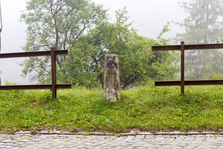
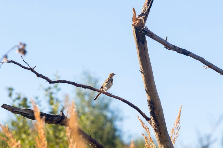
At one of the crosses there was also a sign warning of a large number of bears. That's why I paid attention and was preparing a plan for a possible meeting. I slowly made my way through the young forest along forestry roads, because there were no tourist roads here.
U jednoho z křížků byla i cedule s varováním na velký výskyt medvědů. Proto jsem zpozorněl a připravoval plán pro případné setkání. Pomalu jsem se probojovával mladým lesem po lesnických cestách, protože turistická zde již neexistovala.
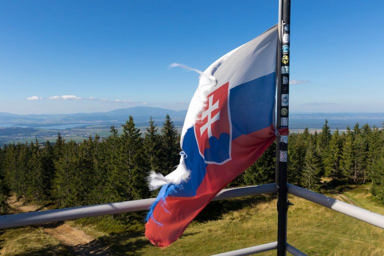
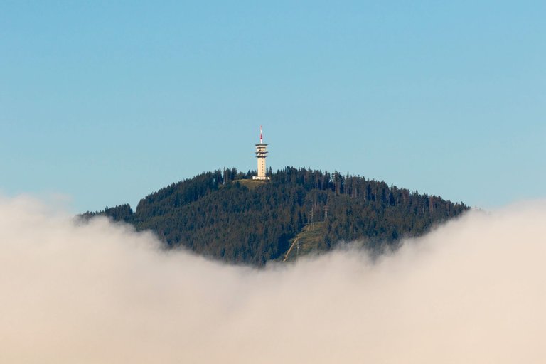
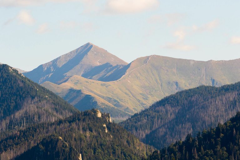
Through several peaks and countless intersections and constant search for a way, I reached the top of Skorušina (1314m). Where is the metal observation tower. According to the diary, I found that the lookout tower is visited, but probably from other directions. Because the road markings on the other side of the peak have reappeared.
Přes několik vrcholů a nespočet křižovatek a neustálého hledání cesty jsem došel až na vrchol Skorušina (1314m). Kde je i kovová rozhledna. Podle deníku jsem zjistil, že je rozhledna navštěvovaná, ale pravděpodobně z jiných směrů. Protože se značení cest na druhé straně vrcholu opět objevilo.
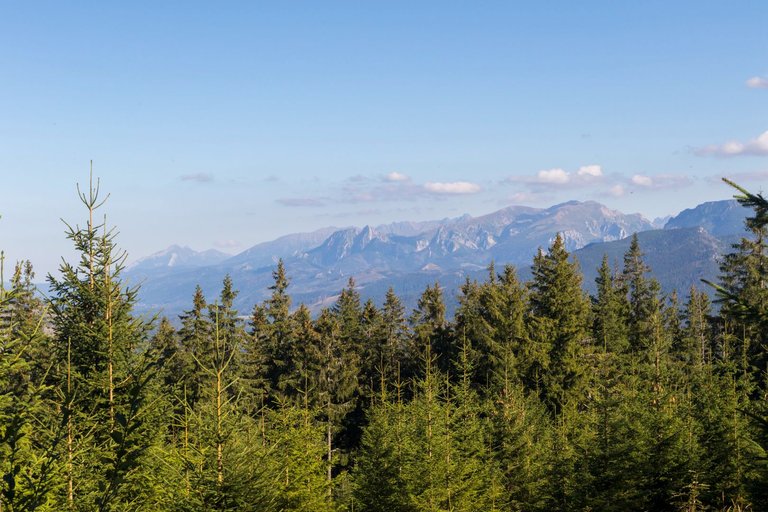
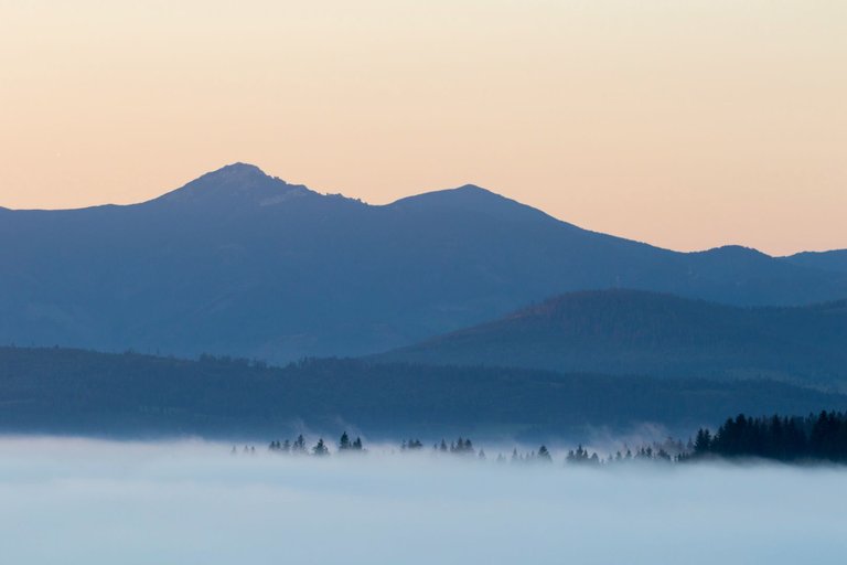
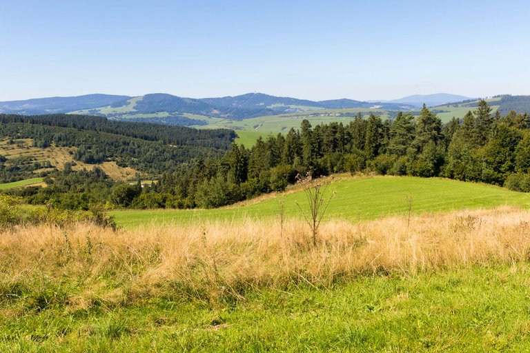
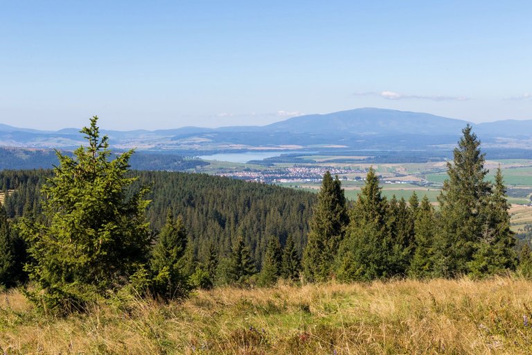
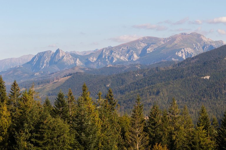
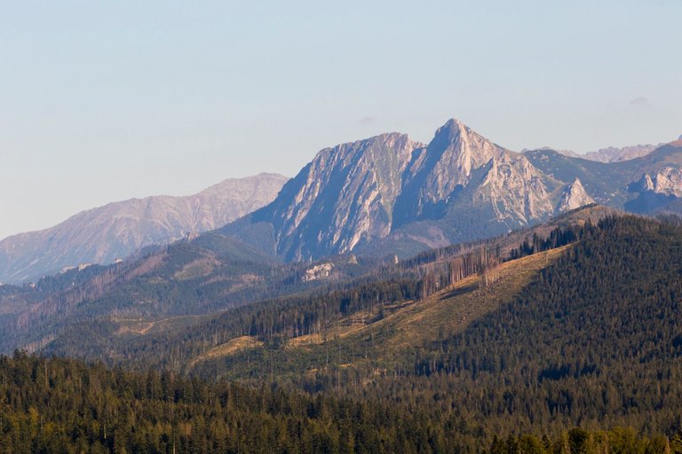
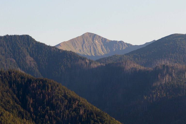
From one vantage point when I started to descend into the valley I saw the High Tatras and realized that I was already quite close.
Z jedné vyhlídky kdy jsem začal klesat do údolí jsem uviděl Vysoké Tatry a uvědomil jsme si, že jsem již docela blízko.
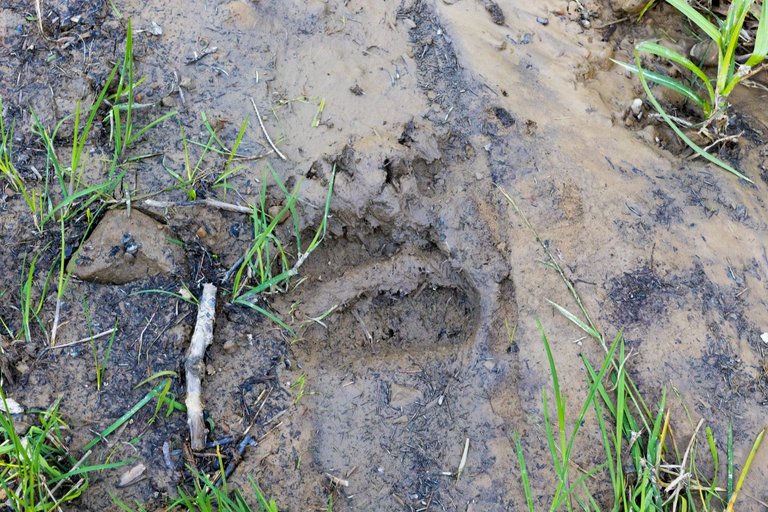
And then I saw a big fresh track in the mud and again I became very attentive and carefully watched what was happening around me.
A pak jsem uviděl velkou čerstvou stopu v bahně a opět jsem velmi zpozorněl a pečlivě sledoval co se kolem mě děje.
I had to follow the path carefully, because everywhere there were deep lakes in the tracks from Lakatoš.
Cestu jsem musel sledovat pozorně, protože všude byly hluboká jezírka v kolejích od Lakatoše.
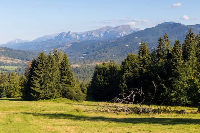
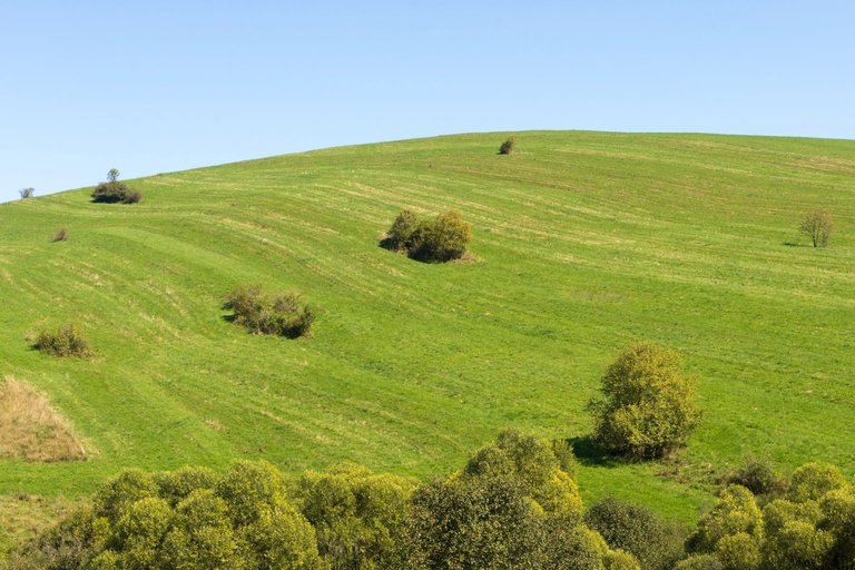
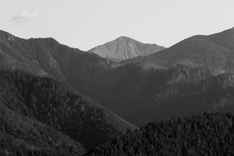
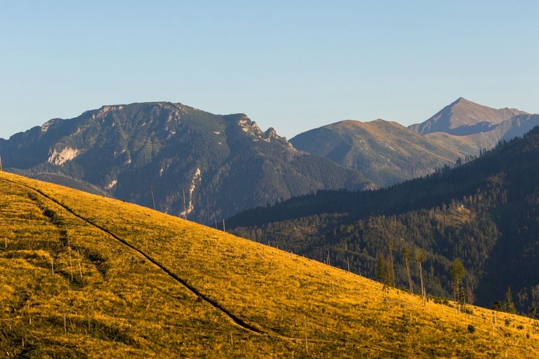
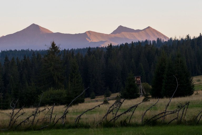
The descent through the meadows to the village of Oravice was spectacular with all the views.
Klesání po loukách do vesnice Oravice, bylo spektakulární se všemi výhledy.
In the village I rested for a while and changed my wet socks to dry ones and started climbing again to the next ridge where I was supposed to end the day. But I was in for a surprise in the form of Lakatoš trail 2.0. On the edge of the High Tatras National Park, the road was so destroyed and full of 1 meter deep liquid mud. So all that was left was to go into the surrounding deep forest. The trip, which should have taken about 30 minutes, stretched to more than an hour, because I not only struggled with the elevation, but also with fallen wood in the forest. Fortunately, I was pleased with the views after leaving the forest.
Ve vesnici jsem si na chvilku odpočinul a vyměnil mokré ponožky za suché a začal opět stoupat na další hřeben kde jsem měl v plánu zakončit den. Ale čekalo mě překvapení v podobě Lakatoší stezky 2.0. Na okraji Národního parku Vysoké Tatry byla cesta tak zničená a plná 1 metr hlubokého tekutého bahna. Takže nezbývalo, než se vydat do okolního hlubokého pralesa. Cesta co měla trvat asi 30 minut se protáhla na více než hodinu, protože jsem nebojoval jen s převýšením, ale i popadaným dřevem v lese. Naštěstí jsem byl po opuštění lesa potěšen výhledy.
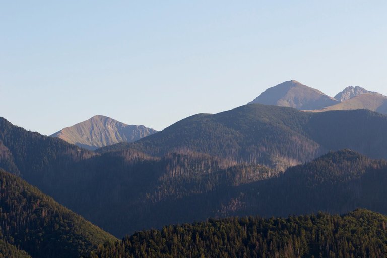
As I continued towards the top of the ridge, the forest completely disappeared and only the paths for Lakatoš were visible in the steep terrain.
Jak jsem pokračoval k vrcholu hřebene les úplně zmizel a byly vidět pouze stezky pro Lakatoše v prudkém terénu.
Another surprise awaited me on the ridge, which I certainly did not want. And that made the bear's track in the mud fresher than the previous one and, moreover, a bit closer to the place where I wanted to spend the night. I had to act fast. Fortunately, I was on the border with Poland. And as I knew Poles are more inclined to make fire. So I decided to spend the night just beyond the border. As soon as I checked in, I listened to the murmuring in the valley. Therefore, I quickly made a fire and hung the food away from the camp in the direction of the smoke. After dinner, I added a wetter log to the fire, which ended up smoking for quite a long time and there was no danger of catching fire when I went to bed.
Na hřebenu na mě čekalo další překvapení, které jsem rozhodně nechtěl. A tím byla stopa medvěda v bahně čerstvější než ta předchozí a navíc kousek do místa kde jsem chtěl nocovat. Musel jsem jednat rychle. Naštěstí jsem byl na hranici s Polskem. A jak jsem věděl Poláci jsou náklonější k rozdělávání ohně. Takže jsem se rozhodl nocovat těsně za hranicí. Jakmile jsem se ubytoval uslyšel jsem brumlání v údolí podemnou. Proto jsem rychle rozdělal oheň a jídlo zavěsil dál od kempu do směru kam šel kouř. Po večeři jsem do ohně ještě přihodil mokřejší pařez, který nakonec vydržel kouřit poměrně dlouho a přitom nehrozilo vznícení když jsem šel spát.
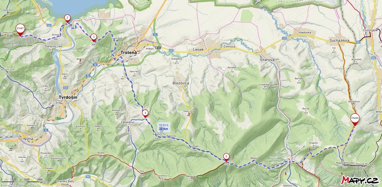
| Total distance traveled | Conquered peaks | Total altitude |
|---|---|---|
| 1305.4 Km | 220 | 76373 m |
If I look back on this day, it was one of the worst days I've experienced on the trail. The lighting conditions for the photo shoot probably couldn't have been better. I also had some adventures with bears, which ended up going well and we didn't meet each other. I refreshed my navigation in the terrain when the trail markings disappeared and I definitely prepared for the next continuation on E3 towards the east of Europe.
Pokud se na tento den podívám zpětně, jednalo se o jeden z nelepších dnů co jsem na stezce zažil. Světelné podmínky na focení asi nemohly být lepší. Zažil jsem i nějaké to dobrodružství s medvědy, které nakonec dobře dopadlo a vzájemně jsme se nepotkali. Osvěžil jsem si navigaci v terénu když značení stezek zmizelo a rozhodně jsem se připravil na další pokračování po E3 směrem na východ Evropy.
Edited: Cover image
Congratulations, your post has been added to Pinmapple! 🎉🥳🍍
Did you know you have your own profile map?
And every post has their own map too!
Want to have your post on the map too?
Hiya, @ybanezkim26 here, just swinging by to let you know that this post made it into our Honorable Mentions in Travel Digest #2063.
Your post has been manually curated by the @pinmapple team. If you like what we're doing, please drop by to check out all the rest of today's great posts and consider supporting other authors like yourself and us so we can keep the project going!
Become part of our travel community:
Beautiful! I hope that some day I will be able to visit the Tatras. It's not far away from me…
This is really an amazing and beautiful view 😍
Congratulations @softa! You have completed the following achievement on the Hive blockchain And have been rewarded with New badge(s)
Your next target is to reach 16000 upvotes.
You can view your badges on your board and compare yourself to others in the Ranking
If you no longer want to receive notifications, reply to this comment with the word
STOP