Solo Hiking In Icelandic Wild, Part 1 - Crossing the Alien Planet-like Mountain Range
I have waited for a while to write about this last hike I did in Iceland before leaving the next day. I'm having fun remembering all the little details. It was a beautiful sunny day and I had already done one hike up the cliff of which you can see post here. I was already a bit tired but I had much bigger ambitions and my last day/evening in Iceland is not going to waste.
I embarked on a pretty unknown trail that I was only able to find from an app called Alltrails where people record trails they have done. Not many mentions on the internet otherwise of this trail. It is located on the Reykjanes peninsula, southwest of the country, near lake Kleifarvatn which I have visited many times during my travels to Iceland.
I will break this hike up into several parts to post because it was a lengthy one and I got so much to show you. Got to see many different landscapes and terrains on this journey. It was a total of 15 kilometers and took me around 6.5 hours to complete.
The trail starts from a known and popular location named Krysuvik with cool geothermal grounds of which I have a couple of posts too, one here. You have to really look for the trail to notice it because there are no signs and the trail is barely visible.
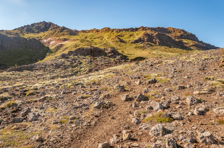
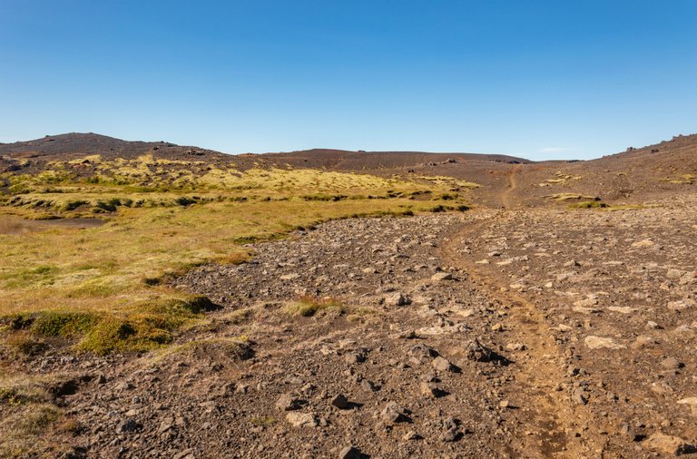
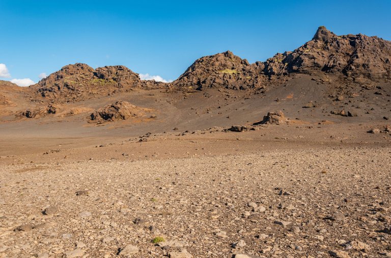
Instantly the trail starts off steep and I had to climb up to the mountain range, about 200m of altitude gain. As you see, hard to see a trail, and it's pretty rugged. Probably very little traffic of people that go up this way.
Beautiful views started to appear when I was higher up.
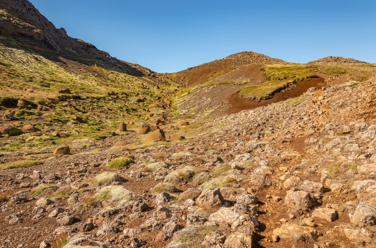
Soon I was up to mountain ridge. I did lose a mobile service there but I had Alltrails map still open to know where exactly I need to go. I'm an idiot, I didn't download an offline map. Well, I won't lose it until I close the map.
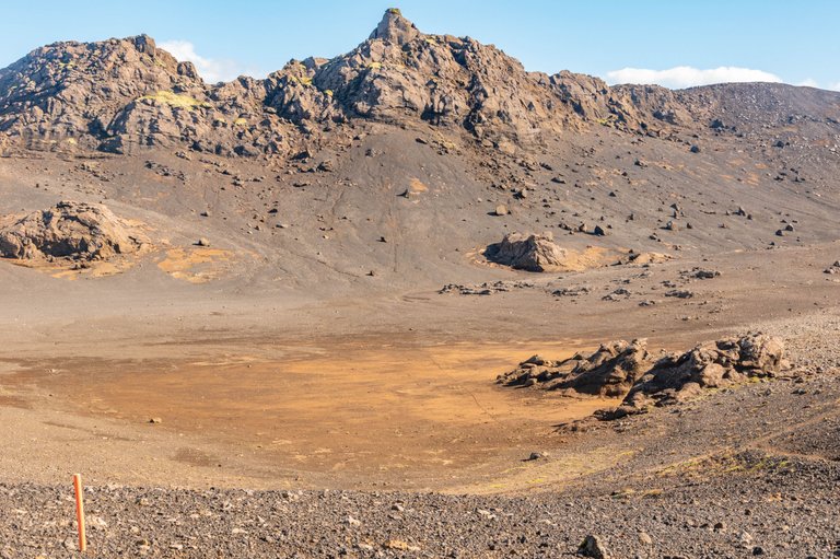
I tired myself up a bit walking up this steep incline but now I was getting a smooth landscape for a while.
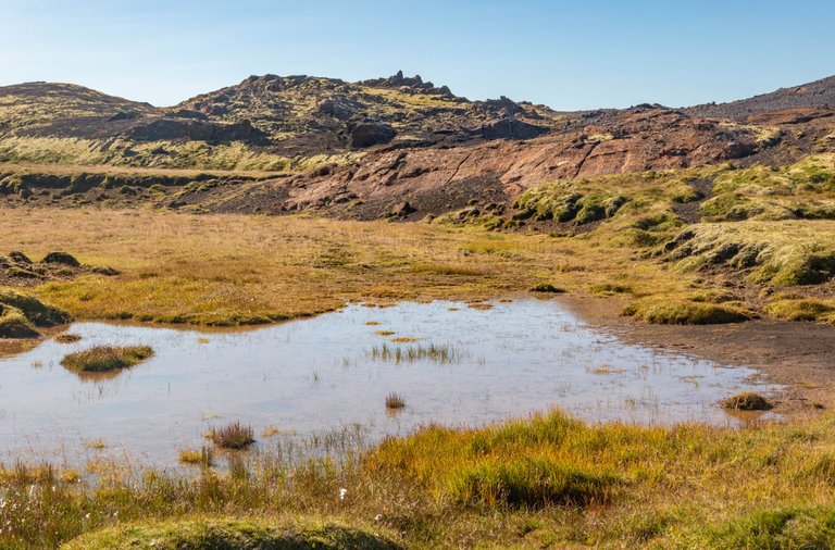
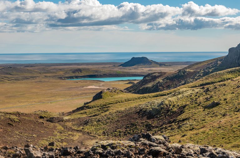
Up the mountain ridge, I found a small lake. It is called Arnarvatn. I felt immense peacefulness feeling there. Just raw nature, calm sunny weather and no other humans in sight anywhere. I did a short break there.
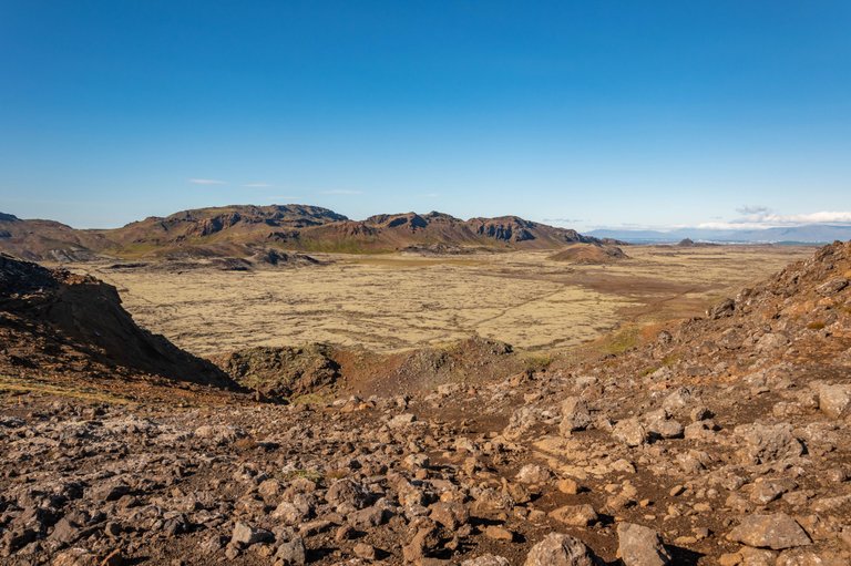
It was time to move forward and I found a crazy valley on the mountain ridge. A huge smooth field surrounded by cliffs and it was all totally brown. It made me feel like I'm on Mars or something. Definitely didn't feel like the earth. Just add orange sky in your thoughts and there is not much difference with Mars.
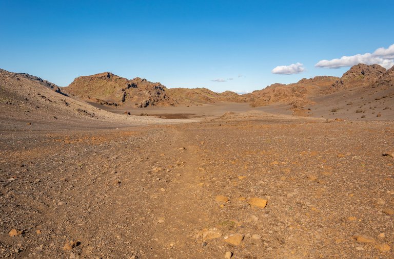
I shouted loud in this valley, it was cool to listen to the echo in this area.
Now it was time to go down the mountain range on the other side and onto a lava field valley and cross it.
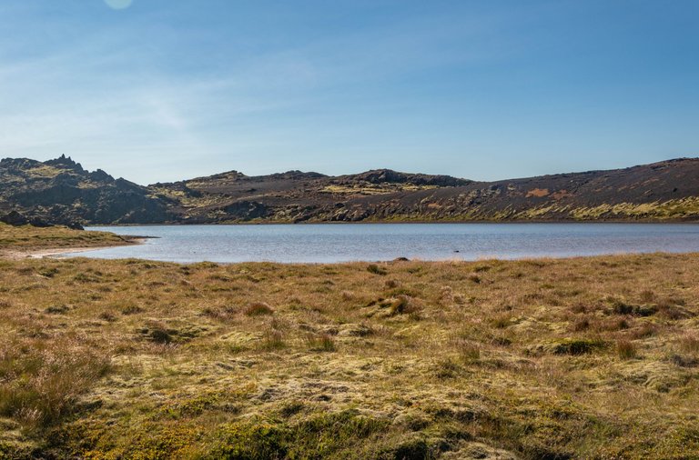
My main target for this hike is a lake hidden between hills that in the picture looks absolutely scenic. Google only showed me a couple of shots of this lake so I felt like this is truly a hidden gem to try and visit.
Stay tuned for the next follow-up post on this hike, it only gets more beautiful.
Don't forget to participate in my simple monthly weather game and have a chance to win 10 HIVE! here. Game is open until 17th January.

Congratulations, your post has been added to Pinmapple! 🎉🥳🍍
Did you know you have your own profile map?
And every post has their own map too!
Want to have your post on the map too?
Hiya, @LivingUKTaiwan here, just swinging by to let you know that this post made it into our Honorable Mentions in Daily Travel Digest #1758.
Your post has been manually curated by the @pinmapple team. If you like what we're doing, please drop by to check out all the rest of today's great posts and consider supporting other authors like yourself and us so we can keep the project going!
Become part of our travel community:
Yeyyy!
This is cool, good job!💪 I would also do same just to listen to the echo😅
Always fun to do. Of course, when nobody is around since I would seem weird otherwise 😀
You haven't experienced any issues with GoogleMaps yet in Iceland? It send me in the wrong direction so many times. Part of the adventure though :)
Not really, I have been traveling there 3 times and have no problem with driving with google maps.
For hiking, I used a hiking app named Alltrails and if don't download a map then you will lose it during a hike when the service goes away. For sure a part of the adventure!
Good to know, I would love to go back to Iceland and spend some more time. I think I will get a 4x4 by then, because my current van cannot take these F-roads.
I sure want to rent a 4x4 too there, I still haven't done that so I haven't been to the central parts of the island. 4x4 also costs a nice premium to rent there. If crypto goes well this year then I might think about it 😀.
I rented one 4 years ago. Don't get a scratch on it, because that will cost a fortune! We travelled with a rooftop tent. That was nice in the South. Further up North and in the peaks close to Myvatn it was a bit chilly...-20 degrees at night. Quite an adventure, good to relax the next day in the Myvatn Nature Baths. Don't forget to check out all the free hot springs along the road, it feels amazing after a long hike.
I usually buy full insurance to have peace of mind and zero self-risk. I have used a campervan 2 times. Guess you went in the winter to have -20C temps, which is pretty cold for camping 😰.
Free hot springs are awesome but have to choose them because well-known places are infested with tourists.
I did the same with insurance, but that was a trap. Paying 750 EUR for a scratch is insane with full insurance 🙈 I went in May, just 2 hours of darkness every day.