Photographs during a demanding hike [ENG-ESP]
I've always liked to photograph the routes I do, and since I have this blog I find it useful to share the story of these experiences so that other people looking for information on the internet about excursions, can read and see, and thus have an idea of how they are, what they will find there. Many times it happened to me that when I was looking for information to make a route I found almost nothing or very vague data, so I like to strive to leave articles as complete as possible on the web about the places I visit.
Siempre me ha gustado fotografiar las rutas que hago, y desde que tengo este blog me parece útil compartir el relato de estas experiencias para que otras personas que buscan información en internet sobre excursiones, puedan leer y ver, y así tener una idea de cómo son, qué se van a encontrar por allí. Muchas veces me pasó que cuando buscaba información para hacer alguna ruta no encontraba casi nada o datos muy vagos, por eso me gusta esmerarme en dejar artículos lo más completos posibles en la web sobre los lugares que visito.
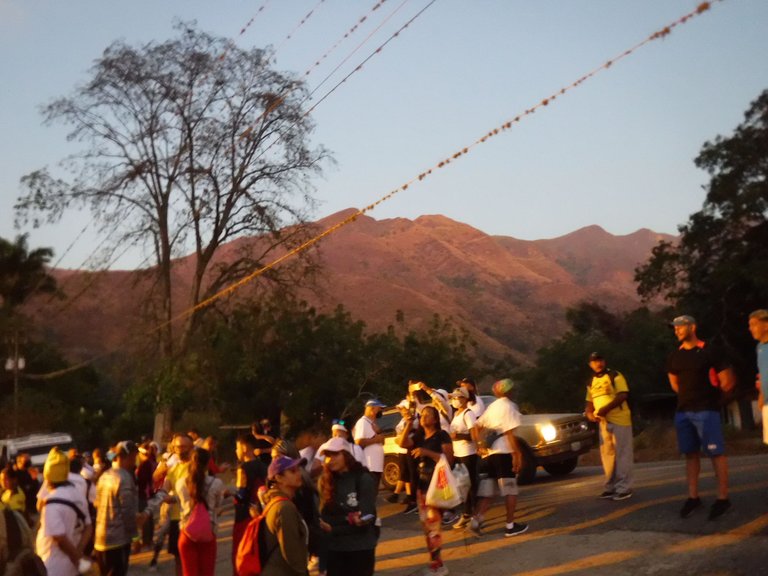
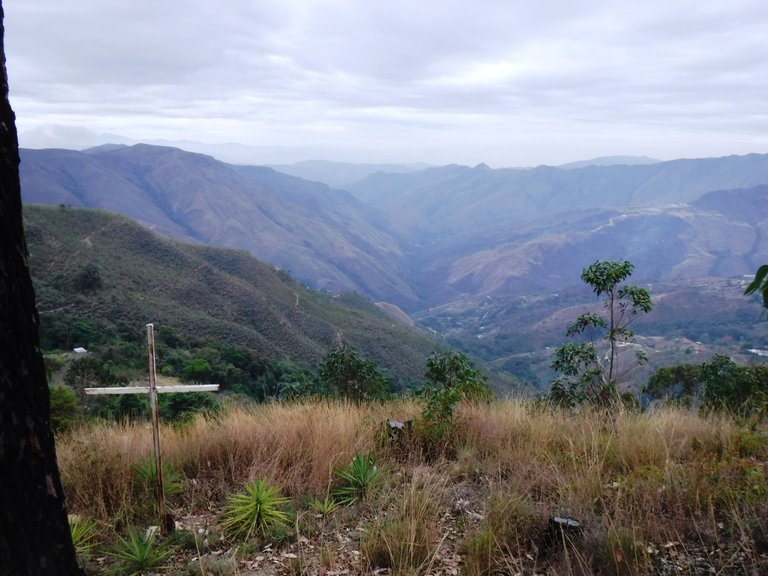
Of course, it is not always easy, because many hikes are demanding and then in addition to the physical effort you must also be aware of photographing each stage of the route and write things down so as not to forget them when you write the review. On this occasion I share images of a hike that has been done every year in February, it goes from Pie de Cerro to Colonia Tovar, both towns are located in Aragua state, Venezuela, separated by approximately 21 km.
Claro, no siempre es fácil, porque muchas excursiones son exigentes y entonces además del esfuerzo físico también debes estar pendiente de fotografiar cada etapa de la ruta y anotar cosas para no olvidarlas cuando escribas la reseña. En esta ocasión comparto imágenes de una caminata que desde hace un tiempo se hace cada año en febrero, va desde Pie de Cerro hasta la Colonia Tovar, ambas localidades ubicadas en el estado Aragua, Venezuela, separadas por aproximadamente 21 Km.
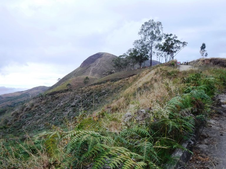
This route is quite demanding, not because of its length but because it has many steep climbs. It is important to start as early as possible to avoid the sun to wear you out and also to go with people who know the way, as there are many parts where you could get lost if you don't know the area.
Este recorrido es bastante exigente, no por lo largo sino porque tiene muchas subidas empinadas. Es importante empezar lo más temprano posible para evitar que el sol te desgaste y también ir con personas que sepan el camino, ya que hay muchas partes en las que te podrías perder si no conoces la zona.
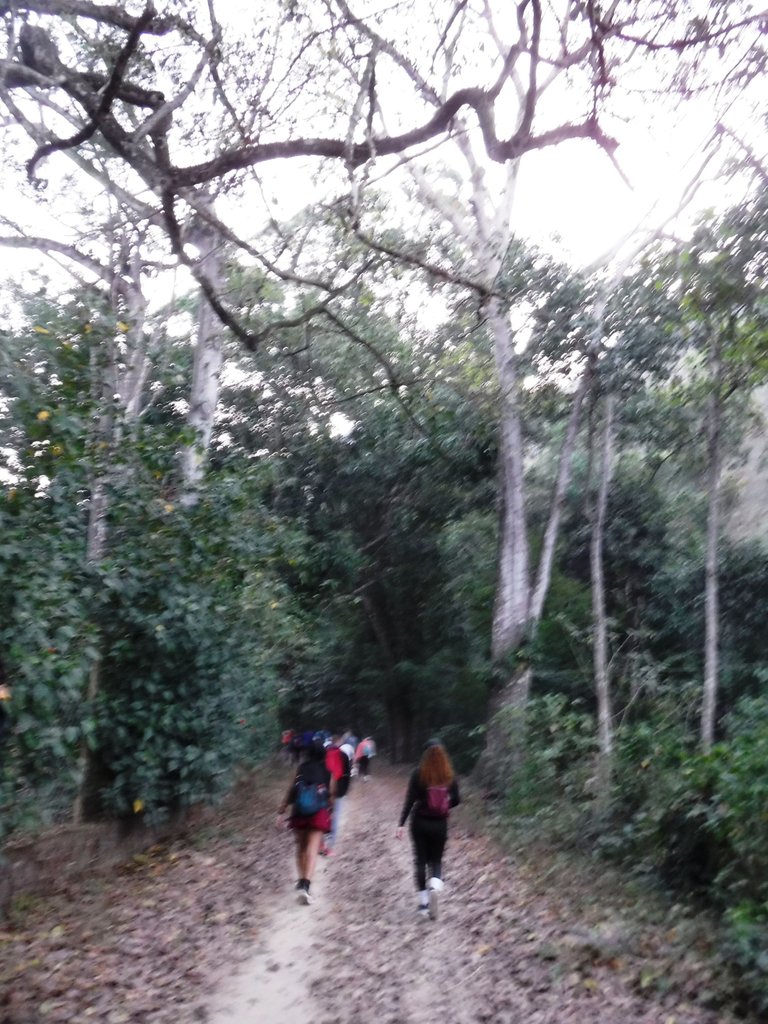
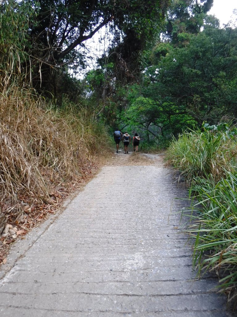
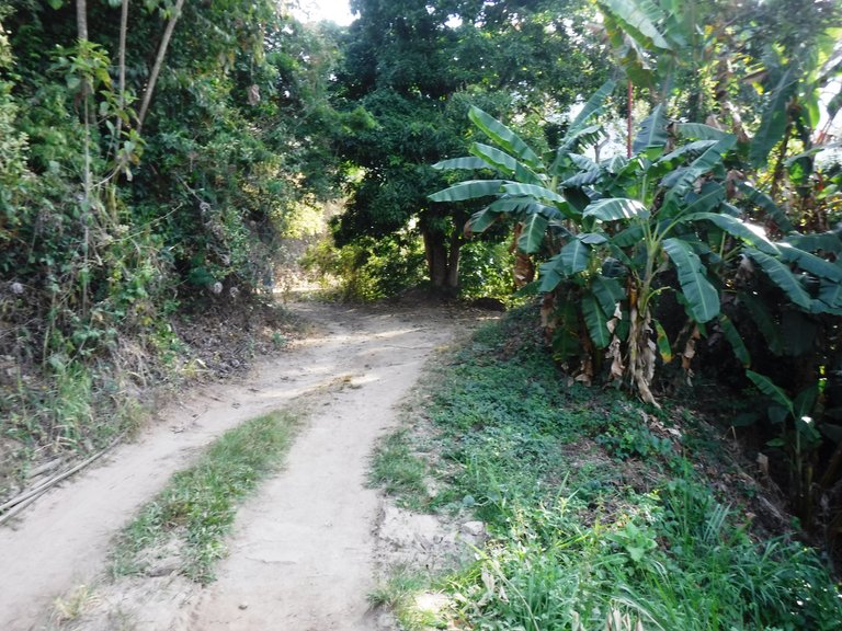
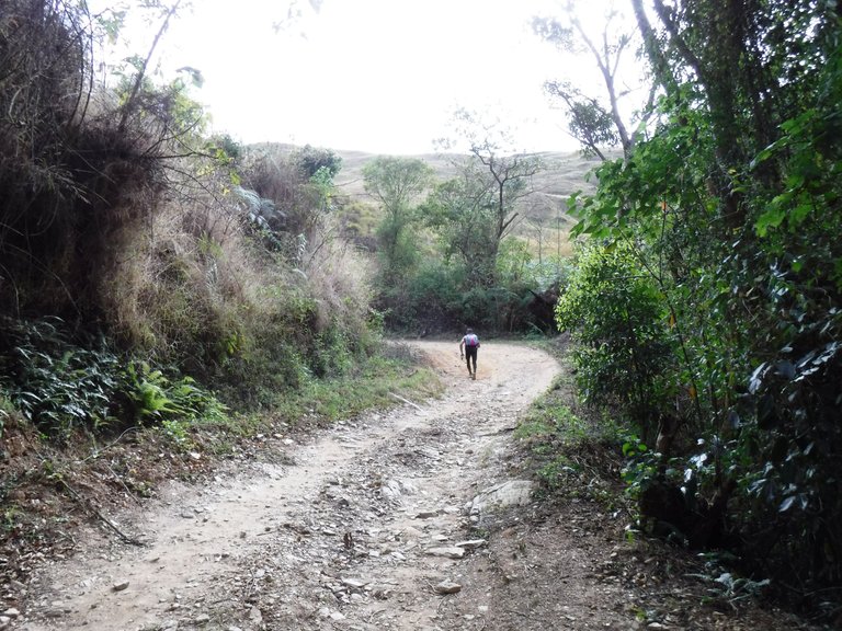
At the beginning you walk through the forest, with large trees and a lot of vegetation around you. You must be prepared to cross the river, which appears five times during, let's say, the first stage of the route. It is not deep but if you don't want to take off your shoes, you will have to cross it walking on the stones, I did it this way and had no problem.
Al principio transitas por el bosque, con grandes árboles y mucha vegetación alrededor. Debes estar preparada/o para cruzar el río, el cual aparece en cinco oportunidades durante digamos la primera etapa de la ruta. No es profundo pero si no quieres quitarte los zapatos, deberás cruzarlo caminando sobre las piedras, yo lo hice así y no tuve problema.
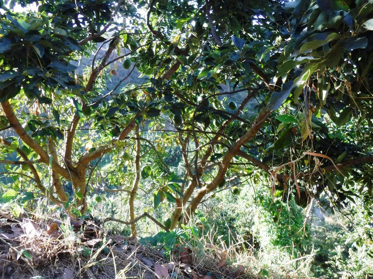
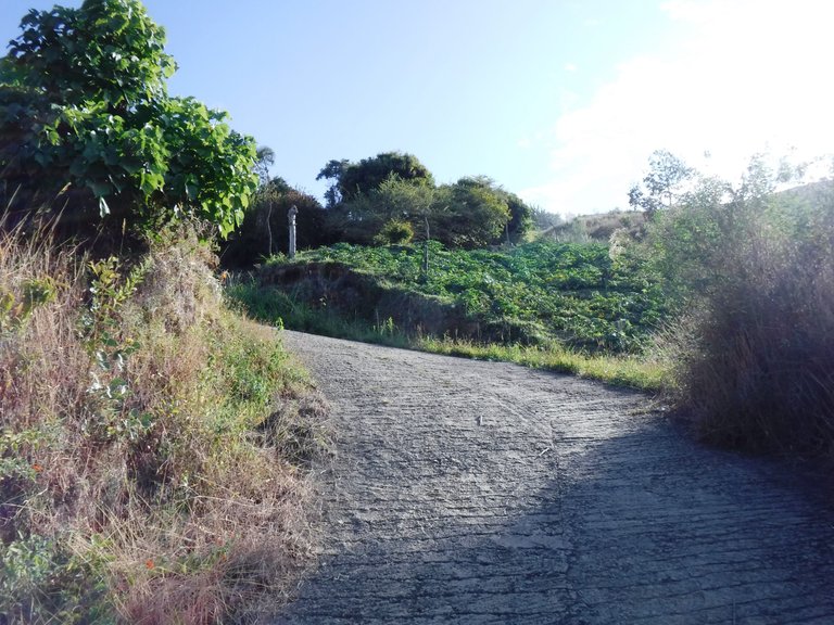
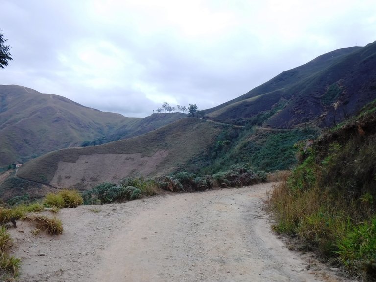
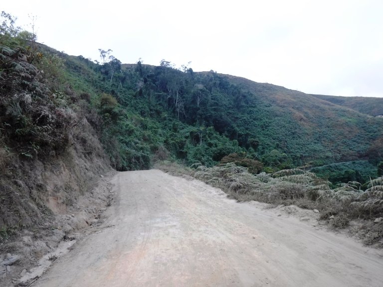
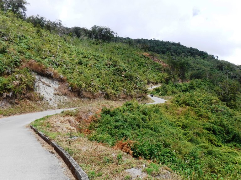
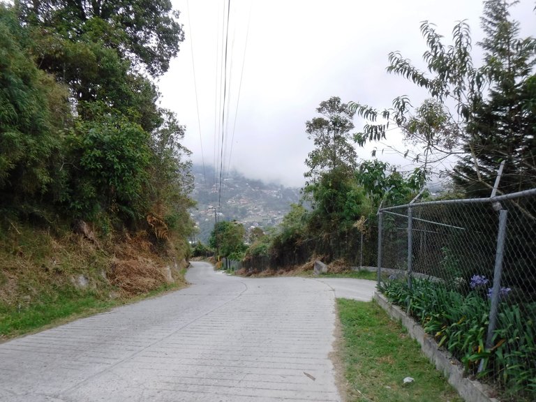
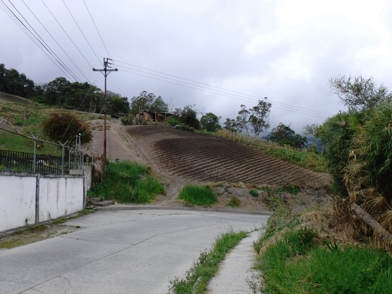
More or less half of these 21 km are on dirt roads, but there are small parts with cement. Throughout the area there are hamlets, the people who live here are dedicated to planting vegetables and fruits.
Más o menos poco más de la mitad de estos 21 Km transcurren por senderos de tierra, pero hay pequeñas partes con cemento. Por toda la zona hay caseríos, la gente que vive por acá se dedica a la siembra de vegetales y frutas.
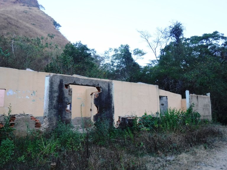
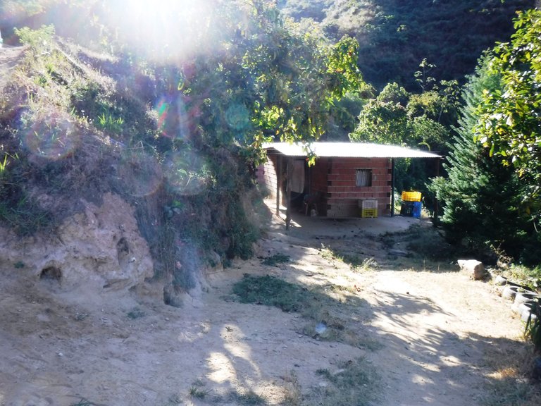
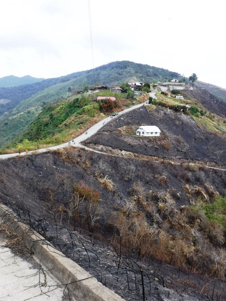
As everywhere, there are places that have been abandoned...
Como en todas partes, hay sitios que han sido abandonados...
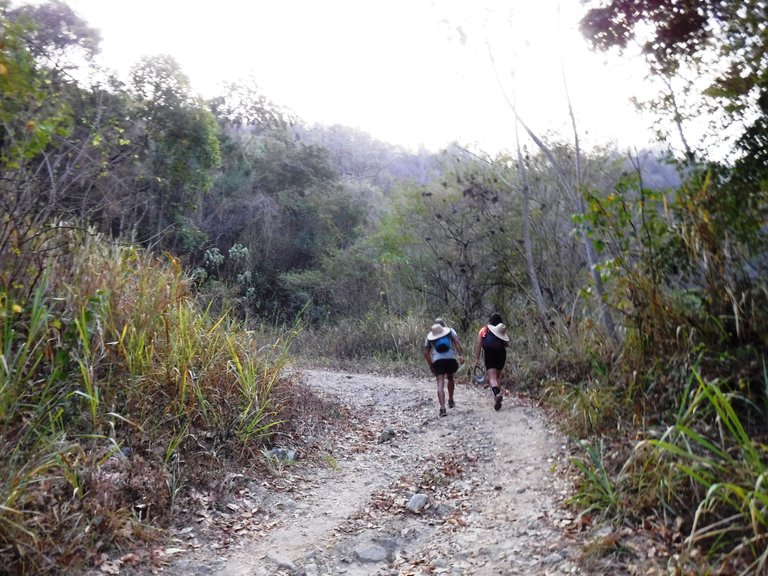
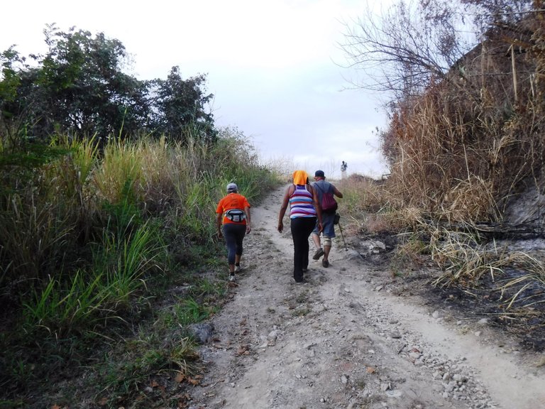
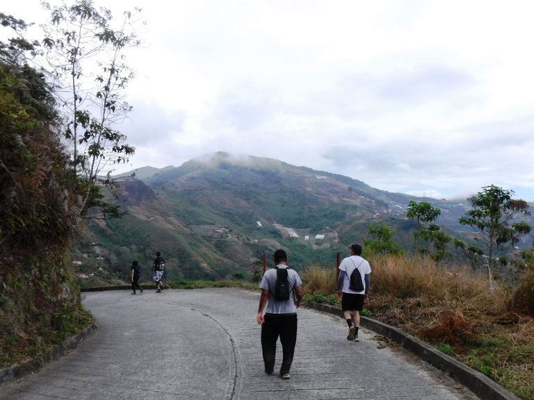
Although we were a crowd on this hike (more than 700 people), as you go along, everyone goes at their own pace, so the crowds disappear.
Aunque éramos un gentío en esta caminata (más de 700 personas), a medida que vas avanzando, cada quien va a su ritmo, entonces las aglomeraciones desaparecen.
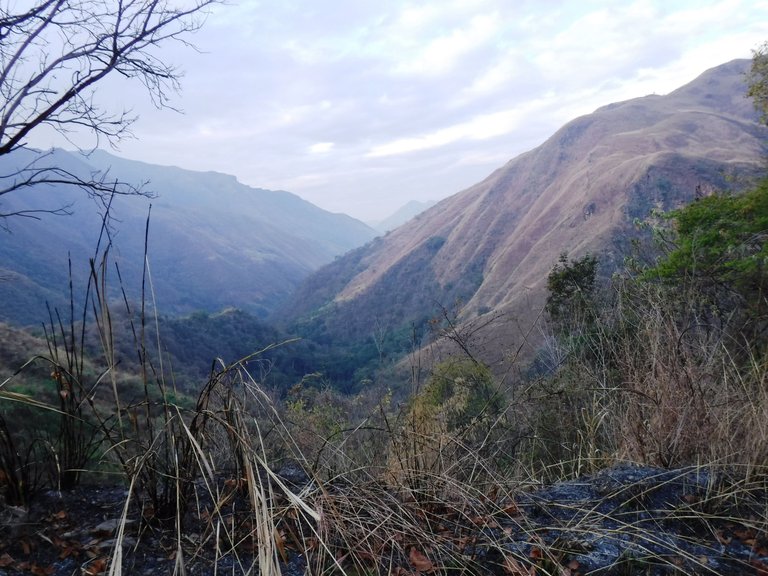
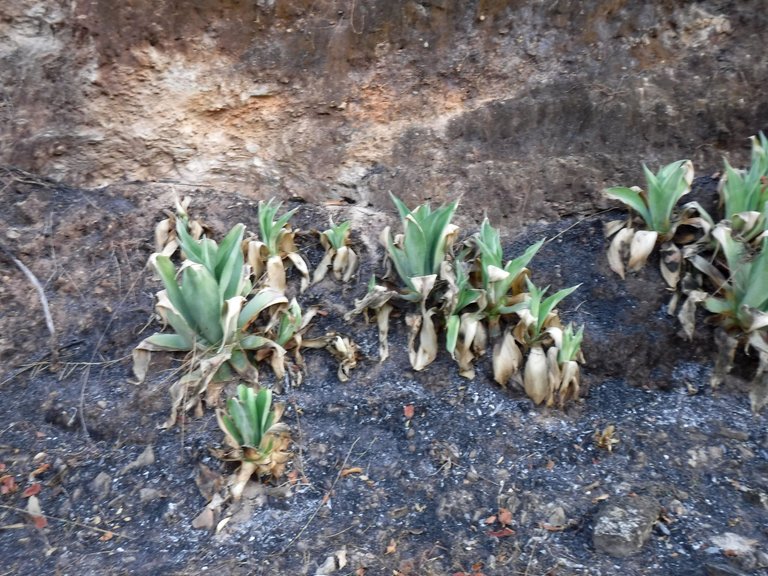
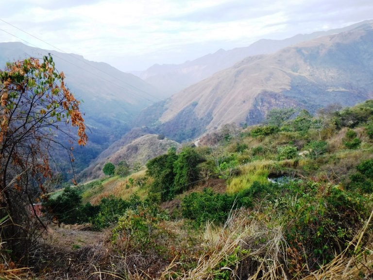
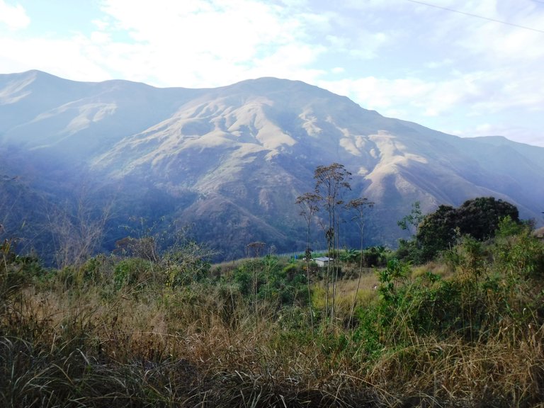
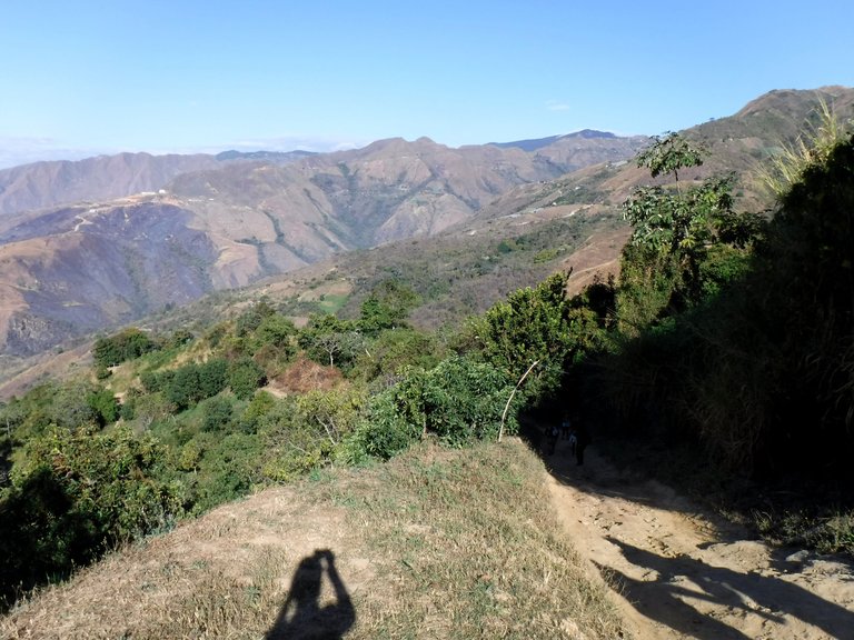
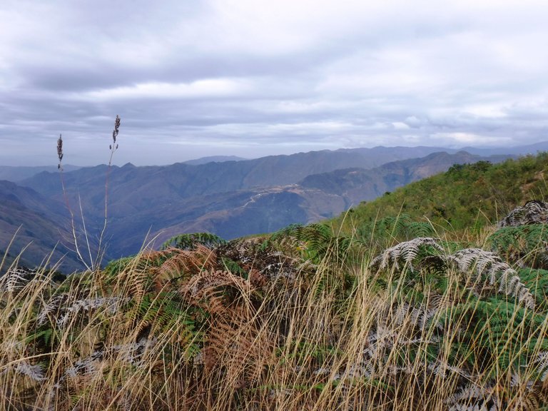
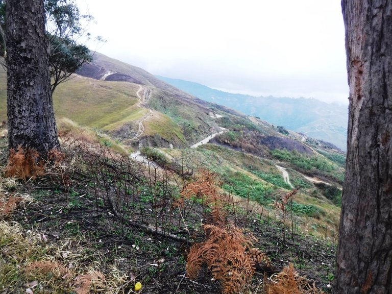
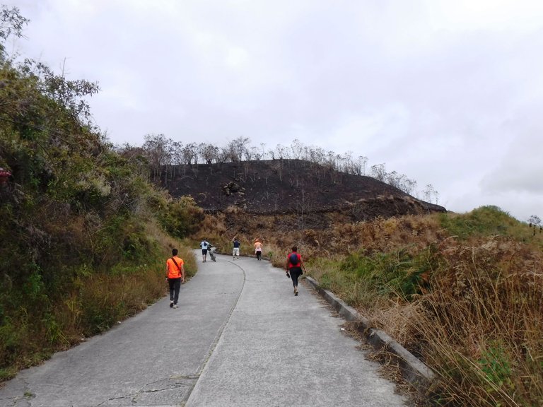
The landscapes in these mountains of Aragua State are incredible, even in the middle of summer and with the usual fires of the dry season, they don't lose their beauty.
Los paisajes en estas montañas del estado Aragua son increíbles, aún en pleno verano y con los acostumbrados incendios de la época de sequía, no pierden su belleza.
One of the things that many people find surprising when they go for the first time to this type of activity, is the amount of older people who hike, the truth is that you don't see many young people doing this, I think it is something that should be encouraged because walking in nature is medicine for the body and mind.
Una de las cosas que a muchos les parece sorprendente cuando van por primera vez a este tipo de actividad, es la cantidad de gente mayor que hace senderismo, la verdad es que no ves a muchos jóvenes en esto, me parece que es algo que se debería incentivar porque caminar entre la naturaleza es medicina para el cuerpo y la mente.
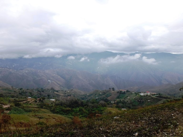
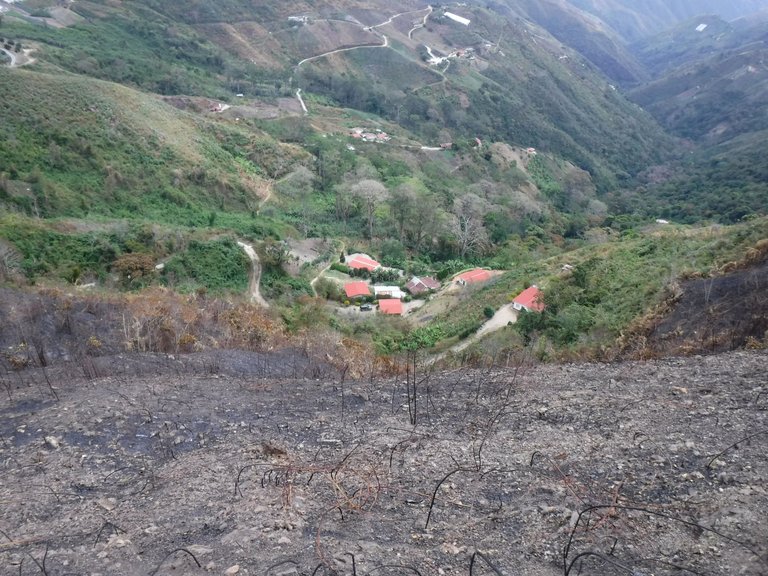
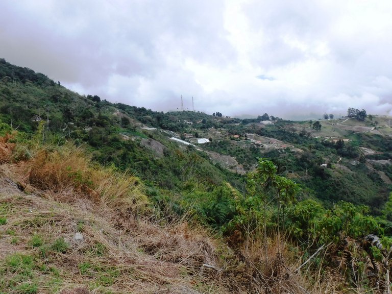
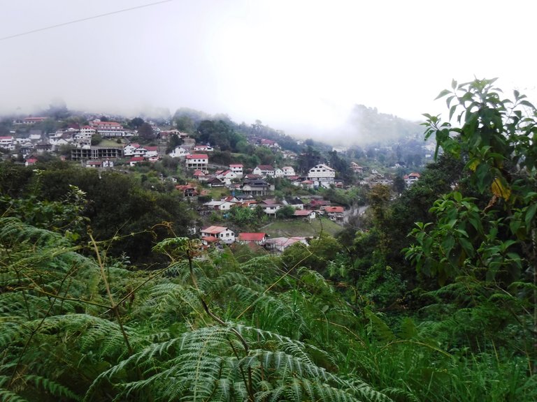
In the brief pauses I made in places that were like viewpoints, I could see some crops, human activity in the distance, look at that water tank and small houses scattered throughout the mountains.
En las breves pausas que hice en lugares que eran como miradores, pude ver algunos sembradíos, actividad humana a lo lejos, miren ese tanque de agua y pequeñas casas esparcidan por las montañas.
But there comes a point where the crops are on one side of the road, and here you come across many motorcycles, a vehicle widely used by the people who live and work in this area.
Pero llega un punto donde los sembradíos están a un lado del camino, por aquí te topas con motorizados, un vehículo muy usado por la gente que vive y trabaja en esta área.
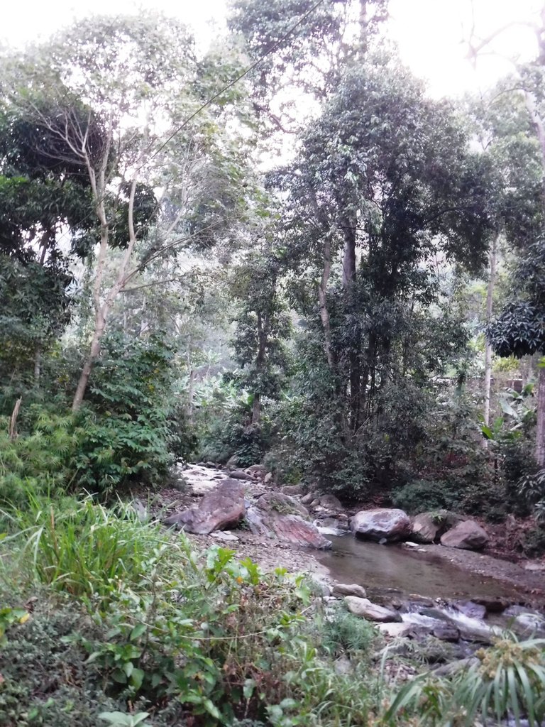
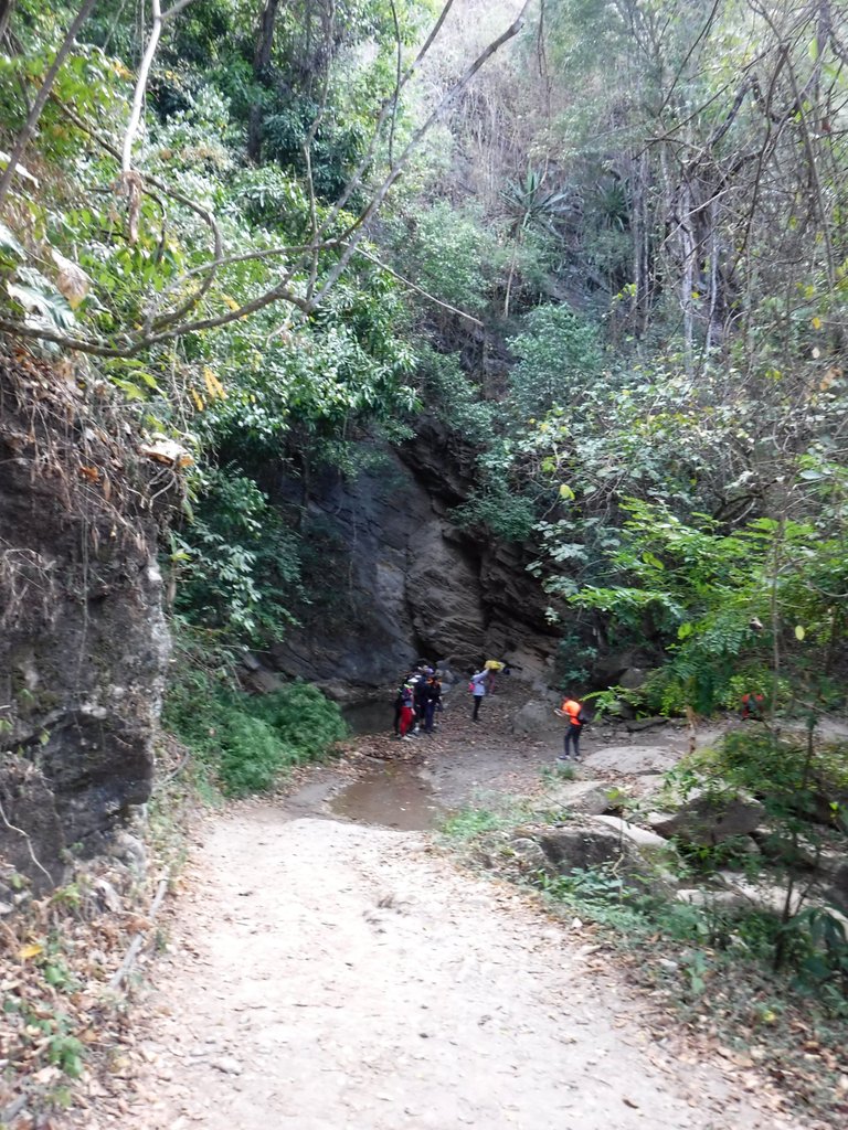
There are many water sources in these mountains, apart from the five river crossings at the beginning of the route, we got some small waterfalls further on. I don't know if it was drinkable, but I think some people refilled their bottles, I had brought three liters of water and I ran out about a kilometer before reaching the finish line, so I recommend bringing a little more.
Hay muchas fuentes de agua en estas montañas, aparte de los cinco pasos de río que se cruzan al inicio de la ruta, nos conseguimos unas pequeñas cascadas más adelante. No sé si era potable, pero creo que algunas personas recargaron sus botellas, yo había llevado tres litros de agua y se me acabó como un kilómetro antes de llegar a la meta, así que recomiendo llevar un poco más.
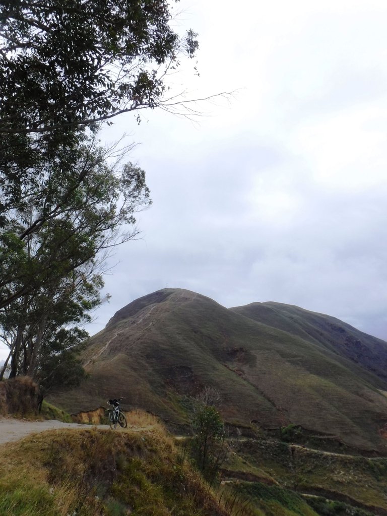
The most difficult part of all seemed to me to be the one they call "The Devil's Ascent", the name says it all hahaha, it is long and super steep.
La parte más difícil de todas me pareció que es la que llaman "La subida del Diablo", el nombre lo dice todo jajaja, es larga y súper empinada.
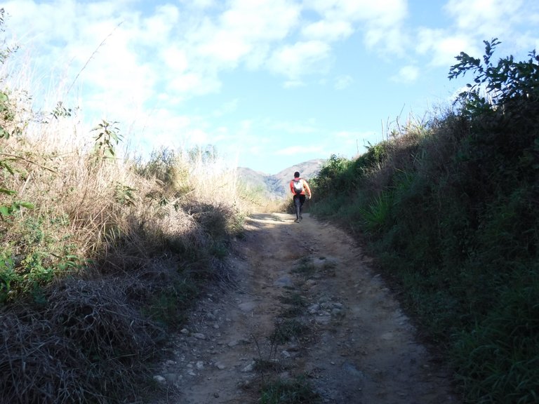
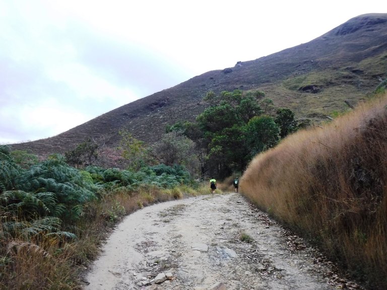
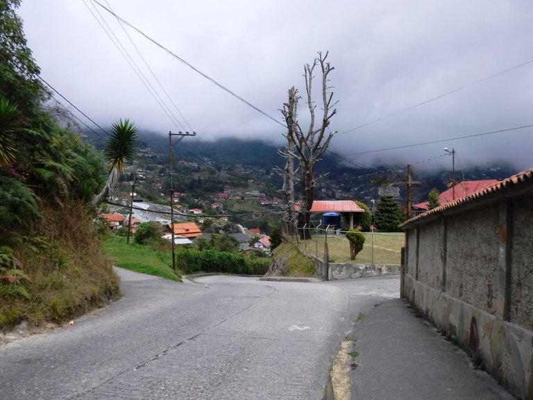
When I had been walking for almost three hours, I began to see more hamlets, a sign that we were more than halfway through the 21 km. Here there was no shade almost anywhere and the sun was strong, but at least the trail was flat, with gentle descents and ascents.
Cuando ya tenía casi tres horas caminando, empecé a ver más caseríos, señal de que estábamos como por más de la mitad de los 21 Km. Aquí no había sombra por casi ningún lugar y el sol estaba fuerte, pero al menos el sendero tenía planos, bajadas y subidas suaves.
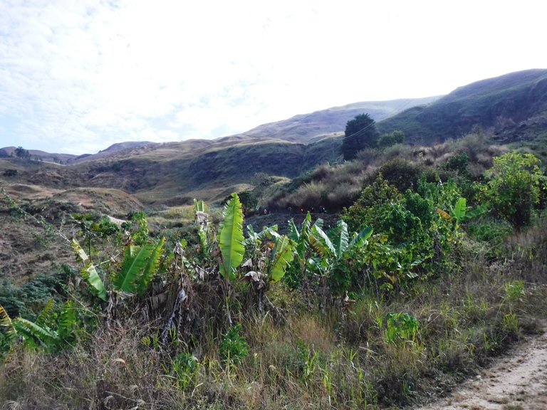
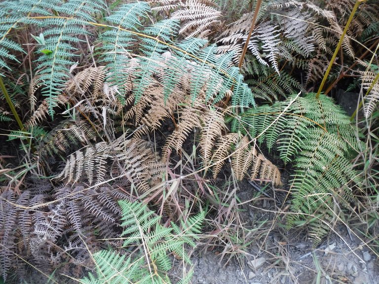
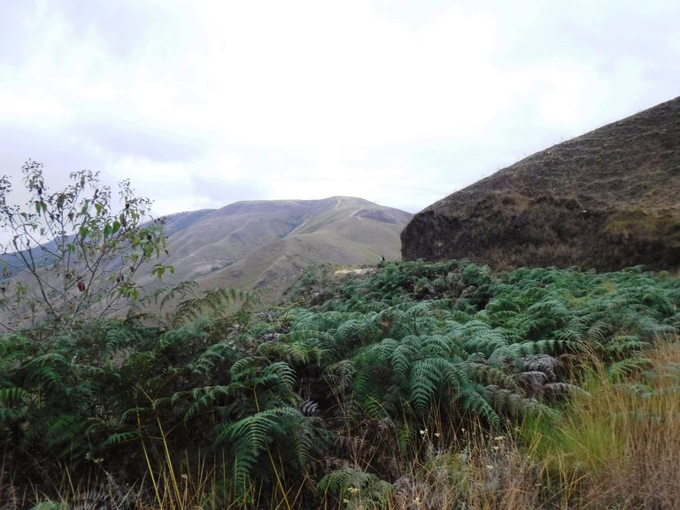
Then we arrived at a clear area with a large number of ferns on the sides, which contrasted with each other because some were very green and others were very dry.
Luego llegamos a un área despejada que tenía a los lados gran cantidad de helechos, contrastaban entre ellos porque algunos estaban muy verdes y otros muy secos.
Then the route took us to a point known as The Eucalyptus, because of the trees of this species that are there.
A continuación la ruta nos llevó a un punto conocido como Los Eucaliptos, por los árboles de esta especie que hay allí.
The Eucalyptus is an excellent viewpoint and also a good place to take a break and eat something, I had brought fruits, cookies and a sandwich. I only ate some cookies there because I don't like to stop for too long, I didn't want my muscles to get cold.
Los Eucaliptos es un excelente mirador y también un buen lugar para hacer una pausa y comer algo, yo había llevado frutas, galletas y un sandwich. Sólo comí unas galletas allí porque no me gusta detenerme por mucho tiempo, no quería que mis músculos se enfriaran.
After that comes a steep descent, and here the road is all cement. Something nice about this part is that you see all those little roads in the distance drawn in the mountains.
Después de eso viene una bajada fuerte, ya por aquí la vía es toda de cemento. Algo bonito de esta parte es que ves todos esos caminitos a lo lejos dibujados en las montañas.
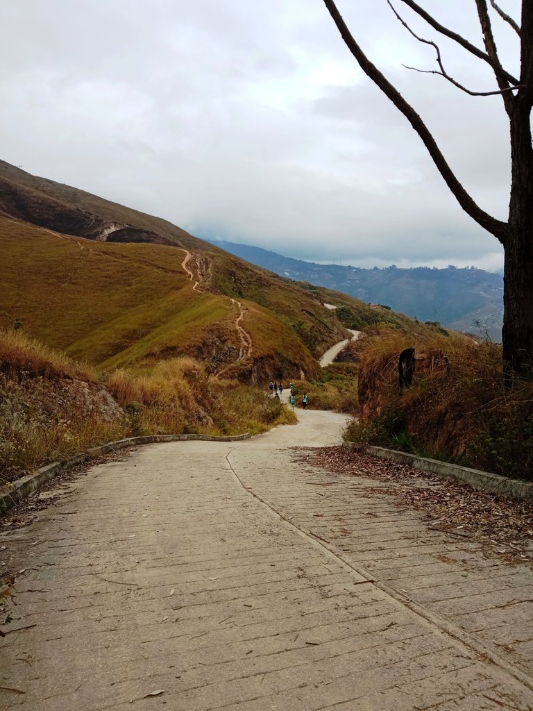
Vehicles circulate along this road constantly and sometimes at high speed, so be alert and don't walk in the middle, as the curves make it difficult for drivers to see walkers in time and brake.
Por esta carretera circulan vehículos constantemente y a veces a gran velocidad, por eso hay que estar alerta y no andar en el medio, ya que las curvas dificultan que los conductores vean a tiempo a los caminantes y frenen.
Colonia Tovar, the goal of this excursion, begins to appear little by little, here it is about 4 km to the village.
La Colonia Tovar, meta de esta excursión, comienza a aparecer poco a poco, aquí ya faltan como unos 4 Km para llegar al pueblo.
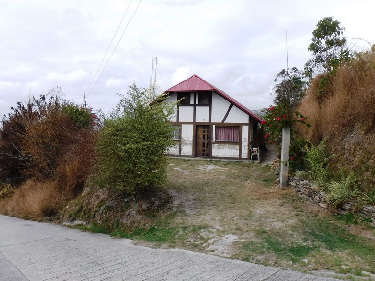
German-style houses dominate the landscape. Colonia Tovar was founded by German immigrants in the mid-19th century.
Las casas de arquitectura de estilo alemán dominan el paisaje, la Colonia Tovar fue fundada por inmigrantes de esa nación a mediados del siglo XIX.
When you see the antennas I show in the photo below you are very close to the village, but be prepared for some extreme descents, many lose their nails after this hike.
Cuando ves las antenas que muestro en la foto de abajo estás muy cerca del pueblo, eso sí, prepárate para unas bajadas extremas, muchos pierden las uñas después de esta caminata.
This street takes you directly to the court, which is where this route ends, and also to the center of Colonia Tovar.
Esta calle te lleva directo a la cancha, que es donde termina esta ruta, y también al centro de la Colonia Tovar.
The crops continue to be cultivated even within the village, any land is exploited, the most famous produced here are strawberries.
Los sembradíos continúan incluso dentro del pueblo, cualquier terreno es aprovechado, lo más famoso que se produce aquí son las fresas.
In Colonia Tovar there is usually a cool climate, on weekends and holidays it is very visited by tourists who come to know and enjoy the culture and gastronomy of this German town in Venezuela.
En la Colonia Tovar suele haber un clima fresco, los fines de semana y feriados es muy visitada por gente de todas partes que viene a conocer y disfrutar de la cultura y gastronomía de este pueblo alemán en Venezuela.
In total it took me six hours to complete this 21 km route, what did you think?
En total tardé seis horas en completar esta ruta de 21 Km, ¿qué les pareció?
All photos are my property and were taken with a Fujifilm FinePix XP90 digital camera / Todas las fotos son de mi propiedad y fueron hechas con una cámara digital Fujifilm FinePix XP90
https://twitter.com/1148004611934117889/status/1628157228413845505
The rewards earned on this comment will go directly to the people( @sofathana ) sharing the post on Twitter as long as they are registered with @poshtoken. Sign up at https://hiveposh.com.
Congratulations, your post has been added to Pinmapple! 🎉🥳🍍
Did you know you have your own profile map?
And every post has their own map too!
Want to have your post on the map too?
Sabes que es posible que haya algun viaje con este tipo de experiencia. Un lugar con montañas y cerros para subir. Me gusta los datos que compartes en este post, ir anotando mientras vas fotografiando cada lugar al paso. Todos los lugares y las fotos son hermosas 😍
!discovery 35
!VSC
@dimascastillo90 has sent VSC to @sofathana
This post was rewarded with 0.1 VSC to support your work.
Join our photography communityVisual Shots
Check here to view or trade VSC Tokens
Be part of our Curation Trail
@dimascastillo90 ha enviado VSC a @sofathana
Éste post fue recompensado con 0.1 VSC para apoyar tu trabajo.
Únete a nuestra comunidad de fotografía Visual Shots
Consulte aquí para ver o intercambiar VSC Tokens
Se parte de nuestro Trail de Curación
Me alegra mucho que te hayan parecido útiles estos datos 🙂, ¡gracias por tu apoyo!
😊🤗
This post was shared and voted inside the discord by the curators team of discovery-it
Join our community! hive-193212
Discovery-it is also a Witness, vote for us here
Delegate to us for passive income. Check our 80% fee-back Program
Thank you so much!
Hermoso!!! Definitivamente me encantaría hacer esa ruta, estamos cerca. Siempre he querido conocer la colonia tovar 🙌
Excelente post, un abrazo ❤️
La Colonia Tovar no te decepcionará jejeje, esta caminata la organizan varios grupos cada año en febrero pero sé que hay gente que la programa en otros meses del año también, sería cuestión de buscar por redes, claro que te encantará :)
Gracias @lunaticanto, ¡abrazo!
Que fotos tan increíbles, se nota que fue un gran esfuerzo el realizar esa caminata pero en definitiva la experiencia debió ser fantástica❤️
Es como dices, el esfuerzo es grande pero la experiencia lo vale, ¡gracias por ver y leer, saludos!
Amiga @sofathana que fantástico recorrido. Que increíble aventura. He conocido gracias a ti esas localidades que algún día sueño con hacer. Es un poco triste ver el estado de abandono de la vegetación y las localidad abandonadas. Me quedaré con las fotos hermosas de la vistas del paisaje. Que gran post amiga🤗🥰. Te felicito 😃.
¡Me alegra que te haya gustado @elamaria!
Es impactante ver algunas partes de las montañas quemadas, pero es porque febrero es pleno verano y cada año suele haber incendios, pero te aseguro que si pasas por allí en época de lluvias todo está verde y frondoso jejeje.
¡Muchas gracias por pasar por acá, saludos!
Amiga @sofathana gracias a ti por compartir tu agradable experiencia 😊😊.
Muy chulas las fotos!
Parece que habeis disfrutado mucho
¡Muchas gracias! Así fue :)