A 15 km Sunday hike for World Environment Day
Although World Environment Day is on June 5, almost a week later, on Sunday 11, the 1st Meeting of Walkers and Hikers of Aragua State (Venezuela) was held in the city of La Victoria to celebrate this date. The meeting point was the Park Ranger Station at the Youth Monument.
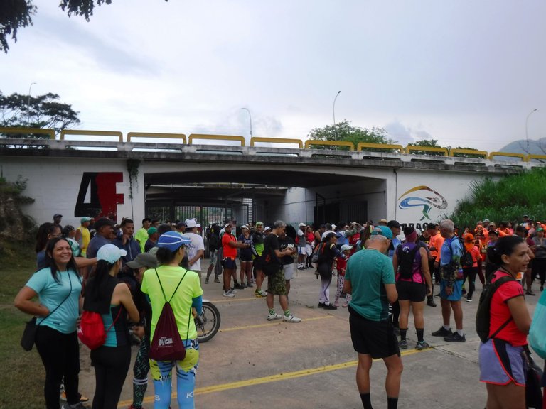
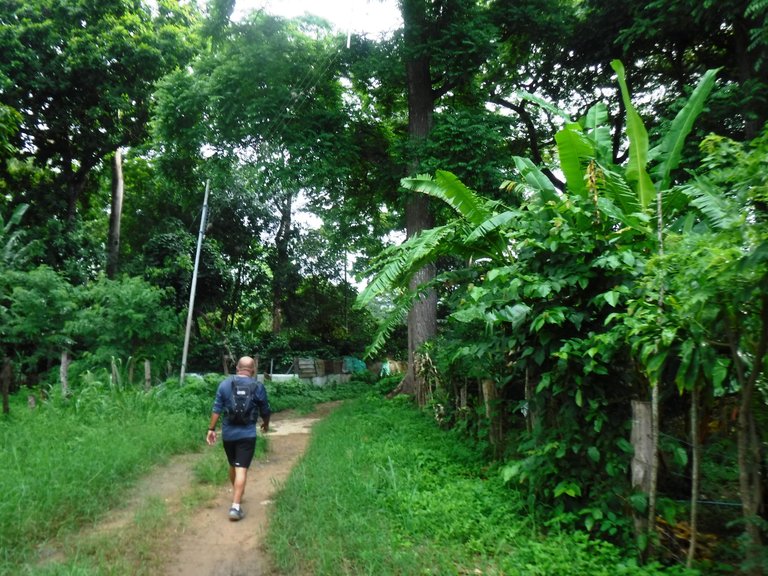
I have hiked in this area but a part of the route they announced this time, I didn't know it, so I was encouraged to go. The departure time was 7:00 am, but we started a little later, at 7:20 am. People came from many places so the atmosphere was very lively.
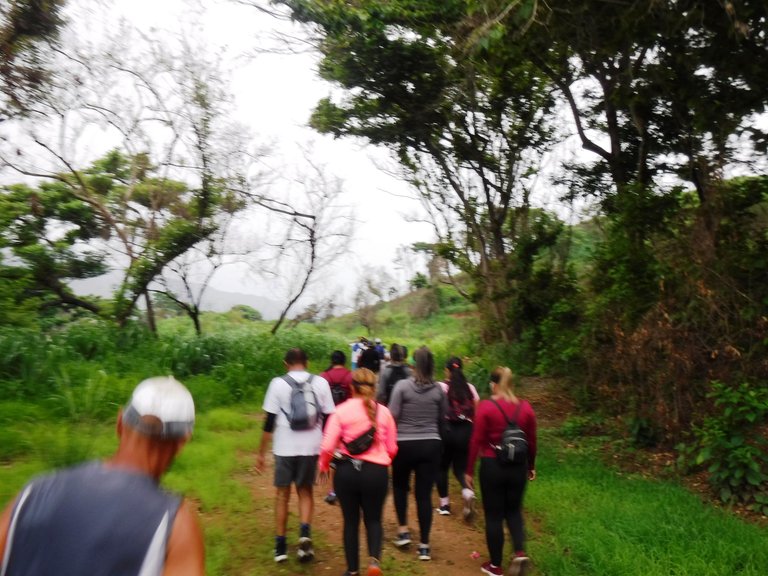
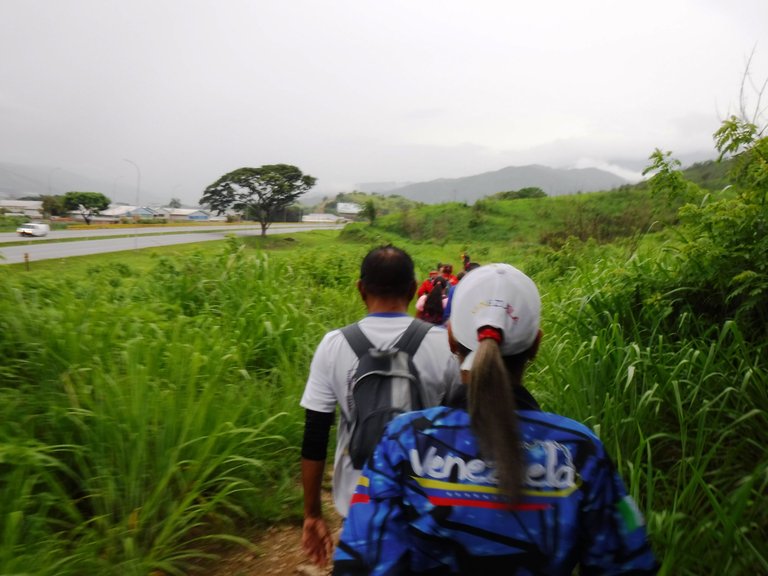
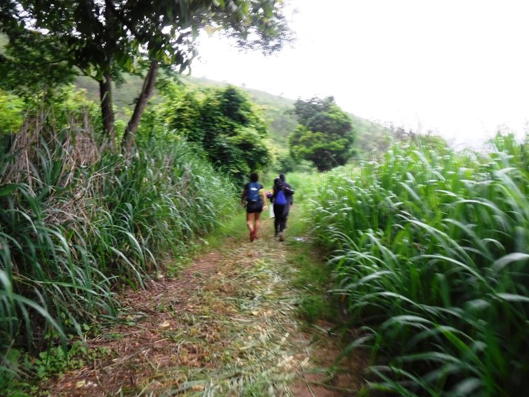
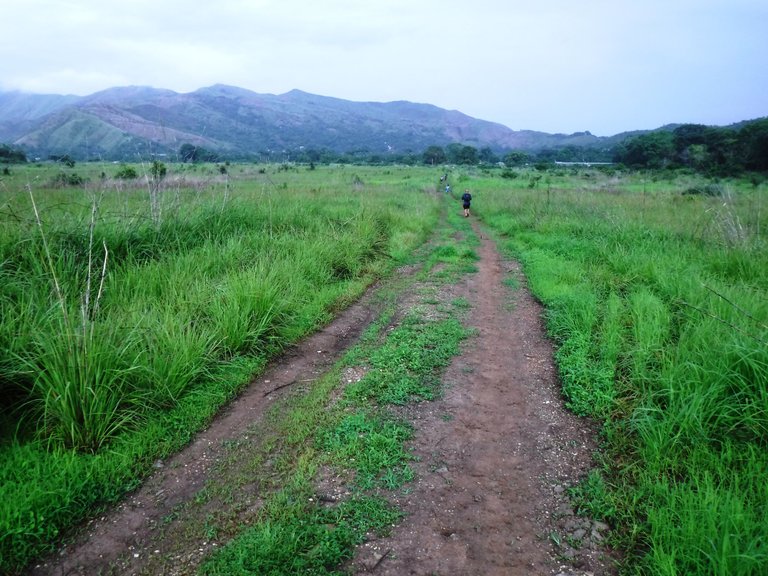
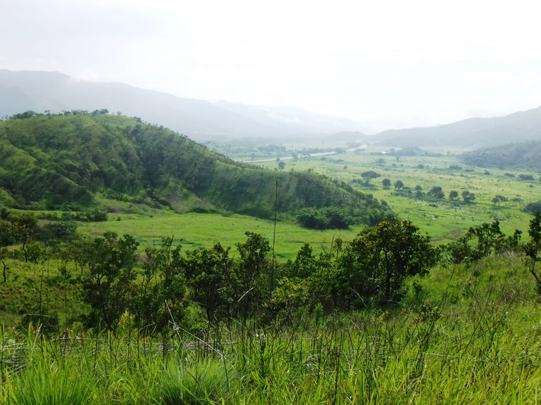
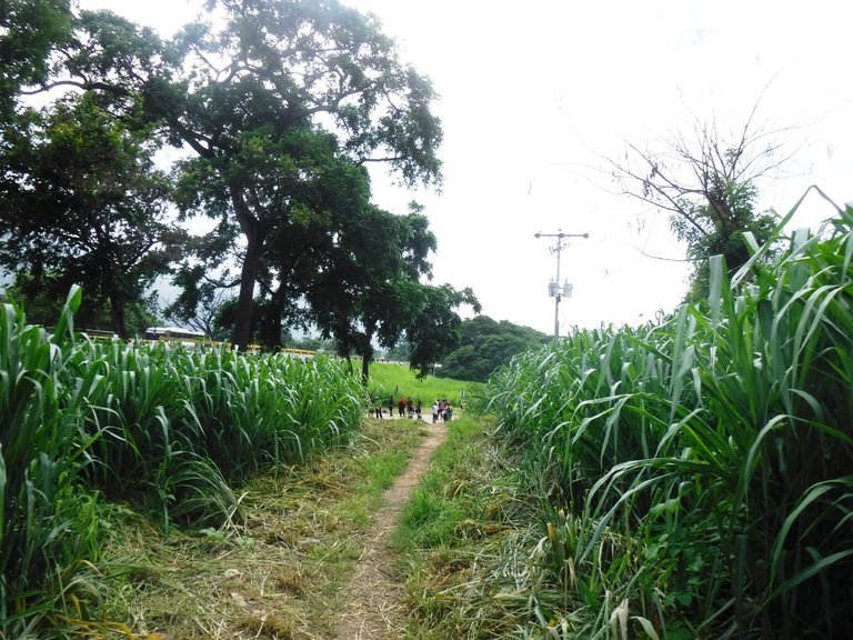
We are in the rainy season here in Venezuela so I expected the day to be cloudy, I just thought it would be good if it didn't rain because the route was 15 km... At first we passed by the side of the highway and then we went into the valleys.
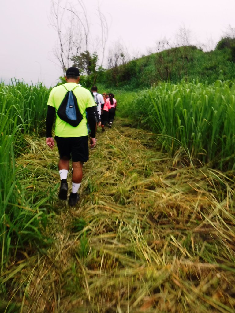
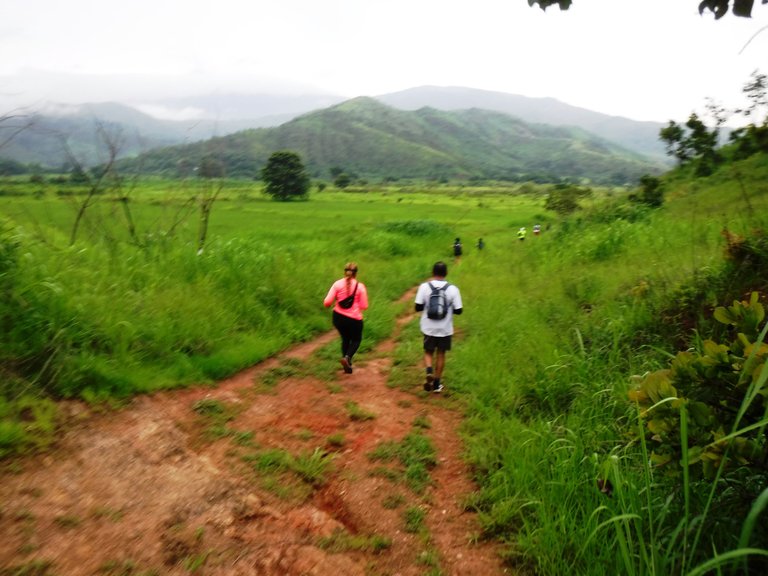
We arrived at a detour where the vegetation had been cut and all that ground was flooded by the recent rains, you stepped on the grass and the water surrounded your shoes, it was inevitable to get them wet.
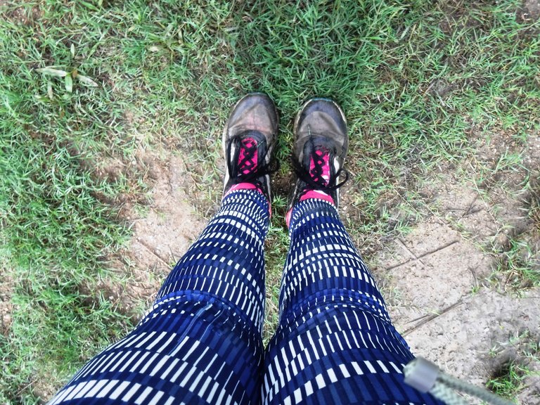
Then the mud appeared and my shoes turned brown 😂, but that was the least of it, you had to step carefully to avoid slipping.
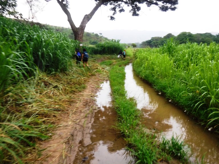
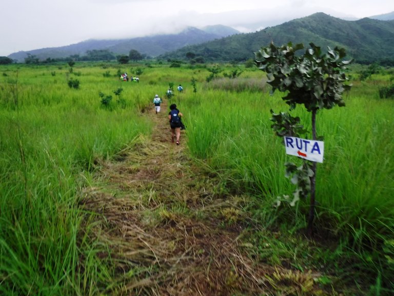
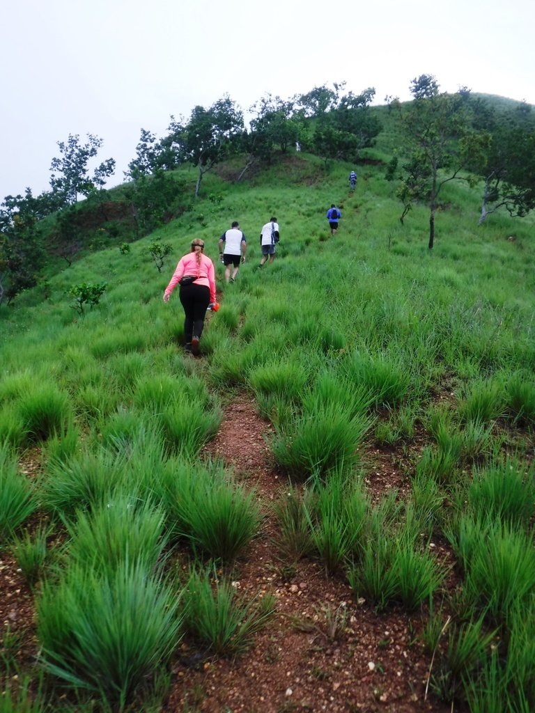
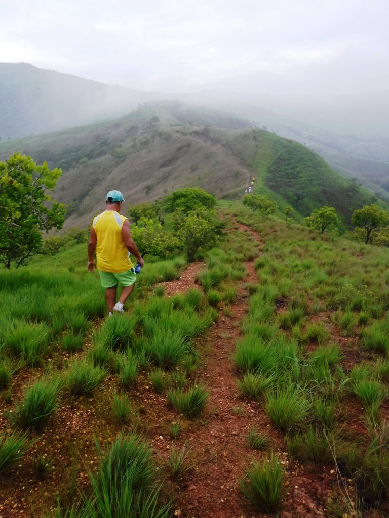
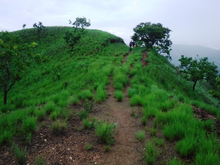
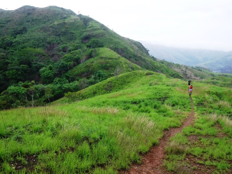
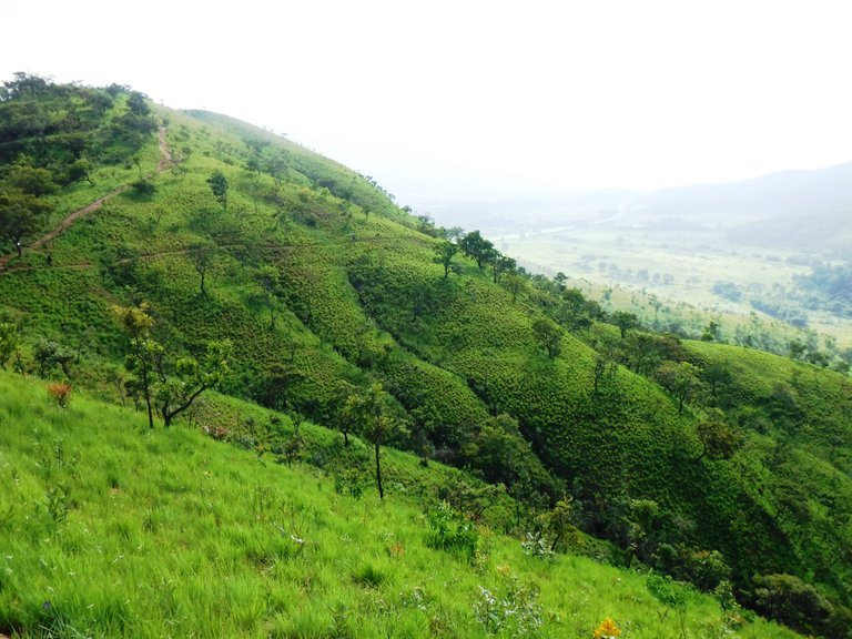
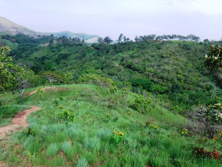
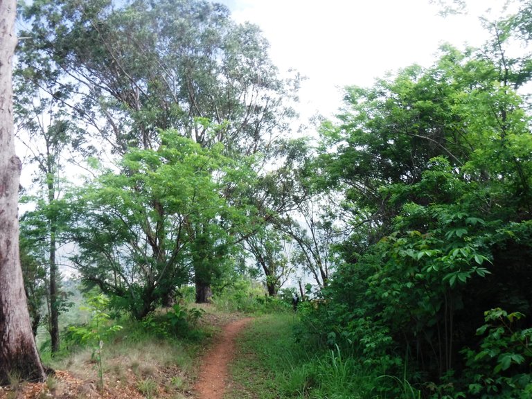
A few meters later the ascent up the mountain began, good on the one hand because there would be no more mud or puddles, but on the other hand we would have to make more physical effort. This is one of the parts that I still didn't know of this area, it is called Las Lapas.
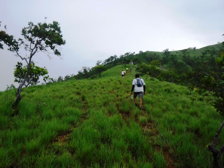
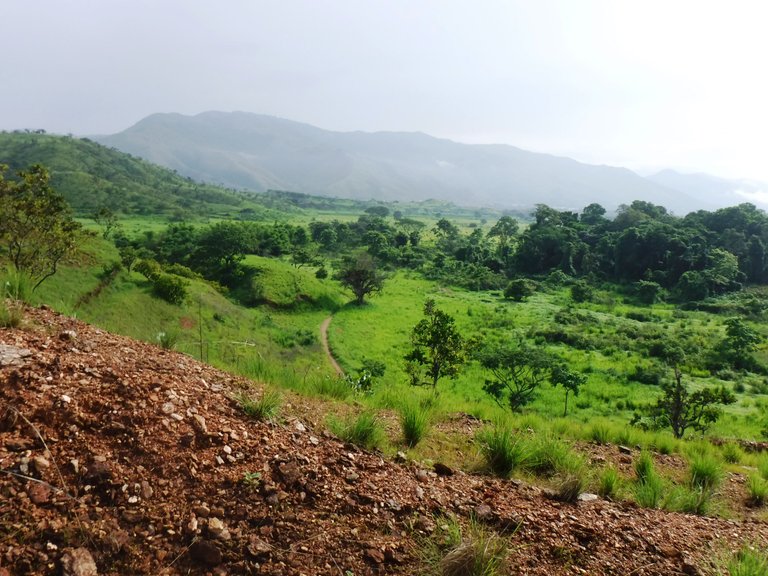
From here you can see the highway and the city in the distance.
This mountain is quite steep, fortunately I had brought my bamboo pole that helped me on the climb, I always say that this hiking "accessory" is like having a third leg.
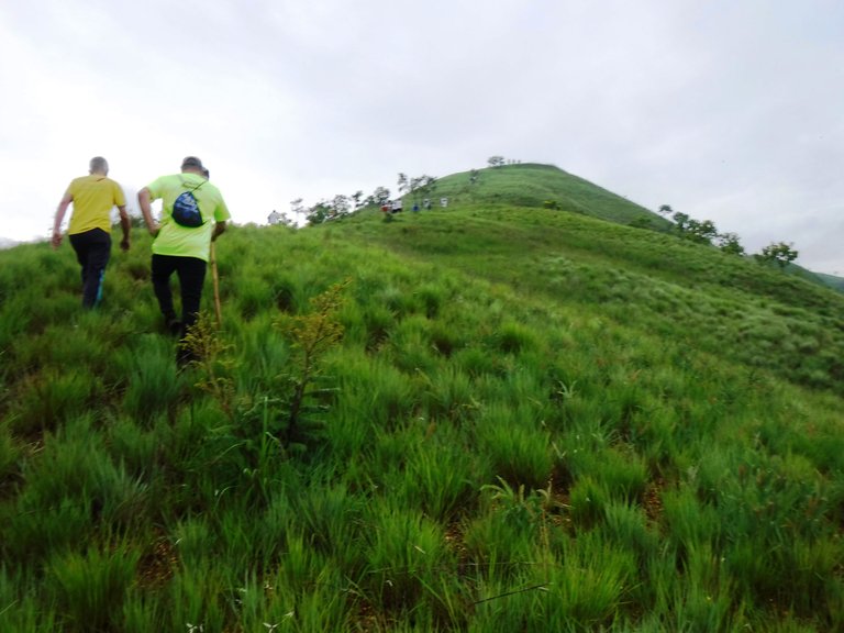
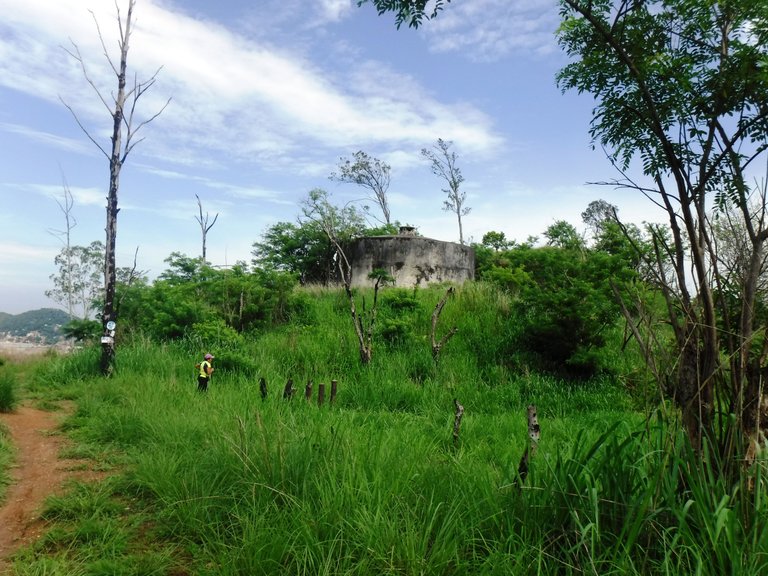
After about 15 minutes of steep climbing I reached a flat part where I stopped for a few minutes to hydrate and relax my legs a bit, also to take a deep breath, taking advantage of the fresh wind blowing.
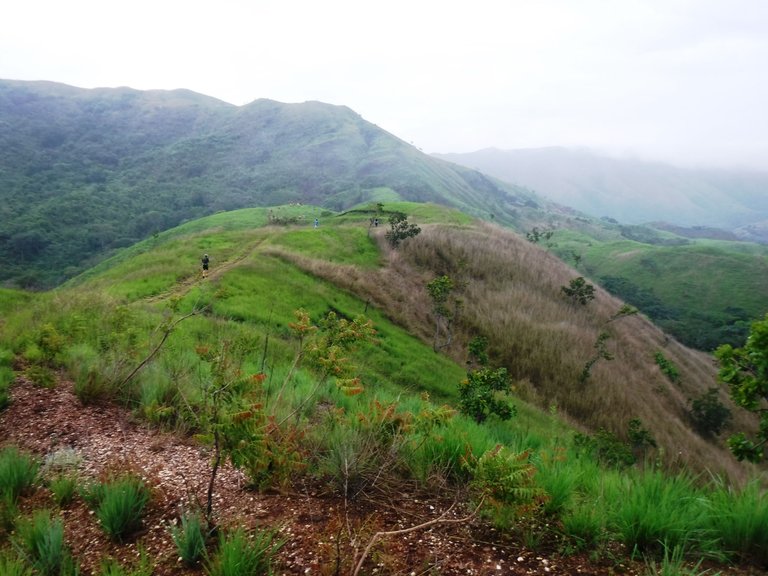
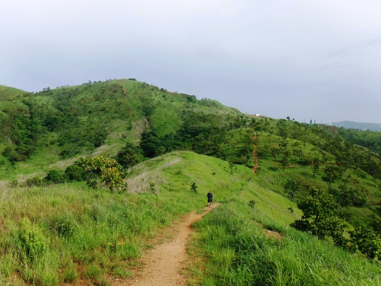
More views of the city and the people coming up.
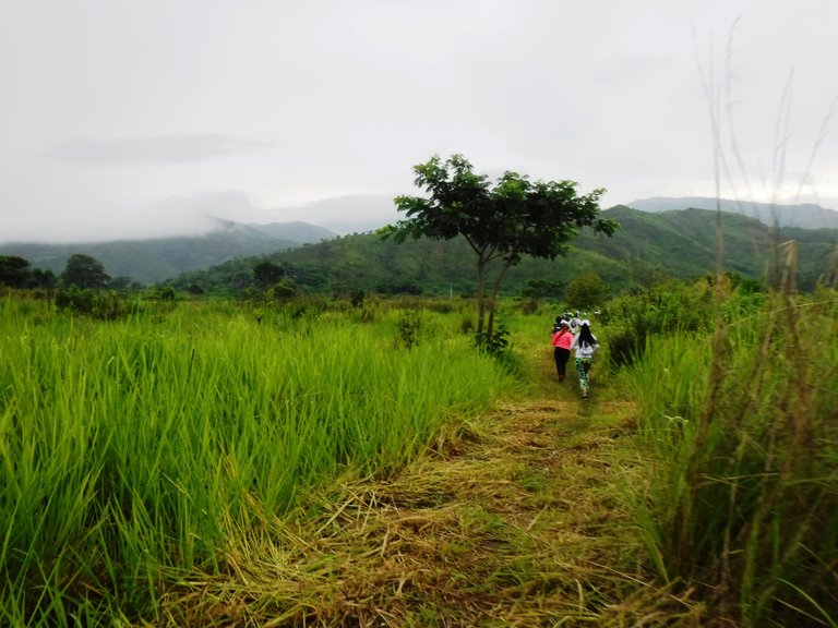
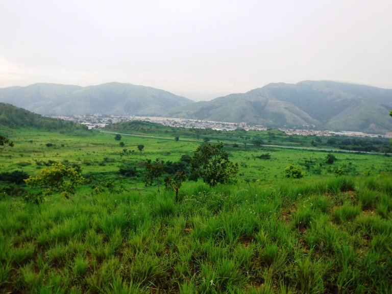
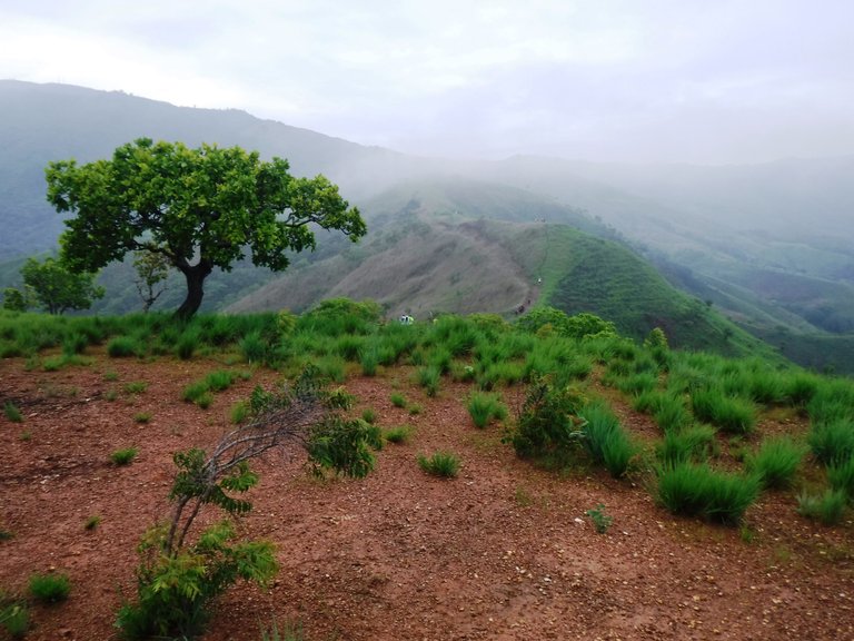
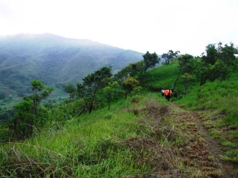
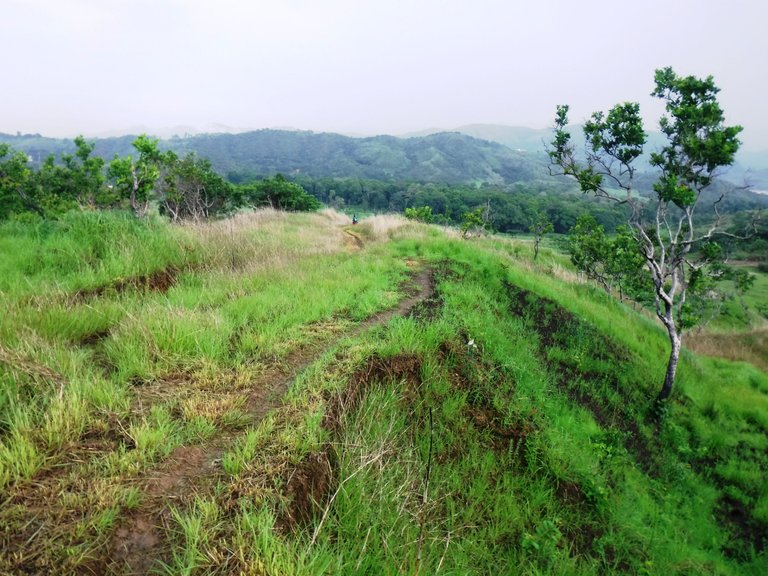
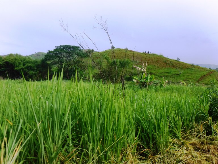
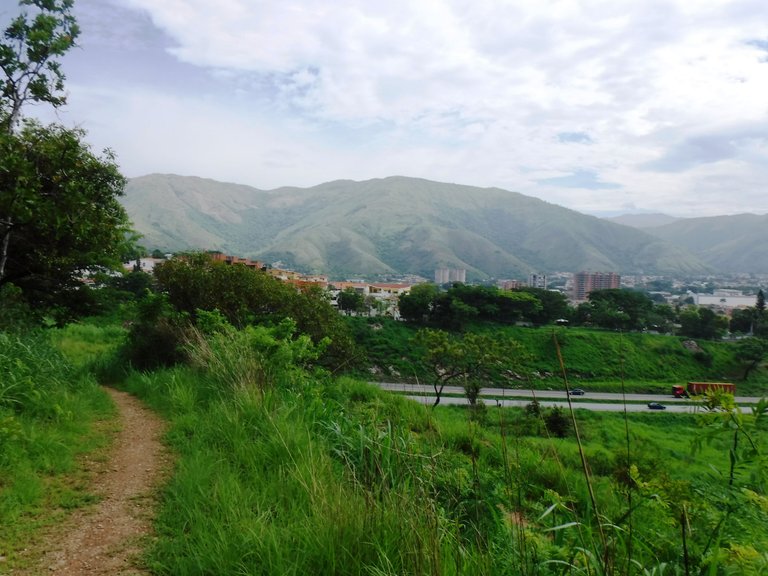
Now came a descent, this part is like a row, I liked it a lot because you could see another side of the mountains and valleys that are around here, plus it looks beautiful because the rains have greened everything.
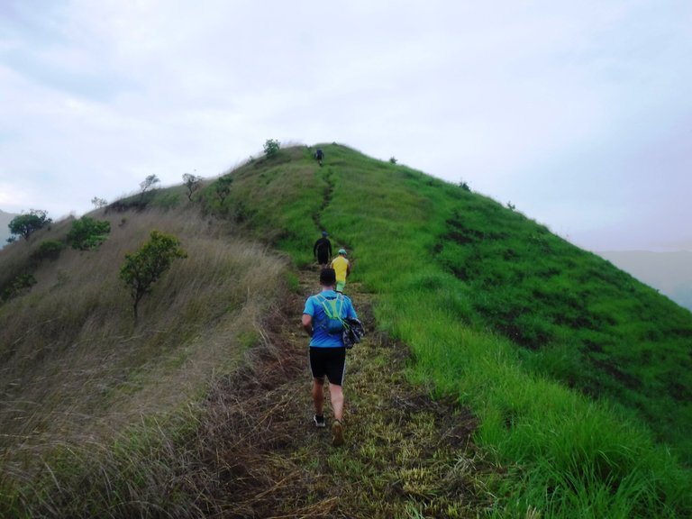
One of the things I enjoy when I hike is to listen and observe the environment, nature, and it is possible because although at the beginning people are more united, as you move forward they disperse, everyone goes at their own pace, so it is possible to stay alone in several sections and pay attention to the sounds and other details that you would not notice if you are talking to someone.
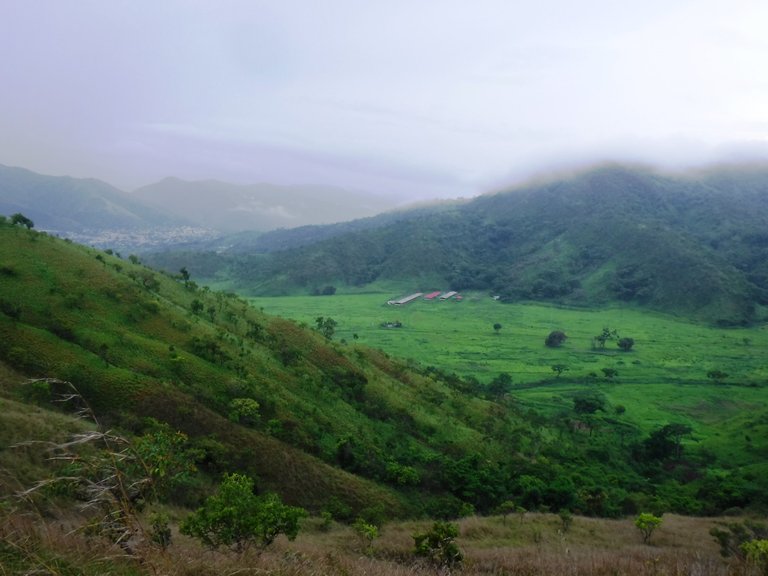
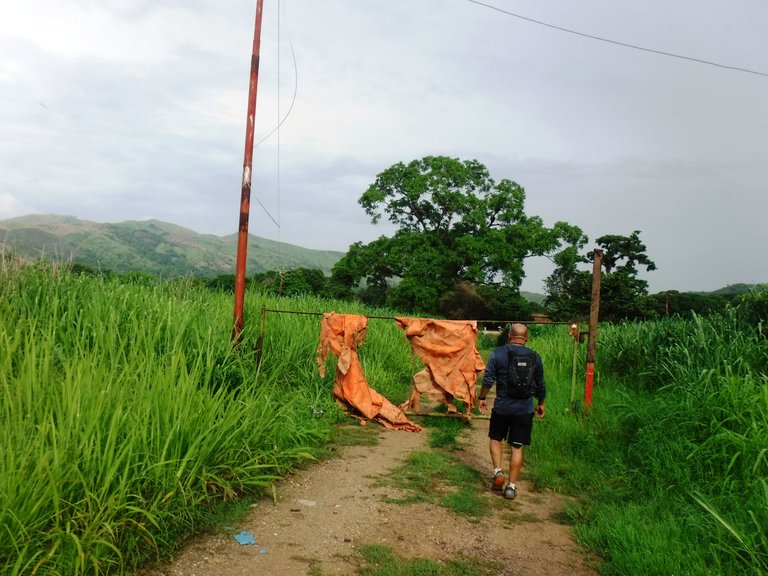
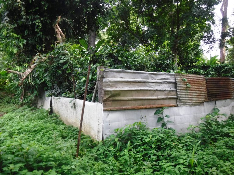
The descent lasted about half an hour and suddenly a little before reaching a valley, traces of civilization appeared, some little houses and a man working on his crops.
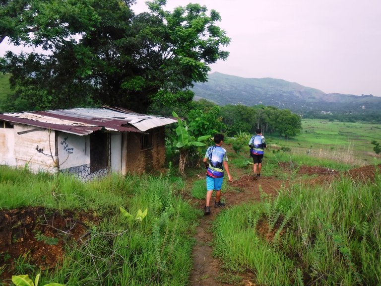
The route was now flat for quite a while, ahead were some police officers who were part of the logistics of this walk, in which the mayor's office of La Victoria and several hiking groups from Aragua state were involved.
That's how my shoes were doing, they had dried out a bit but were brown.
Then I came across these friends grazing, a man was nearby, keeping an eye on them.

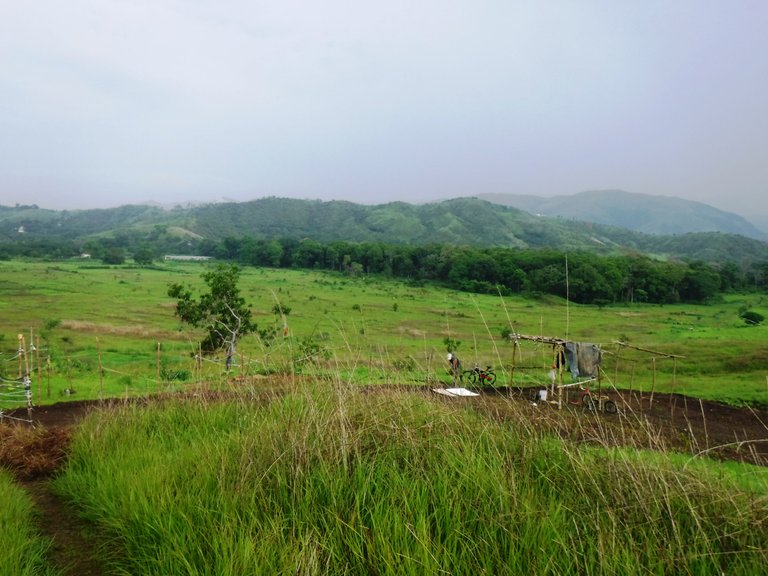
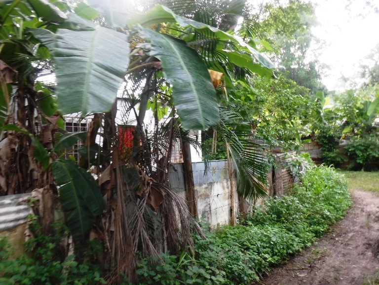
At this point we were already in a sector called Las Guacamayas, a town with many plantations and some farm animals.
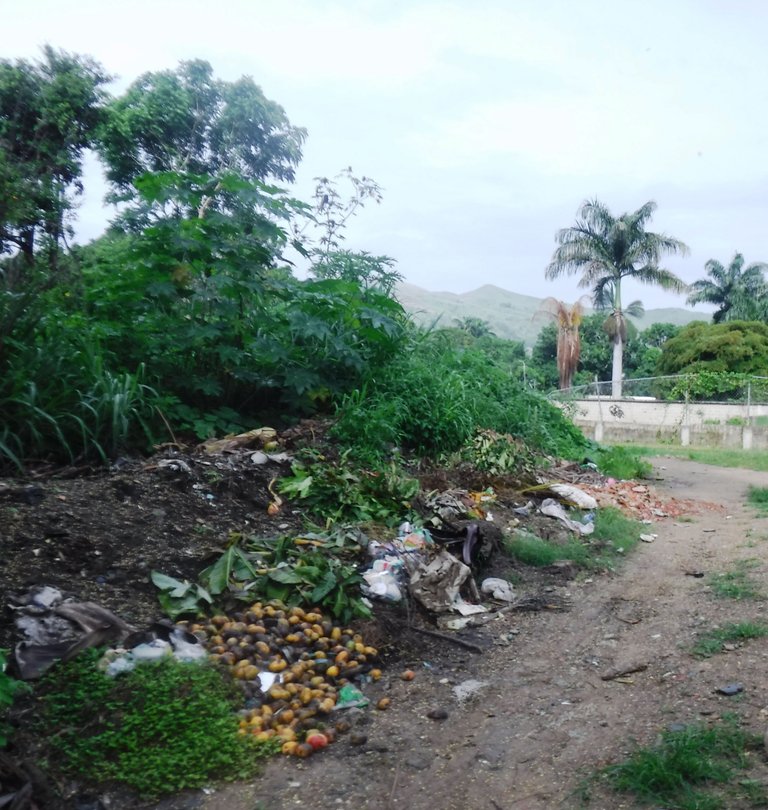
And since we were in civilization we couldn't miss the garbage 😒, and since there are many mango trees around here, the smell of this rotten fruit floated in the air, it is a pity that it is lost like this.
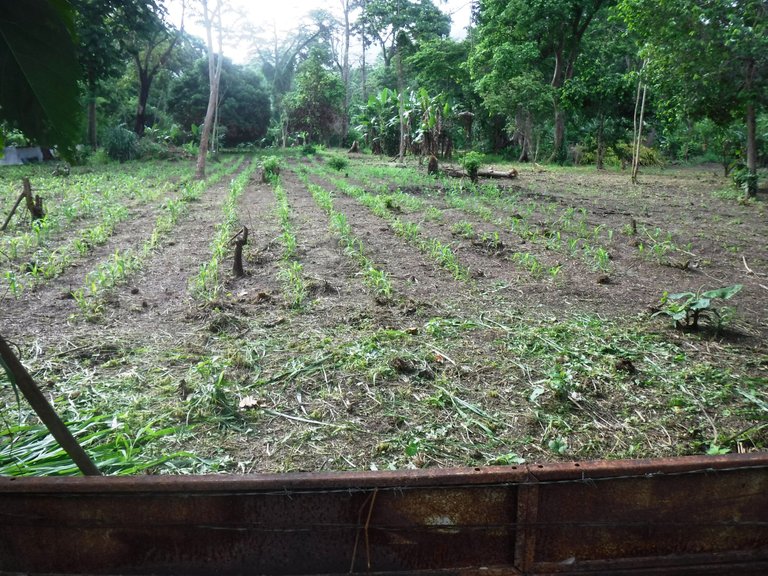
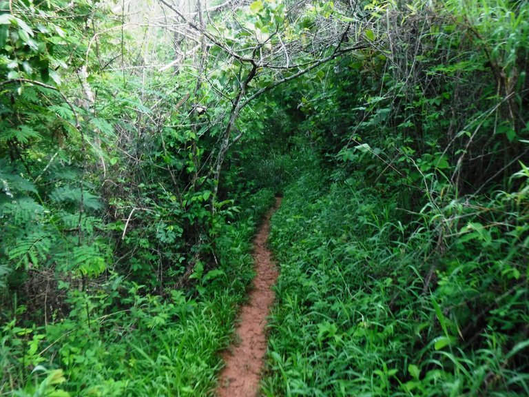
We passed through an area with a lot of vegetation and tall trees, there were several fenced plantations, apart from bananas I could identify coffee bushes.

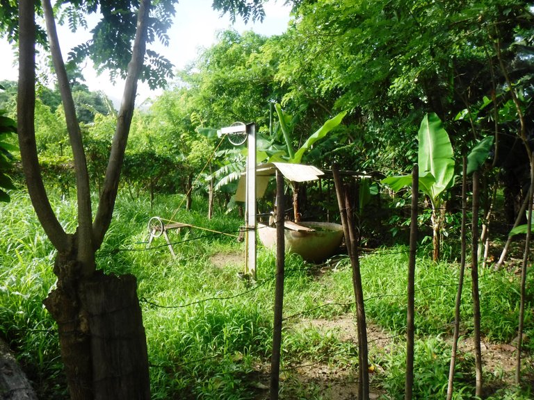
Look at this rudimentary water storage system.
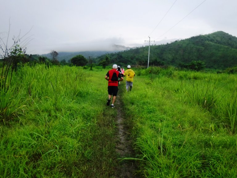
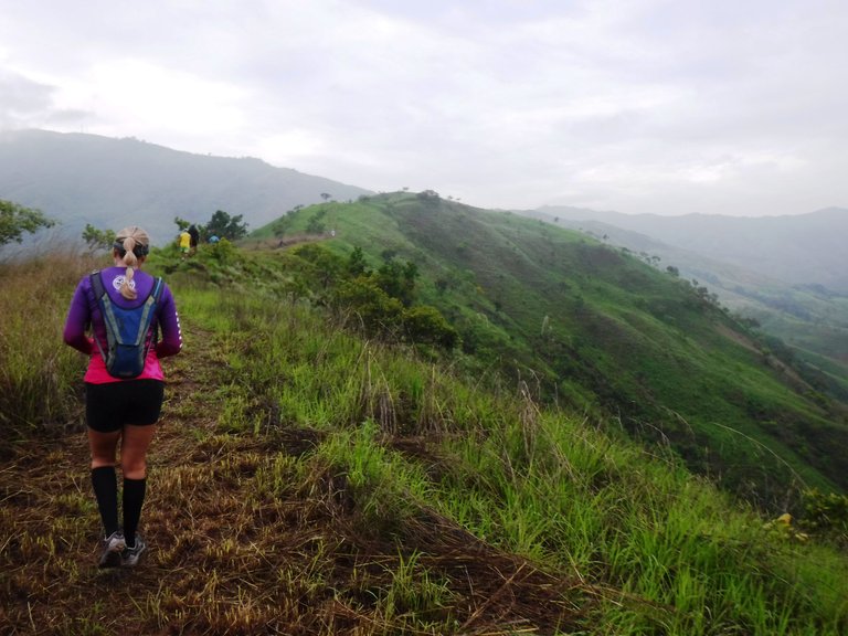
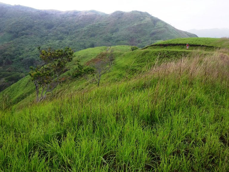
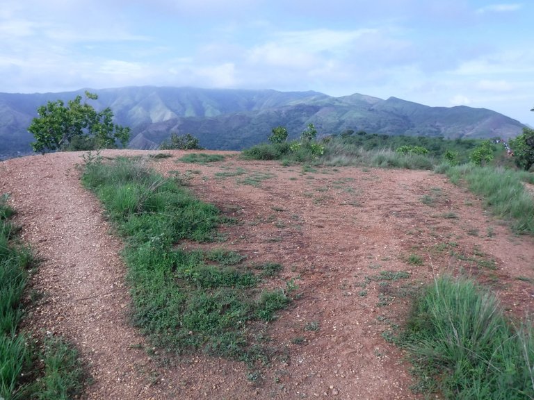
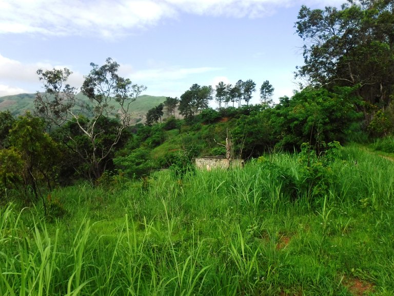
We left this populated area and again there was an ascent through a sector known as Los Lirios. This mountain is not very steep, the sun had come out a little but fortunately it wasn't hot.
There was a hydration point around here and before continuing I stopped to refill my bottle with cold water, what a treat!
This section has no major difficulty, so while I was walking I was taking pictures, aren't these landscapes beautiful?

Then came a pretty steep descent and there was a sign that said "Slippery Zone", I went carefully using my bamboo stick as extra support but almost at the end I fell, fortunately without any consequences other than getting my leggin a little dirty.
What followed is what is known as El Bosquecito (The Little Forest), I have been here before and I knew it was not far to reach the Monument of Youth, starting and finishing point of the 15 km of this route.
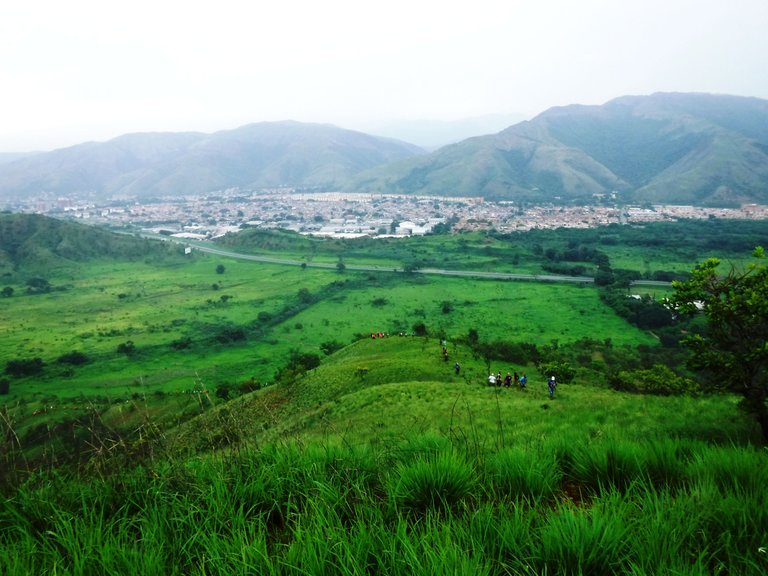
And a few meters later you start to see the city, the industrial zone first.
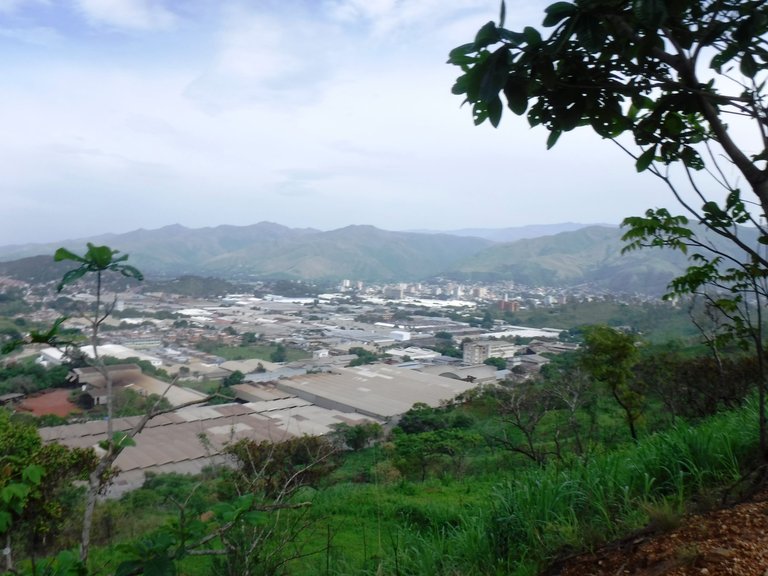
After a detour, the highway and part of La Victoria appear in front of you.
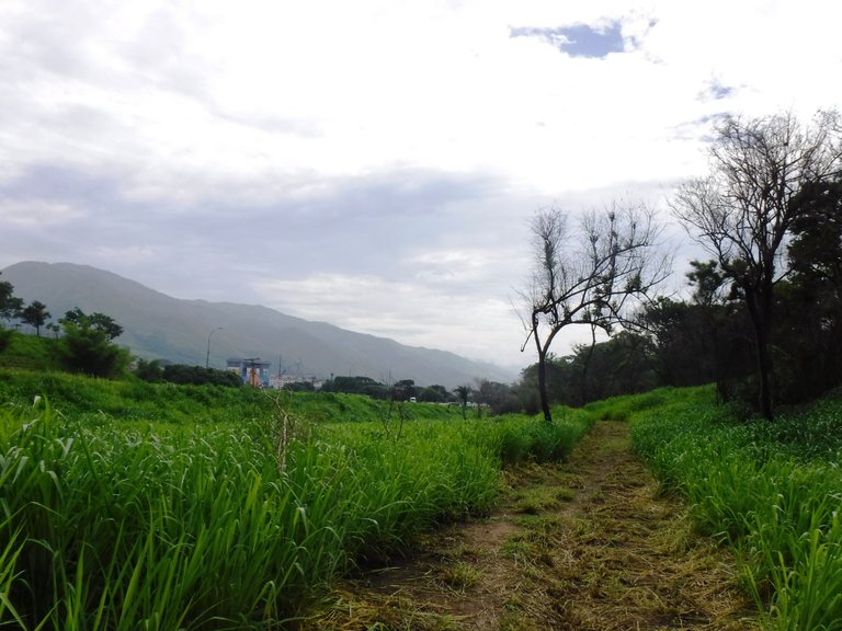
When you reach flat ground again you walk next to the highway, the grass is cut here forming a kind of mattress that doesn't allow you to see the ground. In this rainy season there can be snakes, so I was attentive.
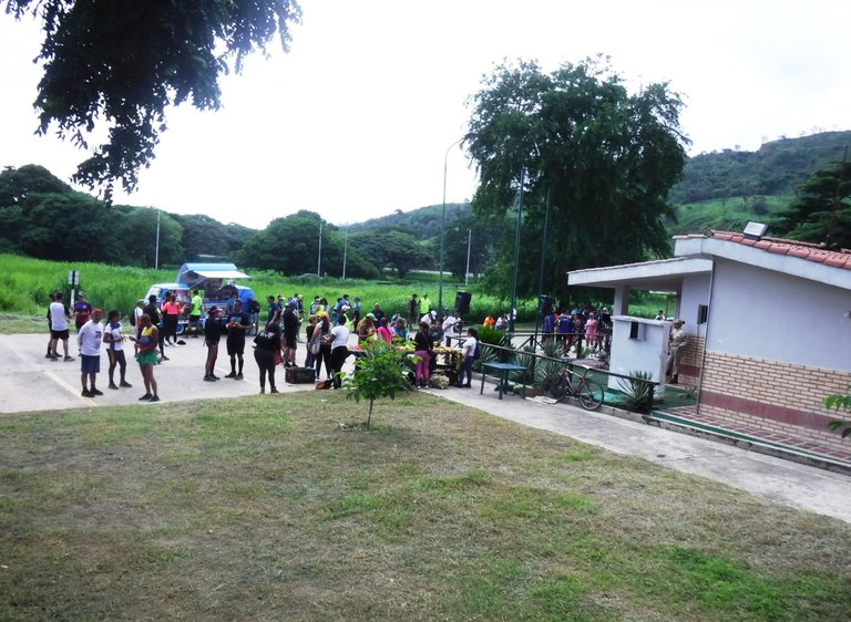
Finally at 10:00 in the morning I reached the finish line, it took me about two and a half hours to complete the 15 km, not bad at all.
There the organizers welcomed us with fruits and hydration, there were also other activities such as dance therapy to relax the muscles, but I didn't stay because I wanted to return home to watch the final of the Roland Garros 😄.
And that's it, what did you think of this route? I love to do this kind of activities on the weekends, it recharges my energy for the following days 😊. See you next time!
All photos are my property
Congratulations, your post has been added to Pinmapple! 🎉🥳🍍
Did you know you have your own profile map?
And every post has their own map too!
Want to have your post on the map too?
!discovery 40
¡Gracias! :)
👍
This post was shared and voted inside the discord by the curators team of discovery-it
Join our Community and follow our Curation Trail
Discovery-it is also a Witness, vote for us here
Delegate to us for passive income. Check our 80% fee-back Program
Thank you so much for your support! :)
https://twitter.com/Lauramica5057/status/1668653530322808844
¡Muchas gracias por compartir @lauramica! :)
Hola Sofía :) Que bueno que organicen cosas así cerca de donde estas, yo tengo que viajar como 1000 km para ver una montaña jajaja. El senderismo en grupo debe ser interesante, aunque que bueno que cada uno pueda manejar su ritmo. Y 15 km es bastante, espero que no se hayan cansado tanto pero al menos pudieron ver unos paisajes hermosos. ¡Saludos ❤️!
Jajaja es cierto, BsAs es plano. Sí, el senderismo es una adicción, es demasiado chévere y la mayoría de la gente que te consigues son buena onda. La parte más difícil de esta ruta fue la primera subida, luego todo fluyó aunque al final sí se me hizo larga... ¡Me alegra que te haya gustado, un abrazo!
#posh
https://twitter.com/sof_athana/status/1668638442815737856?t=p6F9FpbBnxKebNlmD2WzNg&s=19
Esto me lo han dicho mucho y hasta ahora no me había tocado decirlo a mí, pero: chama tú sí caminaaaaas! Jajajaja 🤣🤣🤣
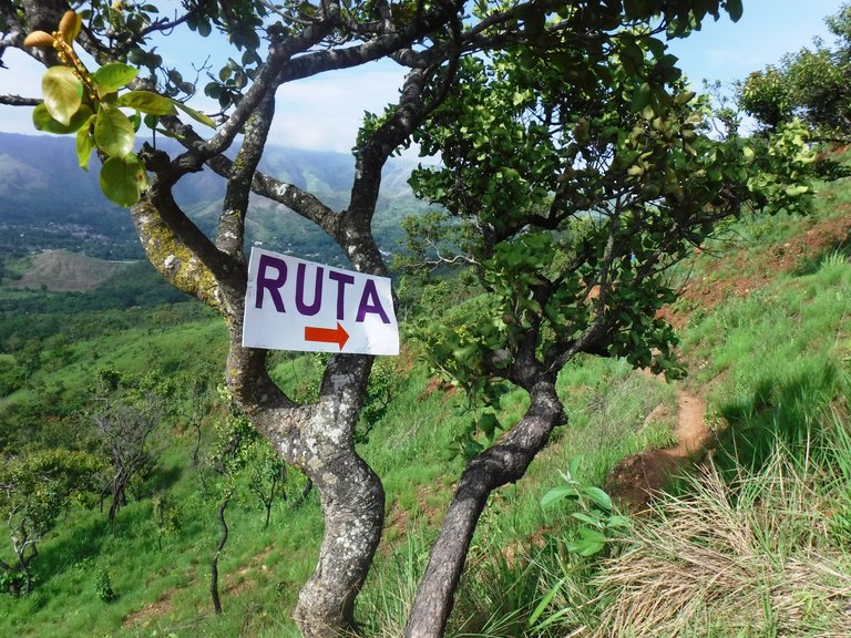
Me dieron risa los cartelistas por ahí que decían “ruta” apareciendo de la nada jeje. Que fino que asistas a esas actividades, a pesar que algunas zonas sucumben a el descuido humano, vale la pena llegar a las zonas vírgenes por ver ese hermoso verdor en las colinas, te quedaron esas preciosas imágenes como recuerdo de tu exitoso recorrido!
Creo que tengo talento para eso jajajajaja...
Oye, sin esos cartelitos existía la posibilidad de perderse porque en algunos puntos había dos caminos y ¿cómo saber por dónde? Cuando me entero de alguna ruta trato de hacerla, es demasiado chévere a pesar de que algunas son fuertes. Me alegra que te haya gustado, ahora con las lluvias los paisajes se ven hermosos, un abrazo :)
It was a great hike. I loved the scenery. The place looks very humid and cool.... well I hope so because of the hot weather we have been having lately.
Yeees, it was super cool that day, in this rainy season the mountains become so beautiful, thanks for stopping by!