Martí Park and its surroundings. Pinar del Río 🇨🇺
Hello, friends of Hive in general and of Pinmapple in particular.
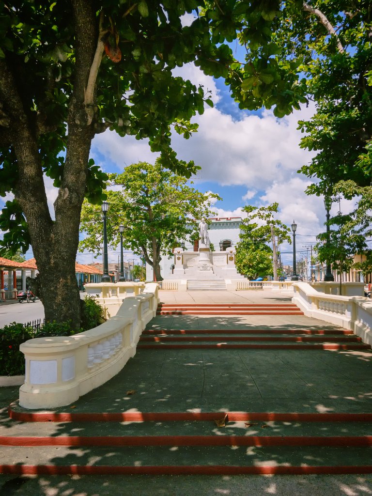
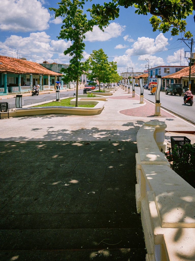
Today I come to tell you about a park located at the confluence of the main streets of my city: Recreo and Vélez Caviedes. It is not actually a large park if we consider its size, but it has a nice history. Some claim that the first population group of this city existed in this place around the year 1641.
A little history
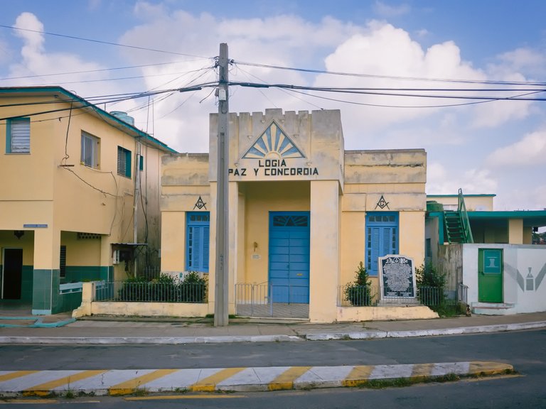
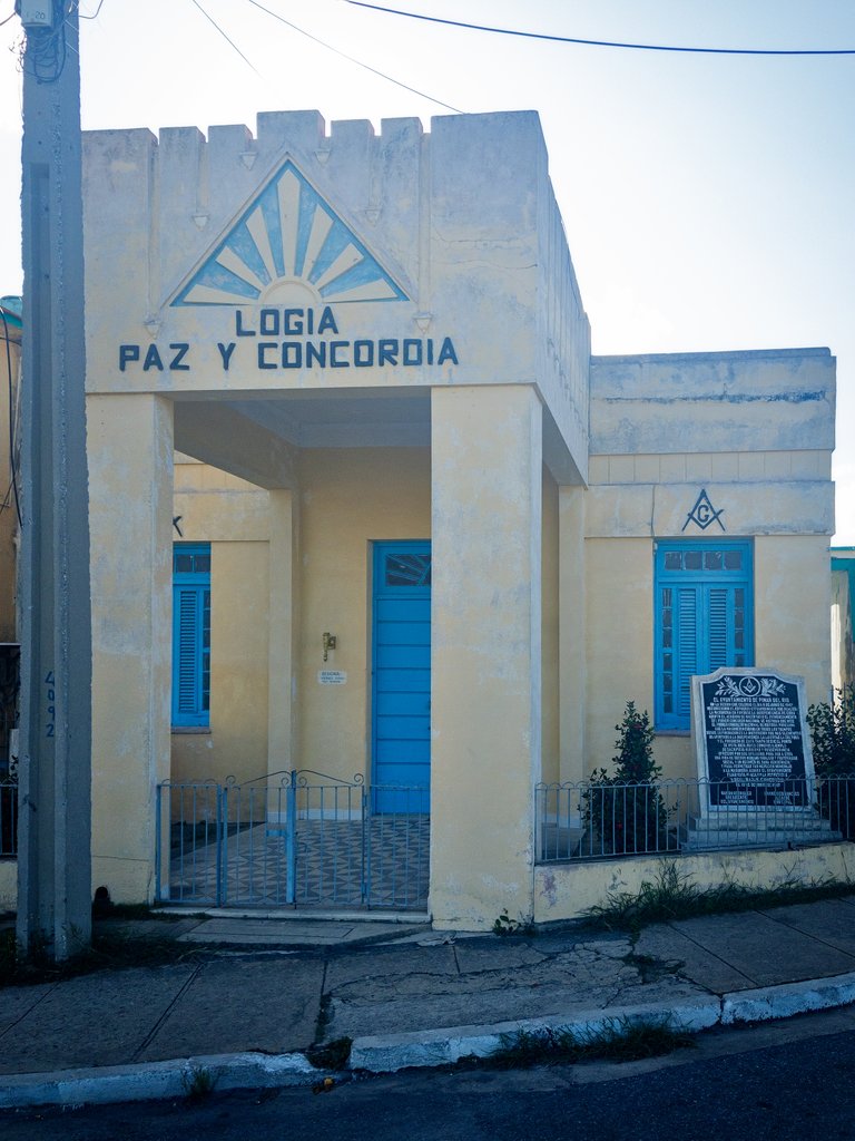
This park did not always have the architectural structure that we currently observe, nor was it recognized by its current name since its inauguration. Before 1906, the park was named "La Fraternidad" (The Fraternity), when two triumphal arches were built at the entrance of Recreo and Vélez Caviedes streets (at that time known as Camino de los Marañones), as if showing the fraternity expected by those who named the park. Between 1906 and 1922, it was named "Parque La Concordia" (Concord Park), apparently due to its proximity to the "Paz y Concordia" (Peace and Concord) lodge that was located there, and the primary school near this lodge, which was named "Concordia".
The park that was better structured as such was completed in 1922, thanks to the effort and attention of the former Mambi commander, then Colonel, engineer José Ramón Villalón, who was honored in Pinar del Río for his valuable contribution to the Antonio Maceo campaign and as a benefactor, for allocating one million pesos in public works for the city.
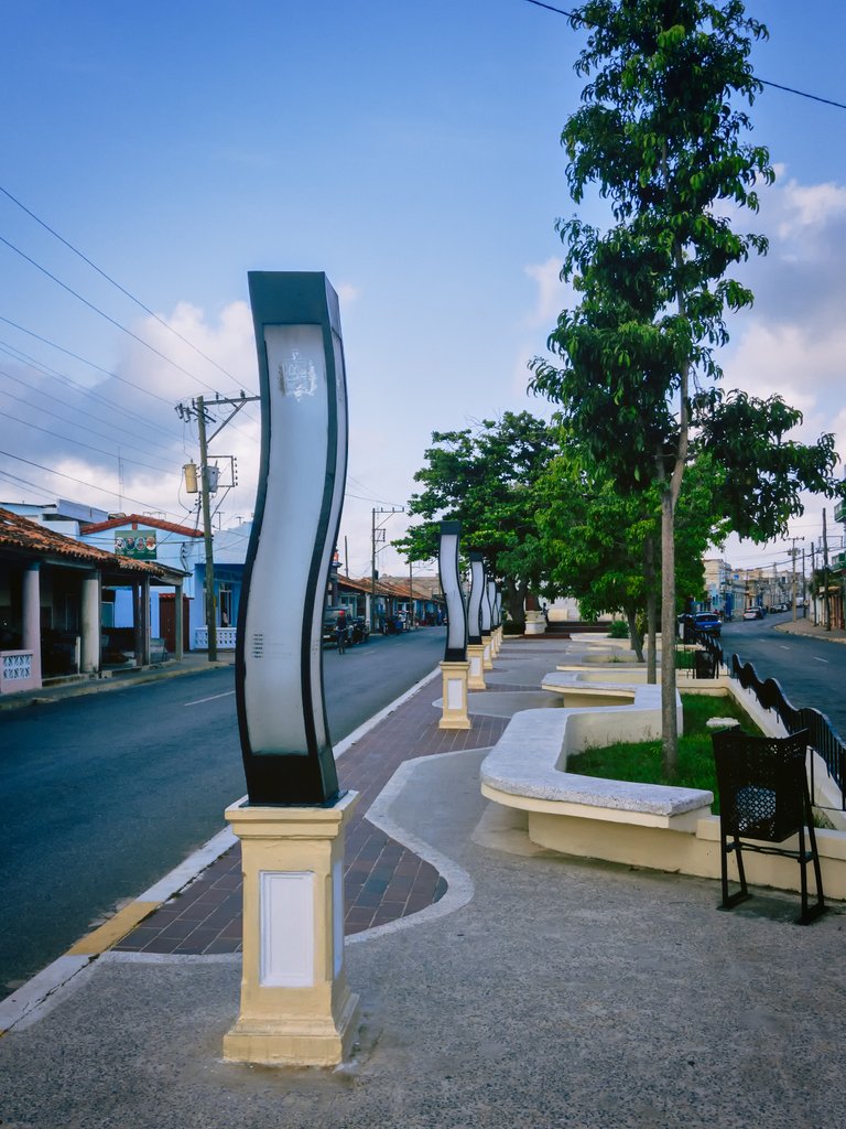
According to reports, it was fully paved and had a wooden gazebo, fountain, benches, street lamps, and even a permanent police officer to take care of it. This justifies the name "Parque Villalón", as it was named after the then minister of public works who had a decisive influence on the remodeling of the park.
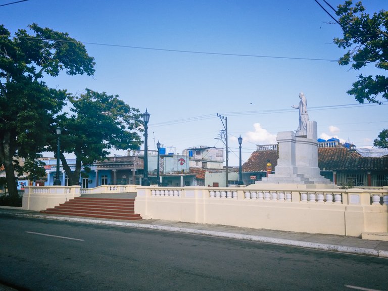
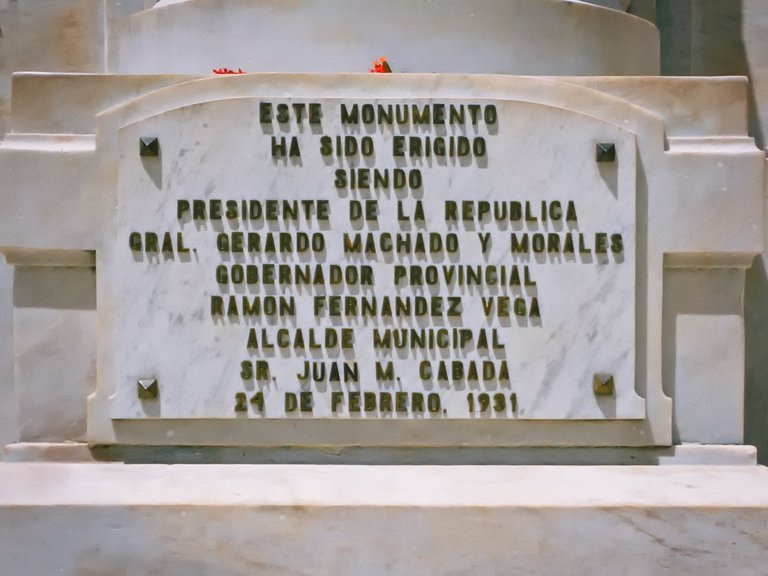
Later, it was named "Parque Wilfredo Fernández Vega", after a senator who was the brother of the current provincial governor, who not only gave his name to the park but also to the "Avenida" from the Guamá Bridge to the park itself. However, for the population of the time, it was better known as "Parque de los Franceses" (Frenchmen's Park), due to the presence of some citizens of that nationality in its surroundings. Finally, this park was renamed José Martí on February 24, 1931, when the beautiful monumental complex dedicated to Martí, which already existed in another central location in the city of Pinar del Río, was moved there.
In the first decade of this century, the park was expanded by adding lighting and seats for the rest of the citizens, remaining so until today.

Monument to José Martí Pérez
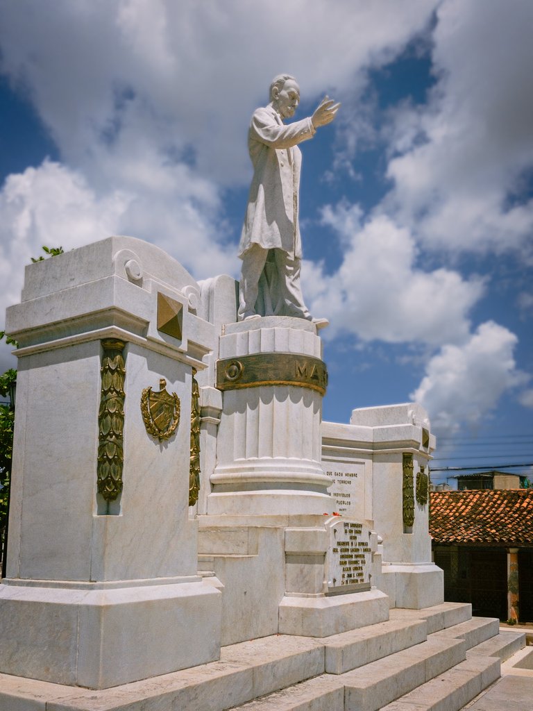
The construction of a bust of the Apostle had been resolved very early on to be located at the end of Martí Street, at the beginning of Calzada de la Coloma. The bust did not meet the required quality and in 1923 it was removed. Later, a new collection of 12,000 pesos was made, which was enough to hire Ettore Salvatori, an Italian sculptor who used legitimate Carrara marble from Genoa to carry out the work that was completed here and placed in the location that the old bust occupied.
The monument to Martí was officially inaugurated on January 28, 1929, at the beginning of Paseo de Estrada Palma (Malecón). The statue was unveiled by Nena Benítez, the daughter of Colonel Manuel Benítez, Chief of the Military District, and Major General Enrique Loynaz del Castillo gave a speech. As the statue of José Martí was located in a place that did not bear his name, it was thought to move it to a more appropriate location. Therefore, on February 24, 1931, the statue was moved to its current location, and the park, which already existed, began to be called José Martí Park.
Martian thoughts that appear:
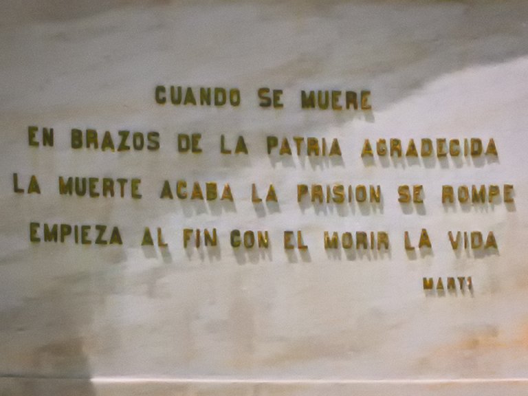
"When one dies in the arms of a grateful homeland, dead ends, the prison breaks, and finally, with dying, life begins."
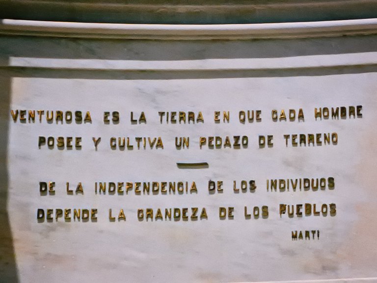
"Blessed is the land in which every man possesses and cultivates a piece of land."
"The greatness of humans depends on the independence of individuals."
Exploring the surroundings
Being located in one of the oldest and most central areas of the city, several economic and social centers of interest are located around this park within a distance of no more than 100 meters.
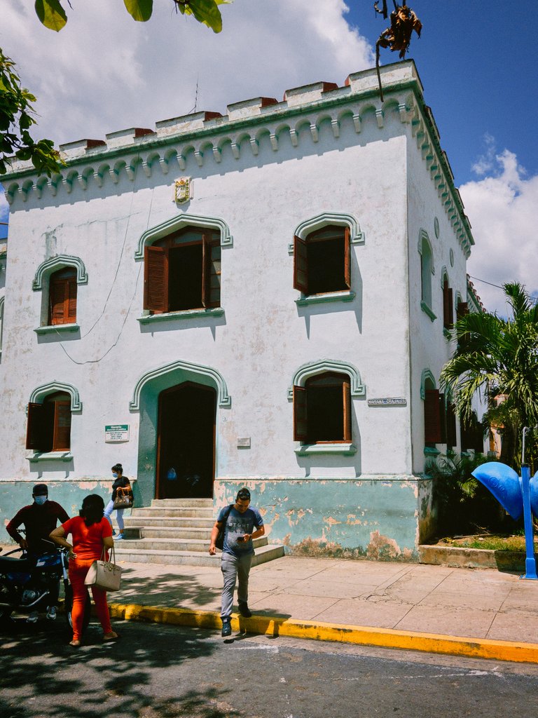
Just behind the monument and across the street is a building that for many years was a police station. After 1959, offices for serving the population with services related to identity cards (DNI), passports, and vehicle registration have been located there.
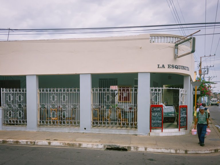
Traveling along Recreo street from south to north, about 100 meters from the park, we find a kind of bar-café called "La Esquinita", which is frequented by young people to hang out with friends.
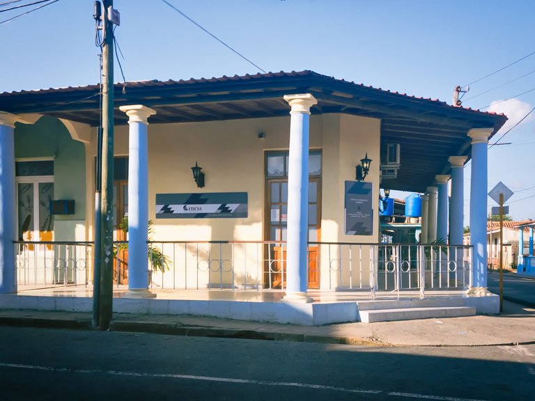
A few meters from there, but on Delicias Street, we find the offices of the telecommunications company ETECSA, where services are provided to the state business sector.
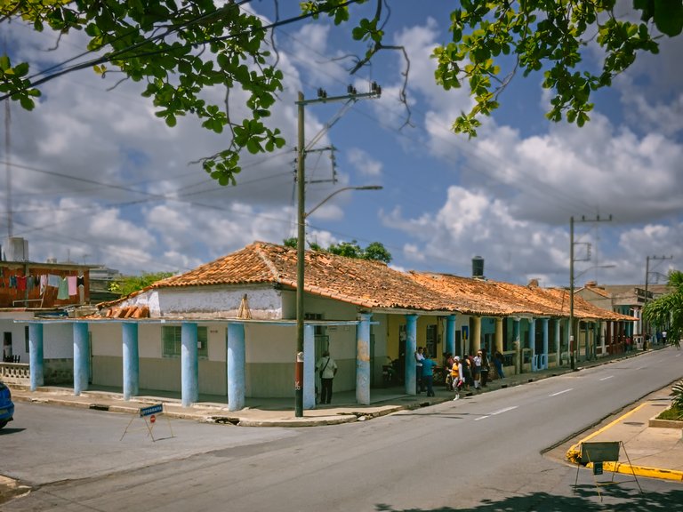
Continuing along Recreo street, we find some of the oldest houses in the city, with their tiled roofs.


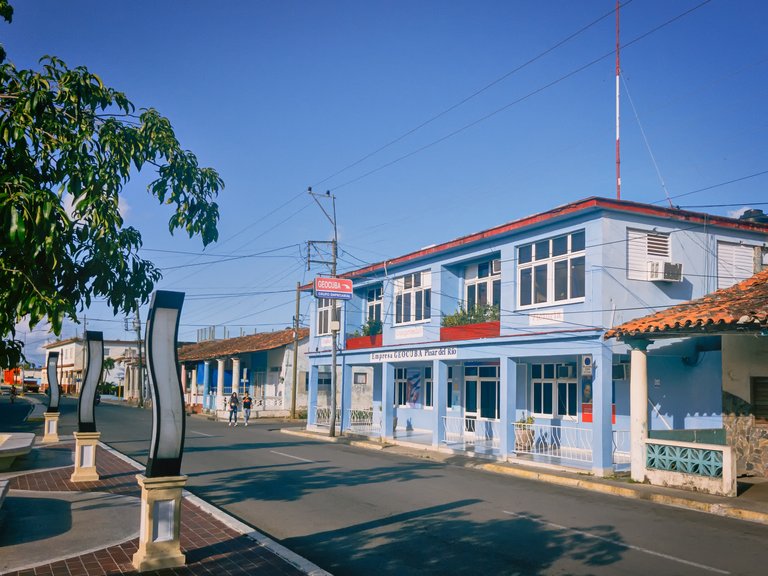
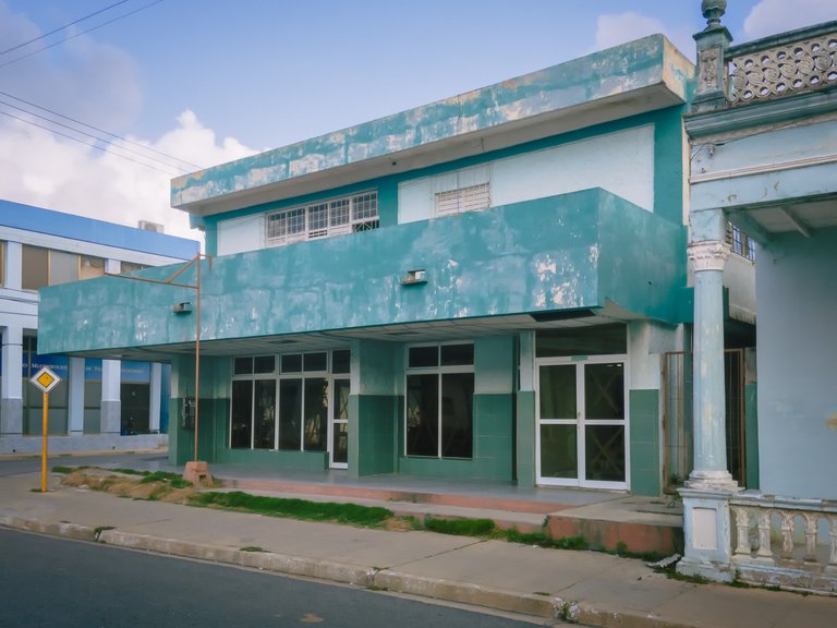
Breaking the monotony of the tiled houses, we find the Geodesy and Cartography company GEOCUBA, with more modern architecture.
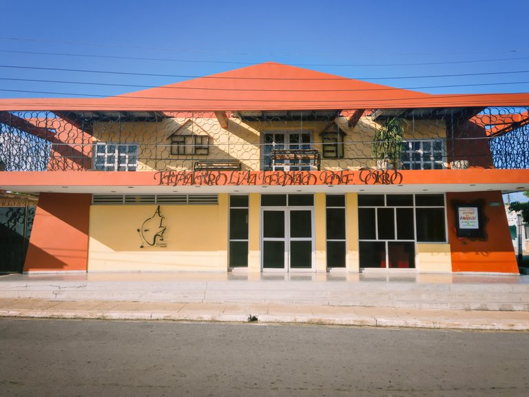
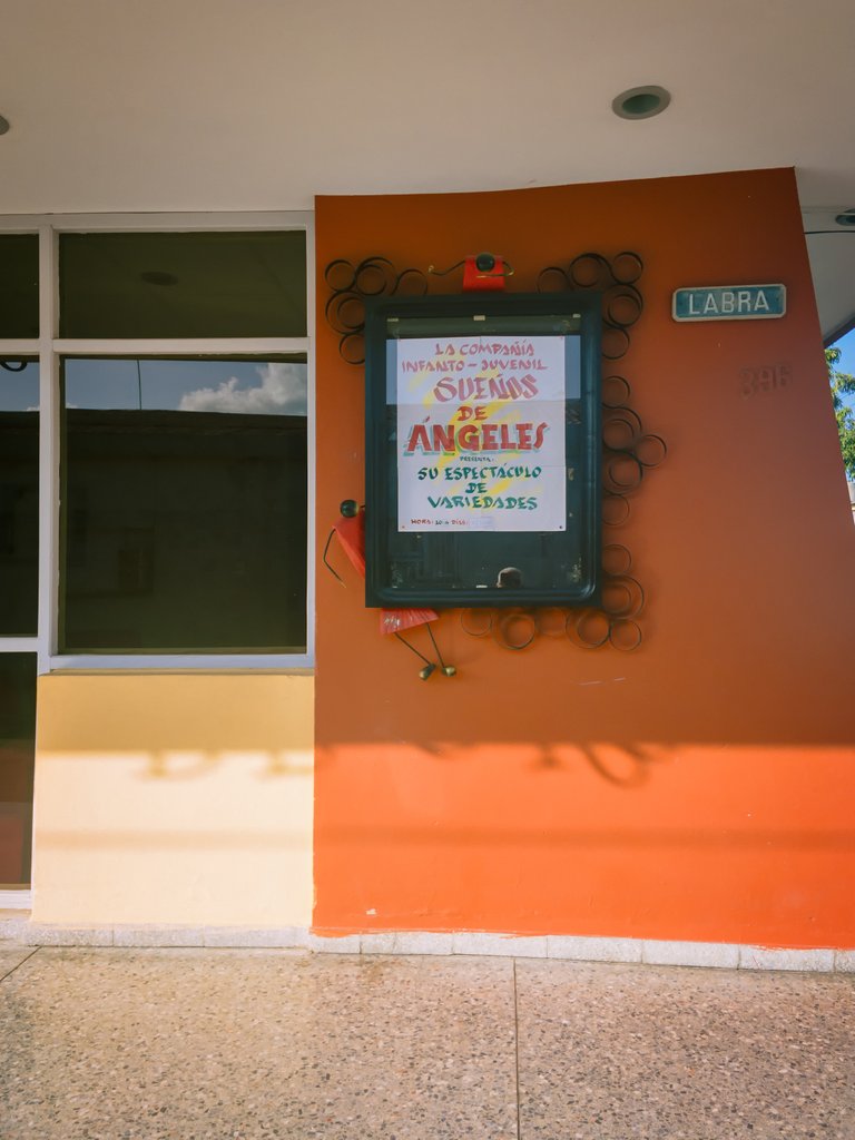
Turning right at the corner of GEOCUBA and a few meters away, we find the children's theater "La Edad de Oro", ("The Golden Age") where many of the city's children have enjoyed the plays that have been staged there.

At the end of the old houses and on the corner of Cabada Street, we find the Orlando Nodarse soft drink factory (formerly La Jupiña), an emblematic place in the city.
Crossing the street and facing the soft drink factory, we find the lodge "Paz y Concordia", which at one time gave its name to the park.
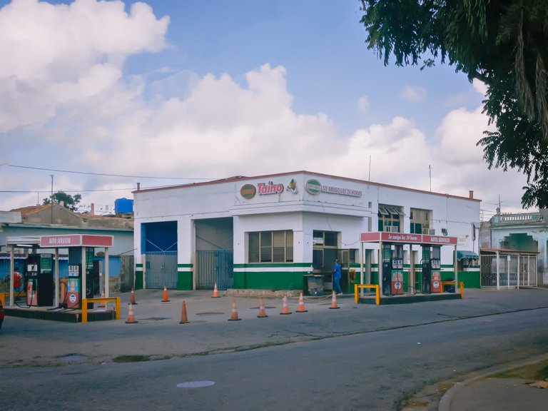
Returning in the opposite direction, that is, from north to south, but now on Vélez Caviedes Street, we find the Taíno automotive service center, where fuels, lubricants, and car accessories are sold, among other things.
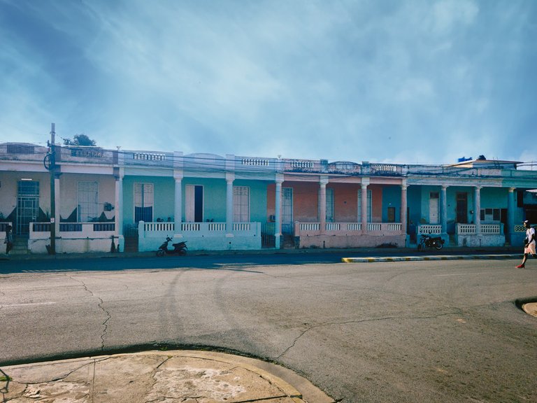
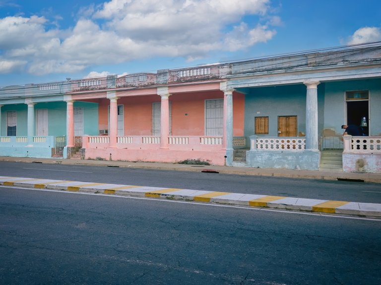
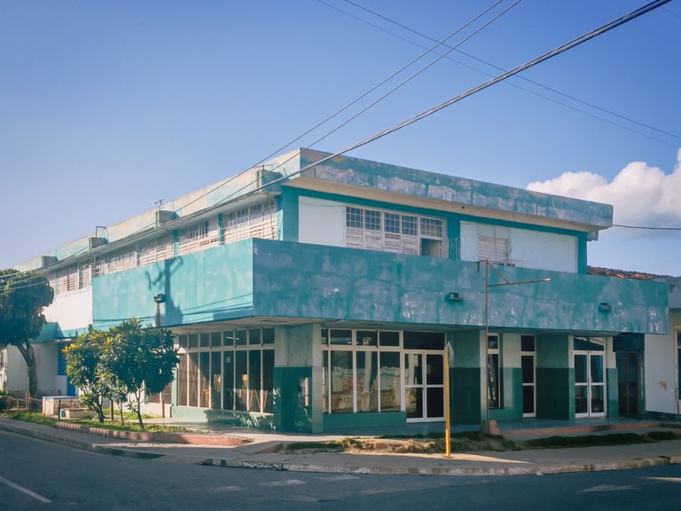
Further ahead, we can see other old houses, but with a slightly more recent architecture than those on Recreo Street, with their porches raised above the street level, high ceilings, and interior courtyards that give the impression of being cool and well-ventilated.
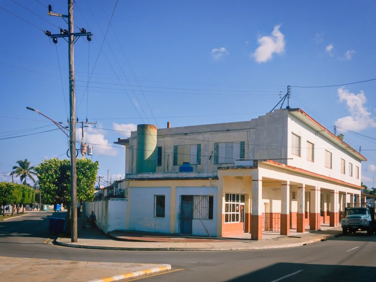
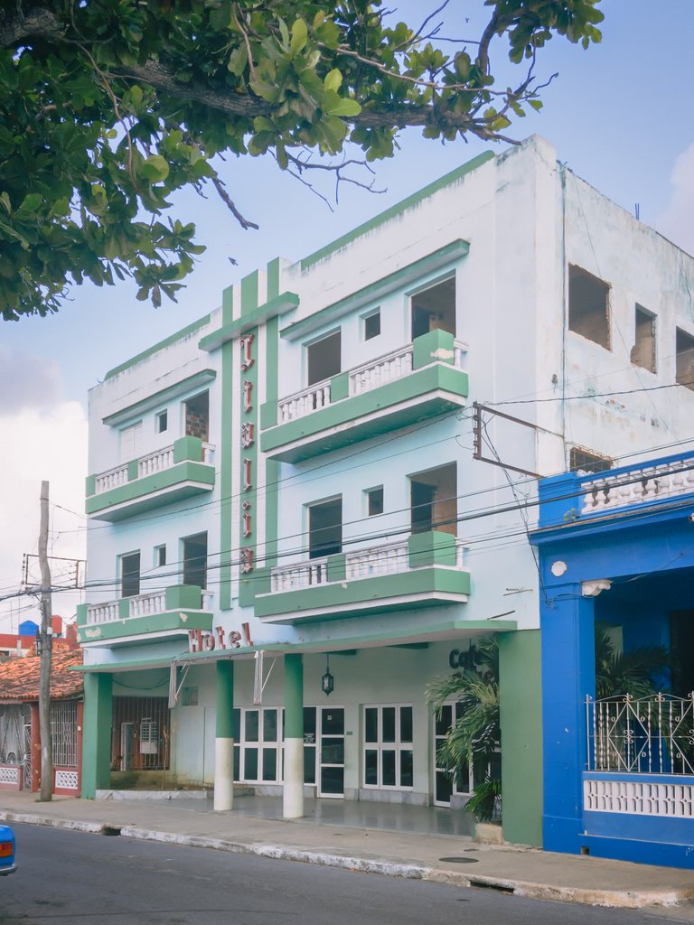
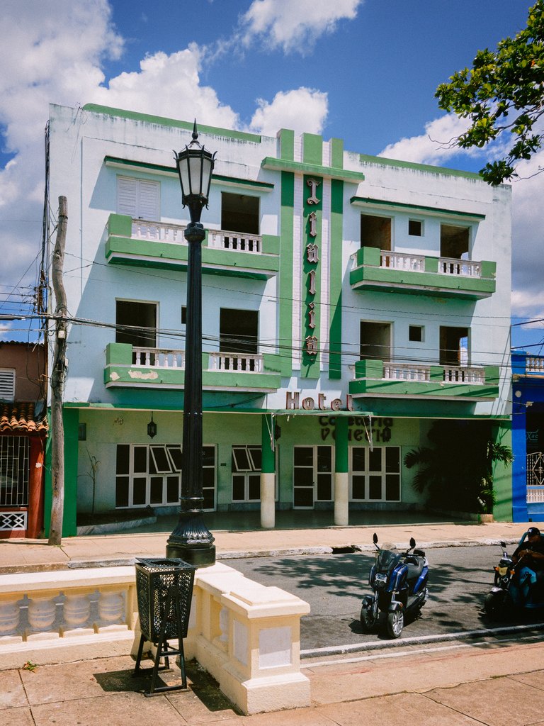
After these houses, we find another emblematic building of the city, the Hotel Italia, formerly known as Hotel Occidente. Unfortunately, it is out of service and in poor structural condition. In the lower part and to the right, on the facade of the hotel, there is a cafeteria that was once famous for the sandwiches prepared there.
After some very old tiled houses, like the ones described before, we come across a medical clinic built in the 80s or 90s, where primary health care is provided to the community.

After the medical clinic, we come across houses of varied architecture and from different periods until we reach the corner, where there is an ophthalmological service center.
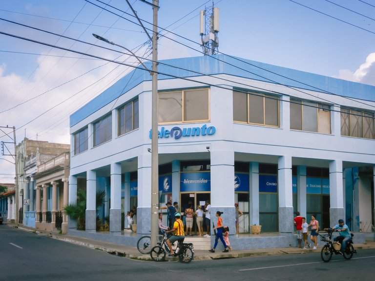
Crossing the street, we find "El Telepunto", a service center for the non-business sector of the telecommunications company ETECSA.
In front of the optical center, we can find "Casa de la Miel", a center for the sale of honey and its derivatives.


In broad terms, this is a description of Jose Marti Park and its surroundings. In addition, the number of private businesses run by local entrepreneurs in that area has been growing, adding color to the city and also increasing the quantity and variety of offers available to the population.
Did you like the post? I hope so. I would appreciate any comments or suggestions you may have. Thank you very much for your time.
| Photographer | @ralbe |
|---|---|
 | All photos were taken with my iPhone 11 and edited in Photoshop. Follow me at: htpps://vero.co/ralbe |
Historical data related to dates were obtained from public sources on the internet, such as Wikipedia and Ecured.
A free template from Adobe Stock was used for the presentation .
Congratulations, your post has been added to Pinmapple! 🎉🥳🍍
Did you know you have your own profile map?
And every post has their own map too!
Want to have your post on the map too?
Hiya, @choogirl here, just swinging by to let you know that this post made it into our Honourable Mentions in Daily Travel Digest #1918.
Your post has been manually curated by the @pinmapple team. If you like what we're doing, please drop by to check out all the rest of today's great posts and consider supporting other authors like yourself and us so we can keep the project going!
Become part of our travel community:
Congratulations @ralbe! You have completed the following achievement on the Hive blockchain And have been rewarded with New badge(s)
Your next target is to reach 1250 upvotes.
You can view your badges on your board and compare yourself to others in the Ranking
If you no longer want to receive notifications, reply to this comment with the word
STOPMuy buenas fotos, siempre sacando buenos ángulos de las edificaciones.
Muchas gracias por comentar
Gracias
Esas fotos están hermosas!. Gracias por tan lindo post.
Muchas gracias a ti por tu amable conentario.
Muy bonita la publicación la disfruté mucho. Un recorrido sociocultural por las principales edificaciones de esa zona de Pinar del Río. Por ahí por el parque Martí comenzó a surgir nuestra localidad pinareña. Rápido tuvo que mudarse para la altura que hoy se conoce como El parque de Independencia porque por ahí alcanzaba el río Guamá en épocas de lluvia. Por eso las casas de por ahí son muy antiguas. Bello tu post. Felicidades.
Muchas gracias por tu comentario. Complementa la informacion del post. 🙏🙏🙏