Sand Ridge Trail - A Central Oregon Hike
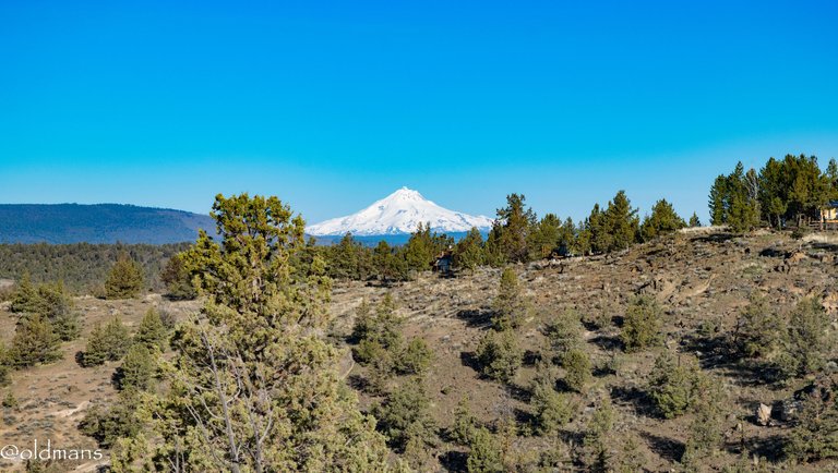
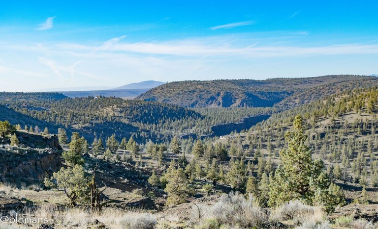
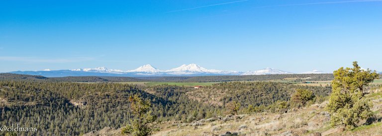 Not far from the trailhead You are met by this spectacular view of the Cascades. There was a bit of a haze in the air from prescribed burns. While these can be a pain while trying to enjoy the outdoors, they are quite useful in mitigating larger unwanted wild fires.
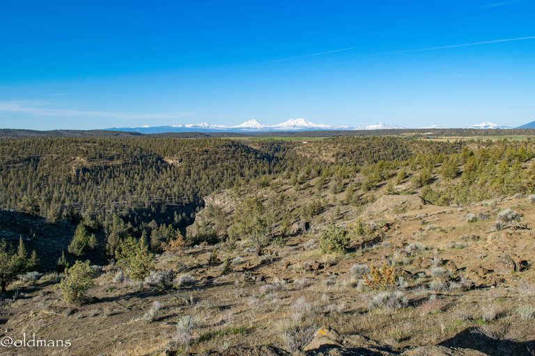 As I move closer to the canyon edge even more peaks come into sight. From left to right: Mt Bachelor,Broken Top,The Three Sisters,Black Crater,Belknap Crater and Mt Washington
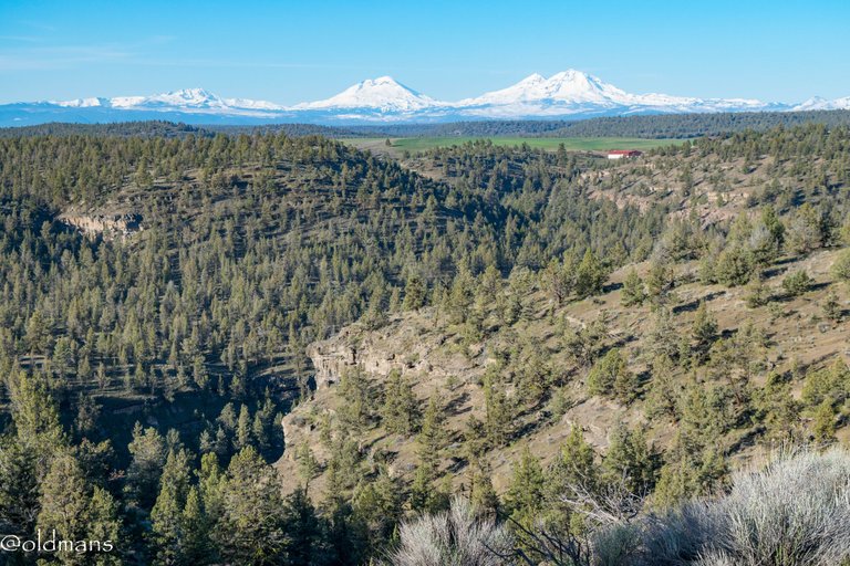 A closer look at Broken Top and The Three Sisters.
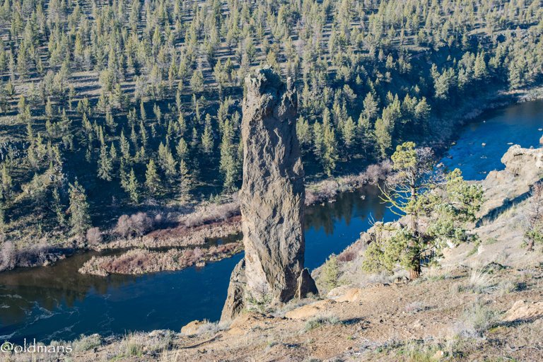
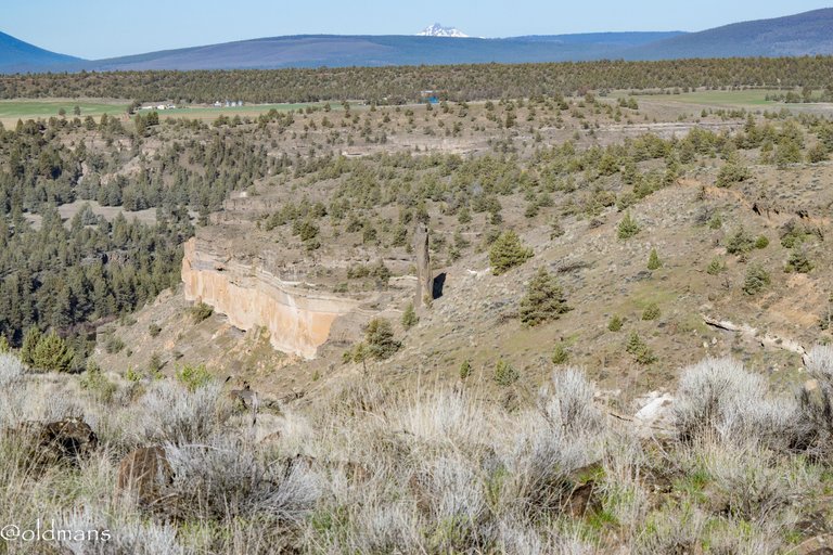
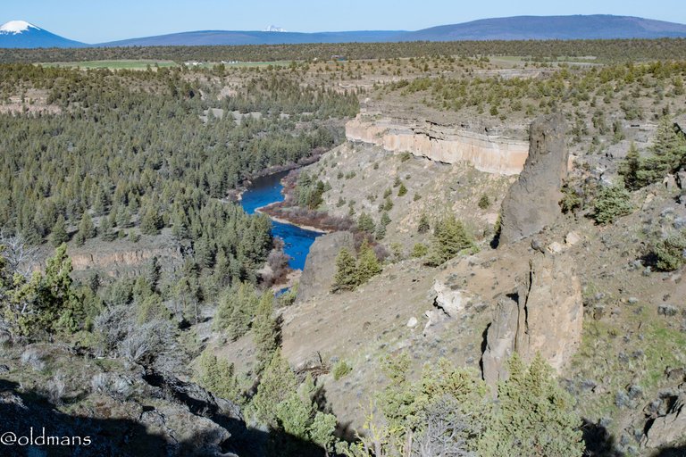
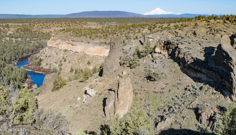
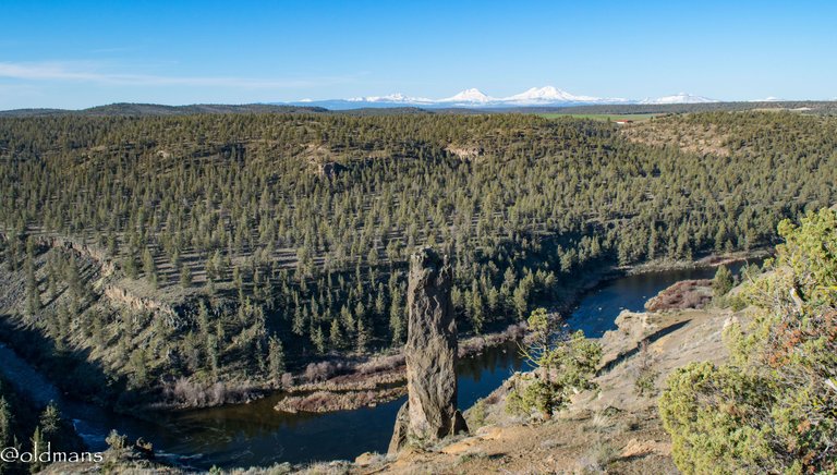 Near the edge of the canyon the first spire comes into view along with the Deschutes River down below.
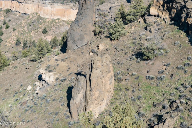
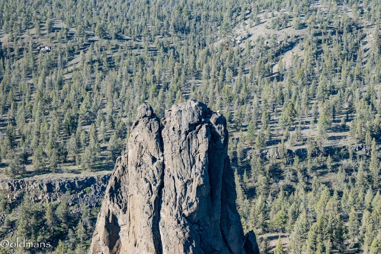
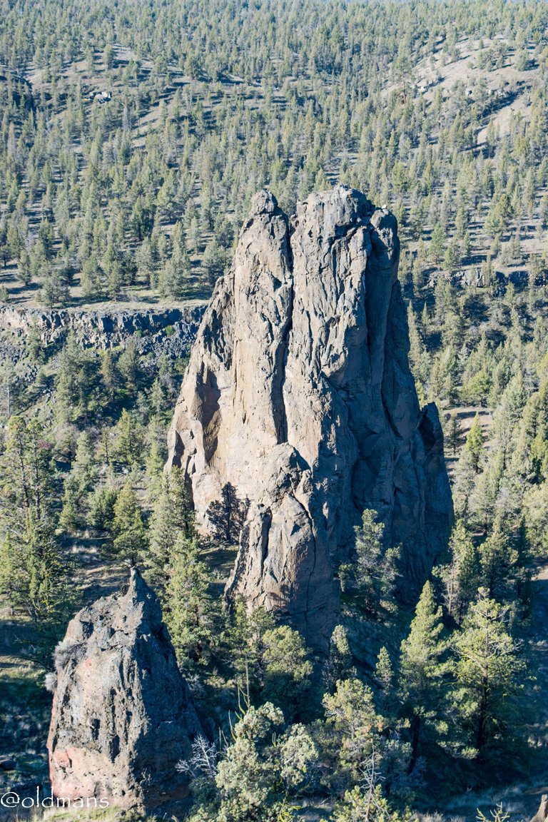
 A closer look. If you zoom in near the top you might be able to see what looks like climbing rope?
 My view to the left and the next destination on the trail.
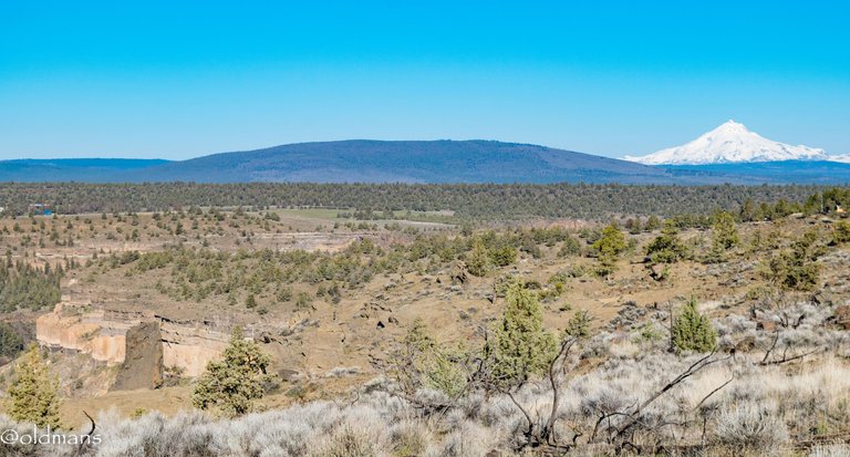
 | Another Cascade Peak, Mt Jefferson in the distance. | 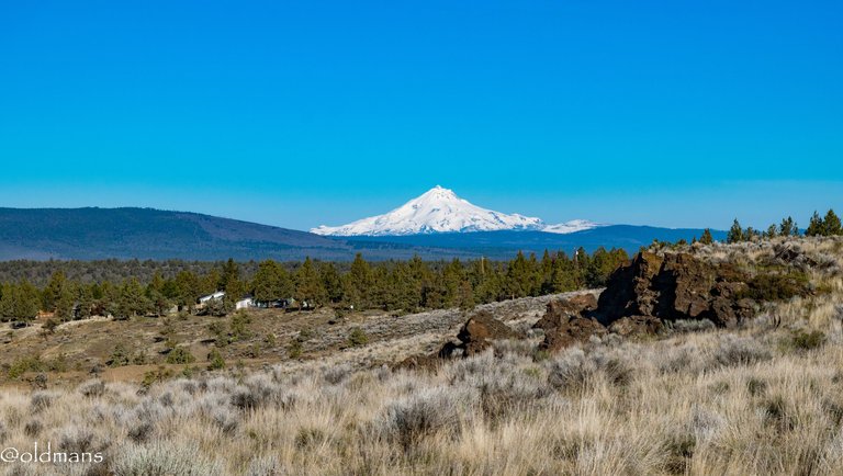 |
|---|---|---|
 A look back at the first spire with Three Fingered Jack peaking over the foot hills.
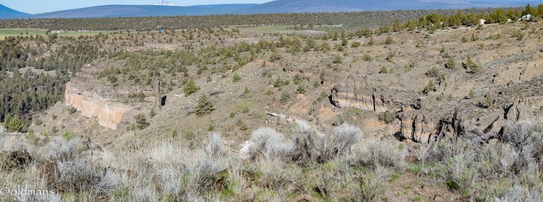
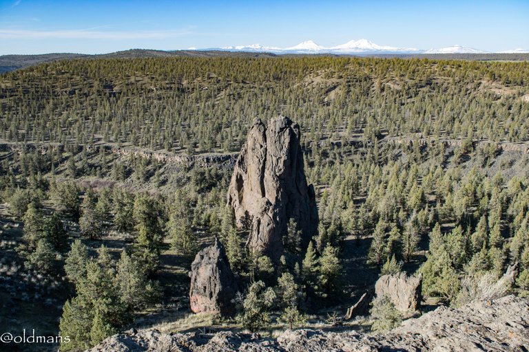
 Time to head down toward the next spires.
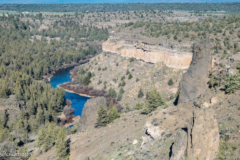
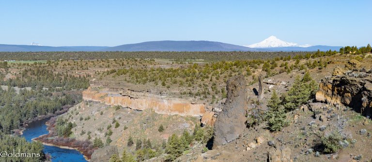
 A look up the Deschutes River Canyon.
 |  | |
|---|---|---|
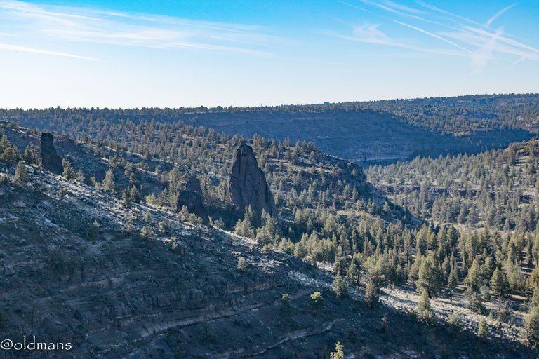
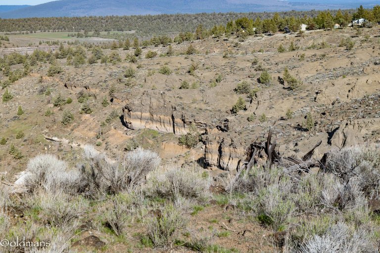
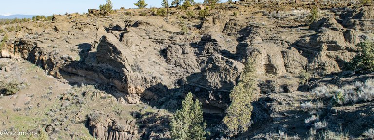
 Some more of the spires.
 If you zoom in and look closely at the right shaded area near the top it looks like there may be an eagle's nest. Also the lone balancing boulder in that area is kind of interesting.
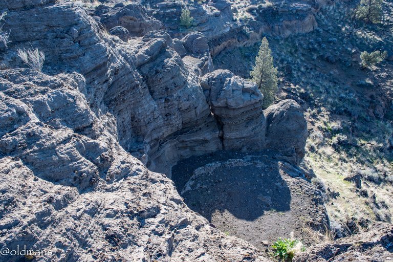 A strange circular feature in the rocks. Carved long ago by river water?
https://img.inleo.io/DQmTYgZK99wiVYCF3VT4fQUGuczuhC2cJHKoX3uVk51D3vJ/me-1.webp
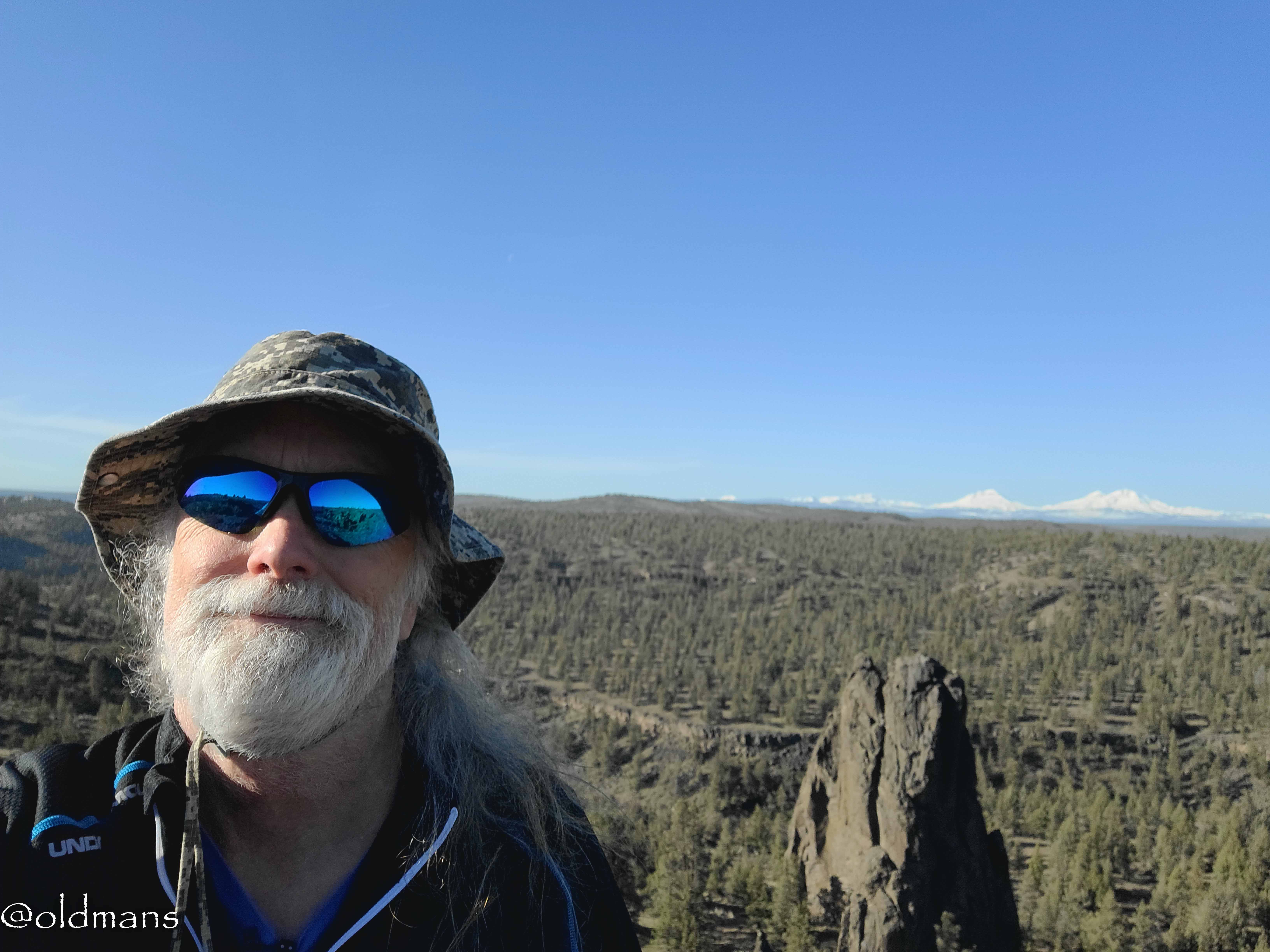
And lastly a pic of your host for this tour. 😍
Hope you enjoyed this visual tour! Please feel free to make comments or ask me any questions about this post.
Photos taken by me, @oldmans, with a Nikon D3300 and some Lightroom post processing.
Please visit Pinmapple to see the locations of some of my other posts.
Thanks for looking and enjoy your day!
Posted Using InLeo Alpha
Congratulations, your post has been added to Pinmapple! 🎉🥳🍍
Did you know you have your own profile map?
And every post has their own map too!
Want to have your post on the map too?
👏 Keep Up the good work on Hive ♦️ 👏
🙏 Don't forget to Support Back 🙏
Hiya, @livinguktaiwan here, just swinging by to let you know that this post made it into our Honorable Mentions in Travel Digest #2175.
Your post has been manually curated by the @pinmapple team. If you like what we're doing, please drop by to check out all the rest of today's great posts and consider supporting other authors like yourself and us so we can keep the project going!
Become part of our travel community:
Such a beautiful place, and wonderful photos, though I struggled to see the eagles nest. The water carved also looks amazing♥️
It was a magical hike. 🙂
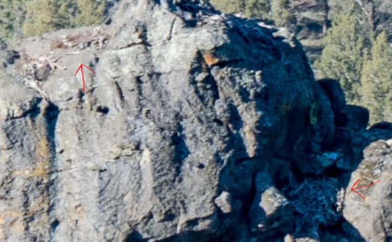
A little blurry but here is a screenshot of a max zoom. the two red arrows point to what could be old nests.
I loved this photo, really incredible 🤩
Thank you! There were some incredible views. 😀
https://www.reddit.com/r/oregon/comments/1h3prcy/sand_ridge_trail_a_central_oregon_hike/
The rewards earned on this comment will go directly to the people( @oldmans ) sharing the post on Reddit as long as they are registered with @poshtoken. Sign up at https://hiveposh.com. Otherwise, rewards go to the author of the blog post.