Oak Canyon Trail - San Diego, CA [EN/PT-BR]
[EN]
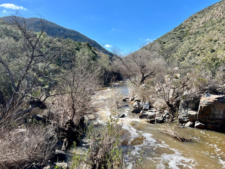
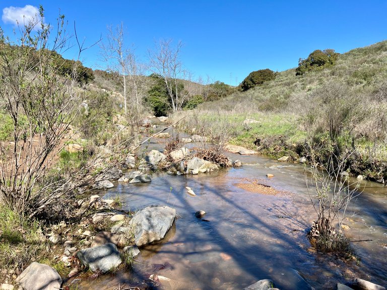
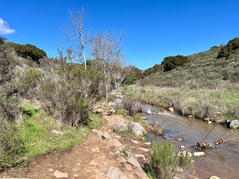
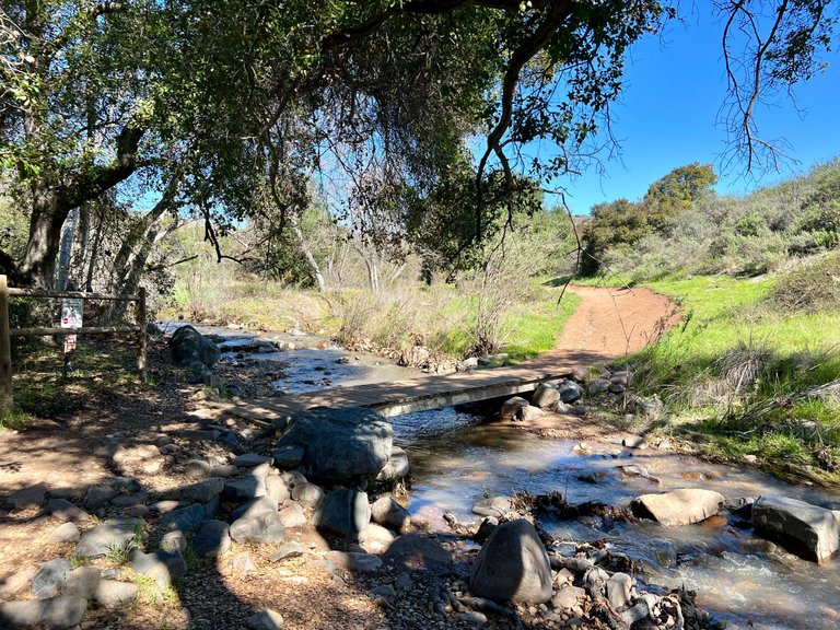
I'm back with another hike this week. As I mentioned in my last post, me and my wife have been going out to hike more lately. This week we went to hike at Oak Canyon Trail, located at Mission Trails Regional Park. I think I saw this trail once on Instagram, and was on my to do list for a while. This trail goes along a river, and since San Diego is too dry, I don't think there is water flowing all year. Since lately we've been getting a lot of rain, then I knew it was a good time to go and check it out.
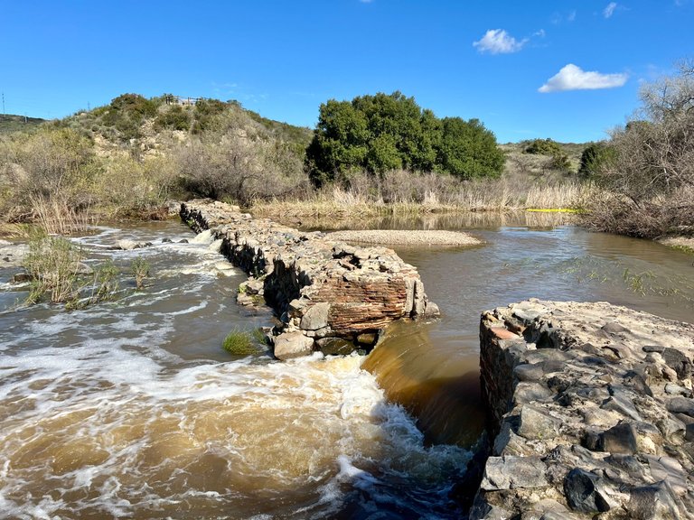
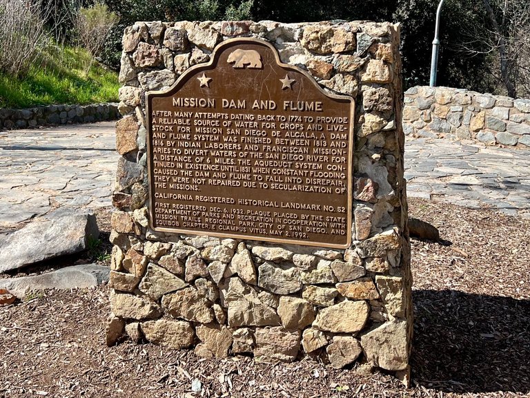
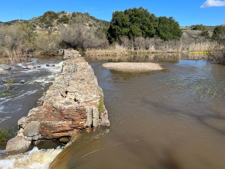
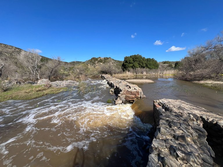
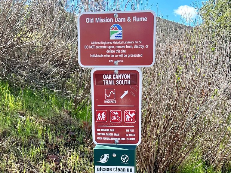
The trail head is located at the Old Mission Dam, a historical landmark. This dam was built around 1813-1816 to collect water from the San Diego river to be used in irrigation of fields that belonged to the Mission San Diego de Alcalá, the first Spanish mission to arrive in this region in the late 1700's.
[PT-BR]
Estou de volta com outra caminhada esta semana. Como mencionei em meu último post, eu e minha esposa temos saído mais para caminhar ultimamente. Nesta semana, fomos caminhar na Oak Canyon Trail, localizada no Mission Trails Regional Park. Acho que vi essa trilha uma vez no Instagram, e ela estava na minha lista de coisas a fazer há algum tempo. Essa trilha passa ao longo de um rio e, como San Diego é muito seco, acho que não há água fluindo o ano todo. Como ultimamente tem chovido bastante, eu sabia que era um bom momento para ir lá e conferir.
O início da trilha está localizado na Old Mission Dam, um marco histórico daqui. Essa represa foi construída por volta de 1813-1816 para coletar água do rio San Diego para ser usada na irrigação dos campos que pertenciam à Mission San Diego de Alcalá, a primeira missão espanhola a chegar a essa região no final do século XVIII.
[EN]
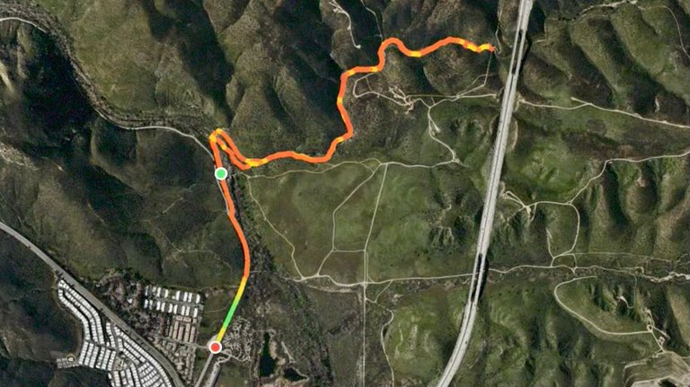
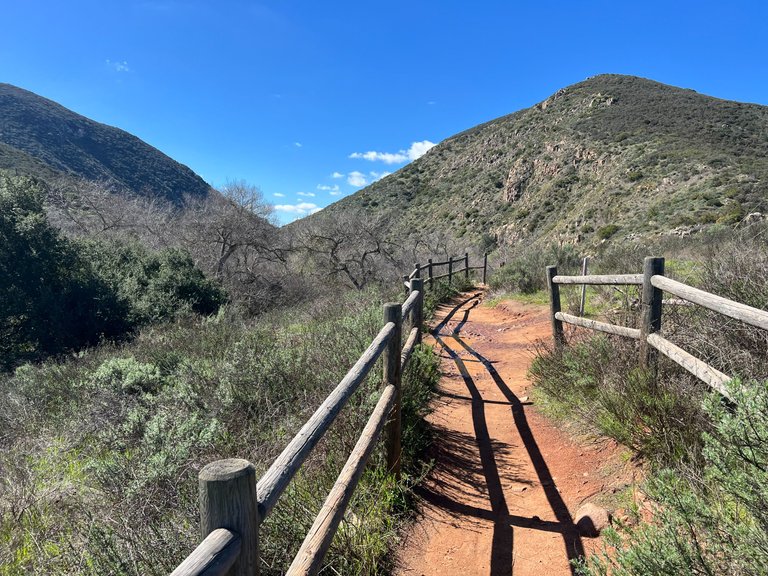
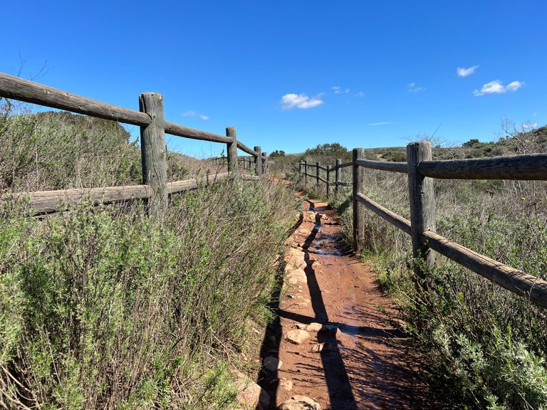
This hike took us about 1 1/2 hours, and was 3.7 miles total. The trail connects to other trails at the end, and even has other trails that would take us back to our car, but we decided to come back the same way because the other trails were more exposed to the sun and didn't have any fun features. Here is the map:
[PT-BR]
Essa caminhada levou cerca de uma hora e meia e tinha um total de 3,7 milhas. A trilha se conecta a outras trilhas no final, e até tem outras trilhas que nos levariam de volta ao carro, mas decidimos voltar pelo mesmo caminho porque as outras trilhas eram mais expostas ao sol e não tinham nenhum recurso divertido. Aqui está o mapa:
[EN]
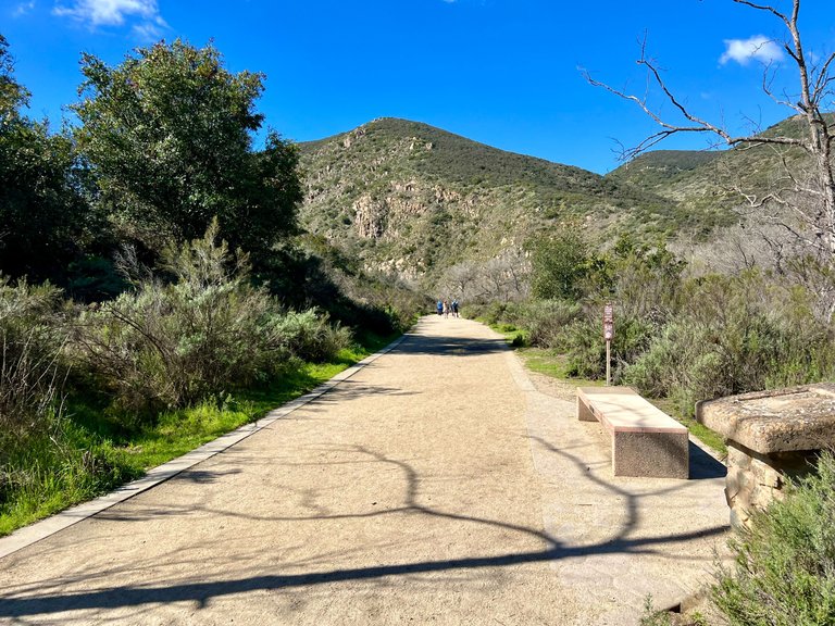
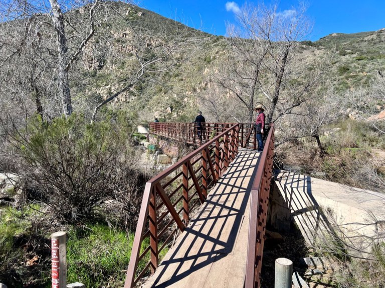
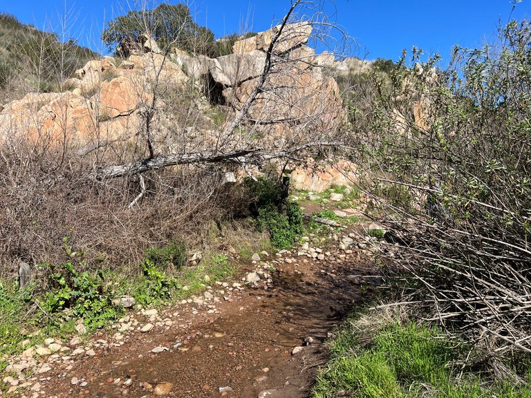
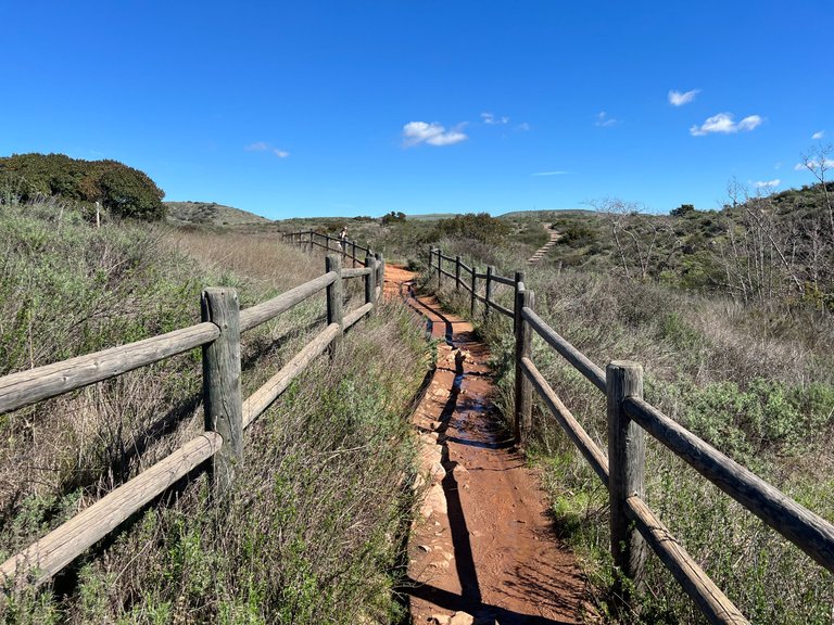
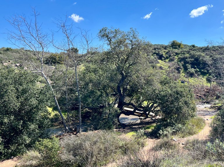
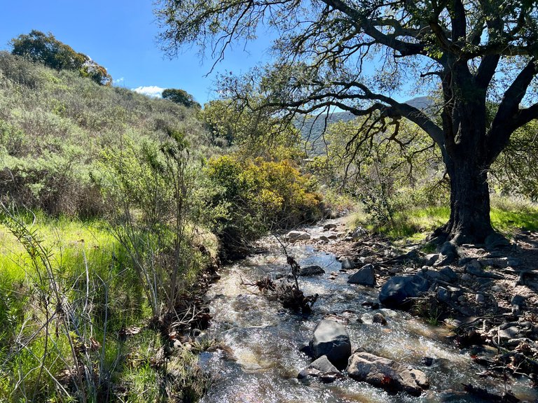
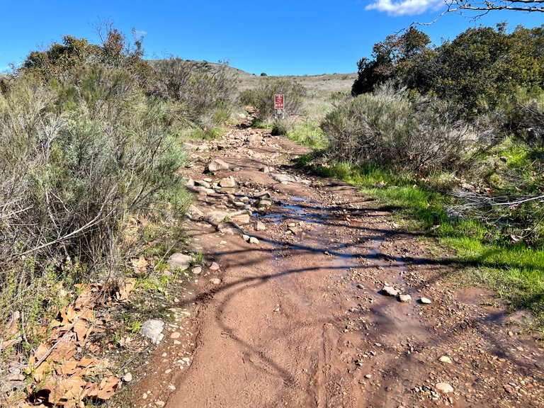
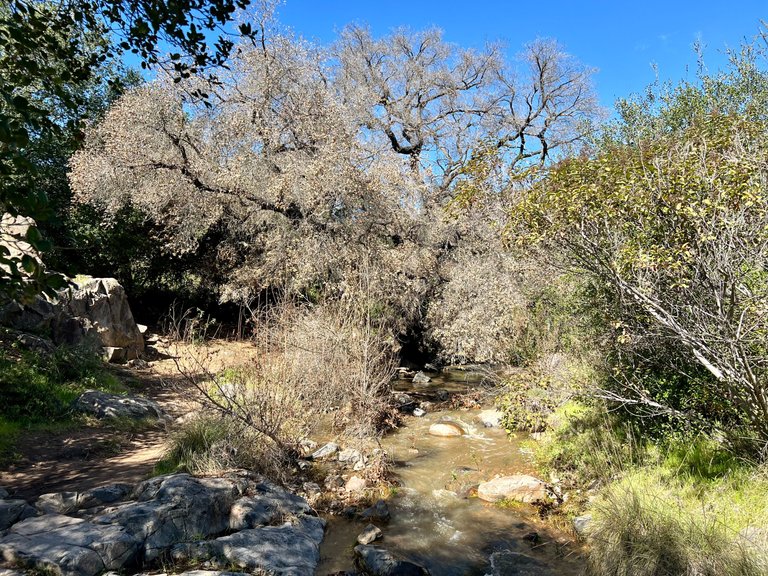
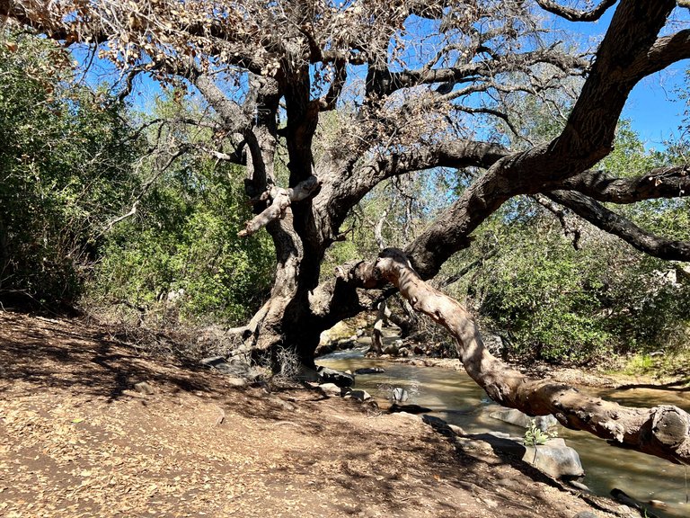
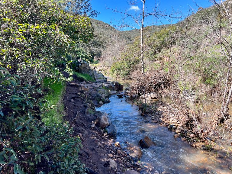
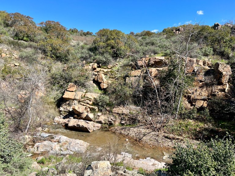
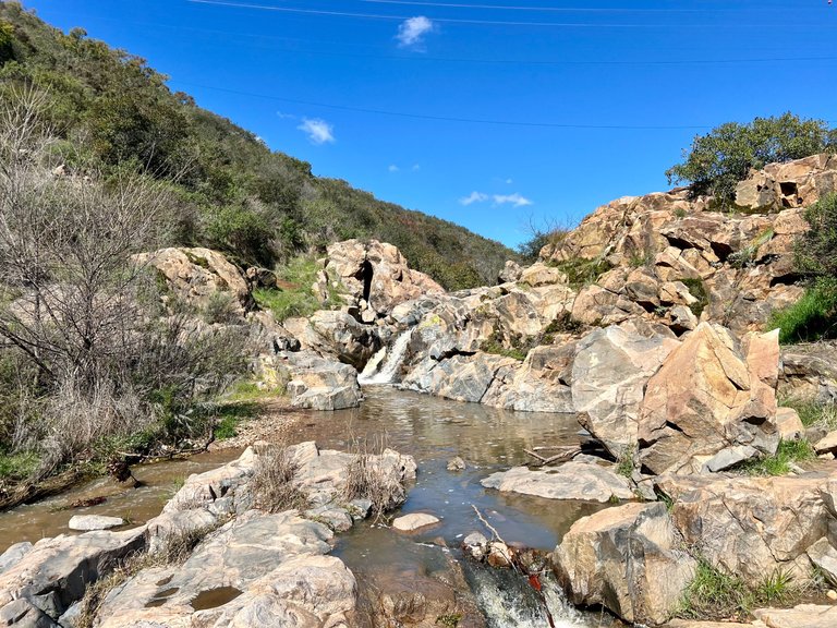
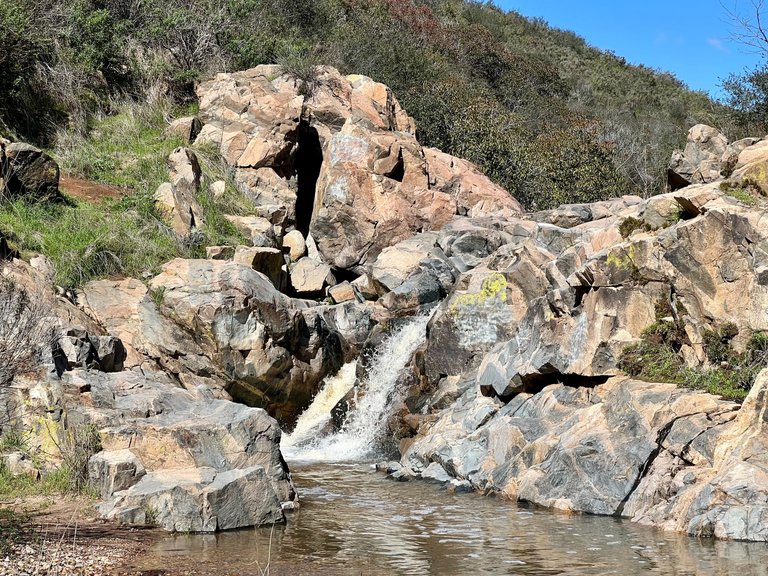
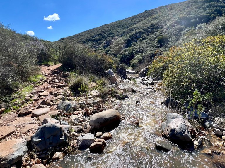
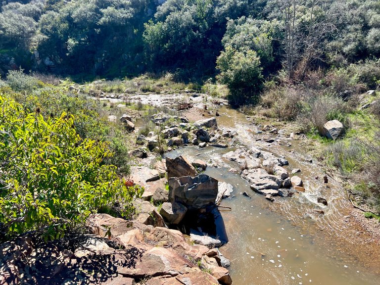
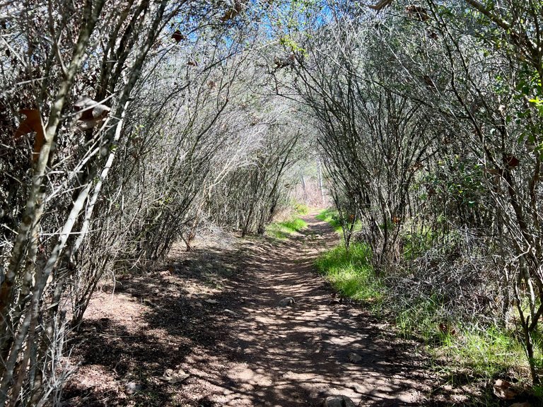
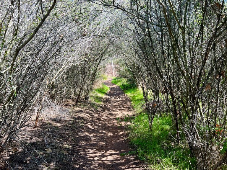
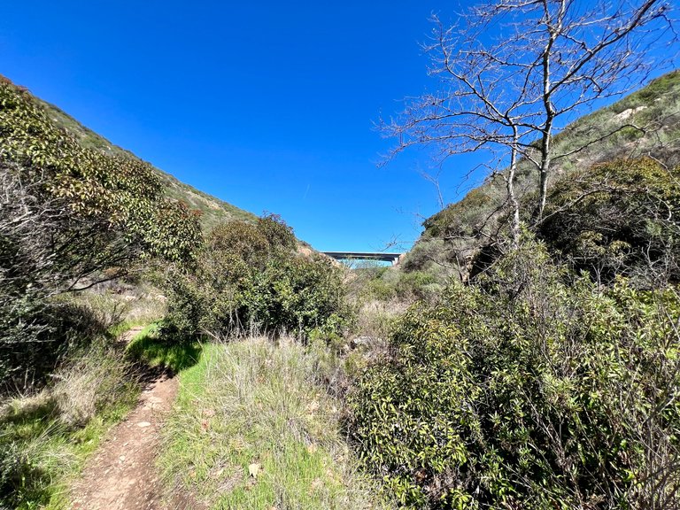
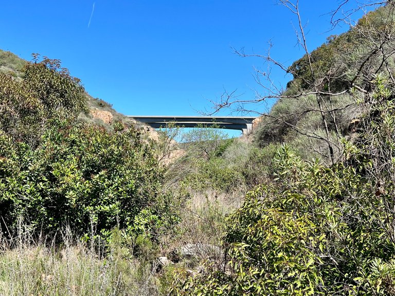
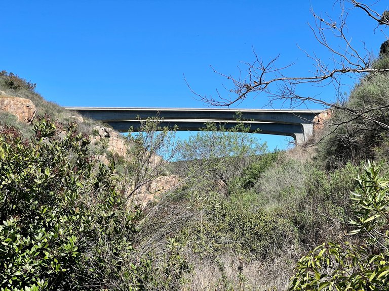
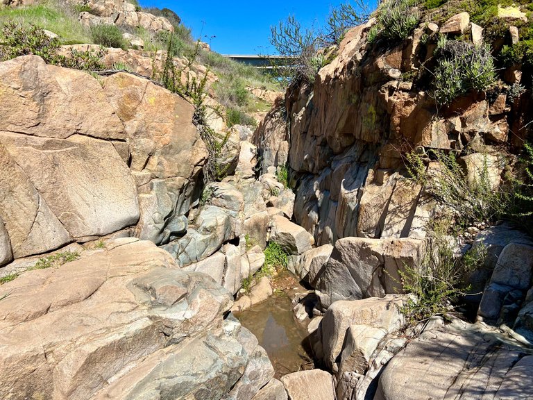
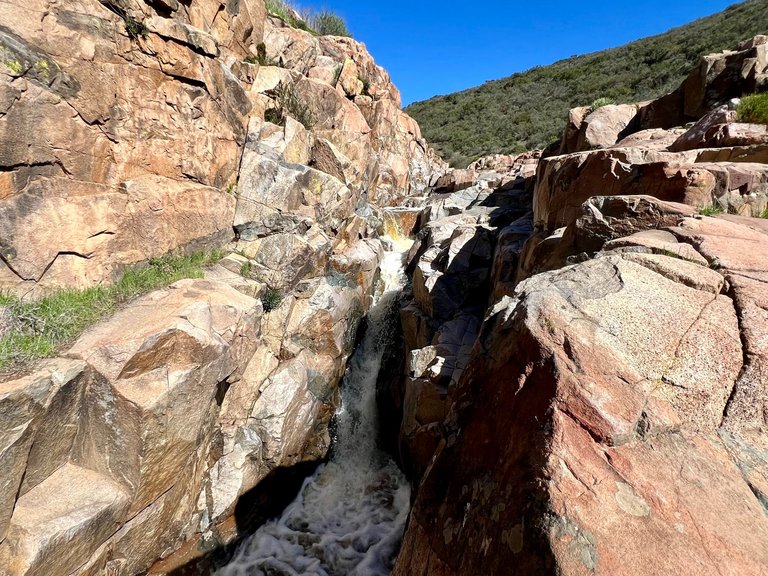
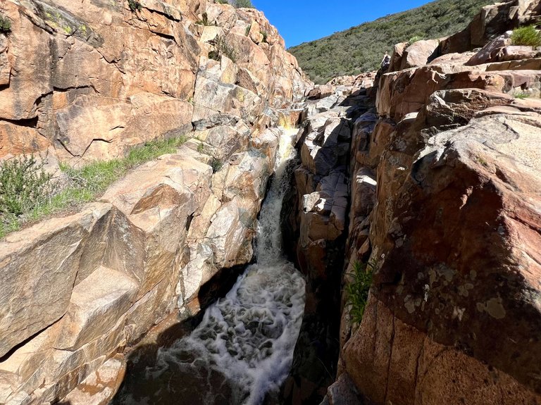
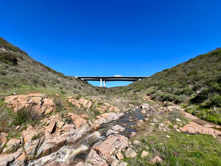
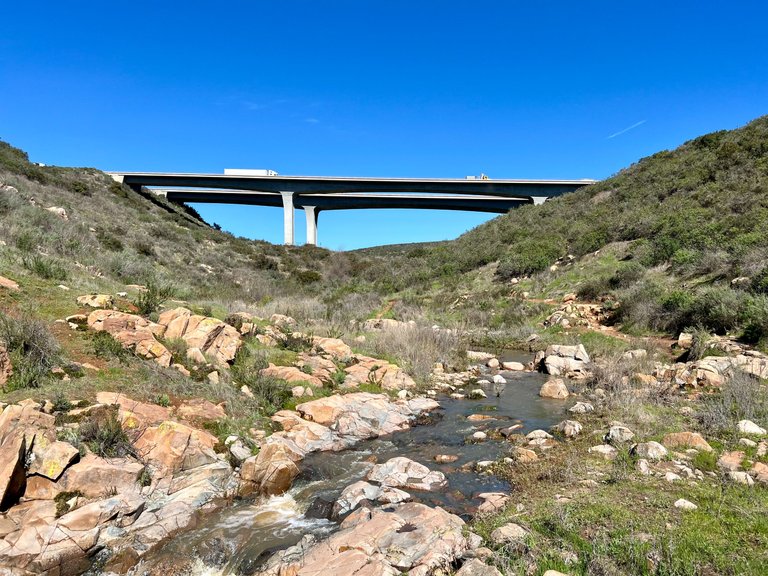
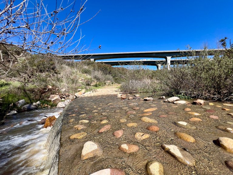
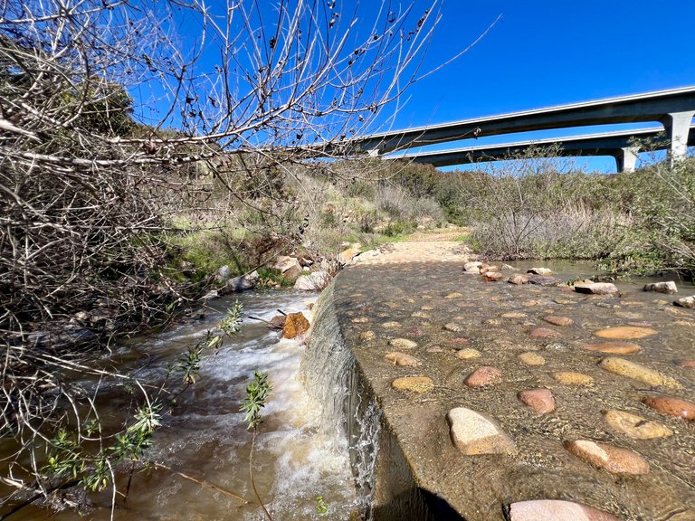
Since Oak Canyon Trail goes along a river, we had to cross the river a few times, on bridges or stepping on stones, and we also had to climb some rocks along the way. It's not a difficult hike, and we saw people from all ages in the trail. There are 3 waterfalls along the way and I was able to get pictures of only 2 of them. The other one had some girls bathing in underware only, so I couldn't take pictures. During most of the trail, you can't hear anything but the sound of nature, but at the beginning or at the end of the trail you can hear the sounds of civilization. The beginning of the trail is located at a very populated area and there is an airport near by. The trail ends almost underneath a bridge for highway 52, and you can hear all the traffic. I got some pictures of this bridge, it's pretty impressive, and speaking of pictures let's check out all the pictures I took during this trail.
[PT-BR]
Como a Oak Canyon Trail passa ao longo de um rio, tivemos que atravessá-lo algumas vezes, em pontes ou pisando em pedras, e também tivemos que escalar algumas rochas ao longo do caminho. Não é uma caminhada difícil, e vimos pessoas de todas as idades na trilha. Há três cachoeiras ao longo do caminho e só consegui tirar fotos de duas delas.A outra tinha algumas moças tomando banho apenas com roupas íntimas, por isso não pude tirar fotos.Durante a maior parte da trilha, não é possível ouvir nada além do som da natureza, mas no início e no final da trilha é possível ouvir os sons da civilização.O início da trilha está localizado em uma área muito populosa e há um aeroporto nas proximidades.A trilha termina quase embaixo de uma ponte para a rodovia 52, e é possível ouvir todo o tráfego. Tirei algumas fotos dessa ponte, que é bastante impressionante. E por falar em fotos, vamos ver todas as fotos que tirei durante a trilha.

[EN]
I hope you enjoyed the pictures, I will tag this post on Pinmapple so you can find this trail easily in the map. We went on a weekday, and parking was pretty easy. I think that on weekends this place can be crowded and hard to find parking. I also believe that summer might be too hot for this trail as well. Check it out if you get a chance. See you next time!
Hey! By the way, I'm running a witness node. So if you are not using all your votes, or maybe you are voting for a witness that is not online anymore, please consider voting for my witness. You can use this link to vote: https://vote.hive.uno/@mengao.
[PT-BR]
Espero que tenham gostado das fotos. Vou marcar este post no Pinmapple para que vocês possam encontrar essa trilha facilmente no mapa. Fomos em um dia de semana e o estacionamento foi bem fácil. Acredito que nos finais de semana esse lugar pode ficar lotado e difícil de encontrar vaga. Também acho que o verão pode ser muito quente para essa trilha. Vale a pena dar uma conferida lá. Até a próxima!
Ahh! aproveitando, estou rodando um node de testemunha. Portanto, se não estiver usando todos os seus votos, ou se estiver votando em uma testemunha que não está mais on-line, considere votar na minha testemunha. Você pode usar este link para votar: https://vote.hive.uno/@mengao.
Obrigado por promover a comunidade Hive-BR em suas postagens.
Vamos seguir fortalecendo a Hive
Great post Mengao with some beautiful photos. You got my vote 😊
thanks my friend!
The natural scenery and forests are very beautiful, I really like seeing the view
Thank you!
Wow, amazing hike! Great pics too! Thanks for sharing! 😎
Thank you!
Hiking fit about two hours is a lot but I’m sure you enjoyed it
It was not tiring at all
Nice one!
It was a good exercise, and a lot more fun then going to the gym.
Thanks!
Me encantó!!! Unas fotos realmente geniales
Congratulations, your post has been added to Pinmapple! 🎉🥳🍍
Did you know you have your own profile map?
And every post has their own map too!
Want to have your post on the map too?
Thank you!