Walk to Indian Landing /
(Edited)

Walk to Indian Landing at Wertheim NWR, Shirley Long Island, NY.
Map provided on their website: https://www.fws.gov/refuge/wertheim/map?trail=black-tupelo-trail
Trail is only a 2 1/2 miles round trip. Feels longer to me 🤣

Path runs south on the east side of Carmans river. Woods are predominantly Oaks with Black Tupelo hear the water. There were large Pitch pines recently destroyed by the Southern pine Beatle.
The view of the river is blocked by the reed marsh grass.

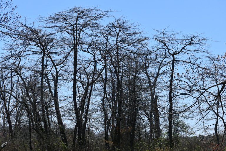
This is early Spring. Leaves not out yet on the Tupelo growing at the marsh's edge /
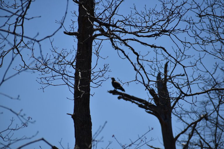
Lucky to spot early arrival of Osprey, up from their winter home in the south to nest up here /


Osprey live cams // https://www.psegliny.com/wildlife/osprey/ospreycams


Rotted Pitch pine being held up by an Oak /


This is Indian Landing, where the bend in the river meets the land. Most of river's shore line is lined with marsh and it's grasses , making the river inaccessible /
This is where the early native American Indians would land with their canoes.


You can see the large pines still alive on the other side .


Natives still frequent the landing /


Flowers just emerging on the High bush blueberry /

0
0
0.000
you have so many nice places to enjoy being an island. ❤️
Maybe that is why so many people live here.. Just visited a big county park near where I grew up but never visited. Will post on it soon.. Blydenburgh County Park
yay! Can't wait to see it.
Congratulations @manorvillemike! You have completed the following achievement on the Hive blockchain And have been rewarded with New badge(s)
Your next target is to reach 52000 upvotes.
You can view your badges on your board and compare yourself to others in the Ranking
If you no longer want to receive notifications, reply to this comment with the word
STOPCheck out our last posts: