Hiking the Pyrenees: Slogging it to Juclar
Preamble
This is the 3rd and last installment of my hike on day two in the Pyrenees mountains of Andorra.
The first installment of the series was a thigh burning hike up to the Peak of Mount Estanyo. The second was a shorter but slightly more technical segment along a Ridge and Through a Mountain Pass,
and now, this is our incredibly long, up and downhill slog of a journey to where we spent our second night on the mountain - Refugi de Jucla.
Keep in mind when reading this that all three of the hikes were done in a single day.
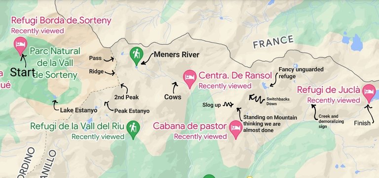
Near the end I will post a map and some stats to give you an idea of the distance that we travelled. I hope you enjoy.
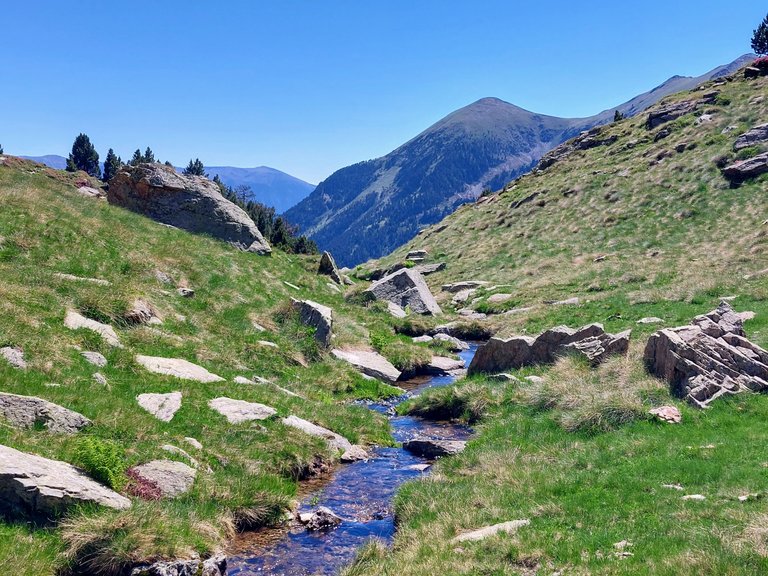
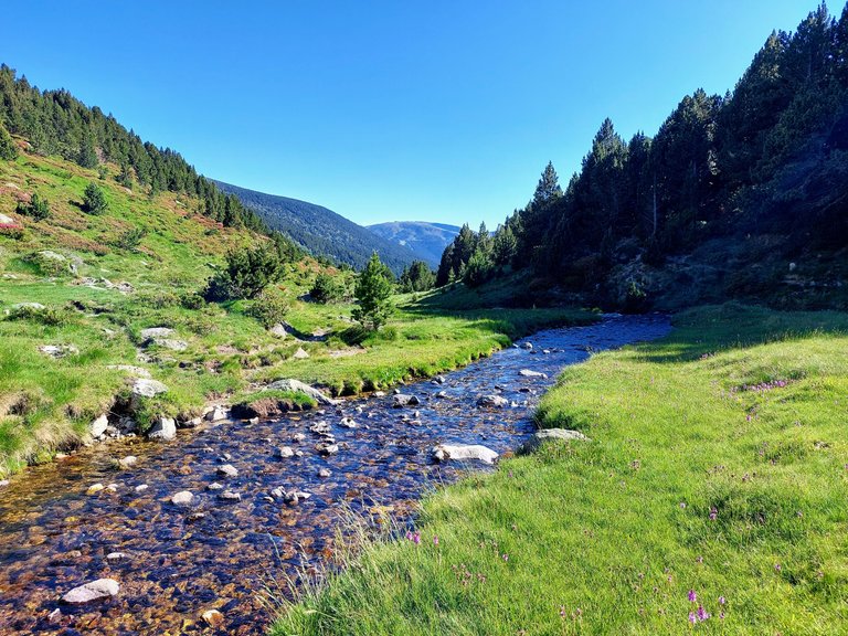
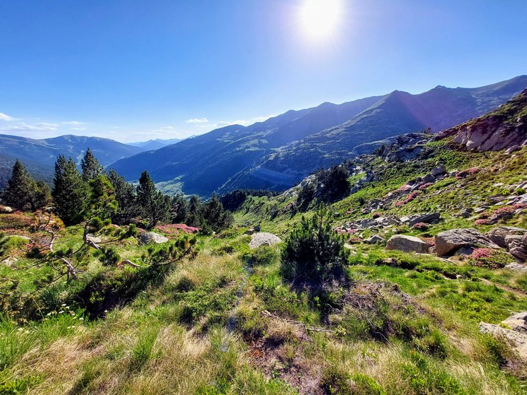
Meners River
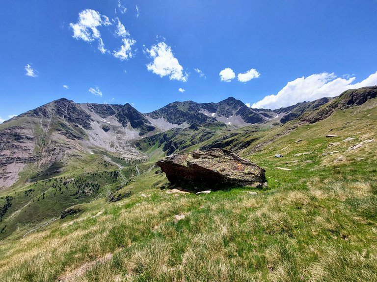
There aren't a lot of landmarks up in the mountains so it's hard to judge where you're at or provide a good explanation to others.
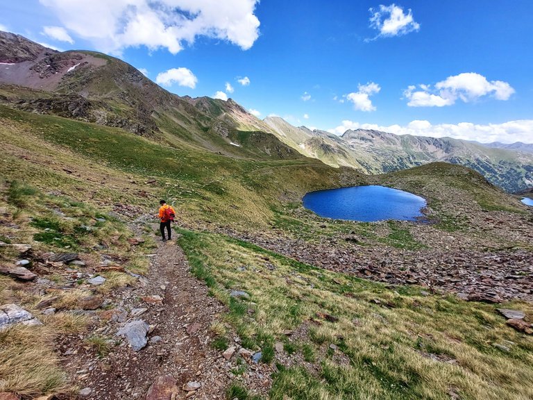
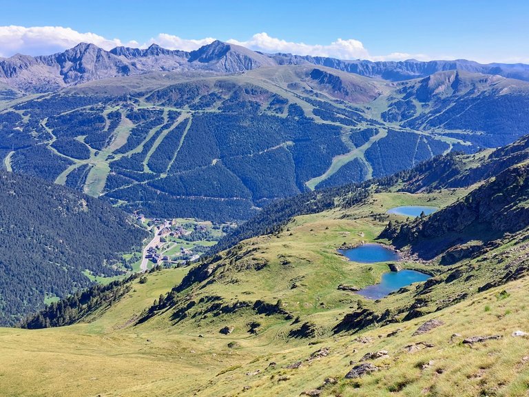
From what I could tell from maps online is that at this point we were somewhere near what is called "The Second Birth of the Meners River." Its basically a mountain stream created by overflow from glacial lakes.
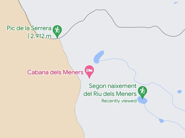
We didn't see a river but we did see a cluster of lakes that look a lot like the ones shown in the map.
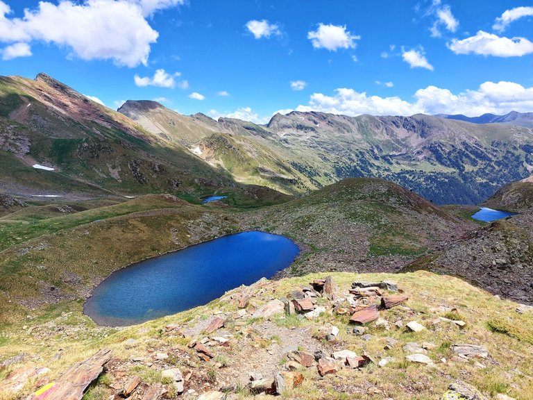
It looks pretty bang on if you ask me.
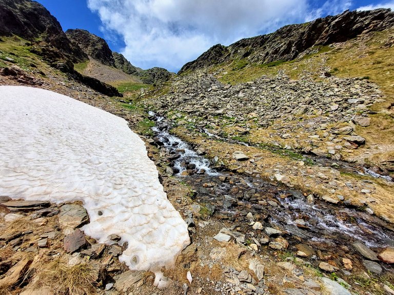
Maybe the river is a little more raging in the early spring when the snow is thawing?
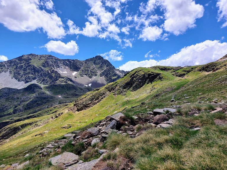
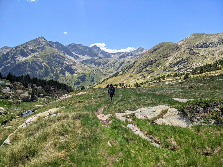
Mountain Cows and Horses
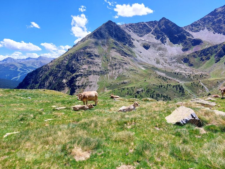
Heading down from the Meners River brought us to a large grassy hilltop pasture where we met a few furry friends.
They had new calfs with them but they were all still very friendly.
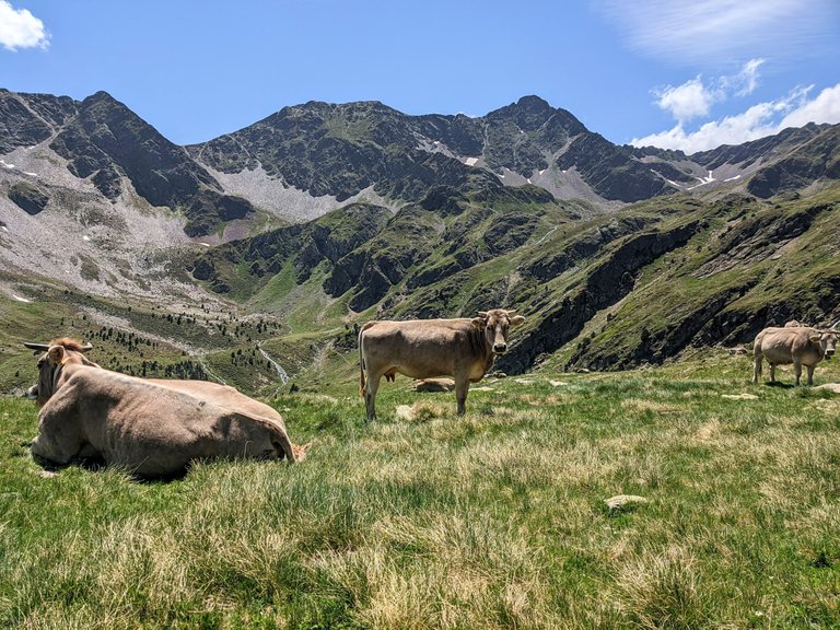
We stopped to say Hello and to take some photos.
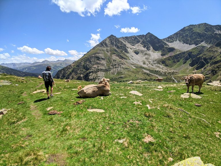
My wife loves cow content so she will be happy that I'm including these photos.
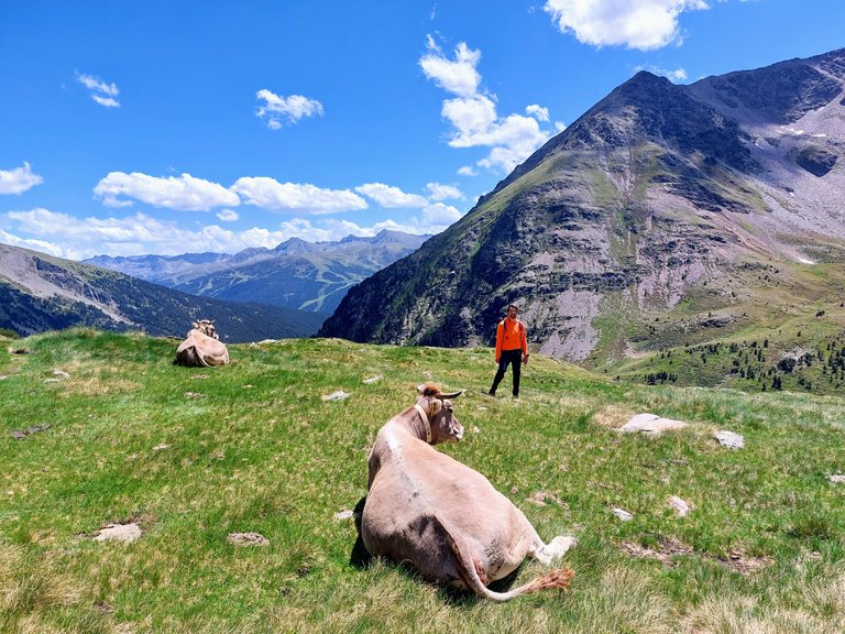
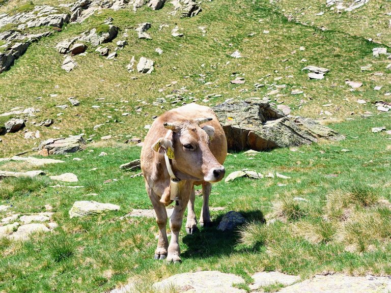
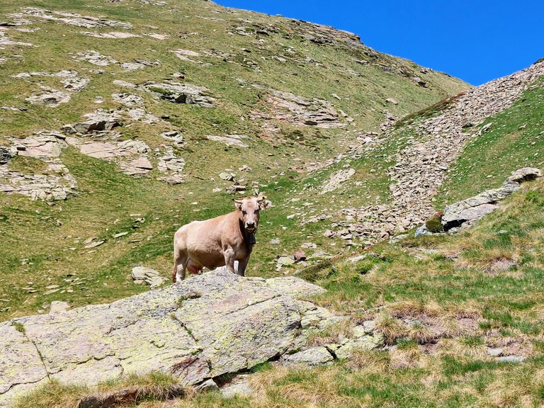
In my experience, mountain Cows are always very friendly.
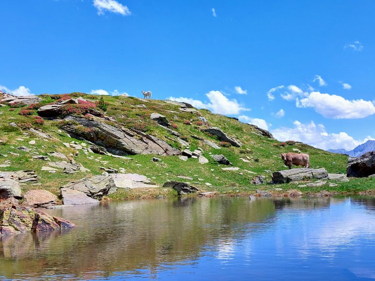
Before our trip I read that the most dangerous animal in the mountains are Pyrenees Dogs. They are a breed specifically bred to watch over flocks of sheep and supposedly can be very aggressive to anything that approaches their flock. The article suggested that under no circumstances should a person ever walk through a flock of sheep on the mountain because the dogs are trained to attack any would be predators.
I don't know if the dogs are used to watch over Cows on the mountains but we didn't have any issues walking through the herd.
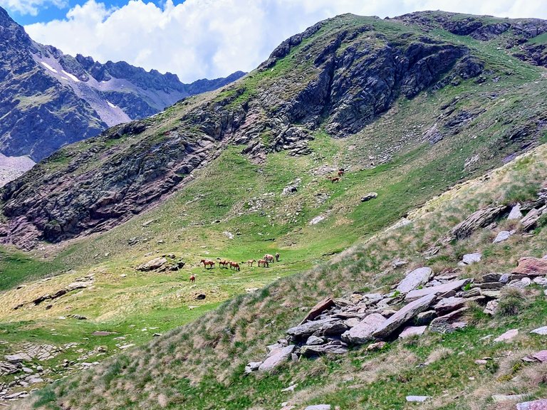
I've seen many Cows on mountains before but this trip was the first time that I had ever seen any horses. They even wore bells around their necks, just like the cows.
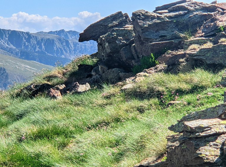
We also saw quite a few Marmots during the trip. They are large mountain groundhogs. You can see one in the photo above if you look closely.
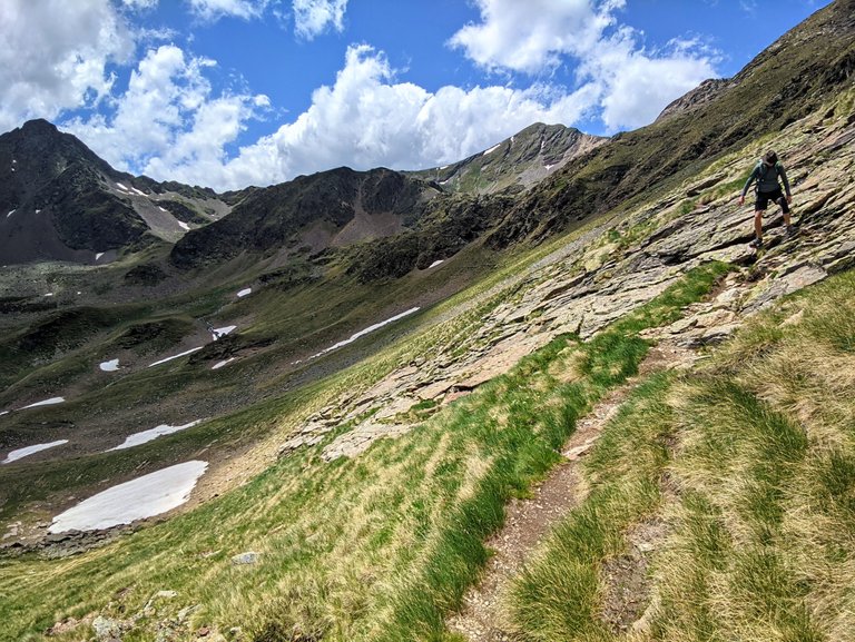
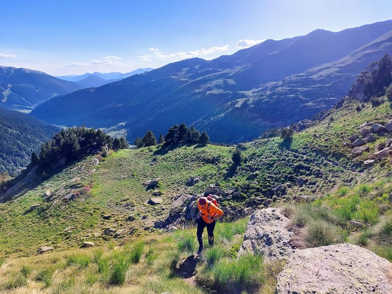
Sloggin It
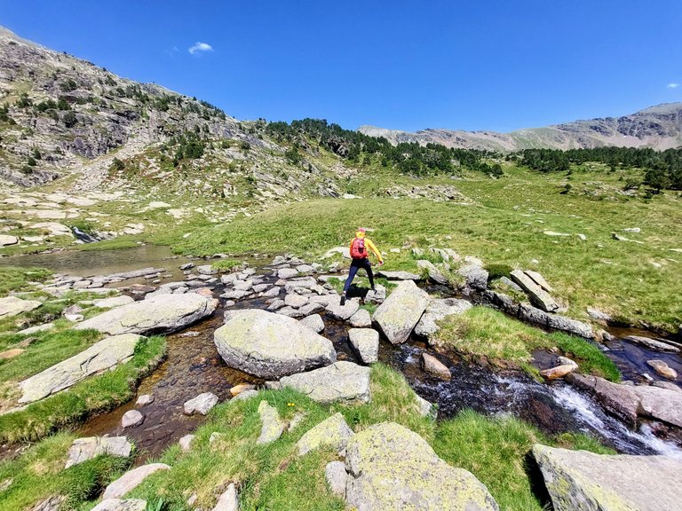
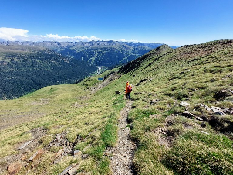
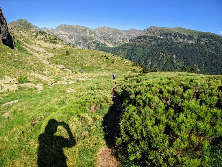
The hike from the ridge and through the grassy pastures was all downhill walking with some horizontal in between.
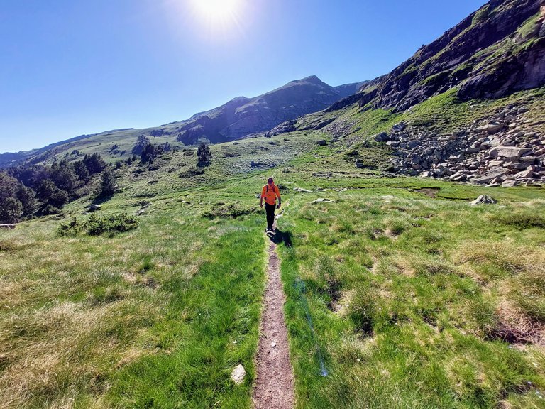
We eventually hit a point though when it was time to walk back up another mountain on the other side.
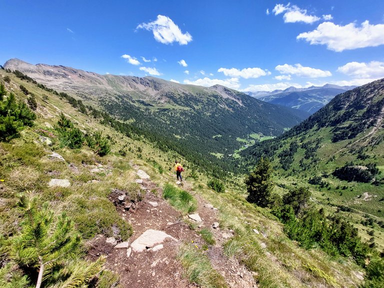
I found this part to be absolutely exhausting.
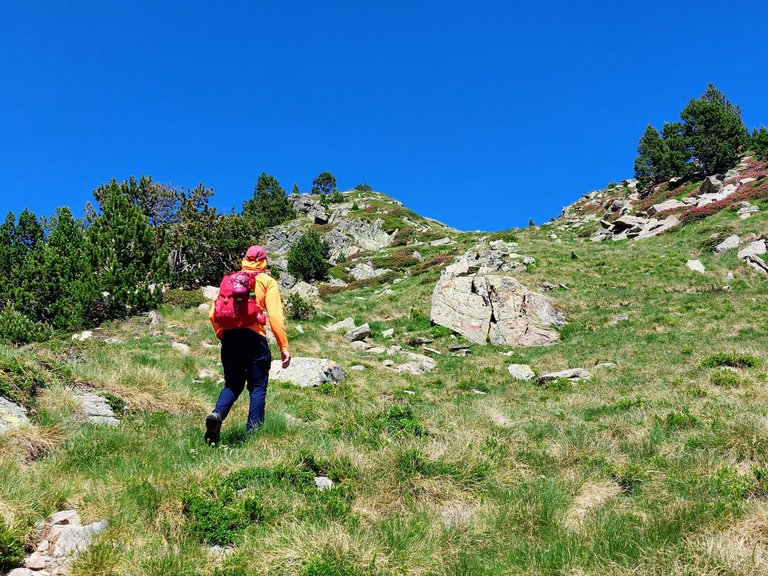
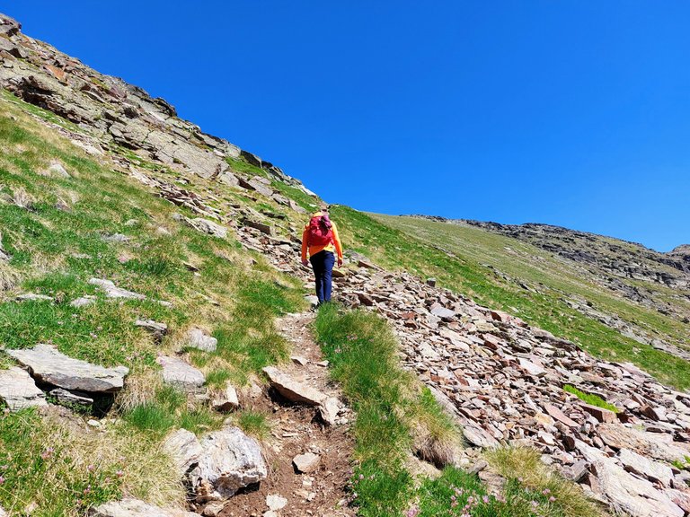
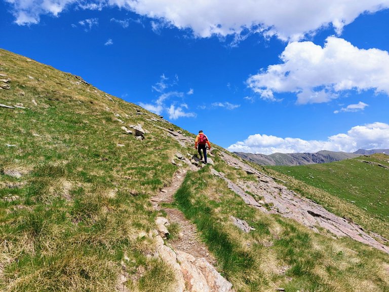
We had already been hiking for about 6 hours and had done a big uphill climb earlier that day to high altitude, so I was more than a little tired by that point in time.
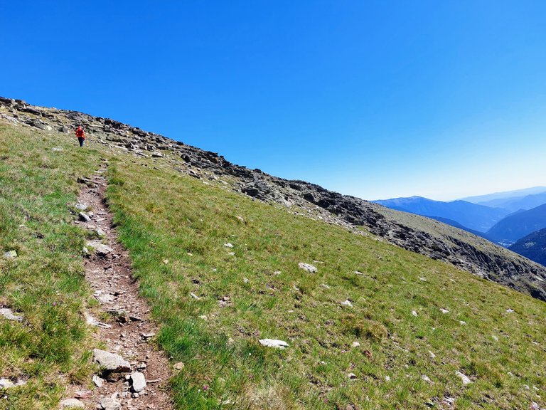
I couldn't keep up with my friends pace here.
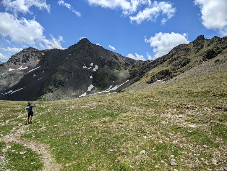
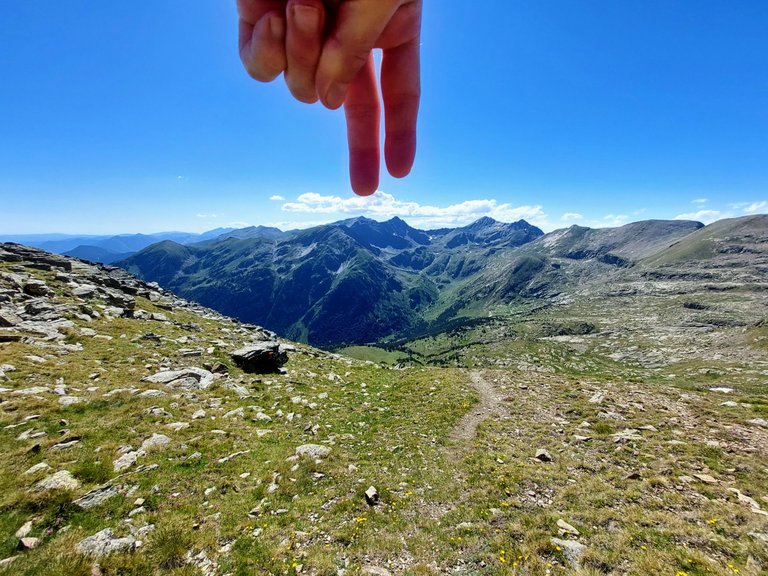
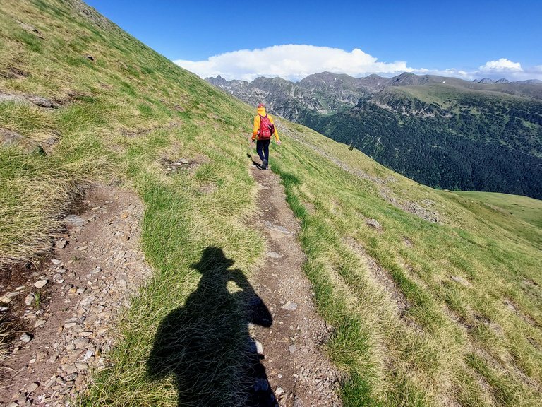
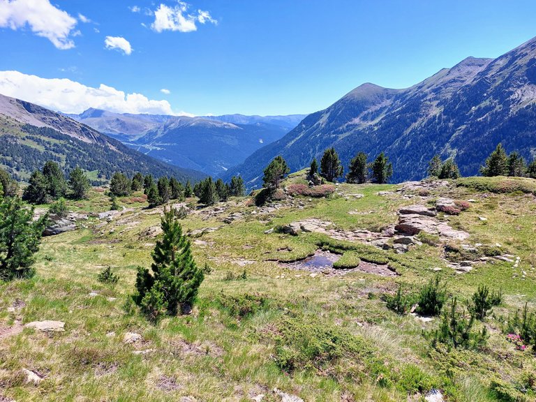
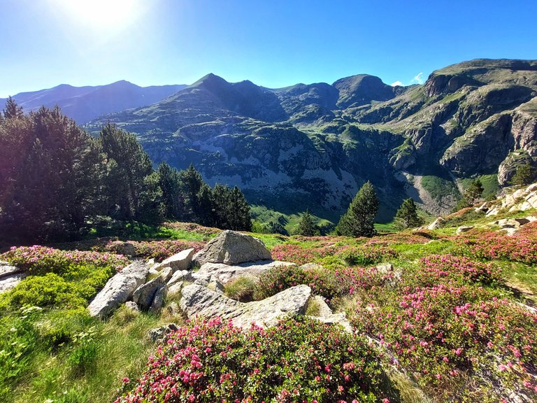
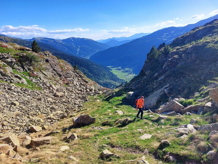
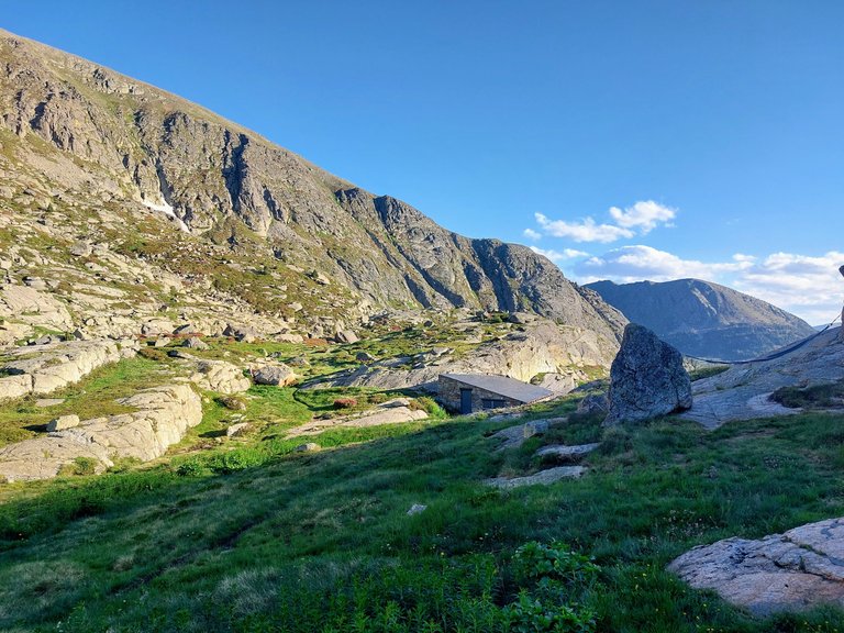
Here I am at the top pointing to where we had just come from.
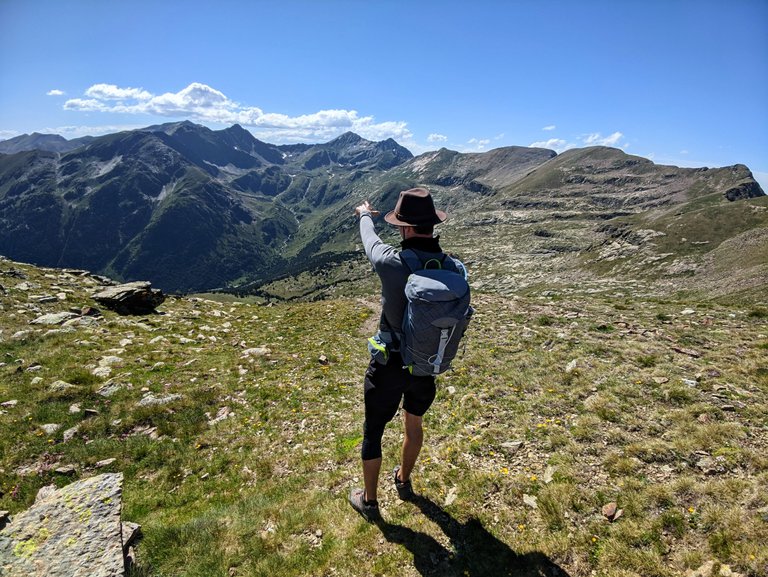
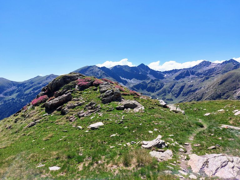
Similarly, these are the two peaks that we had walked to earlier that day.
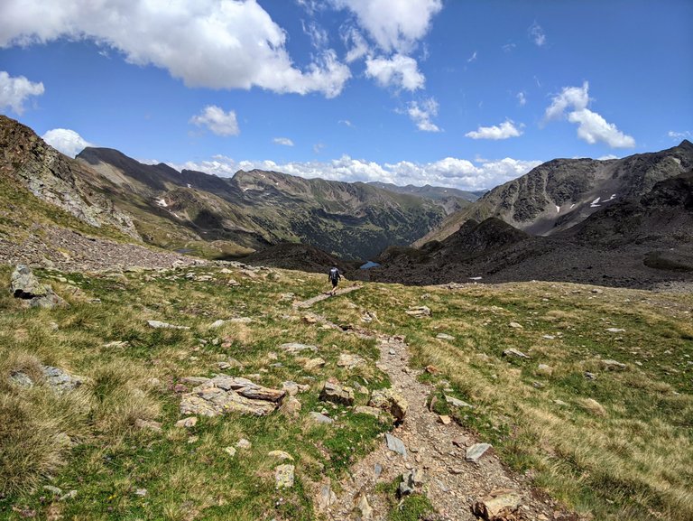
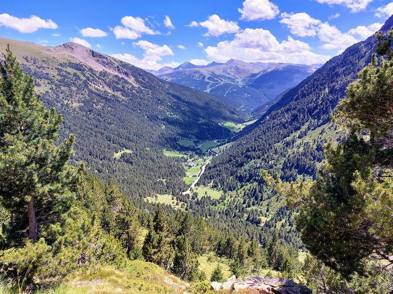
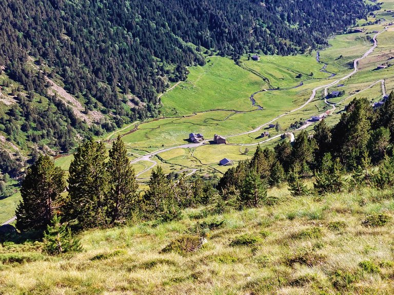
This next one gives you an idea of the general route that we took, not including the uphill hike from where we stayed the previous night - Refugi Borda de Sorteny.
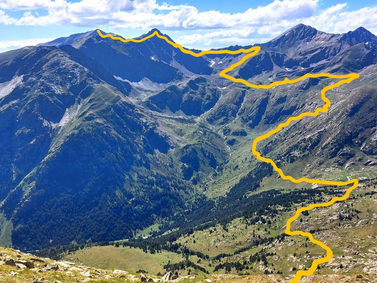
In the photo you can actually see the Meners River, snaking its way down the mountain.
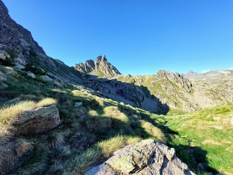
Shattered Dreams
At the top of the mountain we took a break and did a quick assessment of our location.
My friend was tracking our whereabouts with his GPS watch and linking that to a map on his phone.
The problem was that it was very difficult to determine scale and uphill walking vs downhill or horizontal.
Ultimately, it ended up being nearly impossible to estimate exactly how long the walk would take us from any point.
Neither of us really understood that at the time though.
So at this point my friend told me that we were getting close to Refugi de Juclar.
This wasn't the case at all unfortunately. We were actually only a little over half way there, which meant that we still had about 4+ hours left to go...
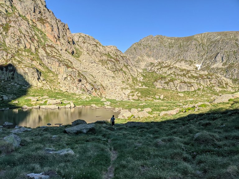
Believing that we had only about an hour left to hike, I drank most of my water that I had been rationing and we headed down the otherside of the steep mountain via a set of criss crossing switchbacks.
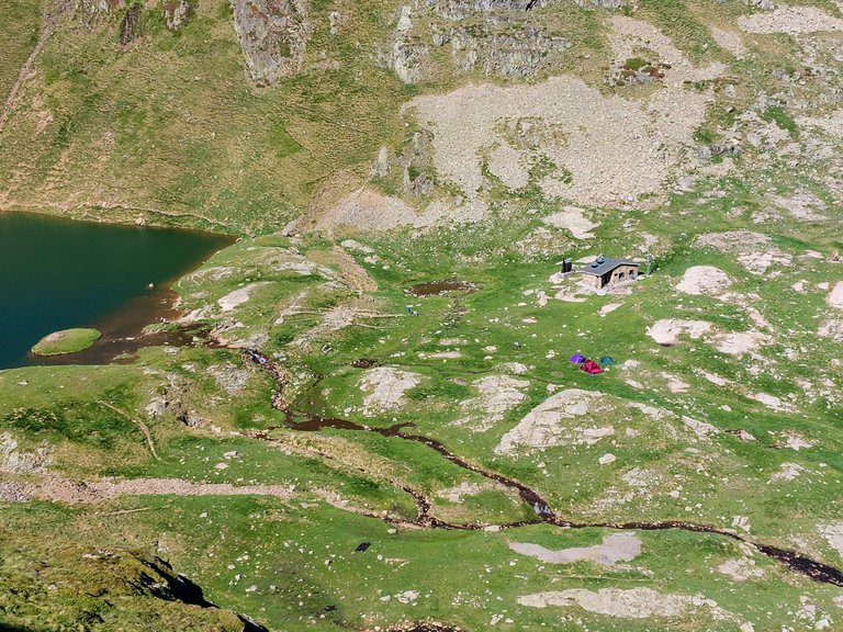
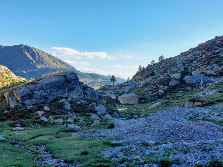
After an hour we passed a really fancy unguarded refuge that we werent staying at and after 30 minutes more I started to get a bit confused and a little worried because there was no indication whatsoever that we were approaching our refuge.
I just kept telling myself that it must be hidden around a corner.
After another knee crushing walk downhill we came to a creek, and this is where all of my hopes and dreams of sanctuary came to an abrupt, moral shattering halt...
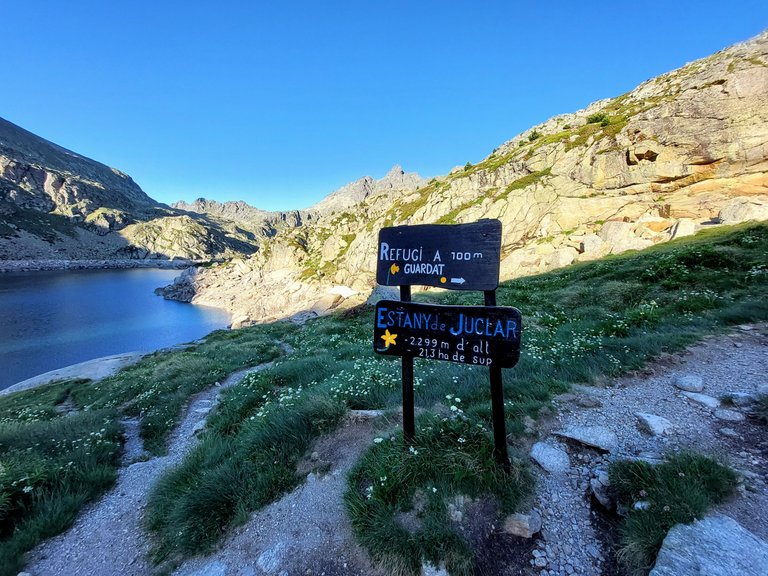
We had just walked for 2.5 - 3 hours from the top of the previous mountain and a sign at the bottom of this next one read...
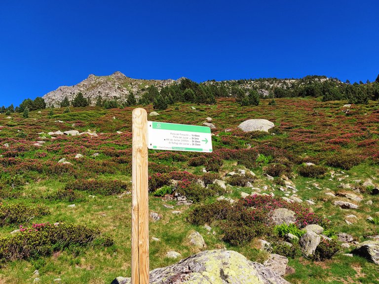
Refuge Juclar 2.5 hours away "What the actual fuck!!!!"
Adrenaline
We started our hike at 9am that morning and reached the sign at 6:30pm.
No lie, the thought of reaching our refuge at 9:00pm gave me a major surge of panic.
So with adrenaline now surging through my veins I took the lead and we plowed all the way back up the mountain in one go without taking any breaks.
It was litterally hundreds of meters of elevation that felt like it wouldn't end.
The up and down all day long was killer.
We started in the morning at 1900m and then climbed up to 2900m.
Then we went back down to 2400m only to walk back up to 2700m.
Then it was back down to 1900m with an immediate turn around to go back up to 2300m.
The last 400m climb to finish off the day was insane, but with adrenaline pumping through us we did it as if it were the start of our day.
In the end we completed that 2.5 hour hike in only an hour and a half and arrived at Refugi de Jucla by 8:00pm.
In the end we hiked for 11 hours that day.
We walked 34km and I clocked 46,000 steps on my fitbit. I don't know our exact elevation gain for the day but my watch registered 720 flights of stairs.
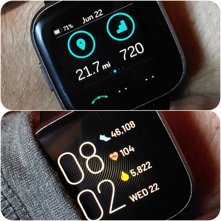
The tallest building in the world has 163 flights so I guess it would be like climbing to the top of that building close to 4.5 times. Needless to say, I was done for the evening, much like I'm done with this post. See you later.
Congratulations, your post has been added to Pinmapple! 🎉🥳🍍
Did you know you have your own profile map?
And every post has their own map too!
Want to have your post on the map too?
This post has been manually curated by @steemflow from Indiaunited community. Join us on our Discord Server.
Do you know that you can earn a passive income by delegating to @indiaunited. We share 100 % of the curation rewards with the delegators.
Here are some handy links for delegations: 100HP, 250HP, 500HP, 1000HP.
Read our latest announcement post to get more information.
Please contribute to the community by upvoting this comment and posts made by @indiaunited.
Thanks for the support 👍
Wow that is one incredible hike. Beautiful and so long and those ups and downs. I would be worried too without the water and being tired after already hiking for so long. Congrats on making it and thanks for sharing it's beauty with us.
yeah the ups and downs were killer. It was all worth it in the end but it was pretty rough in the moment
Beautiful route , what a delight to be walking among those mountains and those totally green landscapes . Thank you for sharing the route
Yes it was a very beautiful hike. The scenery was pretty incredible.
Wow what an adventure, I can imagine it must have been scary at a certain point.
Beautiful views and nature. ⛰🏔
Glad you made it.
Thanks for sharing @leaky20 😎 have a great week!
It was scary in that I didn't think that we would make it to our refuge. We got there in the end though.
Have a good week.
Something you don’t want to repeat.
Thanks a lot, enjoy yours 👋🏻😊
I couldn't see the Marmot for ages, which is staggering considering how obvious it is!!
My wife had trouble seeing it as well. lol. Its not a great photo. I couldn't get close to it so it came out dark and unclear.
I think it's quite clear now. I think I was looking for a smaller one!!
Haha yeah that will do it as well.
Each photograph deserves a frame of its own.🙌
Hiking is not easy, and the scenarios show just how much determination, strength, and perseverance are needed to fulfil your missions when you venture off on hikes. I would believe that it's important to set off with just the right companions:)))
The scenery was so nice that it was hard not to take good photos.
You're right that the hikes aren't easy, you do have to keep pushing yourself forward at times. Having a good hiking companion goes a long way.
I am out of breath just reading our post!!!! Lovely scenery though
Well its a pretty long post so that's understandable 😉
Duh!!!!!! the ramble was so long the thought of it tired me out!!! 😂 Your blog was as ever exceptional 👍
Haha thanks. I appreciate it
👍
Hiya, @LivingUKTaiwan here, just swinging by to let you know that this post made it into our Top 3 in Daily Travel Digest #1742.
Your post has been manually curated by the @pinmapple team. If you like what we're doing, please drop by to check out all the rest of today's great posts and consider supporting other authors like yourself and us so we can keep the project going!
Become part of our travel community:
This is the most beautiful and most detailed hike I've read so far here on Hive. I felt exhausted while looking at your trail😅, but I was more speechless looking at how beautiful the sceneries are! IT IS BREATHTAKING!😍😱
I'm glad you enjoyed it. Yeah it was quite the hike that day. Totally worth it for the scenery though
Dude that must have been pretty nerve-wracking and so beautiful at the same time. Just the thought of drinking all the water and then walking another 3 hours, you got some mental toughness.
Did you drink at the river when your flask was empty? Having then to walk back up must have been borderline torture haha, sorry I am not laughing, I just know in these moments, it's a make or break situation, no time to complain about it on the moment. I am glad you made it on time!
The Pyrenees Mountain are very beautiful. Definitely worth the effort.
We didn't drink any river water because we didn't have any way to sanitize it and there were cows on the mountain. I would bring a UV pen light next time for sure for emergencies.
The up and down and back up again was killer but that's how you build character I guess 😆
Bro, thats a monster ass journey. I love watching cool documentary videos of places like that. Nice job taking us through. Have a good end of year ya beast boss.
!BEER
Yeah it was a long and strenuous day but totally worth it in the end. It was a good accomplishement for me and more importantly a good memory to look back on.
Happy end of thr year to you as well.
11 hours? That was some hike! Do you have tents with you?
Exactly what are the dogs protecting the sheep from? I don't think there would be any wolves around...
This post has been manually curated by the VYB curation project
We didn't have any tents with us because we stayed in manned refuges at night. A person could stay in a tent on the mountain or they could use an unguarded refuge.
I think the dogs did protect against wolves. I don't know how accurate the article was or what sorts of predators are in the Pyrenees though.
So having to stop for the night wouldn't have been comfortable 😂 I'm glad you made it to the shelter!
!PIZZA
yeah exactly lol 😂
I gifted $PIZZA slices here:
@wrestlingdesires(8/15) tipped @leaky20 (x1)
Send $PIZZA tips in Discord via tip.cc!