Canadian Rockies: Columbia Ice Fields, go with the flow
What's up Mountain Lovers, Hikers and travelers!
I have been meaning to give this place a post of it's own, normally treated as a pit-stop for a few hours on a gorgeous but long scenic route that links Banff and Jasper National Park together, the world famous Icefield Parkway, named after this special landmark. National Geographic has named it one of the most beautiful highways in the world. I never get tired of it, looks different every time as the landscape changes slowly over the years. I know I keep meaning to post about the drive too, the Rockies have many treasures to share, one at a time.
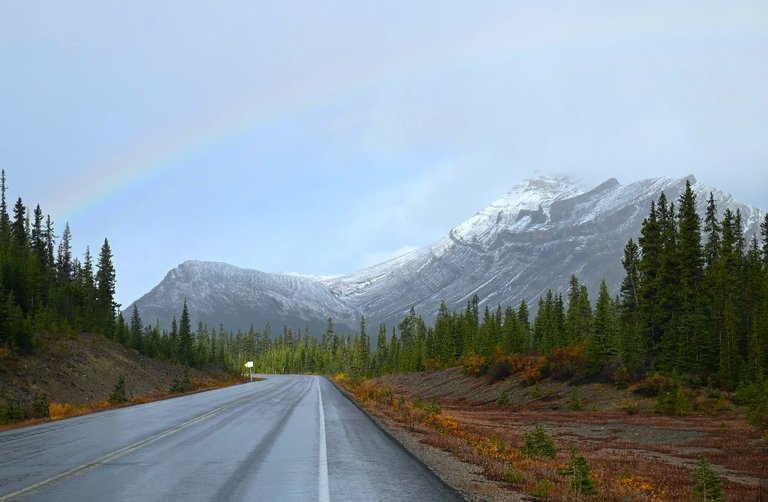
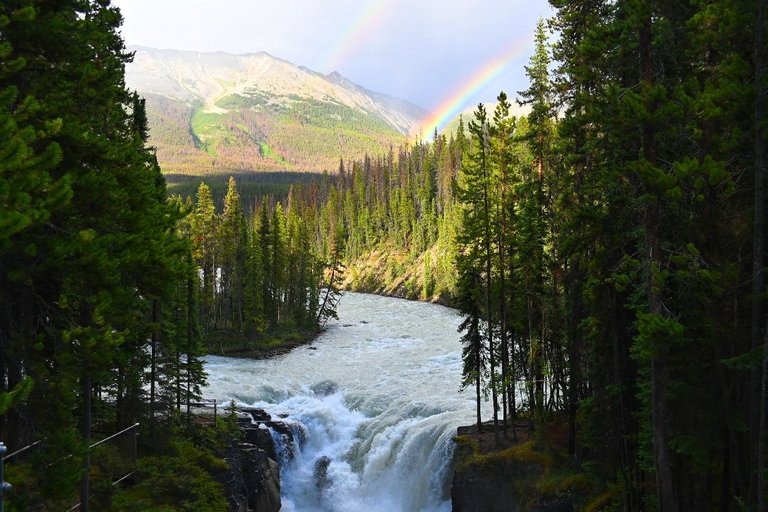
Fall Rainbow driving up un the Glacier. Fall rainbows in elevation, the reflection from water droplets turns into ice crystals delivering longer lasting colors sometimes brighter. I had a constant rainbow show lasting from Bow Lake all the way to Athabasca Falls. I have seen many in one day. 50+ rainbows one after another for good luck, even closer driving up to it, the last turn before the glacier begins to reveal it's glory.
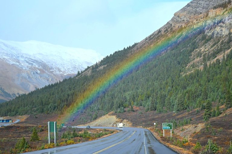
Hang on, the pot of gold is just on the other side of the rainbow like the legends said. Pointing the way to one of the biggest and most precious GEM IN THE WORLD, a rare giant water crystal that finds it's way into 3 oceans. One of the largest source of slow melting water, Alberta's real inheritance. Water security.
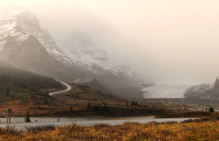
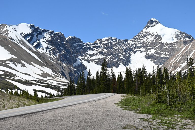
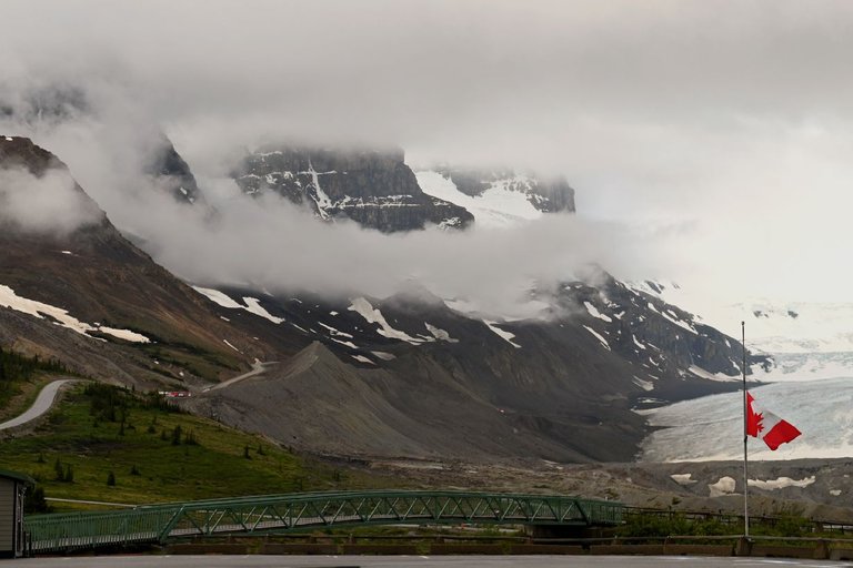
The highest point of the drive to Jasper, Columbia Icefield is often moody with it's angry looking cloud and snow can be expected just about any time, even in summer. Dress warmer if considering spending time outside hiking thru the moraines. When we drive in the mountains, we often point and laugh at the big old angry clouds on top of the mountain, well this is where you are giggling a little less facing it but on a calm day, you never know what kind of magic it might reveal. The photos in this post are a collection of different trips over the last 2 years of unposted pictures with a few previously posted to show different vantage points as each visit I pick a different angle and some take some work to get to.
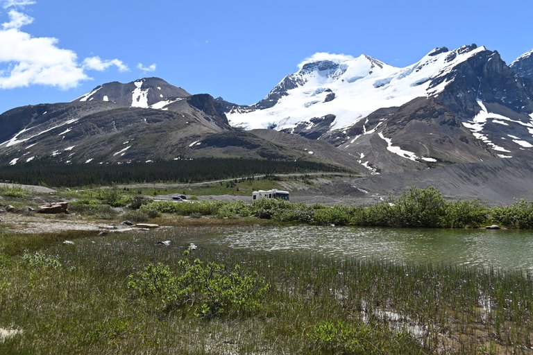
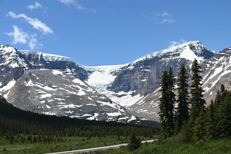
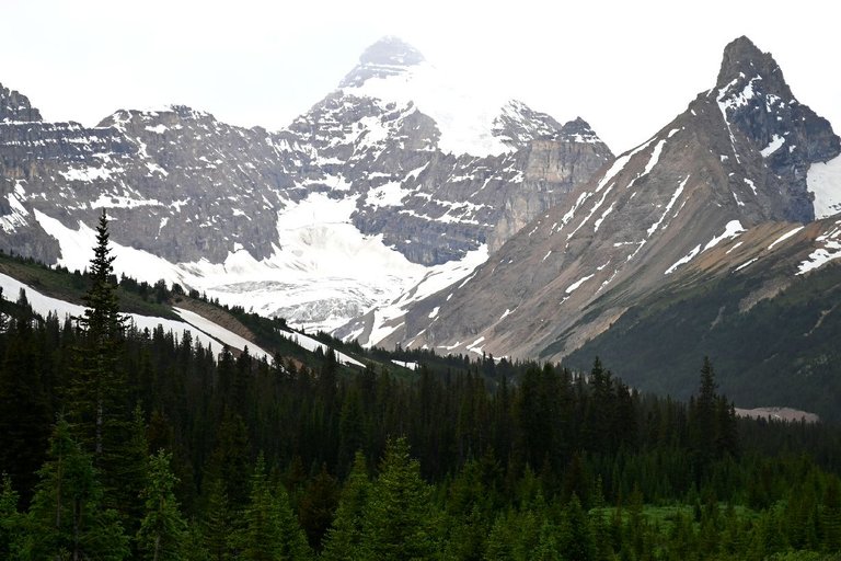
Before we get too much into the post, this is to give you an idea of how high up on the mountain the glacier is located. In these two photos, we are looking at a vantage view of the highway we were just driving on below just before the road plateaus again towards the Ice fields. Look how tiny the road looks! There is a roadside turn off for safe photography but only open in the temperate months as it becomes a snow storage over the winter to hold all that extra snow someplace to keep the road open for vehicle traffic as much as possible.
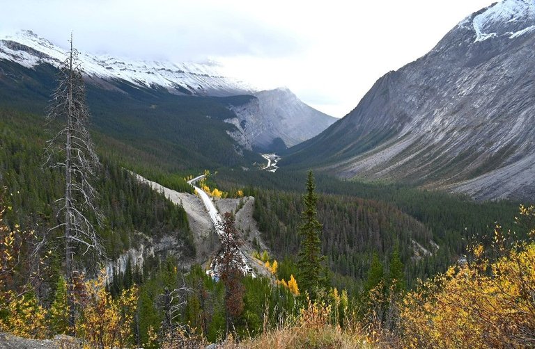
Being the only road to Jasper from Banff, the park does their best to keep the road open year round but before attempting to drive thru in the winter, best to check the road conditions first, things change fast compare to other places in the park. The Icefields generate their own micro-climate, the region is mostly shielded by other surrounding mountain tops trapping moisture at the location and creating a wind tunnel effect. Even in the summer, expecting temperatures feeling like the teens with the cold radiating from the frozen wonder. Layers is best to ensure comfort when exploring around.
The fall colors getting lost in it's foggy moods give it flare but summer reveals The Prairie blue sky we are famous for as a nice contrast with the permafrost on the mountain top. Most of it stays frozen over the summer but the fresh snow accumulated over the winter form various ponds scattered around the grounds and roadside along with directly feeding Lake Sunwapta to end up in the Athabasca River system that eventually feeds many of Alberta's significant rivers that locals use as a fresh water supply.
Being so high up, the growing season is rather short, most trees can be hundreds of years old yet remain small. Also susceptible to a phenomenon called "flagging", caused by the constant wind, the pine needles only grow on one half of the tree.
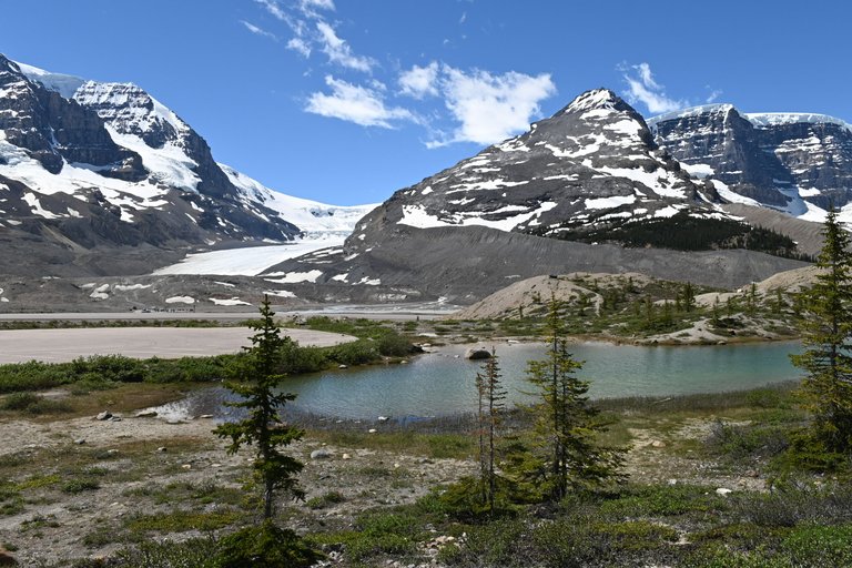
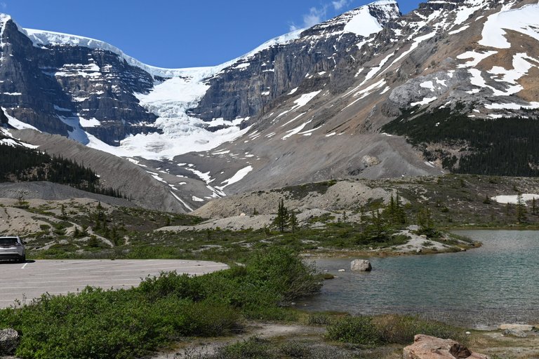
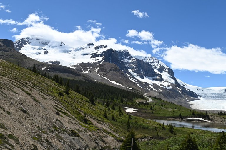
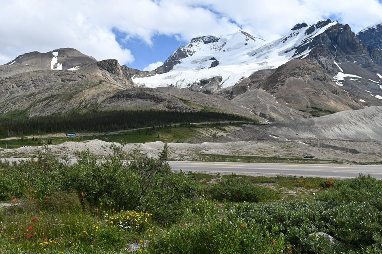
The image with the Athabasca Glacier in the background is taken from the parking lot near the Icefield visitor center that as an interpretive center, a star bucks and the standard trinket shop, one of the official Korite retailers. The facility and the lot is across the street from the glacier and the trail that heads up the moraines left behind to get a closer view. there is a lot there but it can get full fast.
Despite it's short summer and permafrost, there is a few small hardy vegetation that can grow in anything to feed the smaller critters that make up a mountain's ecosystem. Don't expect too see anything large due to harsh conditions or shortage of food. Mostly birds and small rock annimals like chipmunks.
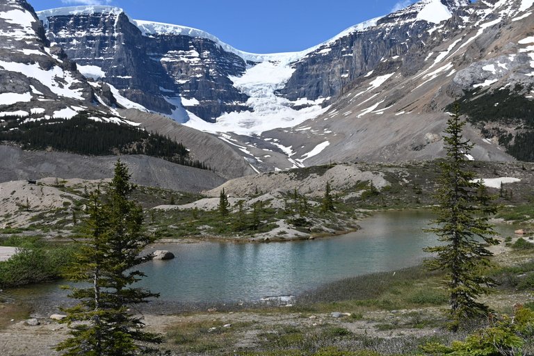
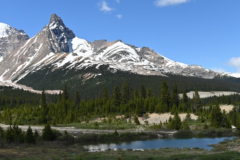
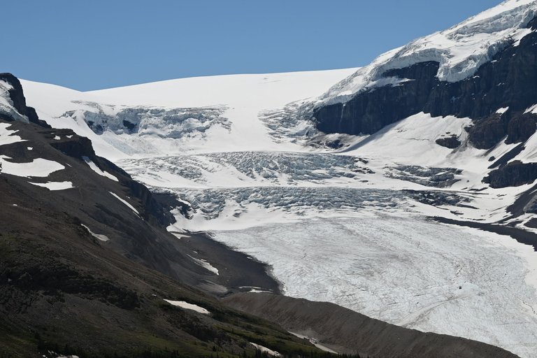
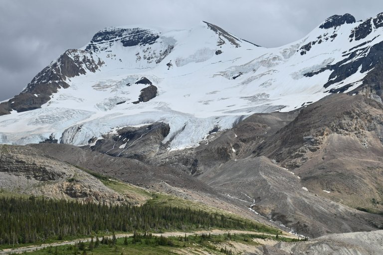
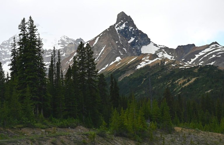
Dome glacier, one of the Columbia's many glaciers is a thick ice sheet of permafrost that covers the top of the mountain like a dome. It looks much larger in real life. The best view for this one is from the lot, not on the trail like it's counterpart, The Athabasca glacier.
The large sand hills you see are what is referred to as moraines and are left over rocky sediment that eroded to the bottom of the glaciers is they receded. Often used as a measuring tool to keep track of the permafrost's melting rate outside of the regular winter snow fall melts.
In the warmer months, a rare few hardy species take root all around the fresh water supply offering a sweet combo of winter and summer in one photo. They are far and few between but end of June to august is the best time to spot them. There are still more species than you might expect hiding in low patches.

The photo below is taken from the Near-by Wilcox Pass Trail head, one that specific day why some of the photos may cross a bit, I never finished displaying the photos from that trip, we did a quick turn around to get our usual view before heading up the mountain ridge to get a better vantage point over the glacier. I did post about the trail under my ladybug account so I'll include a link to it. It was an incredible view worth revisiting, the post is loaded with incredible little natural treasures and show you a glimpse into the ancient traditional path to cross the glacier.
https://hive.blog/hive-163772/@ladybug146/jasper-national-park-flowers-and-glaciers-wilcox-pass-hike
Besides Wilcox Pass, Parker ridge offers another moderate vantage glacier from a different angle, best panned as a day hike as well. I haven't had a chance to do that one yet but it's on the list. I pick a different activity every time I spend time to keep fresh perspectives on the landscape as it changes, these things are better observed from higher ground.
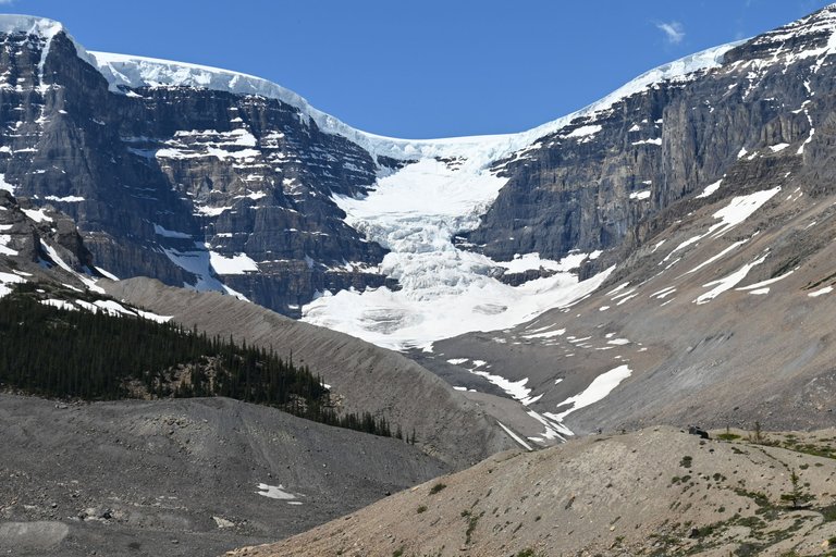
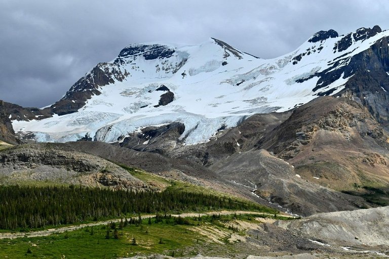
In the right hand side of the top picture is a partial view of the Athabasca Glacier, one of the most substantial accessible ice shelf. the view below is from the Wilcox pass, the first set of chairs. Without doing the entire trail, it is possible to just walk up the hill, get a good rest with the best view and come back down.
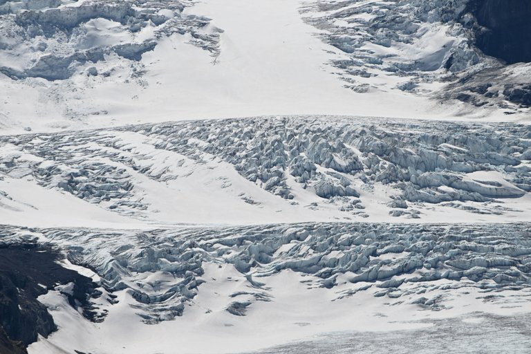
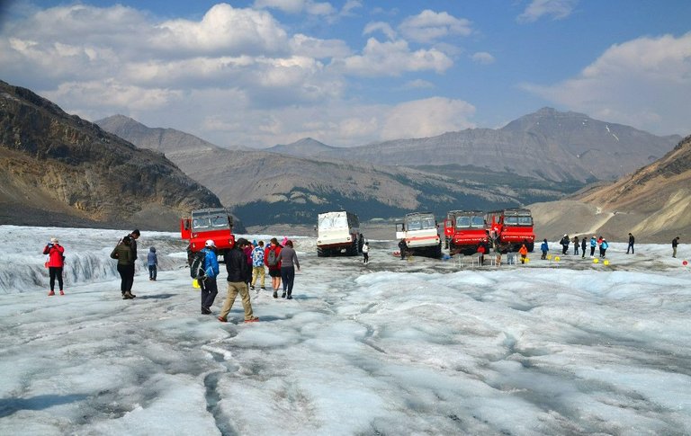
With my 300mm lens, I could really stalk that glacier! The thicker steps are not accessible for any tourism activities but the large bottom flat hill is the part of the glacier where there are tours available in the large snow crawlers for a closer look at a cost.
The tours can be booked online and at the main visitor center, I recommend advance booking. the price is reasonable for what it is but still cost a pretty penny. Brewster is one of the most established and reliable tour brand in the Jasper area, a trusted name that have been operating since the park's inception starting with establishing Maligne Lake as the original expensive fishing resort that led to the creation of the park itself. Brewster is the household name.
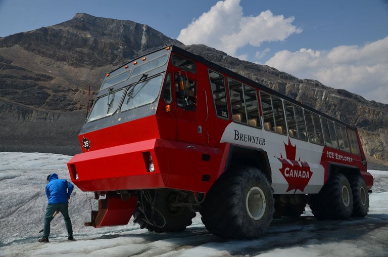
The tours allow us to get off and walk on the glacier shelf and even encourage drinking from the freshly melted supply being transported to the lake at the tow thru crevaces and other hidden features. Mother nature provided strait from the source. Yess, I totally tasted it and it was great, the greatest in fact.
The large glacier is left over from the last ice age and has been depleting since. Some naturally, some aggravated by our actions. The ice shelf everyone is walking on is the original point f8or the consumable water supply for most of the American North-West both in the US and Canada. It makes it's way across the Canadian Prairies via the North Saskatchewan River to feed as much as 3 Canadian Provinces. It ends in both the Atlantic and Pacific ocean along with The Artic Ocean. This phenomenon is called a Hydrological Apex or triple divide and there are few and rare on the planet.
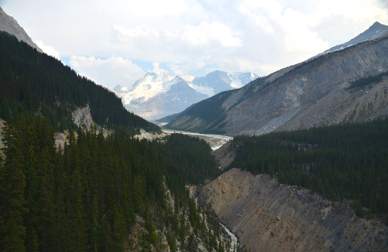
Along with the snow crawler tour and glacier education, the ticket includes a bus drive to the near-by Skywalk over the Sunwapta Valley. The area has a spectacular view that everyone covets but lacks safe parking for viewing. Brewster to the rescue with spending on infrastructure to make it possible. One on the shuttle, you can stay at the location until the last ride but a good half hour to an hour is sufficient for the attraction. It is also available at a lower price without the snowcoach tour also.
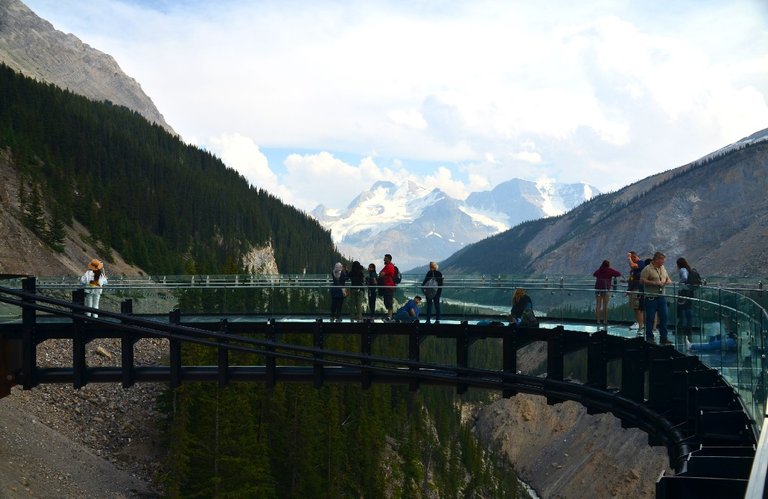
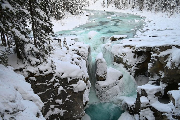
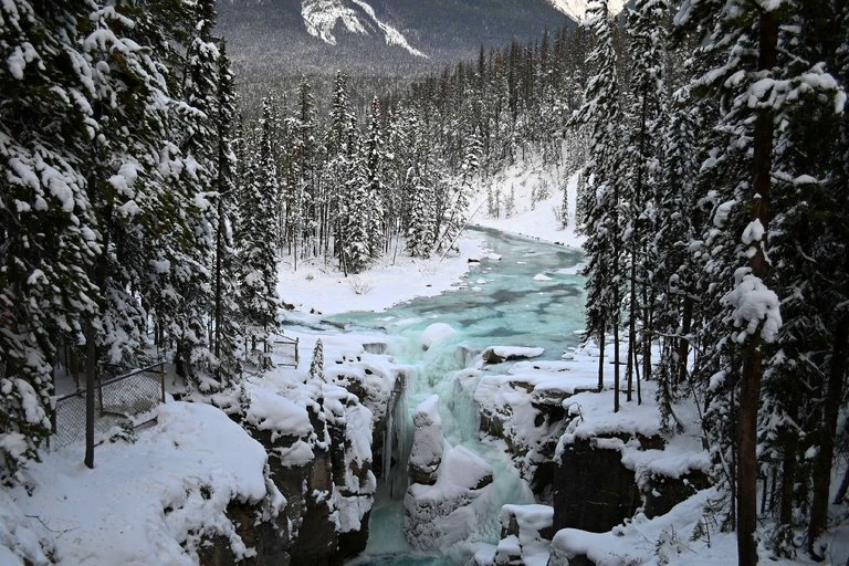
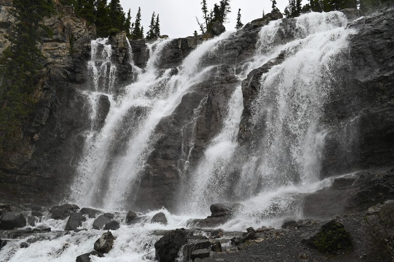
The Sunwapta Valley is the corridor that feeds the Sunwapta falls and later the world famous Athabasca Falls.
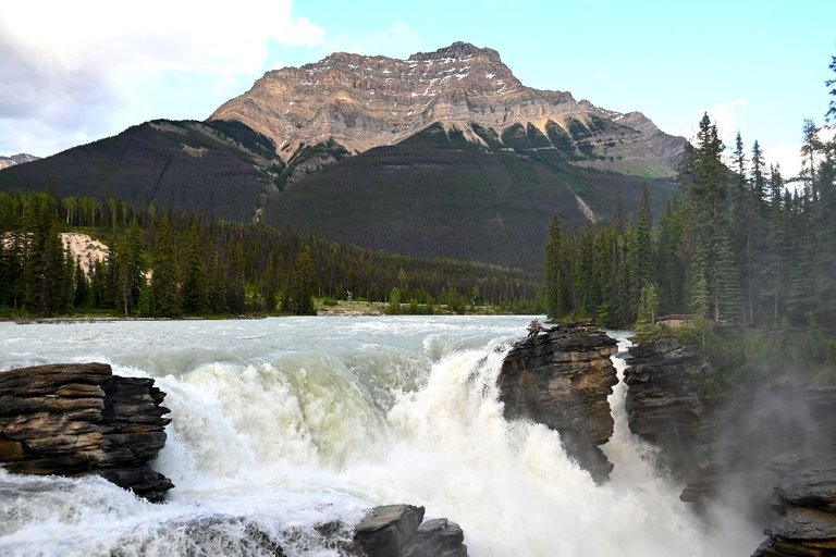
After sharing a few older pictures to explain the jist of the location and to give you a visual of the travel of our most important natural resources, time to get back to newer stock. The mountain in the background from Athabasca Falls is Mount Kerkerslin.
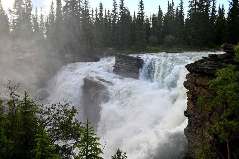
This aggressive section is part of the overflow fall as the main fall gets overwhelmed with the summer melt, the water carves itself a new path in the soft limestone. his section dries up completely over the winter months.
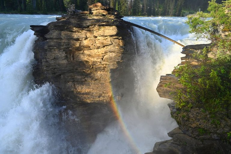
The Rock that was on the right hand side of the picture above this one is from the rock in the middle, the rest of the fall is hidden behind. During the summer months, the water splashes everywhere and in the later afternoon hours, strong rainbows are commonly seen on a clear day, this one is a timing thing but I have been lucky quite a few times with it.
Sunwapta falls, I was eating a freshly BBQ'ed hot dog or burger...or both probably. Don't worry I had watermelon too, throw something healthy in there! We had a light mist and mid dinner this showed up. I had to chose between my meat or the rainbow...MM...Tough choice. Well I still enjoyed the meat cold but clearly the rainbow over the waterfall took priority.
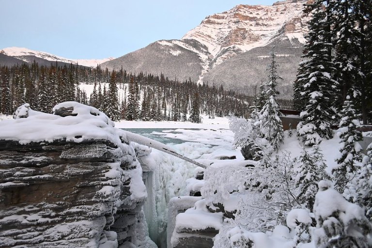
A gorgeous winter fall, the flow reduces but it remains active all winter and builds large ice formations along the rocks. The reduced flow of water exposes the shapes of the rocks normally hidden behind the fall.
Now that we have taken a safe virtual float down from the glacier all the way to, well maybe 2 hours down the road at the most, it still obviously took me a few years and many visits to get a small glimpse of the direct eco-system the glacier supports and give different features a proper tour and hike besides the usual quick stop, Don't worry I do my fair share of too. When I visit these places, I like to pay attention to the travel of water and our own supply. That's when you truly begin to appreciate it and it's true importance all the way to the household tap, this my internet invisible friends, is MY DRINKING WATER from it's original source...strait from the gem. Frozen water is actually listed as a stone. Do you know where your water comes from?
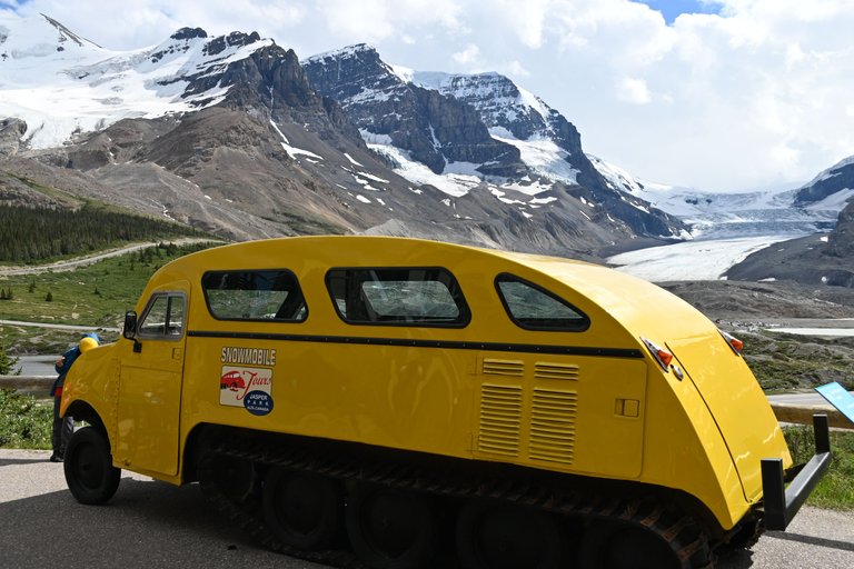
One of the early snow vehicles to explore the glacier is now on display at the visitor center.
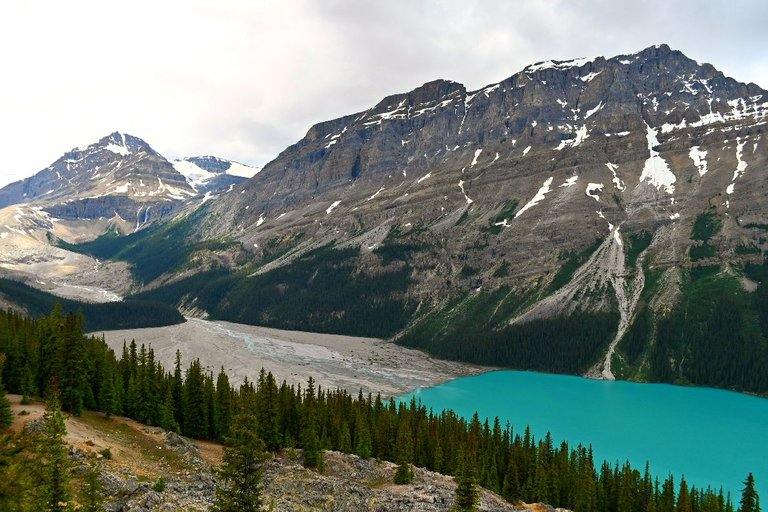
The grey dirt/sand that is left behind in moraines is often referred as rock flour, despite it's dull grey color, the fine particles gets carried over by rivers and the rock flour sediments set at the bottom of lakes giving them their bright blue-green all the way to emerald colored lakes often coveted in Canadian Rockies photographs.
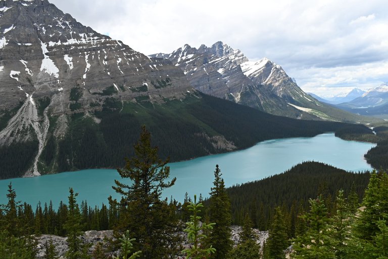
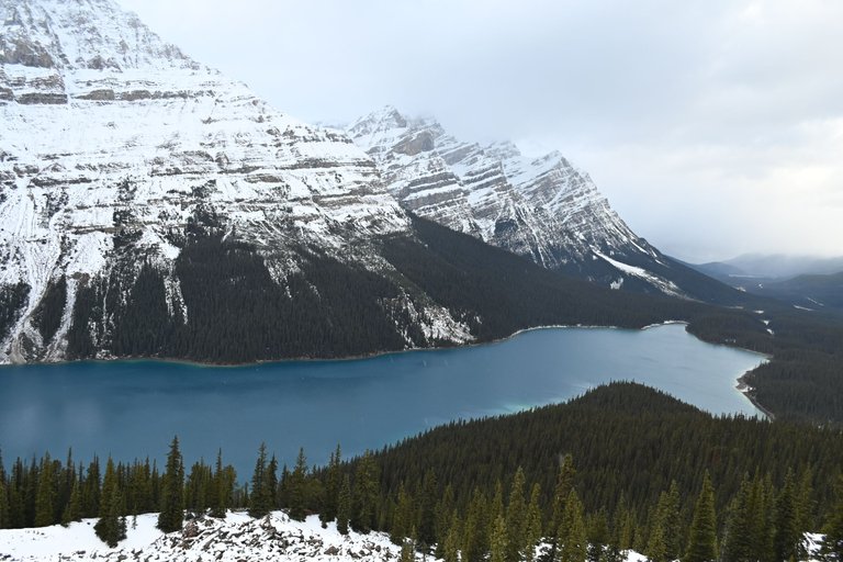
The near-by Peyto Lake, as an example of the "when wet" effect of the dull grey dust. The sediment absorb all the other colors of the light spectrum and only refracts back blue and green, the deep colored lakes are nothing but an optical illusion! The temperature can also change the color the same lake can appear, in the winter this same lake is deep blue. To give you an idea just how much it can play with the color perception. Incredible nature.
Peyto Lake is in the opposite direction going towards Banff, we would pass it on the way near Bow Lake to get to the glacier. Staying at the Crossing Resort is a great place to stay to get a better glimpse of the area and have a few days to explore, there isn't much around, have your own stuff for the most part. Hotel and supplies are expensive being a more remote part of the park despite high traffic. There are hostels and camping too for a cheaper alternative but I'm getting too old for that crap. I like my own space and indoor plumbing.
Besides the glacier tour, most of the pictures are from later 2021, the last section of photos and this new one we are getting into are from 2022 on a more drive-by type fashion but summer is a great time to take a few minutes to explore the ponds for flowers and I can't help myself. The center has new selfie installations to go with the incredible landscape. The clouds change the view every visit as well, any day it's not angry, you bet I will indulge! I want to get back to the glacier because it has other important lessons to teach, both ancient history and moving forward in the future.
We now enjoy a highway to get across the desolate area but it wasn't always the case. The glacier has been loosing it's mass at an alarming rate, as the decades go by, the problem gets worse. As little as a few hundred years ago, the area had been impassable where the road now is. It once was part of the Athabasca Glacier all the way to the visitor center, filled with crevasse and other hidden dangers making it too unsafe to cross at all.
Early European explorers from the Hudson Bay Company would need the help of local tribes to guide them across safely to get to their destinations and trading posts. The local Indigenous knew their way the best having used many of the region's ancestral corridors to get between mountains and tribes for centuries before, trading various goods themselves or following the animal migration patterns for hunting and trapping.
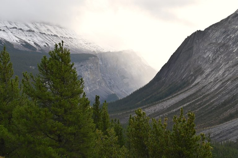
Pine trees make up most of the tree species in the area. It's hard to notice once in it but from the outside, it looks like a big rock bowl and on the inside is where most glaciers can be seen. This section here is close to the Wilcox Pass trailhead once again.
Why are we back to Wilcox pass? It once was the fastest and safest route available to get across the glacier just a few hundred years ago. The trek required going up all the way up the mountain until reaching the pass where one can chose to continue few kilometers to the ridge but the people past continued across onto the next mountain for a few more kilometers 5or 6? Until reaching Tangle Creek Falls to then come back down into the Sunwapta Valley. It is still possible to follow in the footsteps of the ancient along with the early European explorers leisurely. If you have 2 vehicles and park on at both ends, it's a day hike and probably a little less than 15km.
The exit feature that was once used to bypass the glacier. It's easy to miss but also easy to see from the highway just after leaving the glacier on the way to the Sunwapta Falls. There is a large area for parking across the street for finishing the trail or just for a quick visit. One of my favorite spots to stop and have a BBQ. Having your own food and cooking is an asset if you don't want to be bound to specific return to town times especially when hiking, you can make a meal right after the trail. I don't know about the rest of you hikers but I'm starved and think I can eat a full buffalo after a 15 km hike.
We only made it to as far to the ridge as we could before the snow got too deep and returned back the same way we came, either way it's about the same distance and commitment. Not an easy hike but it is one for the future to finish the second half of the Wilcox Pass.
Over the last 100 years or so, there has been much more attention given to monitoring the melting rate of the glacier as it speeds up. Going up on these ridges truly reveals how bad it is especially since I have been taking photos of this frozen beast for the last 15 years. It's like it's disappearing right before my eyes slowly as each season passes. It would take a long time before it all melts and leaves us without drinking water. You and I will be long gone but future generations will still be reliant.
What we do today to aggravate it's melting rate affects the longevity of the water supply or a large number of people, I'm not sure how many people think about that when they visit. Set proper acknowledgement to the significance of this feature in the long term and optimal steps for it's preservation as Alberta's most important legacy. Tourism money helps bring money needed to fund research. Little is clear, it's such a large life cycle in the making since the last ice age, our human brains can never truly comprehend it fully or it's behavior.
One thing is for sure, despite having fun touring the actual glacier, something I might only do once for the experience and ethics of it. The heat from the exhaust of the large busses that run hourly on most "in season" or peak season regular operating days is probably taking a huge toll in melting it faster than it should. The hundreds upon hundreds of warm feet that walk on it. We lose a tremendous amount of body heat thru our feet. I felt guilty a little walking on it. I still enjoyed every minute of it but it still bothered me a bit thinking in a large scale with how many tourist for decades. How badly did the tourism aggravate it's melting rate? Do they take that into consideration? The impact of tourism?
A frozen Athabasca Falls
A better and less destructive way to enjoy for those like me who do think about this sort of thing and perhaps you are not into a long ridge hike. I did mention there is a moraine to cross that gets one near the toe (bottom) of the glacier where it can be admired from solid dirt. There is a safe perimeter set up to avoid dangerous areas but it's self guided and free. The walk up is a bit steep but manageable, it only stings for a little bit then the ground plateaus again. It's safe to say that one hour or 2 is sufficient time to get a chance to read the different markers that have been placed over the decades to mark the glaciers recessions with the year the toe was re-identified.
The features explored in this post marks about 3 hours of road travel on the Parkway and it's impressive to just try to comprehend how much water melts from the Columbia Icefields, let alone once you think just how far it goes and how much life it supports during it's journey even after it's been to the ocean, continuing to support those aquatic systems. Freshwater is a resource we often take for granted especially in western societies as it comes out of the tap so easily, keeping our waterways as clean as possible for the future and maintaining the health of our glaciers is crucial. There may be lots of it now but there will come a time when it might not be there. I can't even imagine life in Western North-America without it.
I hope you enjoyed my lightly educated walk exploring the various Columbia Icefield and related landmarks.
Congratulations, your post has been added to Pinmapple! 🎉🥳🍍
Did you know you have your own profile map?
And every post has their own map too!
Want to have your post on the map too?
nice and perfect trail
Hiya, @lizanomadsoul here, just swinging by to let you know that this post made it into our Top 3 in Travel Digest #2165.
Your post has been manually curated by the @pinmapple team. If you like what we're doing, please drop by to check out all the rest of today's great posts and consider supporting other authors like yourself and us so we can keep the project going!
Become part of our travel community:
Thank you!
Absolutely epic shots. The iconic beauty of the Canadian Rockies at its finest (and wildest). The special place where you can drink right from the glacier and see hundreds of rainbows. Thank for sharing all of this with us, I appreciate the educative part too, never realized that people contribute to the melting in so many ways (including the very simple act of walking on the glaciers). Excellent post ;)
@tipu curate 2
Upvoted 👌 (Mana: 0/56) Liquid rewards.
Thanks! My mind is weird, I think of all these little details, the cumulative effects of small impacts. Yeah the excessive rainbow experience was pretty cool. I have sooo many pictures of them from that day all along the drive. That's where this picture comes from, weirdest rainbow I have ever seen.
Breathtaking! Aptly coming from Lady Rainbow hehe :)
Congratulations @ladyrainbow! Your post has been a top performer on the Hive blockchain and you have been rewarded with this rare badge
You can view your badges on your board and compare yourself to others in the Ranking
If you no longer want to receive notifications, reply to this comment with the word
STOPCheck out our last posts: