THE LANDSCAPE FROM "LA MORITA" IN MONTALBÁN, CARABOBO, VENEZUELA
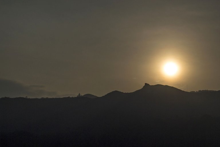
I finished with my obligations for the day around 3:00 PM so I had the idea to take my camera and walk in the direction of the hills called here “LA MORITA” with the intention of watching the sunset from there (📷 01) and explore the place in the afternoon hours, when it is more solitary and quiet... So, about 40 minutes after leaving my house, I found myself going up the steep road (📷 02) that leads to those hills...
Terminé con mis obligaciones del día cerca de las 3:00 PM así que tuve la idea de tomar mi cámara y caminar en dirección a las colinas llamadas aquí "LA MORITA" con la intención de observar atardecer desde allí (📷 01) y explorar el lugar en horas de la tarde, cuando más solitario y tranquilo se encuentra... Así que unos de 40 minutos después de salir de mi casa, me encontraba yendo por el empinado camino (📷 02) que lleva hacia esas colinas...
📷 01
📷 02
📷 03
📷 04
📷 05
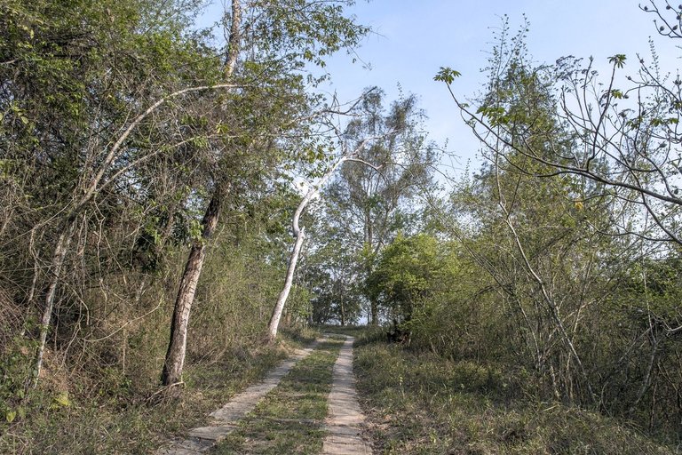
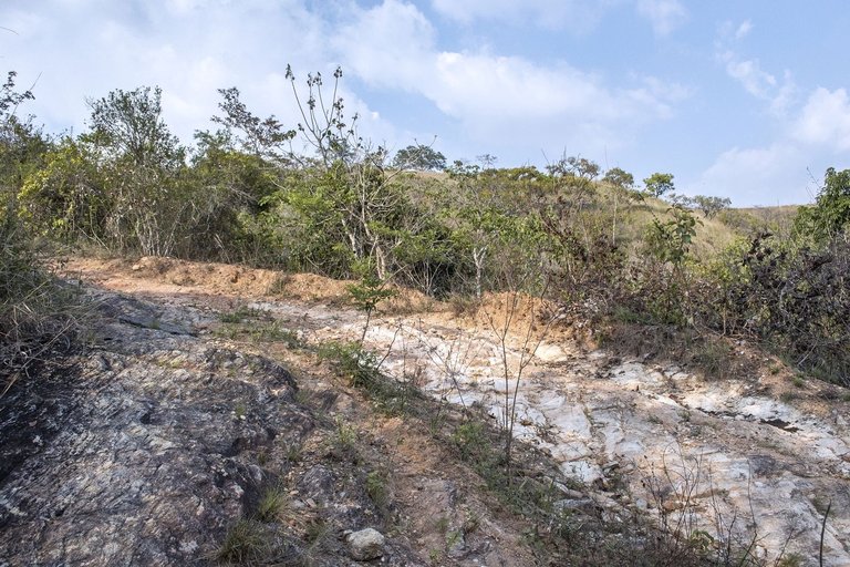
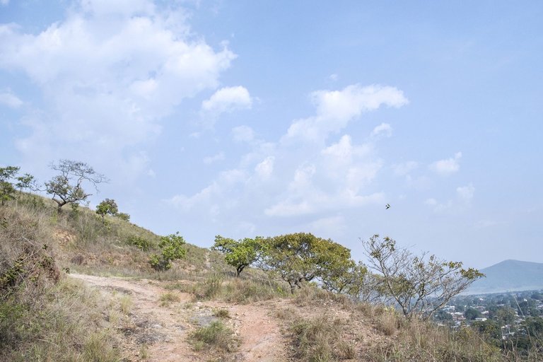
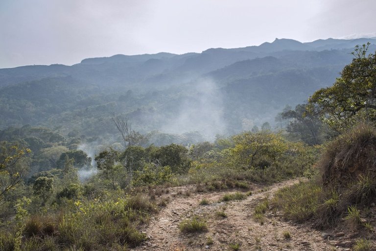
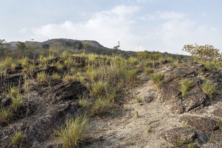
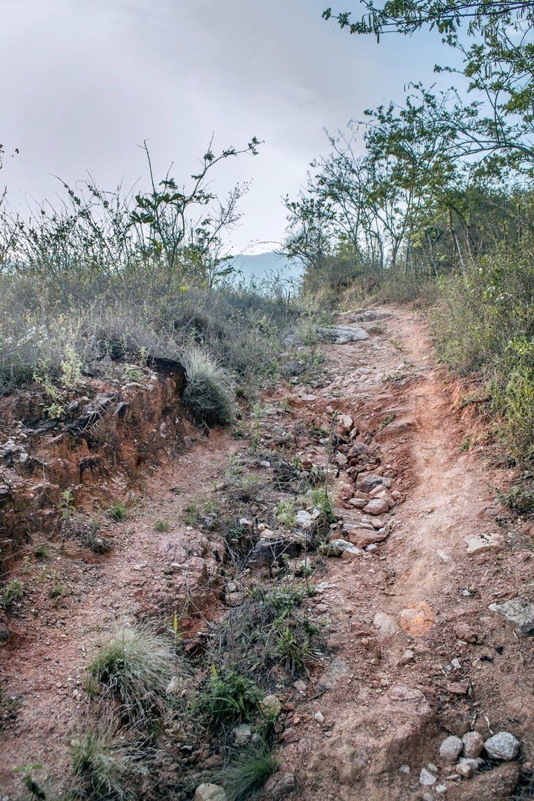
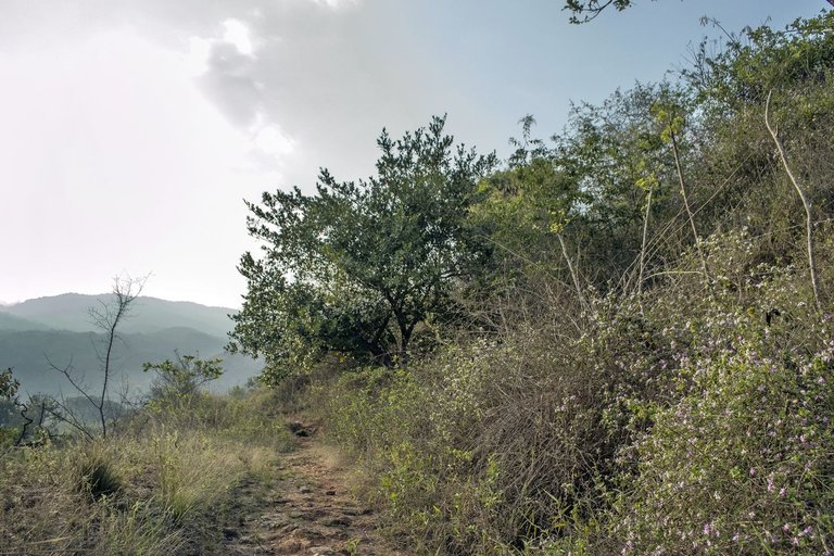
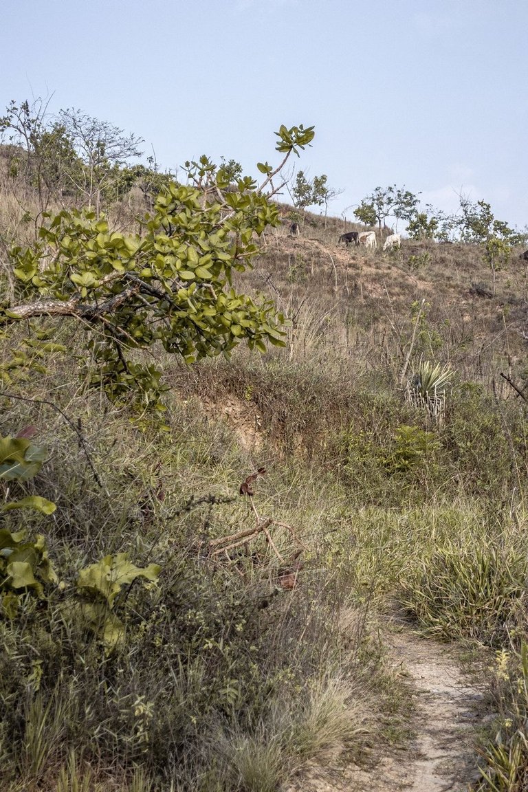
Abruptly the forest and cement roads disappear and the trail becomes dirt and rocks, much steeper and today almost impassable for four-wheelers (📷 03). A few meters ahead I begin to see the landscape with the hills and even some partial views of the town in the background (📷 04). As I turn my view to the west I observe some smoke in the middle of the forest and I remember that the previous day a small forest fire occurred which was put out by groups of town volunteers (📷 05), so I guess that smoke has to do with that...
Abruptamente el bosque y las caminerías de cemento desaparecen y el sendero se hace de tierra y rocas, mucho más empinado y hoy por hoy casi intransitable para vehículos de cuatro ruedas (📷 03). Pocos metros más adelante comienzo a avistar el paisaje con las colinas e incluso algunas vista2 parciales del pueblo al fondo (📷 04). Al voltear la vista al oeste observo algo de humo en medio del bosque y recuerdo que el día previo ocurrió un pequeño incendio forestal el cual fue sofocado por grupos de voluntarios del pueblo (📷 05), así que supongo que ese humo tiene que ver con ello...
📷 06
📷 07
📷 08
📷 09
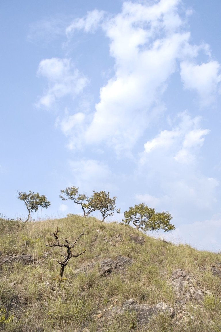
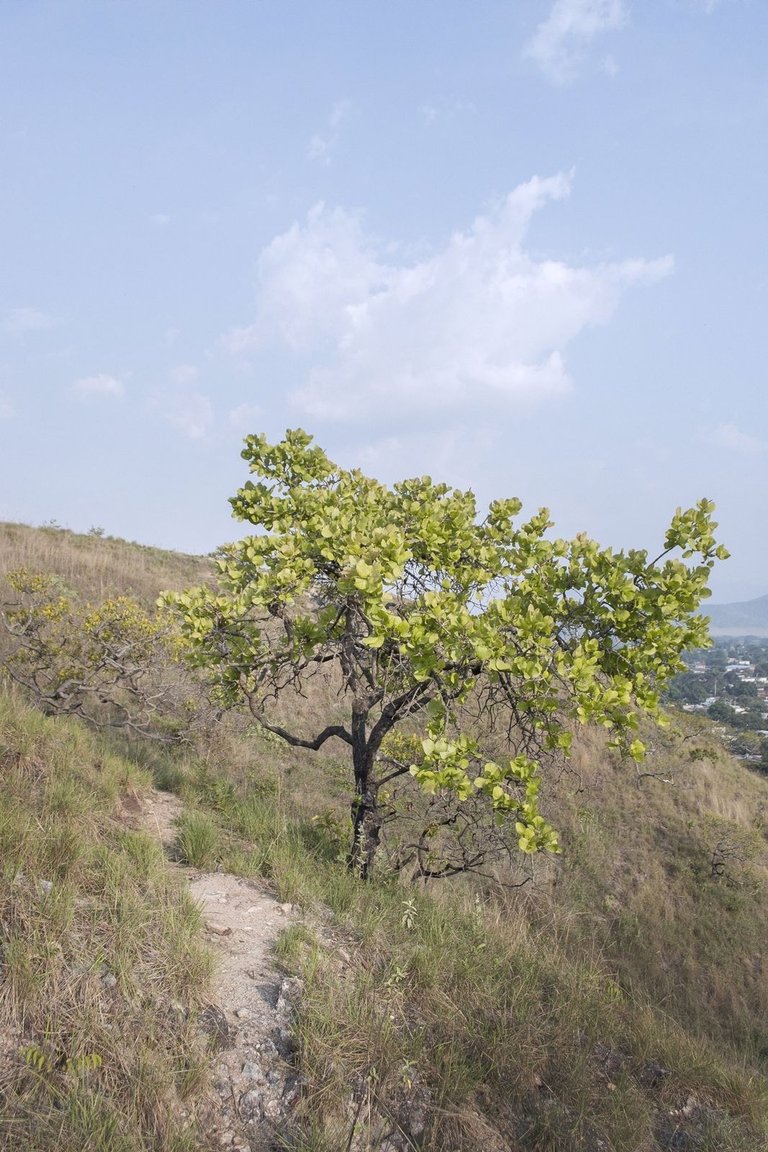
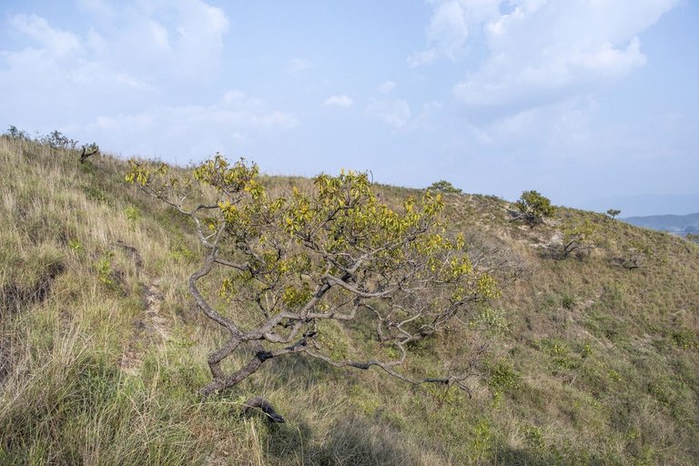
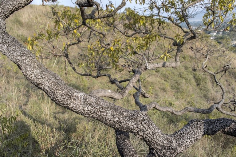
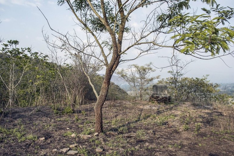
I leave the main road and take some trails climbing up the hills with low, yellowish grasses. I like to look at this landscape where the blue of the sky, the clouds, the relief of the hills and those fantastic, twisted, small trees called by the people here “Chaparros” (📷 06, 07 and 08) which are celebrated for their resistance to the annual fires, which can be proved by looking at their blackened branches (📷 09)...
Salgo del camino principal y tomo algunos senderos que suben por las colinas de pastos bajos y amarillentos. Me gusta mirar este paisaje en donde se combina el azul del cielo, las nubes, el relieve de las colinas y esos fantásticos, retorcidos y pequeños árboles llamados por la gente aquí "Chaparros" (📷 06, 07 y 08) los cuales son celebres por su resistencia a los incendios anuales, lo cual se puede comprobar al mirar sus ramas ennegrecidas (📷 09)...
📷 10
📷 11
📷 12
📷 13
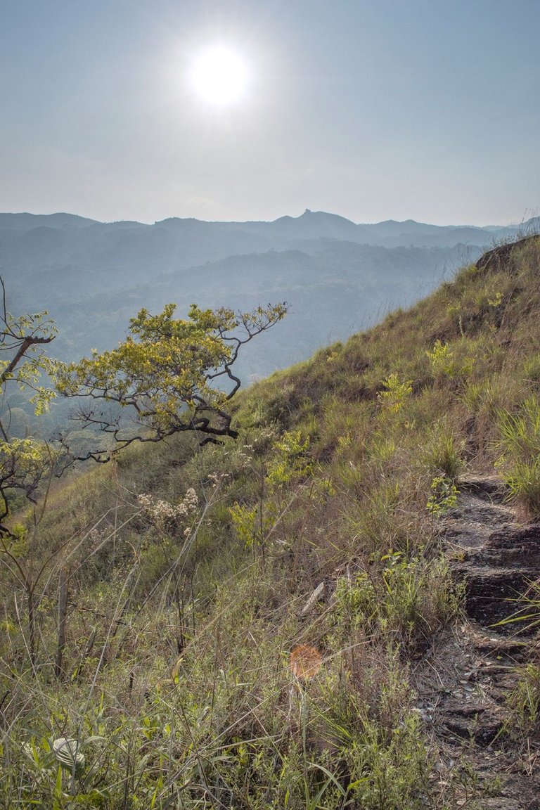
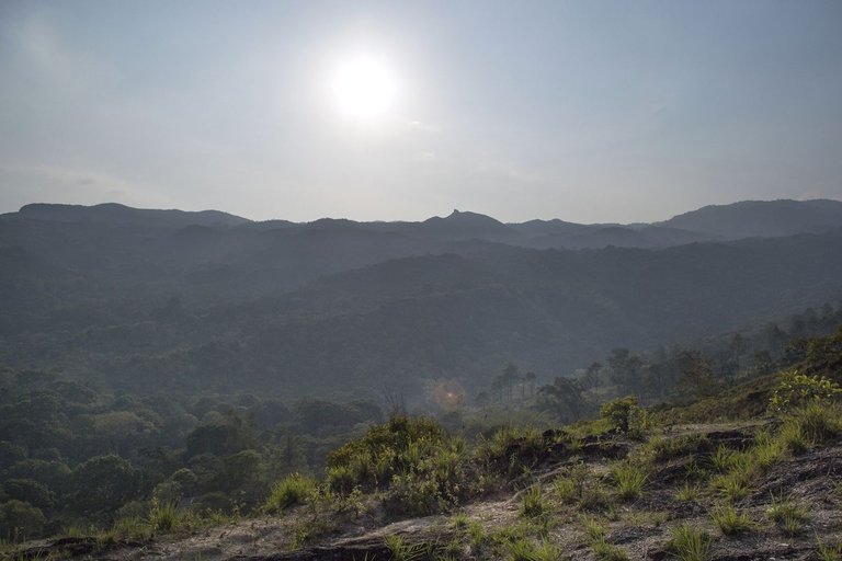
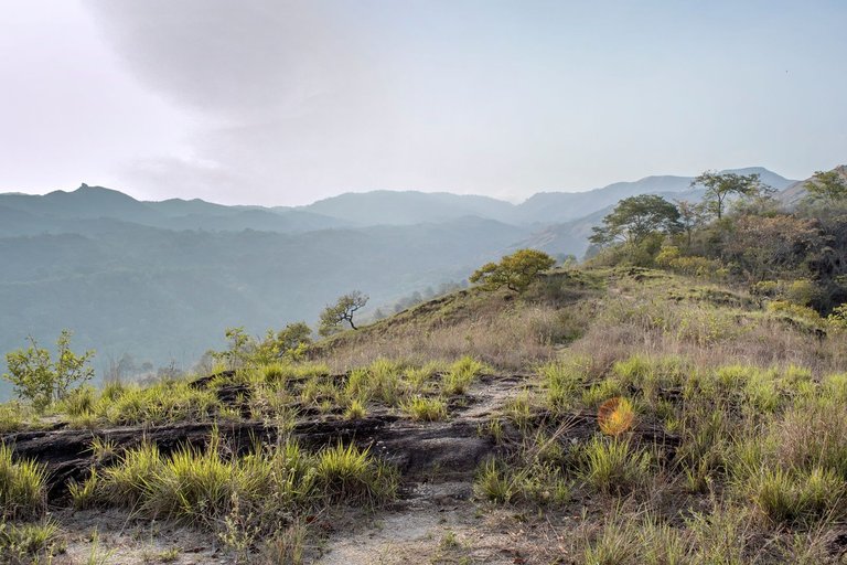
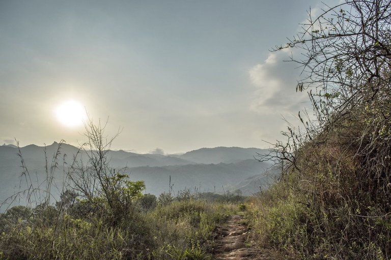
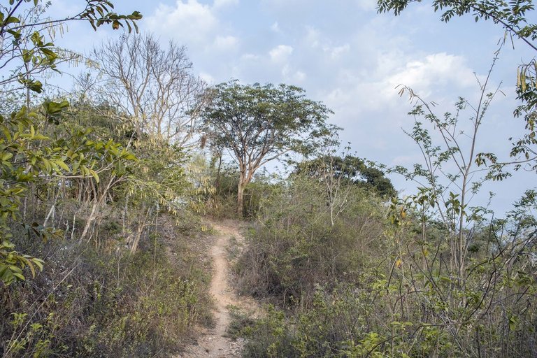
I turn my view to the west and observe the mountain range called “La Copa” (📷 10 and 11) and notice that the atmosphere with a soft haze presages a very good sunset to photograph, so I decide to take the most steepest trail to ascend the most meters in the least amount of time possible (📷 12 and 13).
Giro mi vista al oeste y observo la cordillera de montañas llamada "La Copa" (📷 10 y 11) y constato que la atmósfera con una bruma suave presagia una puesta de sol muy buena para fotografiar, así que decido tomar el más empinado de los senderos para ascender la mayor cantidad de metros en la menor cantidad de tiempo posible (📷 12 y 13).
📷 14
📷 15
📷 16
📷 17
📷 18
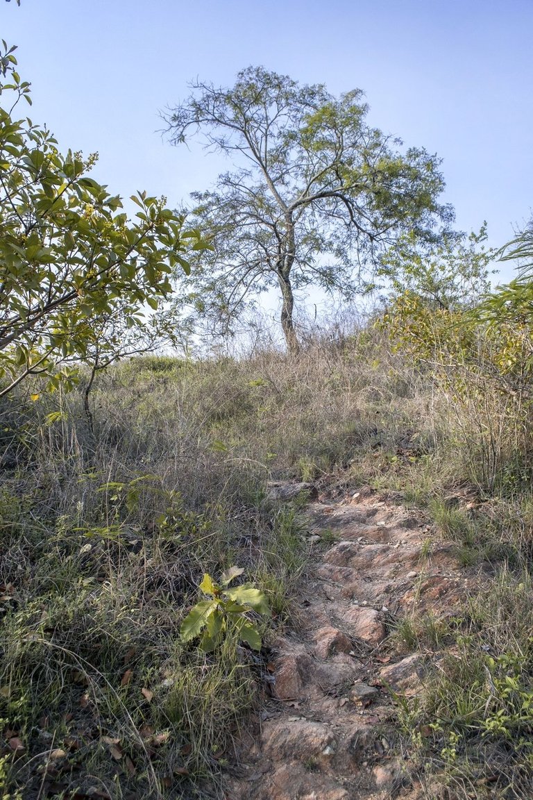
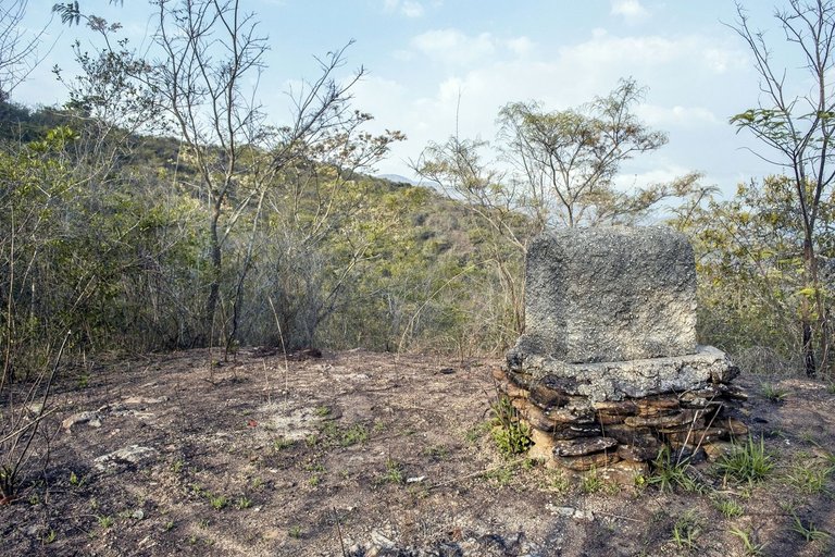
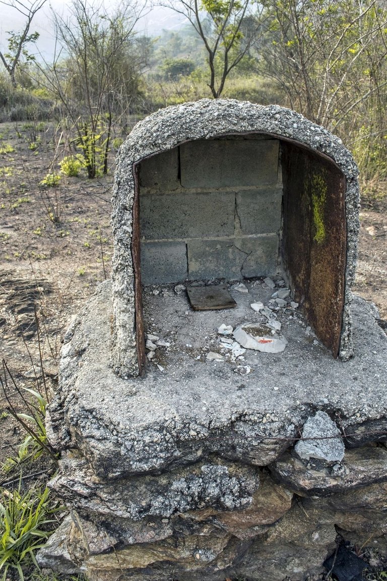
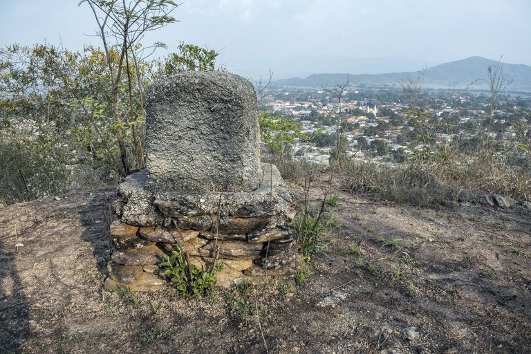
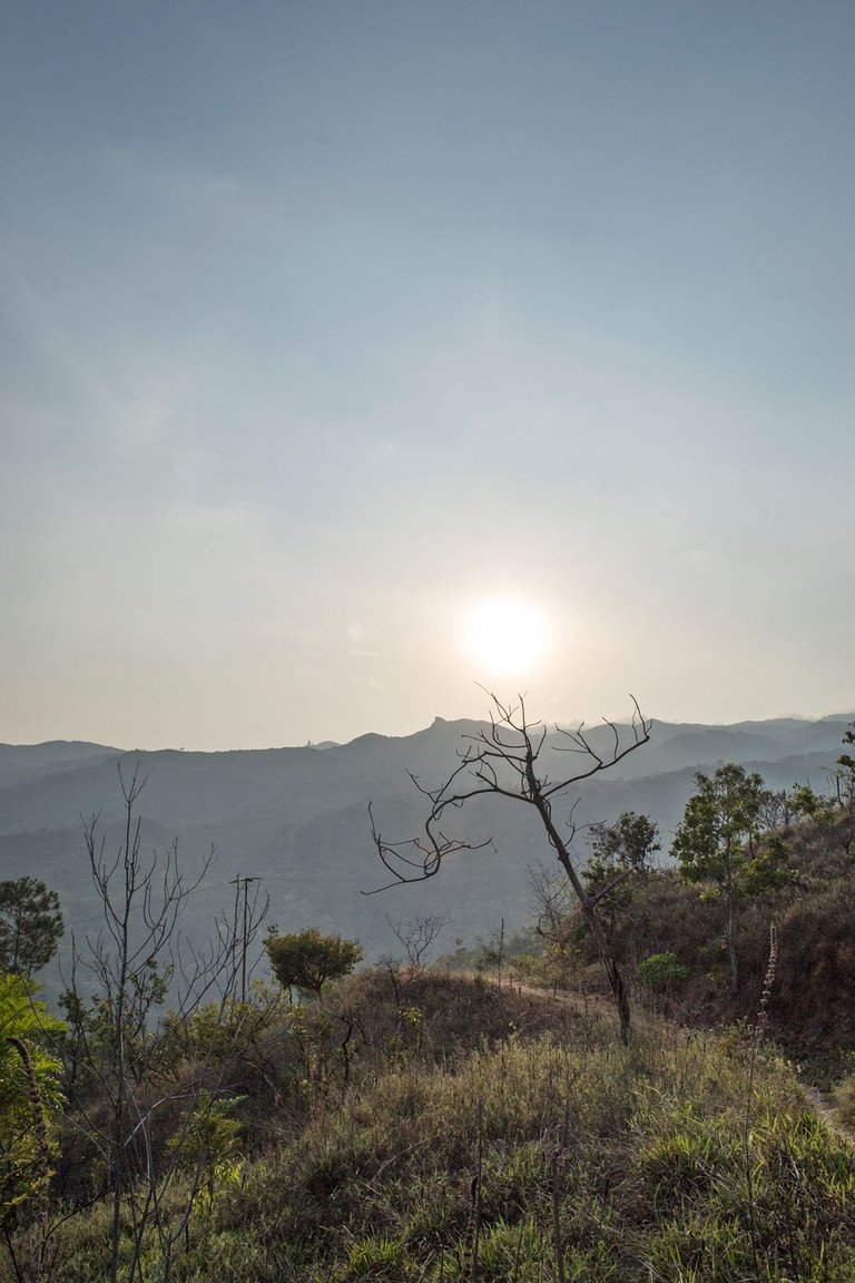
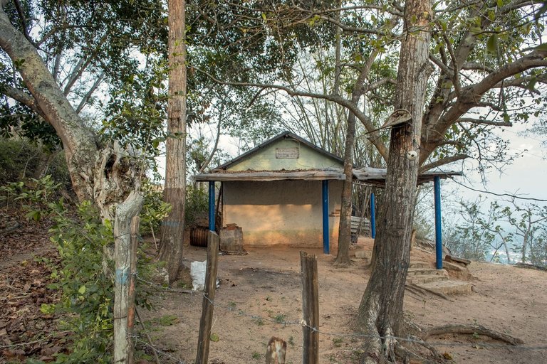
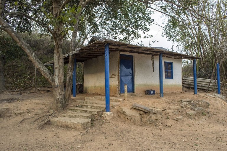
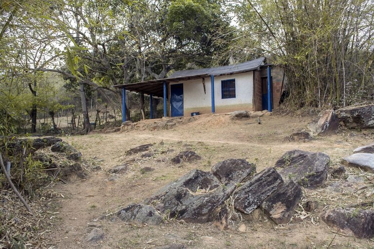
After a ridiculously steep stretch of road (📷 14) I arrived to a place called by the people here “The Dead Man's Hill” where there is a flat area with a small chapel built with cement and stones (📷 15 and 16) which was put there by the relatives of a man who was kidnapped in the late 70's of the last century and who was killed by his captors in this place where his body was found 😕... Before, the chapel always had some flowers or small statuettes, but nowadays it is empty (📷 17) and its niche seems to look directly to the valley where the village is (📷 18)...
Después de un ridículamente empinado tramo de camino (📷 14) llegué a un lugar llamado por las personas aquí "La colina del muerto" en donde hay un área plana con una pequeña capilla construida de cemento y piedras (📷 15 y 16) la cual fue puesta allí por los familiares de un hombre que fue secuestrado a finales de los años 70 del siglo pasado y quien fue asesinado por sus captores en este lugar en donde se encontró su cuerpo 😕... Antes la capilla siempre tenía algunas flores o pequeñas estatuillas, pero hoy por hoy está vacía (📷 17) y su nicho parece mirar directamente al valle donde está el pueblo (📷 18)...
📷 19
📷 20
📷 21
📷 22
I left behind “ The Dead Man's Hill” and went back to the old main road (📷 19, 20) until I got a place with a good view to take pictures of the sunset with the sun approaching the horizon formed by the mountains (📷 21, 22)...
Dejé atrás "La Colina del Muerto" y retomé el viejo camino principal (📷 19, 20) hasta conseguir un lugar con una buena vista para más hacer fotos del atardecer con el sol acercándose al horizonte conformado por las serranías (📷 21, 22)...
📷 23
📷 24
📷 25
📷 26
📷 27
📷 28
📷 29
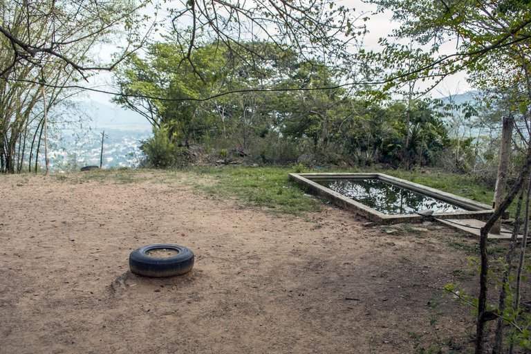
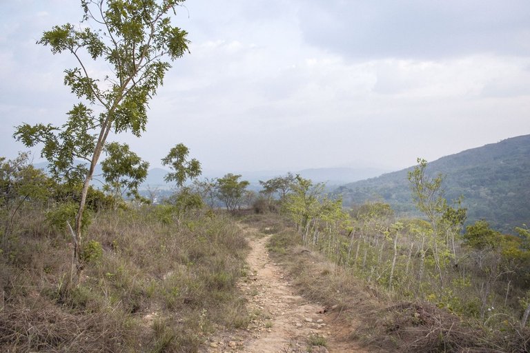
After taking a handful of photos, I started my return to town using an alternate trail (📷 23, 24 and 25) and decided to enter a place called “El Rincón de Don Simón y Simón” ("Mr. Simón & Simón corner") (📷 26, 27 and 28) so called in allusion to my friend Simón and his son who has the same name. This place years ago worked as a kind of “Mountain Bar” but apparently it ended up being an unviable project, so my friends “Mr Simón & Simón” ended up closing the place and dedicated themselves to raise cows. One of them told me about it: “It's much easier to get a cow up here than beer cans, the cows walk by themselves!” 😂 and they also told me: “Besides, that pool (📷 29) has become an excellent watering place for cows and now no drunk guy tries to drown there! 😂... This day the place was alone, but I had no inconvenience to enter and take these pictures, the entrance is just a piece of wire fence which can be opened with the hand...
Después de hacer un puñado de fotos, comencé mi retorno al pueblo usando un sendero alterno (📷 23, 24 y 25) y decidí entras a un lugar llamado "El Rincón de Don Simón y Simón" (📷 26, 27 y 28), llamado así en alusión a mi amigo Simón y a su hijo quien se llama igual. Este lugar años atrás funcionó como una especie de "Bar de Montaña" pero al parecer terminó por ser un proyecto inviable, así que mis amigos "Don Simón y Simón" terminaron por cerrar el lugar y se dedicaron a criar vacas. Uno de ellos me ha dicho el respecto: "¡Es mucho más fácil subir una vaca hasta aquí que bidones de cerveza, las vacas caminan por si mismas!" 😂 y también me dijeron: "Además, esa piscina (📷 29) se ha convertido en un excelente abrevadero para vacas y ahora ningún tipo borracho intenta ahogarse allí! 😂
📷 30
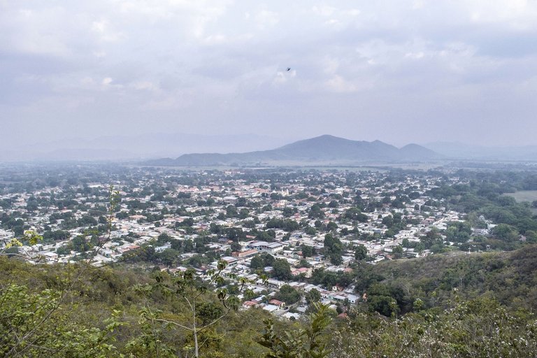
I took a panoramic photo of the town valley seen from the viewpoint of my friend Simón's property (📷 30) and I set out to walk the last stretch of road back to town trying to take advantage of the remaining daylight (📷 32)... But not before taking this wonderful photo with the mountains and the sun's glare already set and also the silhouette of a tree with a huge nest of weaver birds! (📷 31)... I loved this photo!... 😍📷
Hice una foto panorámica del valle del pueblo visto desde el mirador de la propiedad de mi amigo Simón (📷 30) y me dispuse a recorrer el ultimo tramo de camino de regreso al pueblo procurando aprovechar la restante luz del día (📷 32)... ¡Pero no sin antes hacer esta maravillosa foto con las montañas y el resplandor del sol ya puesto y además la silueta de un árbol con un enorme nido de aves tejedoras! (📷 31)... ¡Amé esta foto!... 😍📷

📷 31
📷 32
Thank you very much for your visit and appreciation on my work!
Muchas gracias por pasar y apreciar my trabajo!
ADDITIONAL TECHNICAL NOTE: Photographs captured with my Nikon D7000 DSLR camera in RAW format, then processed in Adobe Camera RAW for adjustments regarding light, sharpening, contrast and depth... They were then exported to JGP format on which minor modifications such as straightening and adding watermarks were carried out using PhotoScape 3.6.3.
NOTA TÉCNICA ADICIONAL: Fotografias capturadas con mi cámara DSLR Nikon D7000 en formato RAW, procesadas posteriormente en Adobe Camera RAW para ajustes relativos a luz, afilado, contraste y profundidad... Luego fueron exportadas a formato JGP sobre el cual se llevaron a cabo modificaciones menores como enderezado y agregado de marcas de agua usando PhotoScape 3.6.3.
"We make photographs to understand what our lives mean to ourselves." - Ralph Hattersley.
"Hacemos fotografías para comprender lo que nuestras vidas significan para nosotros mismos." - Ralph Hattersley.

Lens: Sigma 18-200mm f3.5-6.3 II DC OS HSM
Lente: Sigma 18-200mm f3.5-6.3 II DC OS HSM
You can check out this post and your own profile on the map. Be part of the Worldmappin Community and join our Discord Channel to get in touch with other travelers, ask questions or just be updated on our latest features.
Your photos guided me during this exploration on the land of La Morita
Thank you
Can you see the entire surrounding plains and see the sunrise from this place?
Yes, the entire valley stretching from north to south, and the sunrise to the east indeed...
Amo estos lugares naturales que lindas fotos amigo me encantaria ir alguna vez
Gracias por pasar y apreciar mi trabajo, honrado de que te guste @rut.hernandez06!
That makes a lot of sense, although the view is so nice for a bar, but logistics can really be a big problem. Yep the cow will walk by itself, easier to manage, and the most important thing is there won't be a drunken complaint from them.
!LOLZ !PIZZA
lolztoken.com
The Boo Boo Dolls.
Credit: reddit
@jlinaresp, I sent you an $LOLZ on behalf of ekavieka
(2/8)
NEW: Join LOLZ's Daily Earn and Burn Contest and win $LOLZ
🤣... That's right @ekavieka friend!!!... Thanks for appreciating and supporting!
!PIZZA
$PIZZA slices delivered:
jlinaresp tipped ekavieka
@jlinaresp(7/15) tipped @gretelarmfeg
ekavieka tipped jlinaresp
Come get MOONed!
Congratulations @jlinaresp! You have completed the following achievement on the Hive blockchain And have been rewarded with New badge(s)
You can view your badges on your board and compare yourself to others in the Ranking
If you no longer want to receive notifications, reply to this comment with the word
STOPNice shots of the sunset. The blend of sky, clouds, and rolling hills must create a peaceful rhythm that soothes the mind and stirs the soul. Such a breathtaking spot.
I'm glad you liked it!... Thanks for appreciating and supporting my work @gretelarmfeg friend!
!PIZZA
Al ver esa nube que se te viene a la mente?
Al verlo, Yo pienso en un conejo
The place of Venezuela contains lots of beautiful and overlooking places. The place you visited is truly perfect for those who loves to do mountain climbing adventures Sir @jlinaresp .
Thanks for visiting ans comment @thelivingworld!... And Thanks for appreciating and supporting my work!
Every time I see these trails it reminds me of the only time I went to the Rock, on a day when it was hotter than it had been in a long time and climbing was a challenge.
¡Hola José! ¿Son las colinas de La Morita y El calvario la misma? vemos que parte del recorrido es igual que cuando nos hablaste antes de esta zona.
Hola @worldmappin team!... El ascenso inicial se hace por el mismo camino (un área repleta de colinas llamada por todos aquí "La Morita", un nombre heredado de una antigua hacienda por cierto), pero a "El Calvario" se llega siguiendo hacia el Este en un punto cercano a la foto 📷10. En esta oportunidad continué por el sendero de montaña que va hacia el Oeste y sube hasta el lugar de las últimas fotos llamado "El Rincón de Don Simón y Simón" dónde terminé este recorrido... De hecho, a través del mismo camino que atraviesa las colinas de "La Morita" también se llega a otros espacios de interés, uno llamado "Los Cachicamos" y otro llamado "Las mesas", tengo planeado explorar estos lugares apenas me sea posible... Aquí ha comenzado la temporada de lluvias, quizás lo voy a tener más complicado ahora, pero haré el esfuerzo, son paisajes encantadores y vale la pena visitarlos y hacer fotos en ellos... Saludos 🤓📷🙏
Muchas gracias por el detalle de tu explicación, revisábamos el mapa y queríamos estar seguros de las rutas.
Poco a poco, no vayas a enfermarte por mantener el espíritu aventurero jajaja aunque nos alegra mucho que te entusiasme seguir compartiéndonos tus aventuras. 😉
@jlinaresp, I paid out 0.452 HIVE and 0.110 HBD to reward 7 comments in this discussion thread.