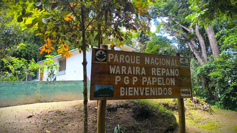
P.G.P. Papelón
A special hello to all Hive travelers and a happy start to the week! As many of you know, I really enjoy my visits to El Ávila, and whether it's hiking or climbing to discover new places, each place is a new destination for me. These photographs are from my visit to the Papelón Ranger Point camping area, which is just above the Cruz del Ávila.
¡Un saludo especial a todos los viajeros de Hive y feliz inicio de semana!. Como muchos sabrán disfruto mucho de mis visitas a El Ávila, y ya sea con motivo de hacer senderismo o de subir a conocer lugares nuevos, cada lugar es una nueva meta para mí. Estas fotografías son de mi visita hasta la zona de acampado del Punto de Guarda Parques Papelón, que queda un poco más arriba de la Cruz del Ávila.
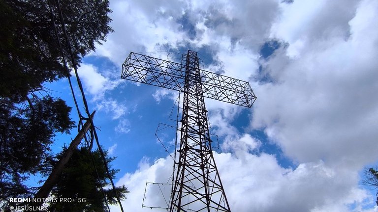
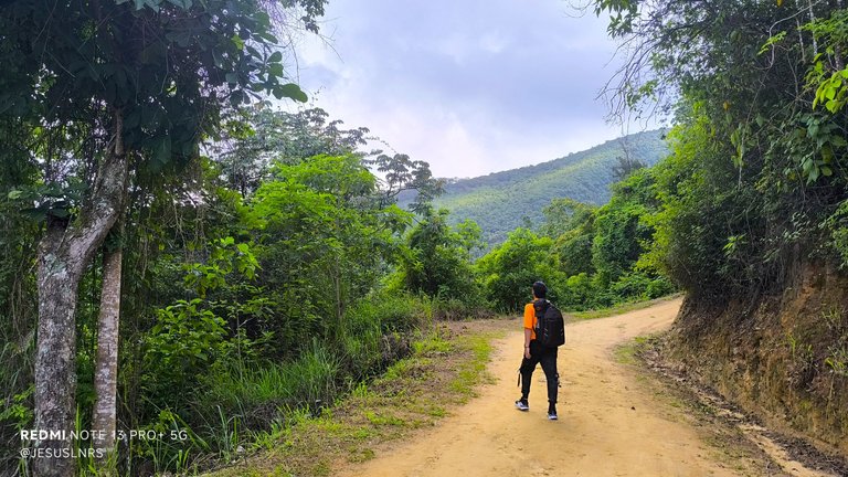
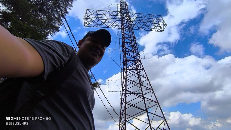
The altitude of this point in Ávila is approximately 1,600 meters above sea level, but since I get here on foot, it's actually a 3,500-meter hike. Those who read this will know that earlier this year, when I began climbing and exploring places in the mountains, I used the Corta Fuegos del Sendero de San Bernardino as my goal, both for training and to discover places to photograph. Now that I have more stamina, I always prefer to reach the cross. However, it's good to climb a little higher, as there's a significant reward in this P.G.P. Papelón.
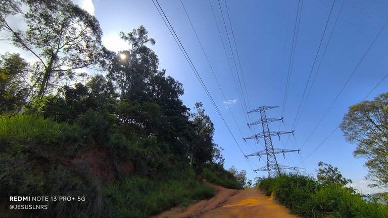
La altura de este punto en el Ávila es de unos 1600 metros sobre el nivel del mar aproximadamente, pero como llego hasta aquí a pie en realidad es una caminata de 3.500 metros. Para quienes me leen sabrán que a principios de este año cuando comencé a subir y descubrir lugares en la montaña usaba como meta el Corta Fuegos del Sendero de San Bernardino, como entrenamiento y para descubrir lugares que fotografiar, y ahora que tengo más resistencia siempre prefiero llegar hasta la cruz, sin embargo es bueno subir un poco más, ya que hay una importante recompensa en este P.G.P. Papelón.
Although I'm aware that it's not halfway between Caracas and the summit, many of us consider this point as such. The most important thing is that there's water to drink here, so it's worth the effort to get there to hydrate and fill our containers. There are no nearby streams on this particular route, so this point is important, in addition to the fact that there's always security at the small park ranger's house.
Aunque estoy consciente de que no es la mitad del camino entre la ciudad de Caracas y la cima, muchos consideramos este punto como tal. Lo más importante es que aquí hay agua para beber, así que vale la pena el esfuerzo de llegar para hidratarnos y llenar nuestros envases. En esta ruta en particular no hay alguna quebrada cerca, así que es importante este punto, además de que siempre hay seguridad en la pequeña casa de los guarda parques.
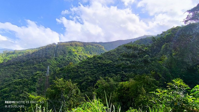
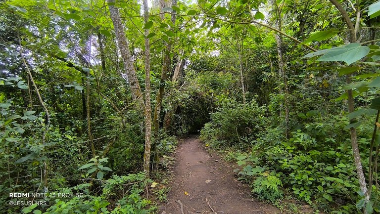
With my friend Douglas, I've reached the summit of this area of Ávila, but only once last year. Since then, I've tried to train to do it alone sometimes, so daring to reach this area halfway alone is important to me. From here, the path begins to get a little rougher, as we reach La Pared, one of the steepest concrete points I've seen on this mountain. Then it narrows, and you can only walk on dirt and rocks, on a heavily wooded route, perfect for feeling totally connected to nature.
Con mi amigo Douglas he llegado hasta la cima de esta zona del Ávila, pero fue una sola vez el año pasado. Desde entonces he tratado de entrenar para hacerlo yo solo alguna vez, así que atreverme a llegar hasta esta zona a mitad de camino en soledad es importante para mí. A partir de aquí el camino comienza a ponerse un poco más rudo, ya que encontramos La Pared, uno de los puntos de concreto más empinados que he conocido en esta montaña y luego se pone más angosto y solo se puede caminar entre tierra y rocas, en una ruta muy boscosa, perfecta para sentirse en conexión total con la naturaleza.
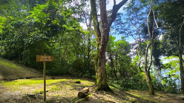
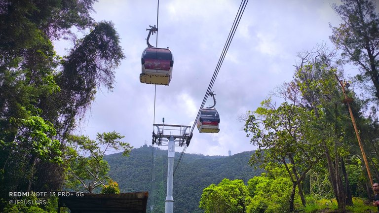
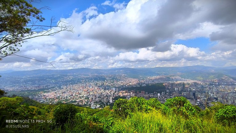
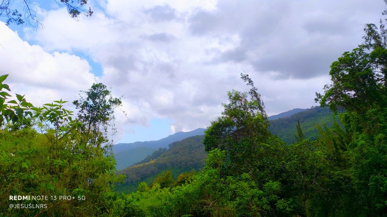
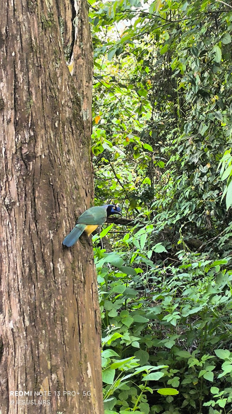
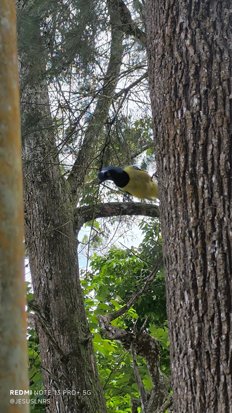
This is a perfect place for camping, video recording, photography, and eating. There are spectacular views here, as you can see in some of my photos. There's a table with a roof where we can sit, and it also coincides with the cable car cabins, passing very close above us. Plus, you can see many flowers, something unusual on this route, which has so much human influence, since the paths are clearly defined and very clean. Of all the destinations I've visited up there, this spot is one of my favorites and where I've stayed the longest to share with my wife or friends, and yet there are still many areas left to explore. In fact, when there's a full moon, this is the best place to photograph it ❤️
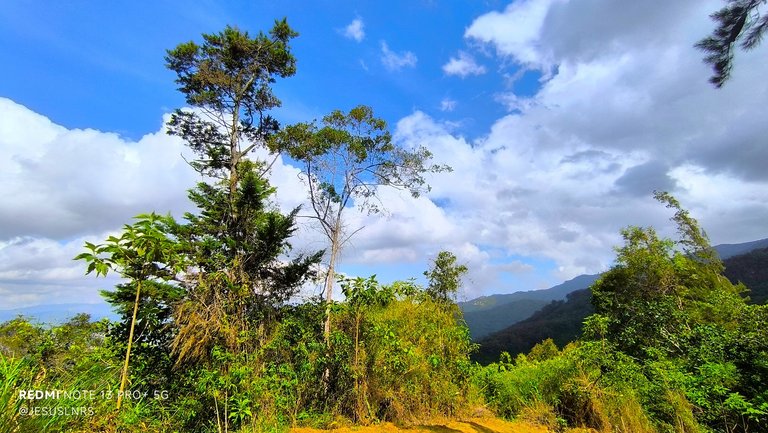
Este es un lugar perfecto para acampar, grabar videos, tomar fotografías y comer. Aquí hay vistas espectaculares como pueden ver en algunas de mis fotos. Hay una mesa con un techo donde podemos sentarnos y también coincide con el paso de las cabinas del teleférico, pasan muy cerca sobre nosotros. Además de que se puede apreciar muchas flores, algo poco común en esta ruta que tiene tanta influencia de las personas en estructura, ya que los caminos están claramente definidos y muy limpios para transitarlos. De todos los destinos que conozco allá arriba, este punto es una de mis preferidos y donde me he quedado más tiempo para compartir con mi esposa o mis amistades, y aún así hay muchas zonas aún para explorar. De hecho cuando hay luna llena, este es el mejor lugar para fotografiarla ❤️

You can check out this post and your own profile on the map. Be part of the Worldmappin Community and join our Discord Channel to get in touch with other travelers, ask questions or just be updated on our latest features.
Thank you Worldmappin 🙏
Hey @jesuslnrs you are welcome.
Thanks for using @worldmappin 😘
Congratulations, your post has been added to the TravelFeed Map! 🎉🥳🌴
Did you know you have your own profile map?
And every post has their own map too!
Want to have your post on the map too?
- Go to TravelFeed Map
- Click the create pin button
- Drag the marker to where your post should be. Zoom in if needed or use the search bar (top right).
- Copy and paste the generated code in your post (any Hive frontend)
- Or login with Hive Keychain or Hivesigner and click "create post" to post to Hive directly from TravelFeed
- Congrats, your post is now on the map!
PS: You can import your previous Pinmapple posts to the TravelFeed map.Opt Out
Amazing! Thank you so much 🙏
Always grateful. Thank you, @qurator, and thank you @ewkaw, for so much love 🙏
me gusta mucho ese tipo de lugares, el Avila, waraira Repano, como le llamen, es genial para visitar
Sí hermano, es un gran lugar, que a la vez tiene muchas zonas por explorar y visitar, yo no dejo de maravillarme. Gracias, espero que estés bien 🙏
Hello Jesus, good afternoon.
What a peculiar name this national park has.
It's great that you're hiking up the hill and discovering such beautiful places. I love the view from up there; the photos are truly gorgeous.
If you keep training like you've been, you'll be able to reach the summit at some point.
What beautiful photographs.
Thank you very much. Yes, I'll keep training and discovering wonderful places up there, and you'll see the photos here 😘
Wow! It's a great achievement for that walk! That’s no easy task, but it feels incredible once you get there, surrounded by nature and that breathtaking view.
Yes, my friend, it's very satisfying. I imagine you've done it before, too. Thank you so much for stopping by to comment. Hugs!!!
You're welcome my friend!🤗
What an accomplishment @jesuslnrs! ✨ It's awesome that you're training to hike these spots on your own, and P.G.P. Papelón sounds like a perfect reward 💖 It’s a great feeling to find a favorite spot that offers everything you need, from water to great views 💕 Keep up the good work! 👏
Thank you so much, Ella. This is a great place to start, and over time I know it will be easier for me to achieve more goals; it all depends on consistency and training. Thank you so much my friend 🙏
Congratulations @jesuslnrs! You received the biggest smile and some love from TravelFeed! Keep up the amazing blog. 😍
Thanks for using TravelFeed!
@for91days (TravelFeed team)
PS: Did you know that we launched the truvvl app? With truvvl, you can create travel stories on the go from your phone and swipe through nearby stories from other TravelFeed users. It is available on the Apple App Store and Google Play.
Wow, thank you so much, I'm very happy 🙏
As soon as I saw the name, I thought you'd been to Cerro Papelón, but in Carabobo state. Well, they have the same name, so maybe they have the same origin. Cheers!
Hi Wil! Glad to meet you. This name only refers to a small section up there, halfway up the mountain, but I'd love to see other Venezuelan mountains. Maybe next time I'll first visit Aragua, which is my birthplace. We'll see... Thanks brother 🙏