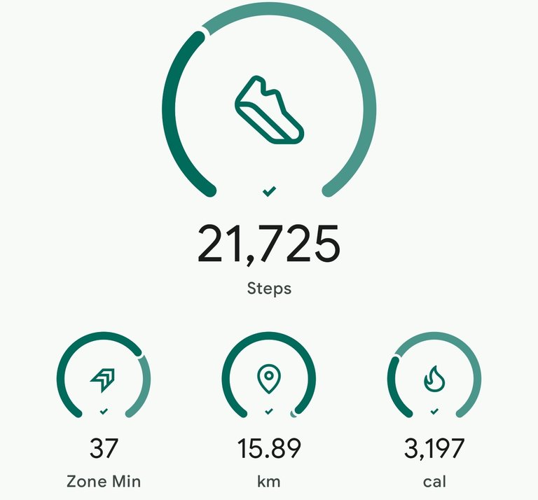
course M - tokyo walking map : April 6 2025
finally, a walk which does not involve any sakura. i actually saw a tokyo walking map site with recommended courses in each ward of tokyo. in that site, you get to specify which ward you are interested in, what things you would like to see, and how many steps you are willing to have. i chose one just nearby, for cultural and historical purposes with at least 10 thousand steps.
you can check the site in here for your daily walking needs.
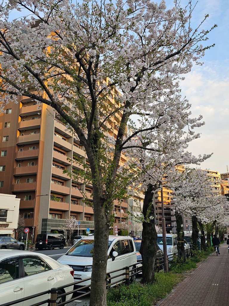
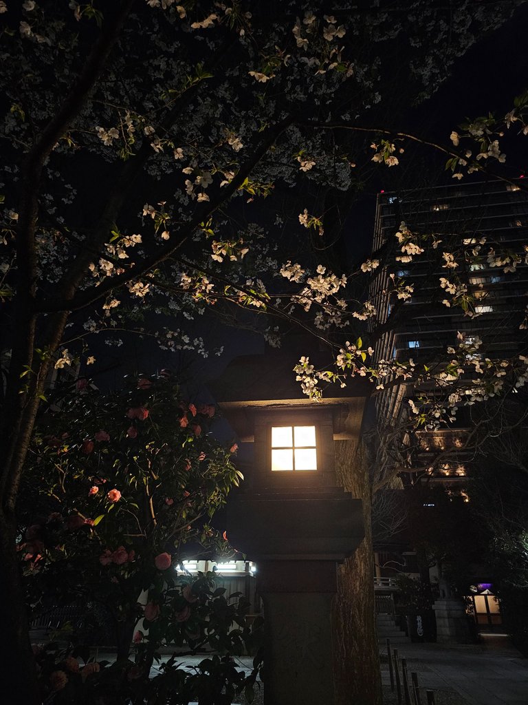
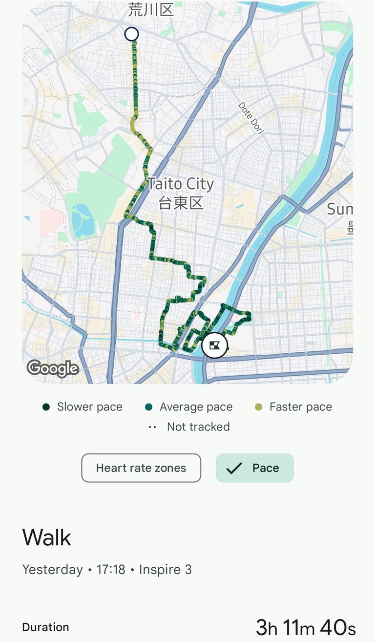
of course i had to reach the area first, and because i chose a course relatively close, i also walked going there. yet again, another beautiful cherry blossom passed by. by now i was so done with sakura, those tiny but very beautiful flowers are everywhere. i was so surprised when @wittyzell mentioned yesterday that she hasn't been to any hanami (flower watching) this season yet, and here i am with no intentions get to encounter these pretty little things on a daily basis.
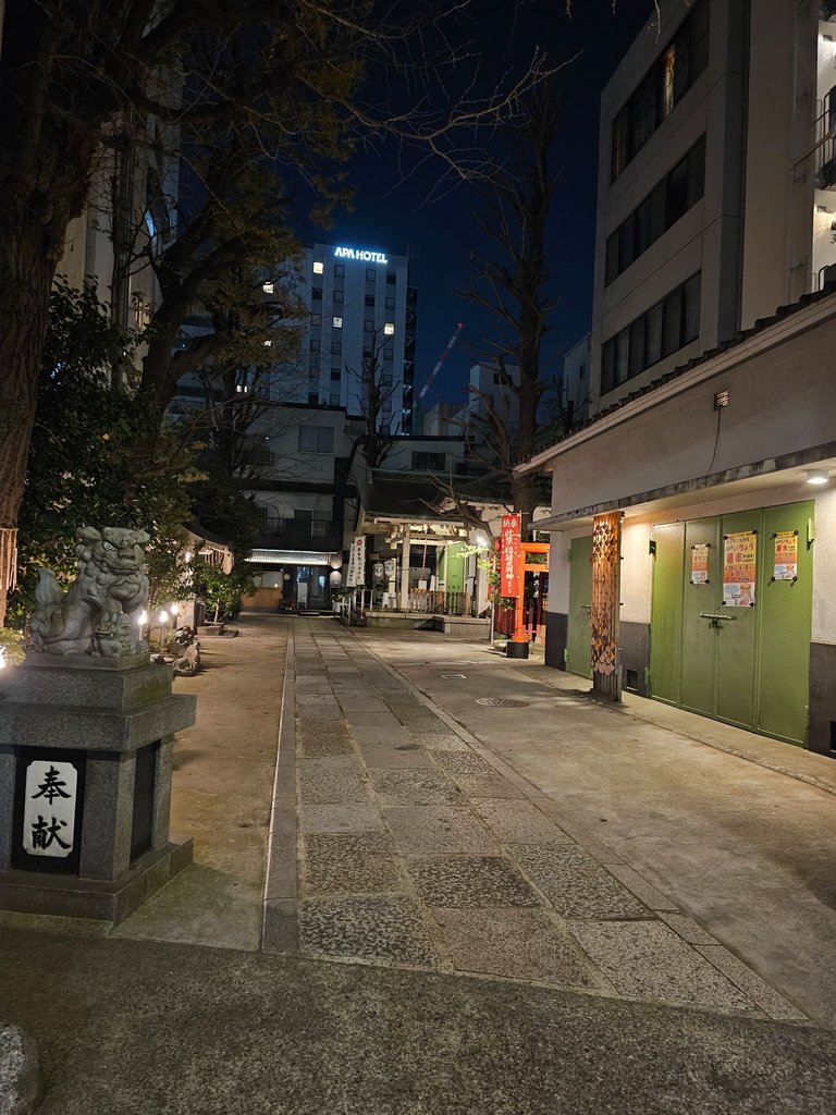
back to the route, this one started in taito-ku, in an area unfamiliar to me. let us start with:
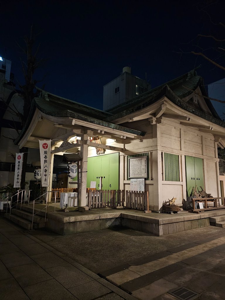
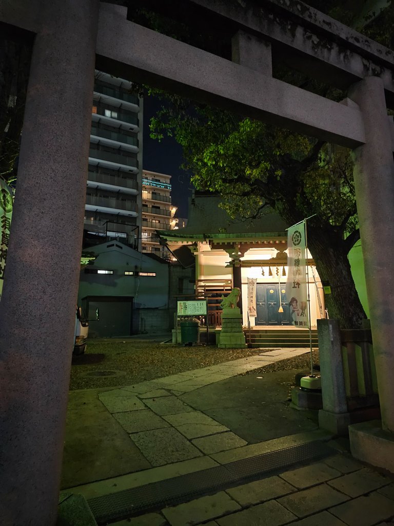
Shitaya Shrine (下谷神社)
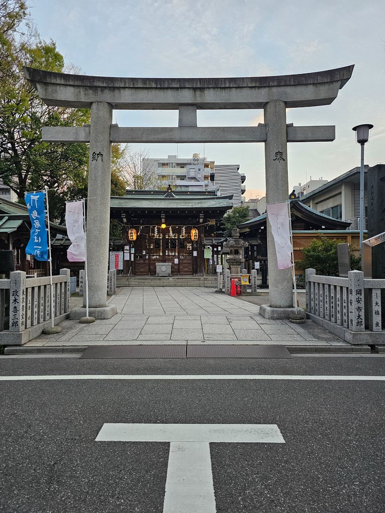
this shrine was founded in the nara period around the year 730 and is the oldest inari shrine in tokyo. and then i got curious what an inari shrine is. these are shrines dedicated to a deity inari, associated with foxes, rice, prosperity, household wellbeing among many things. these shrines usually have those red (vermillion) torii gates lined.
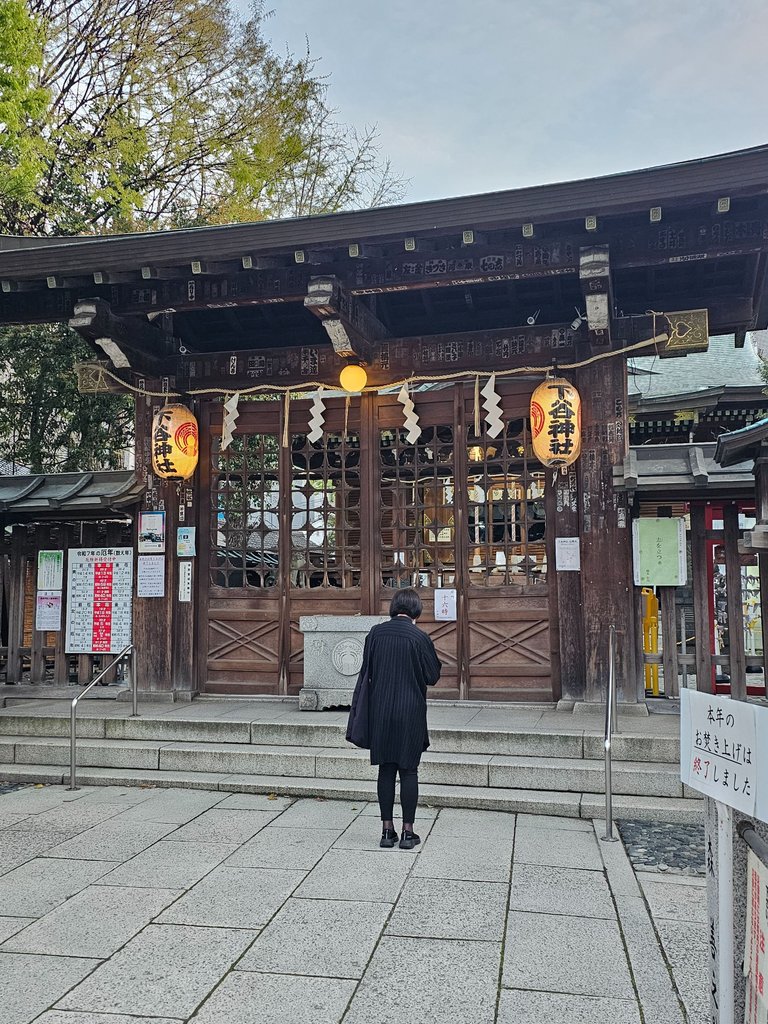
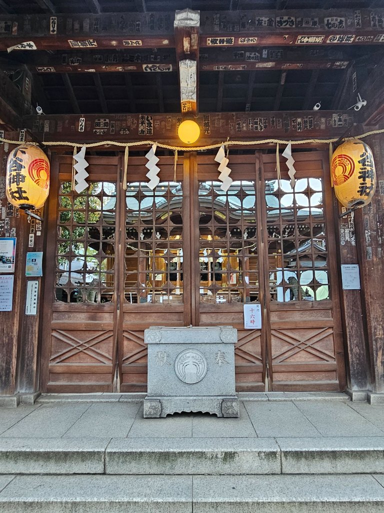
the shrine moved to this location at 1928 for the rezoning. the main shrine was closed that time and people just prayed in front of this donation box outside. don't ask for the vermillion gate picture, it had a very large one beside the main road but i didn't take a picture of it.
Satake Shotengai (佐竹商店街)
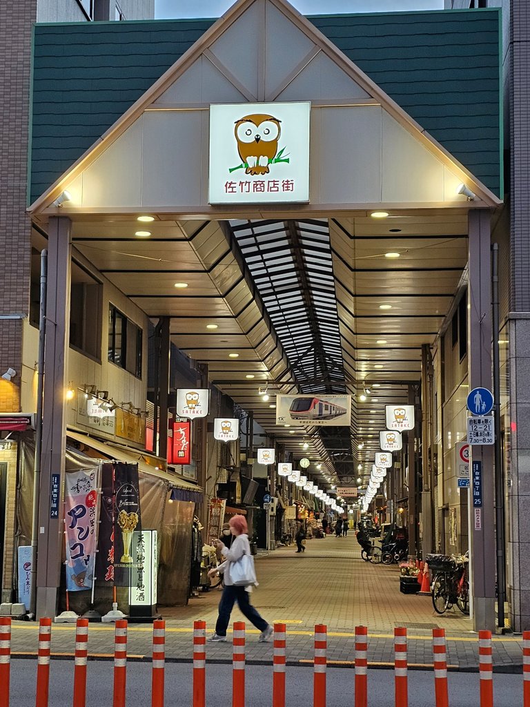
this shopping street came to view after walking a bit from the shrine. apparently this too had quite a history, built in 1884 and got completely burned down from the great kanto earthquake and the second world war. but the people rebuilt the area after each destruction, the current version was built in 1977.
Taito Kuritsu Seika Park (台東区立精華公園)
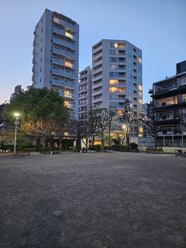
there was really nothing special in this park it was in here were i read why tokyo had many mini parks within the city. it was after the great kanto earthquake in 1923 where they found out how greeneries in parks and open spaces helped extinguish the fires by acting as firebreaks. it was then after that tokyo developed 52 small parks in those areas ravaged by the fires. in taito, one large park and 15 small parks were established including this very park i was on.
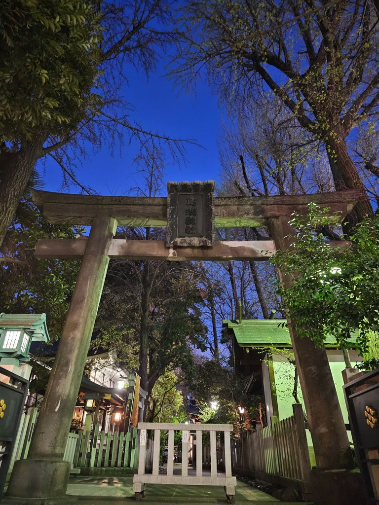
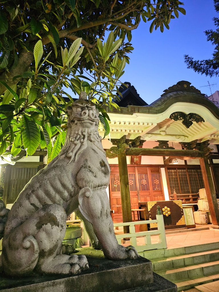
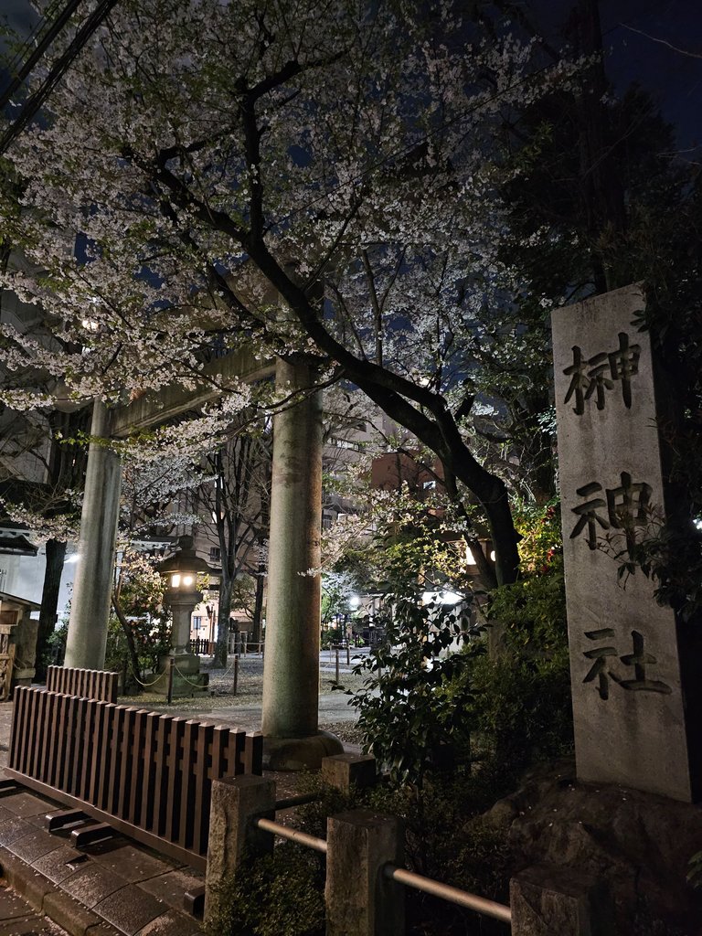
Torikoe Shrine (鳥越神社)
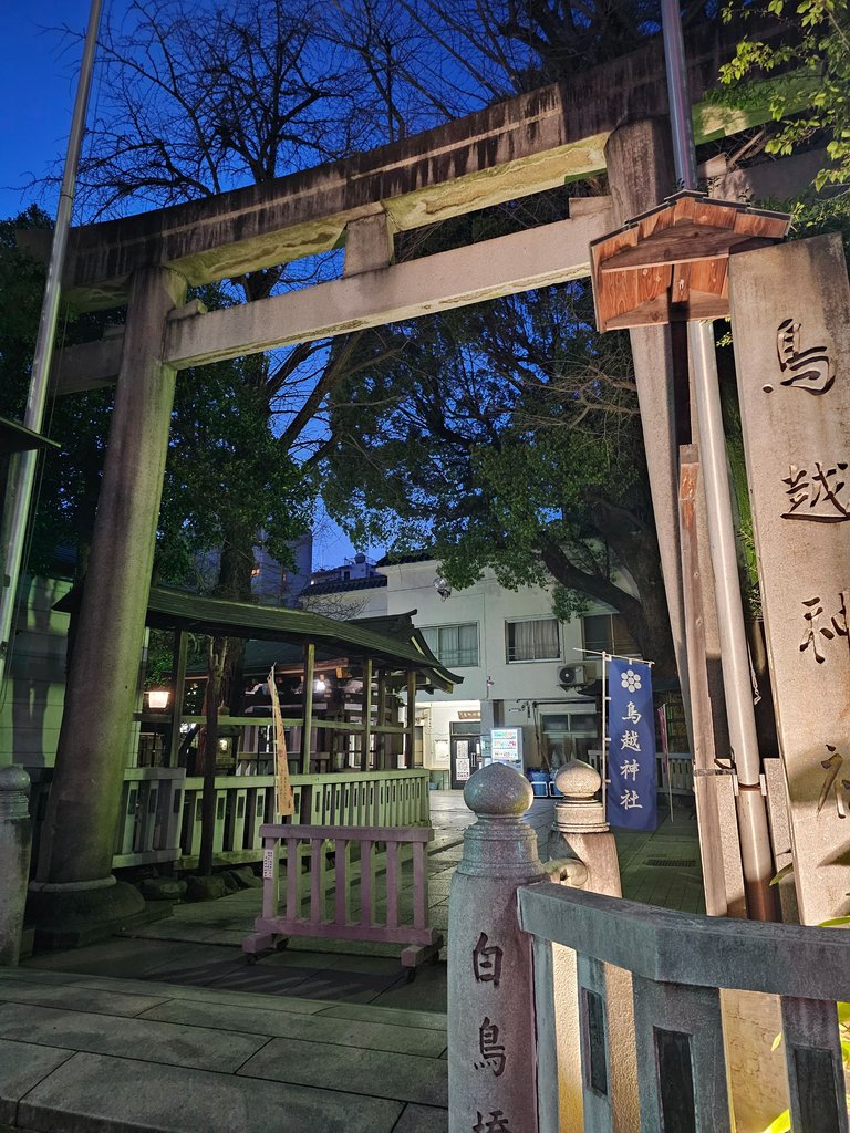
it was at this point when i realized that i have been in this shrine back in december. i was finding churches at that time so this shrine was never featured in my blog. back then i vowed to return for the new year shrine and temple pilgrimage, but i did that in a different area instead.
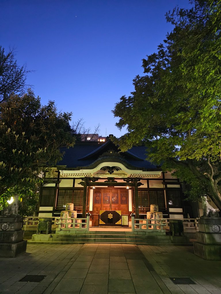
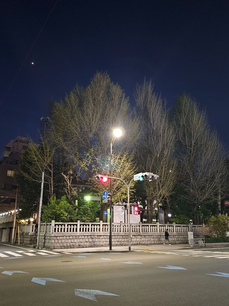
now about the shrine, it was founded in the year 651 when the ancestors of most of modern japanese were still driving out the old ainu populace. now don't ask me whether that is wrong or right, history should be taken as it is. with that out of the way, just look at how pretty the sky looked against the yellowish lights of the shrine.
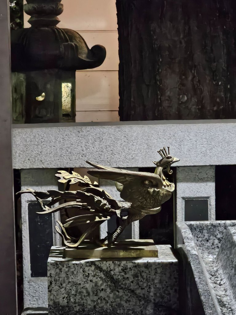
this shrine hosts a festival on january 8th where new year's decors, charms and trinkets of the previous year are gathered and burned inside the shrine grounds. those flames are also used to bake some mochi rice cakes in the shrine; the only remaining shrine in all of tokyo that maintains this tradition. now i intentionally took a picture of this bird decoration in the shrine's "washing area" because the "tori" in this shrine's name means bird.
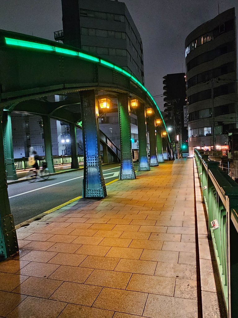
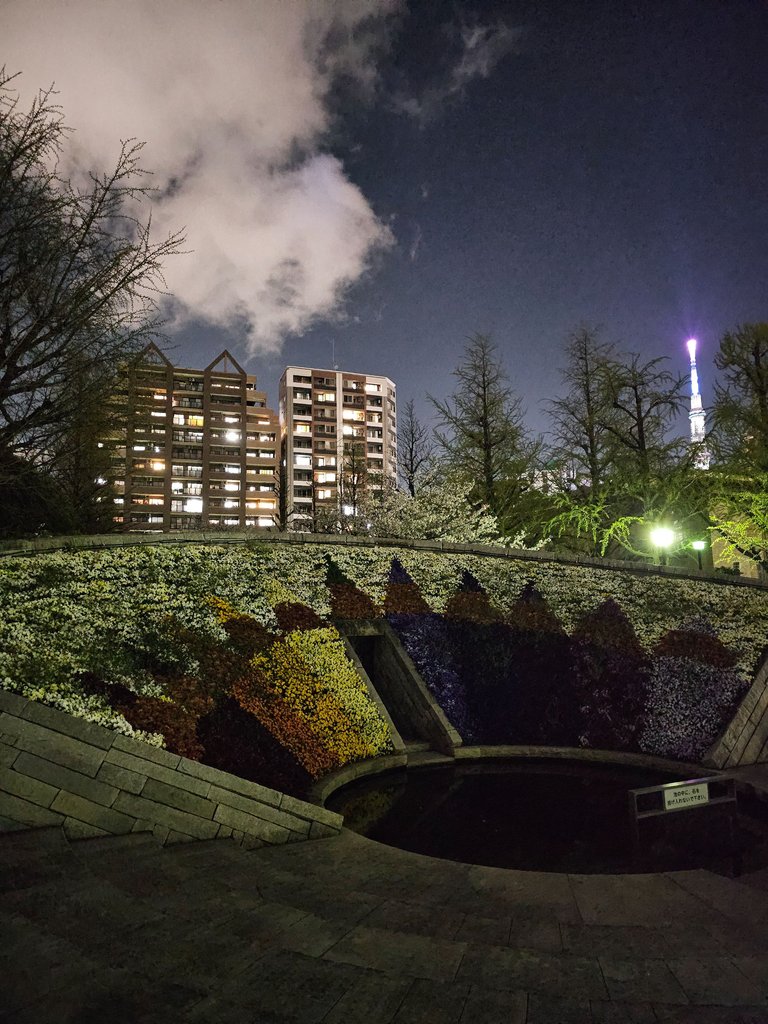
Ryuhoku Park (柳北公園)
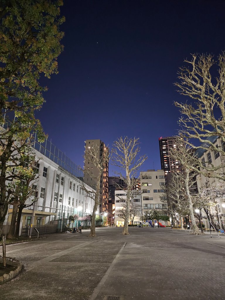
there was supposed to be a large gingko tree around the area but that was closed off from the public and had no lights. so here i took a picture of the next door park instead. let us just imagine how big that next door tree might have been. and by the way, this park was also one of the original 15 small parks built in taito after the great earthquake.
Kanda River (神田川)


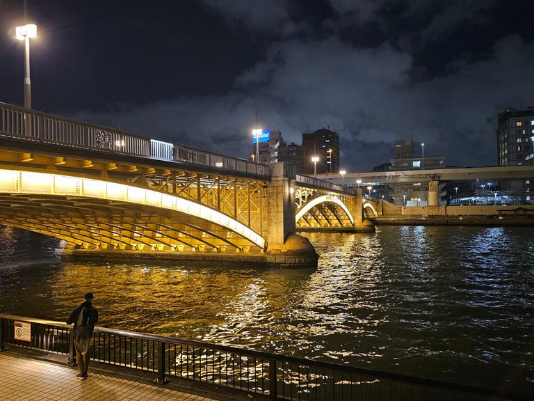
i continued my walk until the river area which led to a bridge. at the foot of the bridge was this majestic sakura tree. crossed the saemon bridge (左衛門橋) and behold at what i saw, boats floating on the kanda river. that was quite a sight! i was now entering chuo-ku after crossing the bridge.
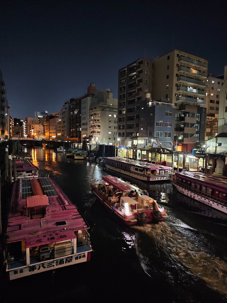
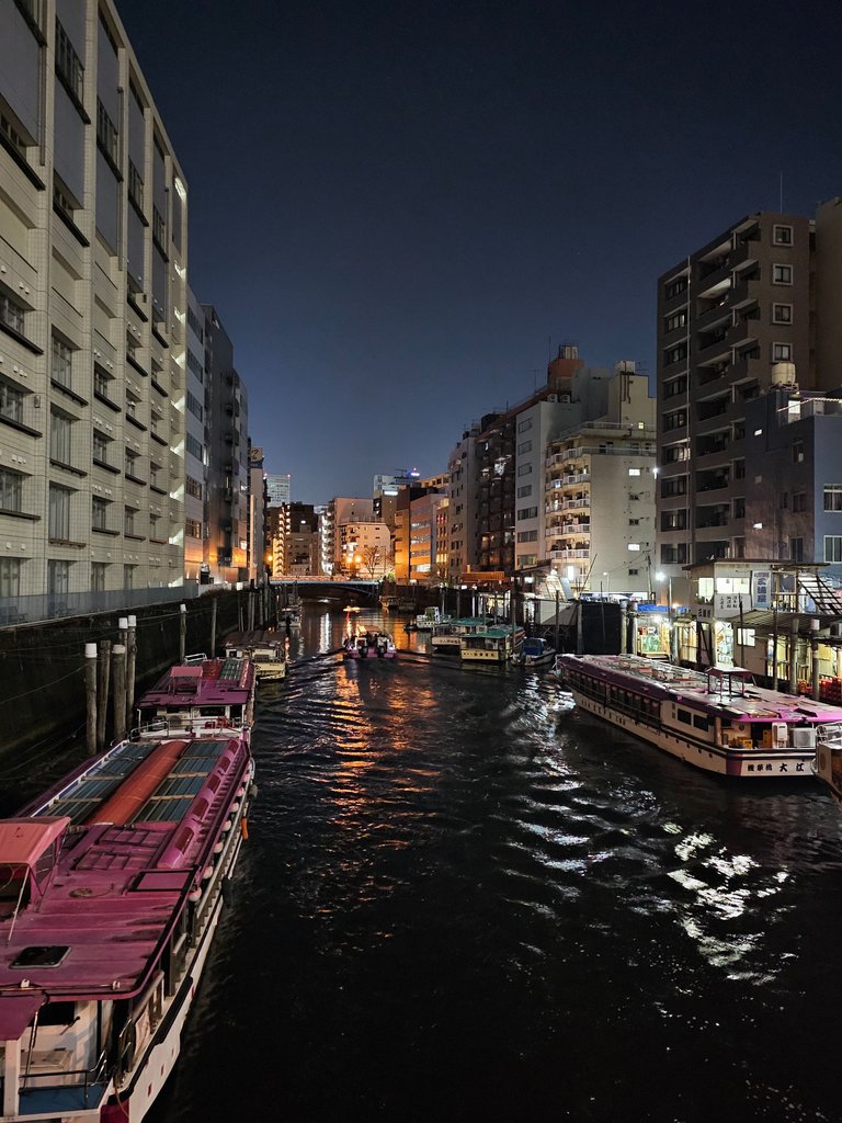
not for long though, as i crossed another bridge over the same river after a block worth of walk in the chuo side of the city. Asakusa Bridge (浅草橋) was the name of the bridge and that view was splendid.
Ichogaoka Hachiman Shrine (銀杏岡八幡神社)
the next shrine was not that big. it is but a simple shrine where everything was paved except for the soil directly planted with trees.
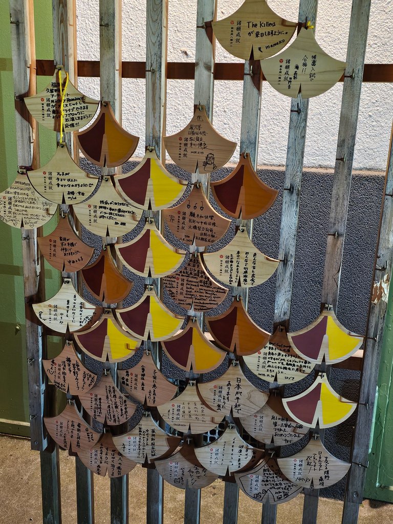
one thing that caught my interest was this ginkgo leaf shaped ema or prayer tablets. their must be some connection with with ginkgo and this shrine.
Suga Shrine (須賀神社)
this time i really had no clue what to see in this shrine. but my walking course specifically mentioned the shrine so there must be something about it.
Dairokuten Sakaki Shrine (第六天榊神社)
now this shrine was a bit normal sized, but there were 3 other mini shrines within the complex. there was history plaque inside which stated the asakusa public library was once built in this place. while open, it had around 110 thousand books. but that library was discontinued and the books were redistributed to two national libraries in tokyo with some markings still indicating that they were from the old asakusa library.

the first picture is one of the minor shrines within the complex. i loved how the sakura decorated the torii gate. the second one is the main shrine.
Shinozuka Inari Shrine (篠塚稲荷神社)
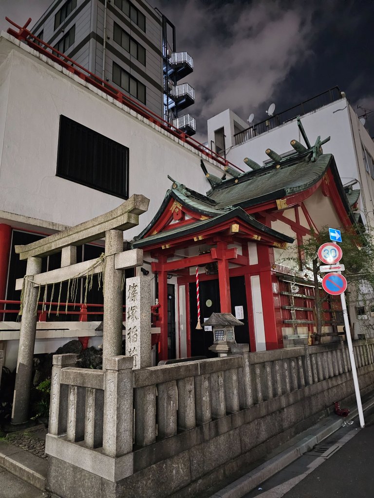

this was a very small shrine at the corner of the street. small and somewhat uninhabited but still maintained clean. it was unknown when it was founded but it was believed to be the shrine where a feudal lord's best warrior fled after his defeat and became a monk.
Yanagi Bridge (柳橋)
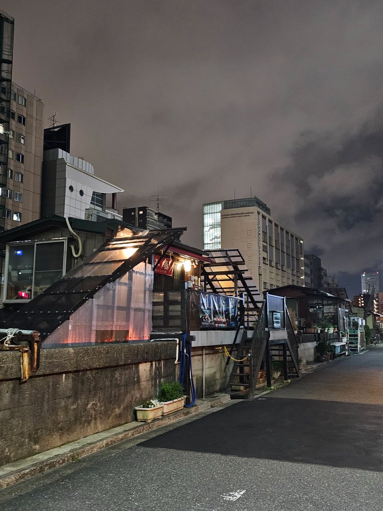
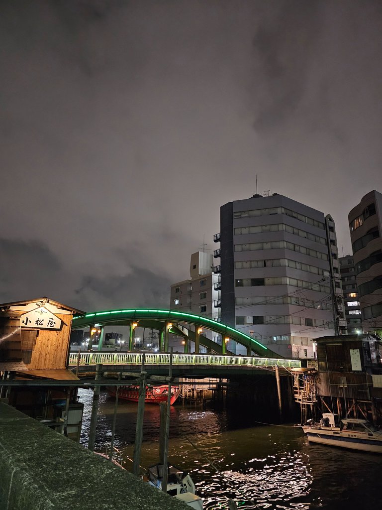
and now we are back at the kanda river banks. as seen earlier, the river is filled with boats and those boats must have been loaded from one of these port like structures on the banks. a little walk would lead you to a well lit bridge, the last of the kanda river bridges before it merges with the sumida river.
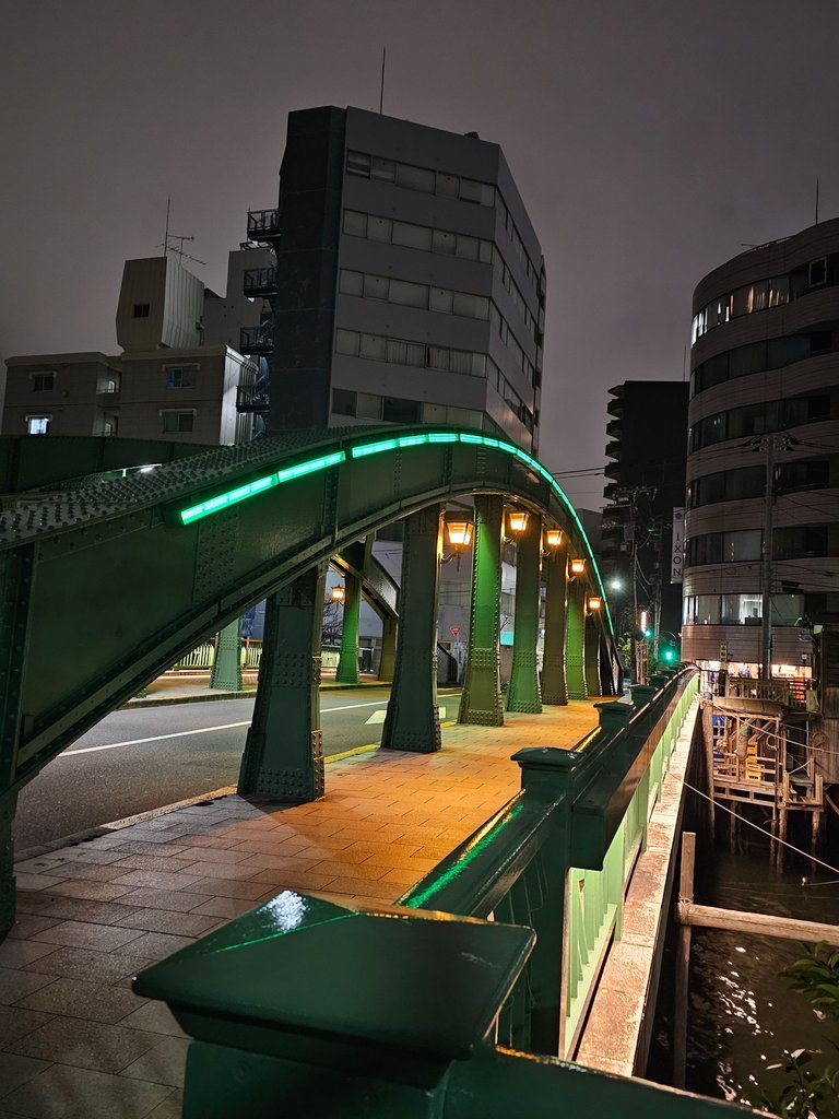
the bridge's name means "willow" in english and has been depicted in many old paintings in the edo period, the previous wooden version that is. this steel bridge version was built in 1923. around this area, the historic yanagibashi red light district area was also established since the 1800's. geisha's were said to be thriving in the area skilled in different arts and musical instruments. after the tokyo olympics of 1964, the district slowly declined. the construction of the sumida river banks was a fatal blow as it blocked the view; on january of 1999, the last of the geisha restaurants went out of business officially ending the 200 year history of the district.
Sumida River (隅田川)
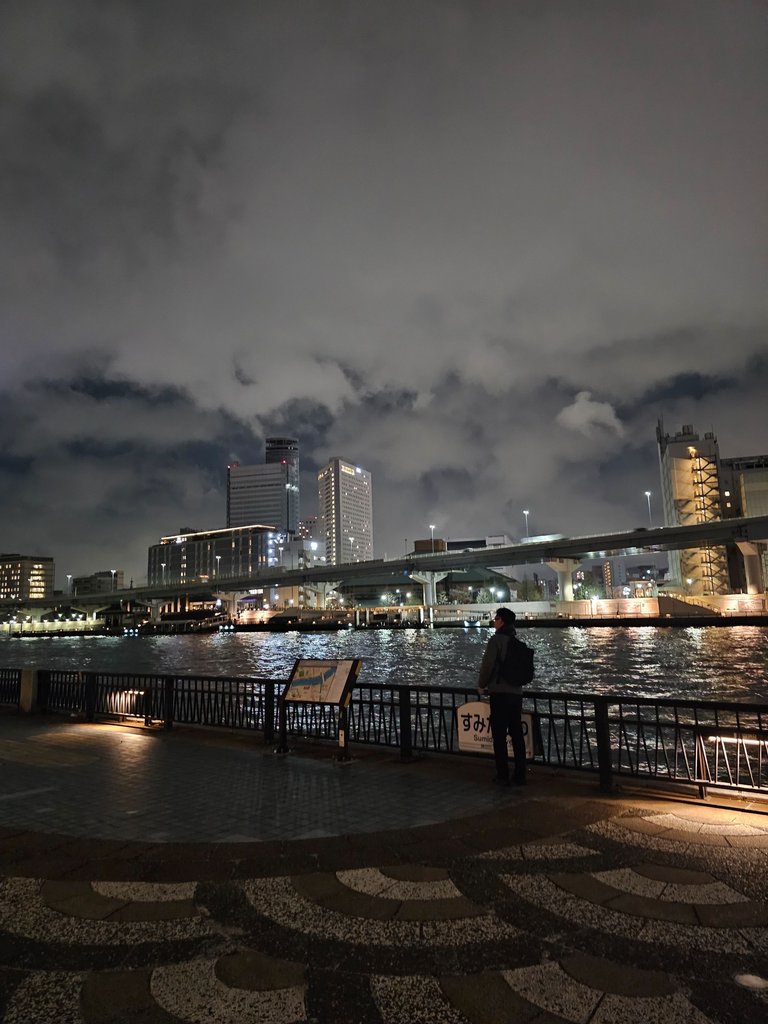
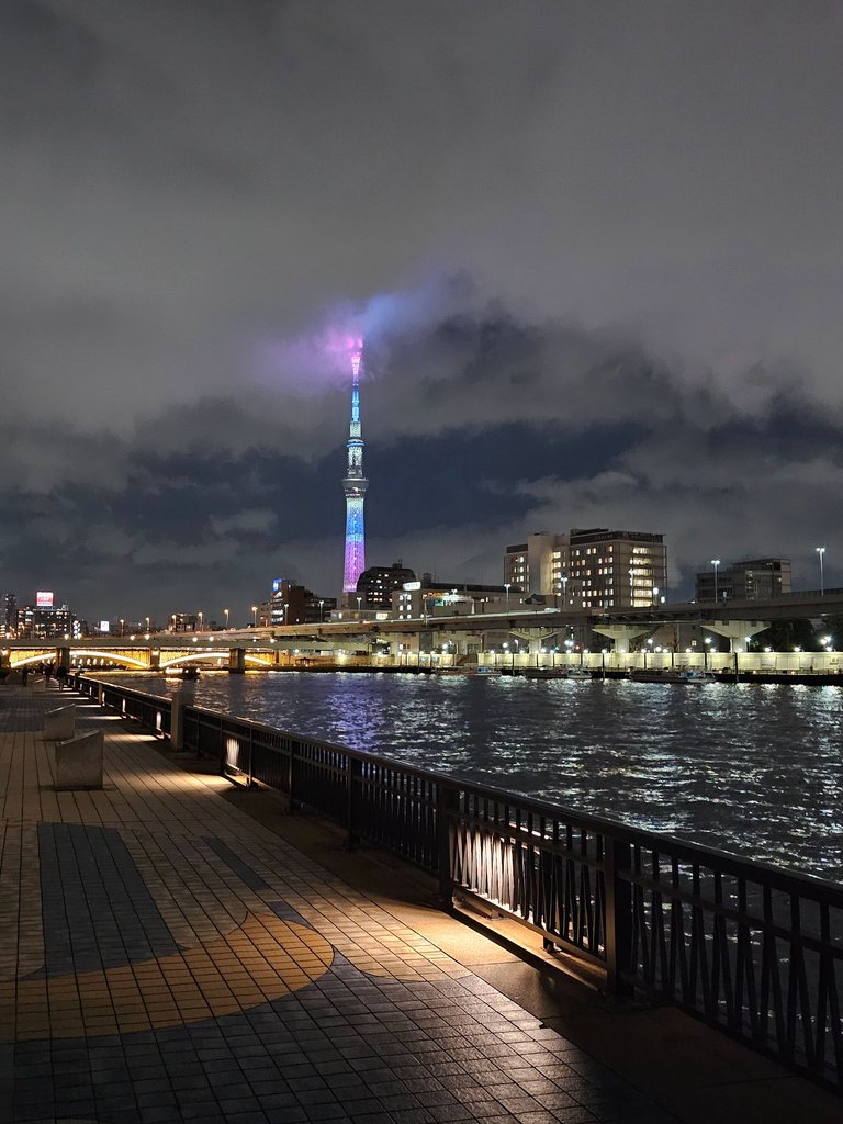
this was the embankment which blocked the view and killed the red light district. for some unknown reason, fishing hobbyists were in the area. this had a clear unobstructed view of tokyo skytree. this was also a popular spot for jogging and for dating. along the route, it also features some art from the edo period which depicted the river.
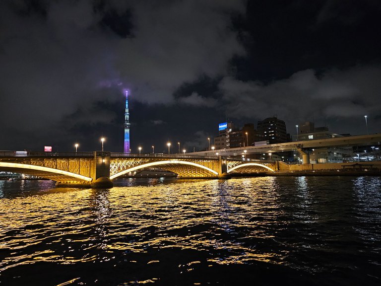
Kuramae Bridge (蔵前橋)
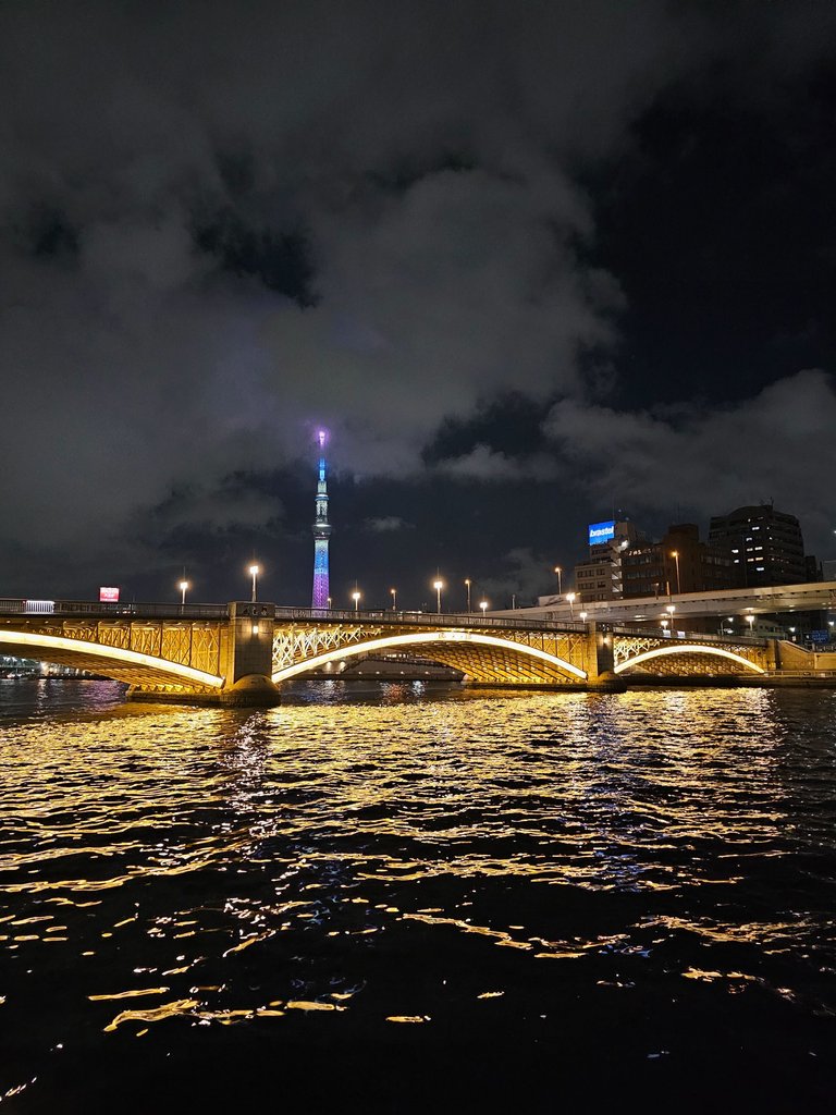

built in 1927, this three span bridge was so well lit and is a great addition to the sumida river wonders. i found it very dramatic colorwise and couldn't stop myself from taking pictures of the well lit bridge with the tokyo skytree at the back. (this second picture will be submitted as an entry to #aroundtheworld photocontest)
from my readings, it must be because of the color but parts of the bridge are said to resemble an ear of rice. i definitely tried but i really couldn't see it. i saw fishing folks though, that man over there was fishing when i passed by. now crossing this bridge would lead me to sumida ward which i will be in until the end of the course.
Yokoamicho Park (横網町公園)

this park unfortunately had a very sad history. in this site alone around 38 thousand lives were lost during a fire which broke out in the area during the great kanto earthquake of 1923. this area also served as the final resting place of those who died during the great tokyo air raid of the second world war.
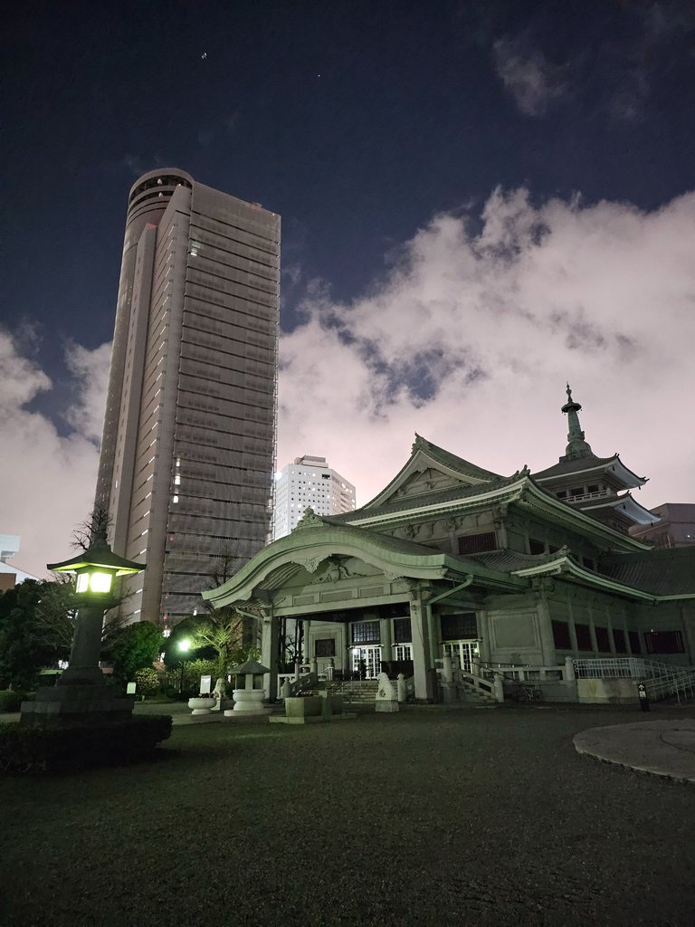
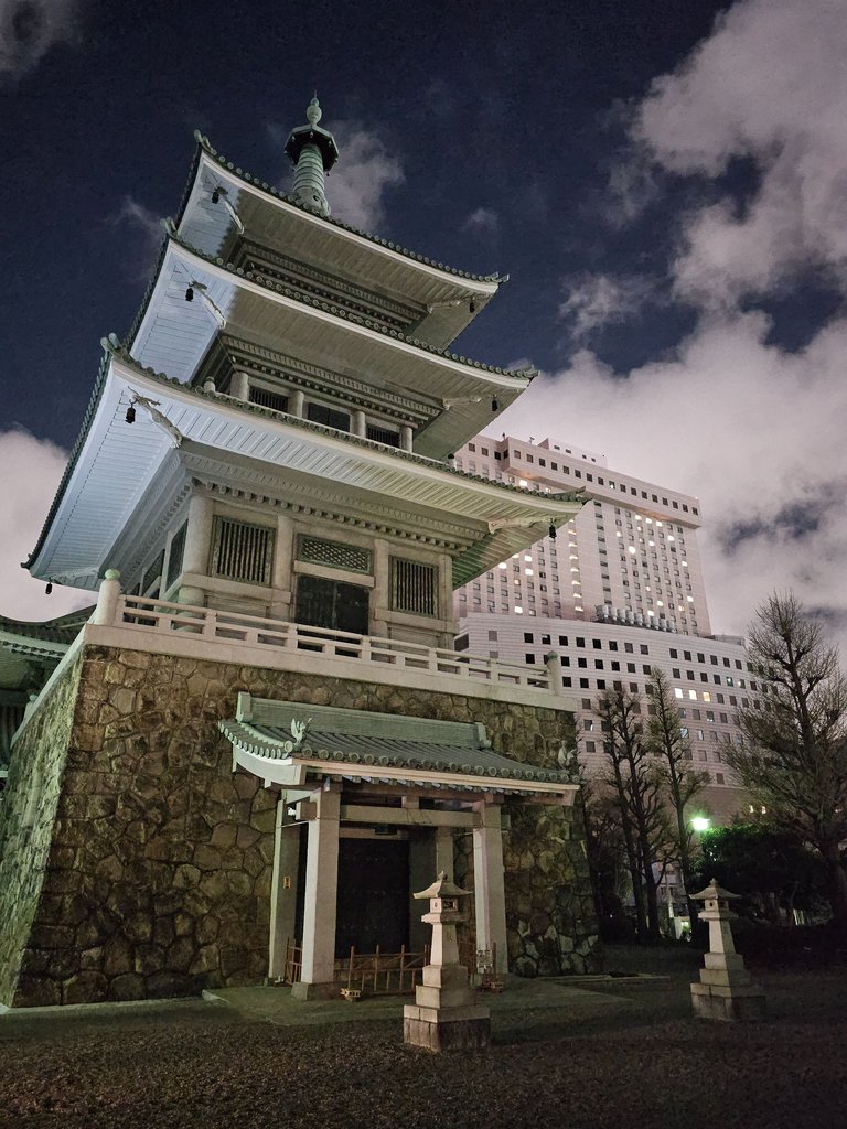
as a result of these two disasters, the tokyo metropolitan memorial hall was built inside the park and the remains of around 163 thousand people were enshrined in this building.
Ryogoku Kokugikan National Sumo Arena (両国国技館)
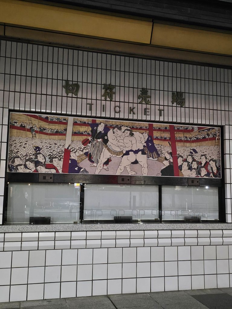
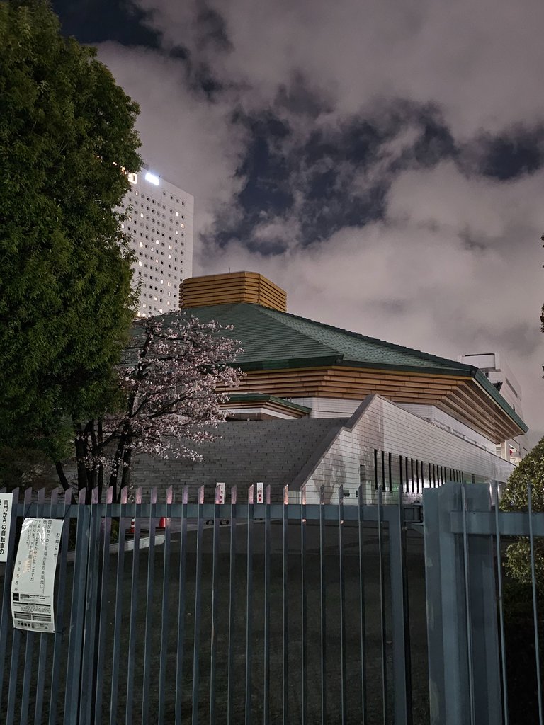
i really had no idea what was instore for this final leg of the walk. i knew the name but it never came to me what it really was until i saw the ticket booth. this sports hall is the home of sumo wrestling matches. this hall was opened in 1985. other sports and even concerts are also held here when sumo matches are off season.
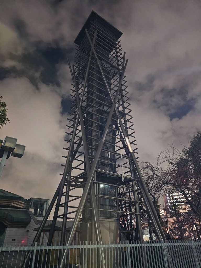
just beside the gate was this tower of some sort. drums are played in here, and flags of the different sumo houses are displayed here during matches.
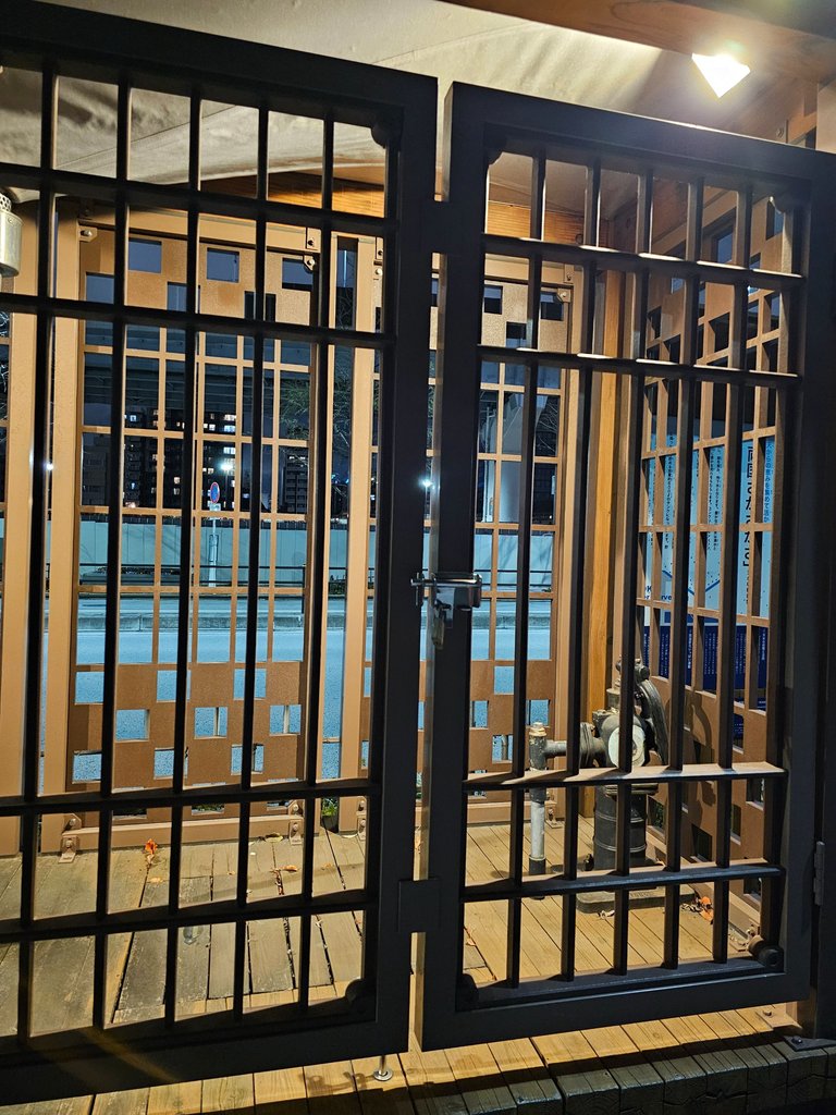
the second picture was taken just outside and was a rain collecting device. rain water was collected and used to water the plants in the gardens. such a great use of water.
Ryogoku Station (両国駅)
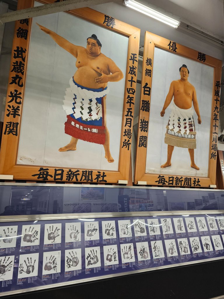
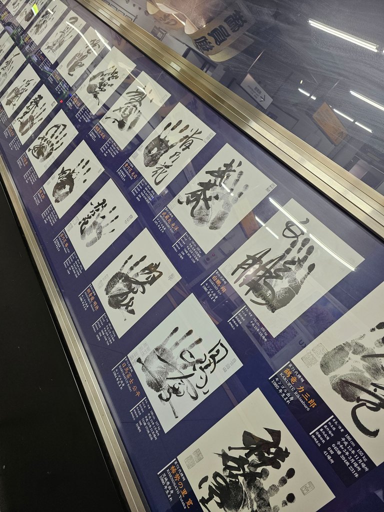
with the sumo arena beside, it is but natural that this station features sumo wrestlers on its walls. it also featured palm prints and personally written names of the sumo champions along with other personal details. very on brand with the surrounding, this station is the last stop of this walking map.
i returned home from this station with joy and a lot more appreciation of the history of the area.
as always, AMPNG KANUNAY!

all content is by yours truly unless otherwise specified
all photos are taken with a galaxy s23 ultra
This report was published via Actifit app (Android | iOS). Check out the original version here on actifit.io


Height168.0 cm |  | Weight71.3 kg |  | Body Fat% |  |
Waistcm |  | Thighscm |  | Chestcm |  |


You can check out this post and your own profile on the map. Be part of the Worldmappin Community and join our Discord Channel to get in touch with other travelers, ask questions or just be updated on our latest features.
Congratulations, your post has been added to the TravelFeed Map! 🎉🥳🌴
Did you know you have your own profile map?
And every post has their own map too!
Want to have your post on the map too?
- Go to TravelFeed Map
- Click the create pin button
- Drag the marker to where your post should be. Zoom in if needed or use the search bar (top right).
- Copy and paste the generated code in your post (any Hive frontend)
- Or login with Hive Keychain or Hivesigner and click "create post" to post to Hive directly from TravelFeed
- Congrats, your post is now on the map!
PS: You can import your previous Pinmapple posts to the TravelFeed map.Opt Out
nice lagi tong walking map. murag kita kog ingon ani similar before, but nakalimot nako unsa to. murag Kita kog pud syag ingon ani, or maybe mao jd d i ni sya hahahaha anyways thanks!!
go go go. try mo na. maraming andyan sa walking course map site na yan.
Thank you for providing the link to the site and those pictures are very beautiful
thanks. gotta share what i can
You are always welcome
Congratulations @itz.inno! Your post made the TravelFeed team happy so we have sent you our big smile. Keep up the good job. 😃
Thanks for using TravelFeed!
@for91days (TravelFeed team)
PS: Did you know that we have our own Hive frontend at TravelFeed.com? For your next travel post, log in to TravelFeed with Hive Keychain or Hivesigner and take advantage of our exclusive features for travel bloggers.
Looks like you started with a “day walk” and ended as a “night walker”!🤗
Awesome @actifit steps, and beautiful photos, my friend!😊
so true. i waited for the sun to soften a bit before i went out.
Sounds like you had an enjoyable day, my friend!🤗😊
it was it was. but quite far
Glad your housemates joined you last night for your night walk!👍😊
some of them had leg aches after. 🤣
lol…. They need to get in good shape like you!👍😊
more leg work will probably do. 🤣
💪😅
Congrats on providing Proof of Activity via your Actifit report!
As your total AFIT balance across chains is below 5,000 tokens, you are still not eligible for AFIT rewards. You can buy some AFIT tokens on hive-engine, pancakeswap, digifinex or dex-trade.
You received rewards as 0.97% upvote via @actifit account.
Rewards Details
AFIT rewards and upvotes are based on your:
To improve your user rank, delegate more, pile up more AFIT and AFITX tokens, and post more.

To improve your post score, get to the max activity count, work on improving your post content, improve your user rank, engage with the community to get more upvotes and quality comments.
Chat with us on discord | Visit our website
Follow us on Twitter | Join us on Telegram
Download on playstore | Download on app store
Knowledge base:

FAQs | Whitepaper
How to signup | Maximize your rewards
Complete Actifit Tutorial
Support our efforts below by voting for: