Exploring Vestmannaeyjar - Island Where Half a Town Got Buried Under Lava in 1973
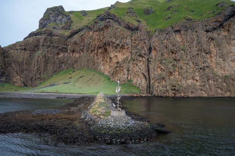
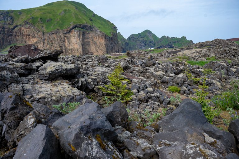
Vestmannaeyjar is not one island but a collection of them and these belong under Iceland, in the southern part of the country. Yes, Iceland has islands and actually quite many of them. We visited the biggest island that is named Heimaey where also a town with about 4000 people is located. To get there you need to take a ferry from the mainland. Here you can see some cliffs in the harbor area. I took these shots when we arrived at the Heimaey island.

There are 10 islands that belong under Vestmannaeyjar but Heimaey is the only one you can visit. All the other islands are visited only for scientific purposes. Heimaey is about 4km wide and 6 km long, pretty small island really.
We wanted to visit this island in 2021 too but the ferry trip was canceled due to a storm so im glad we got to go this time.
We left our car at the port on the mainland and rented electric scooters to get around on the island. The first place we went was a museum of the eruption disaster and local islands formation history. They have excavated one house that was buried under lava in 1973 and built a museum around it.
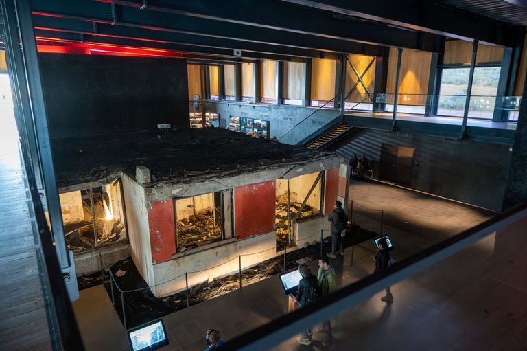
For me who is extremely interested in volcanoes and geology, it was extremely interesting. Here you can see a house half-buried under lava.
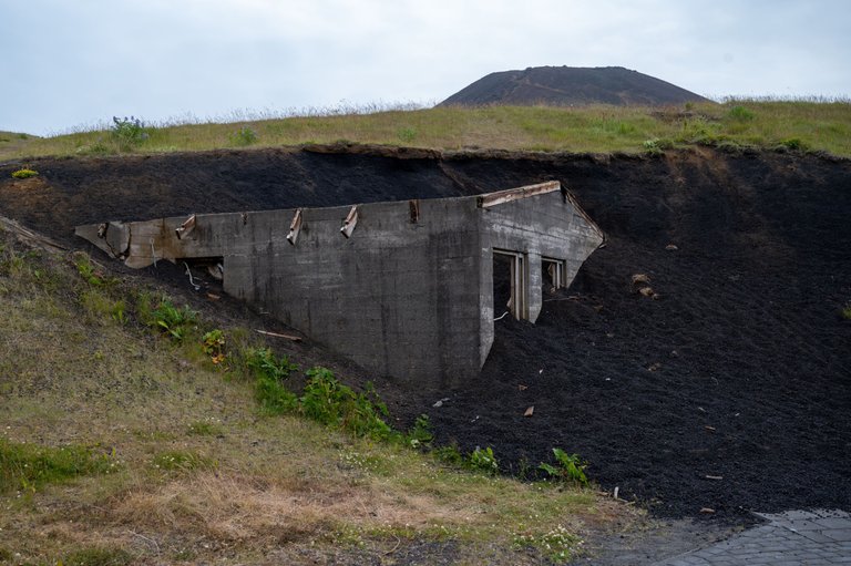
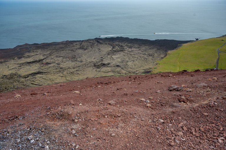
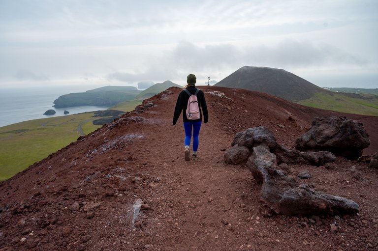
Next up, our plan was to hike up the 200m high eruption crater that erupted and produced a disaster for this community.
The hike was not too hard but some sections are steep and have loose gravel. The crater itself is called Heldfell.
The higher we hiked, the more apparent it got how much lava this eruption spewed out.
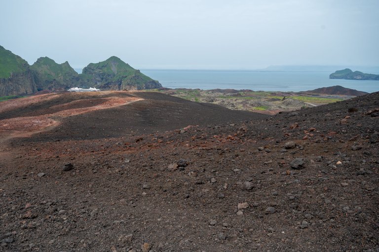
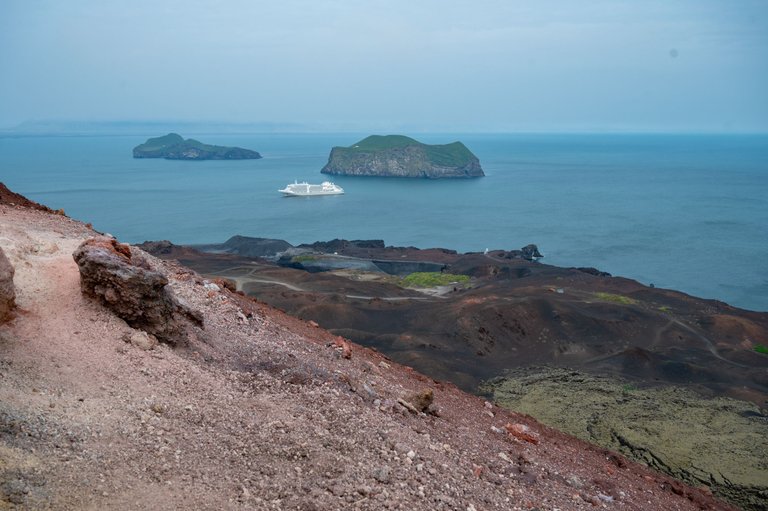
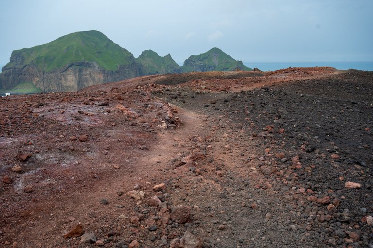
The two smaller islands back there are Elliðaey on the left and Bjarnarey on the right.
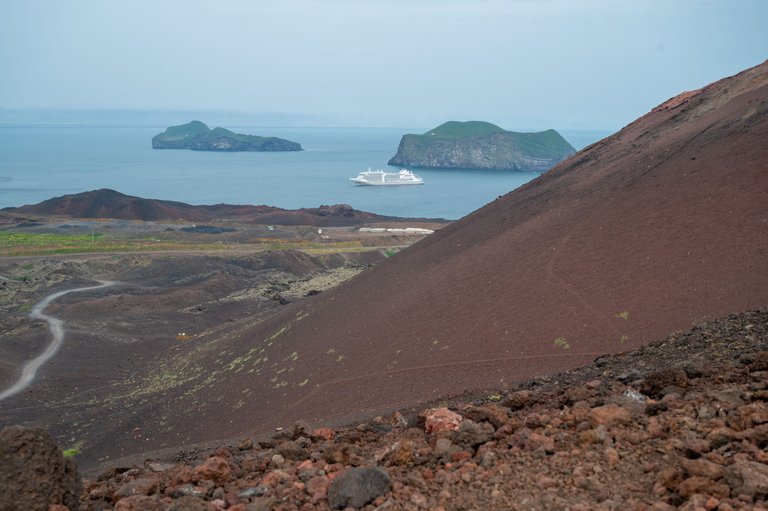
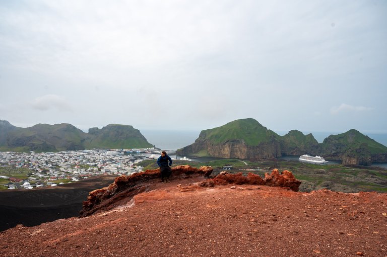
Here is another volcano named Helgafell, it's about 6000 years old and is situated right next to Heldfell we were hiking. We wanted to hike Helgafell too but ended up being short of time later so we didnt.

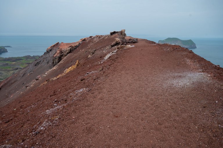
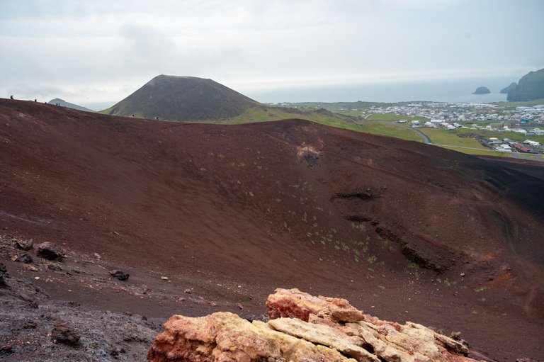
Here you can spot some people on the crater rim. This shows a bit of perspective on how large this crater is.

Didnt take too long before we were up there too.
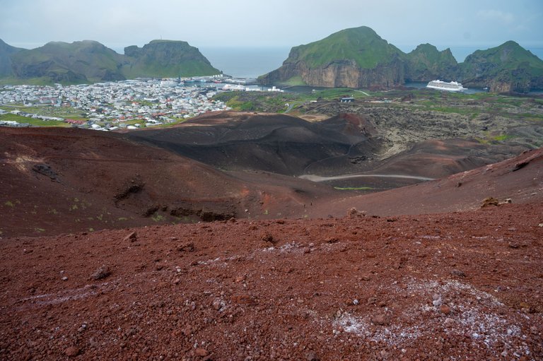
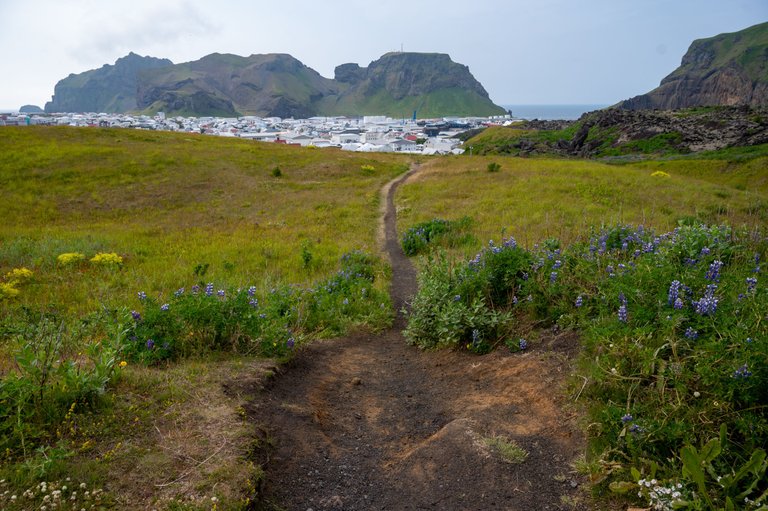
From up there we got to see some great views all over the Heimaey island. It is also very apparent where the lava flowed in the year of 1973. It's clear as day how the lava wall moved over parts of the town.
Me sitting on the rock formations on the crater rim.
View to the south.
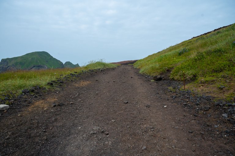
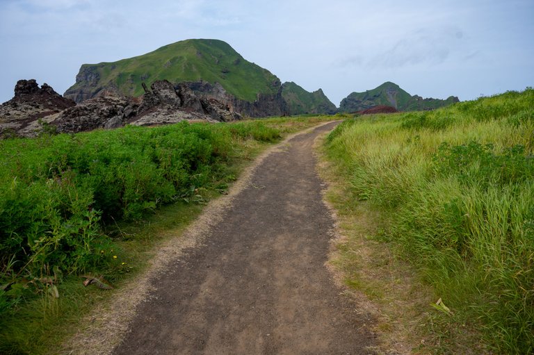
We took another way down along the lava flow.
Nothing describes the destruction of this eruption better than this photo below. Here you can see the photo before the eruption and the view after the eruption so you can see how much the landscape changed. I don't remember the exact number but hundreds of homes were buried under lava.
Note how much you can see water in the old photo and now.

It was surreal to think that there are ruins of the homes about 10-15 meters below our feet. Here is a memorial of one of the houses that was exactly below this spot. We saw at least 5 of these memorials.

We descended into the town. Here you can see the wall of lava that approached in 1973 and the houses right next to it were barely saved.

I will add a couple of photos here too from the town itself. Brothers Brewery was a great place to sit down and have a couple of beers. A great choice of different kinds of draft beers.

A rainbow street.

We did more hikes and saw some places around this island but these will be the subjects of other posts, stay tuned!

Congratulations, your post has been added to Pinmapple! 🎉🥳🍍
Did you know you have your own profile map?
And every post has their own map too!
Want to have your post on the map too?
I enjoy the beauty of these islands, but if I had to climb to the top I wouldn't be able to @greddyforce
Yeah, well depends much on your physical capability but overall it's not a hard one to do. Takes 30 minutes the most.
!discovery 20
This post was shared and voted inside the discord by the curators team of discovery-it
Join our Community and follow our Curation Trail
Discovery-it is also a Witness, vote for us here
Delegate to us for passive income. Check our 80% fee-back Program
Very nice place and quite interesting but also I will say this place is really horrible.
I wouldn't prefer to visit such places where there is a danger of volcanoes.
When there is no danger of eruptions then the place is as safe as ever to visit.
These photos are proof that you hiking was a successful one. I love seeing island, it reminds of nature mostly.
Yes, it sure was a success. Nature is epic in this country. We did a very hard hike after that too, will write about it soon.
Hiya, @choogirl here, just swinging by to let you know that this post made it into our Top 3 in Travel Digest #2069.
Your post has been manually curated by the @pinmapple team. If you like what we're doing, please drop by to check out all the rest of today's great posts and consider supporting other authors like yourself and us so we can keep the project going!
Become part of our travel community:
The island really had a beautiful view
Sure has!
Alright
@greddyforce
Really impressive and attractive shoots. But Is there easy to live a peaceful life because among the hikes there may be lack of resources or our basic facilities. The last one photos shows the development of that area I think.
No there really isn't. Stuff gets carried from mainland with ease
$WINE
That house half burried under lava is so scarry. In Romania we have plenty of towns and villages entirely covered by water or mine extraction fails but can't imagine the pain seeing lava take everything from you..
We have a quarry village underwater and the water is clear blue, a surreal sight. But yeah, lava flowing over a house is violent...
It's a scary situation, but it's a natural phenomenon. There was nothing to do at the time, I hope it never happens again.
Not much to do but they managed to reroute part of the lava flow by pumping sea water on it and cooling it
This is a great event. This is a very interesting and researchable event.
These are really places that you need to see once in a lifetime, I'm not a hiking person, but I think this place it's worth a visit. Can I ask how much the ferry costs to get to this island?
Not extremely expensive. About 20eur from mainland but Iceland itself is expensive overall.
What an incredible journey! 🌋 Your vivid descriptions and stunning photos transported me to Heimaey. The mix of natural beauty, geological wonders, and the historical impact of the 1973 eruption is truly captivating. It must have been surreal to stand on the crater rim and witness the transformation of the landscape
Sure was surreal but even more surreal was to see a live erupting volcano!
Awesome place! The mountains with the old human infrastructure is very contrasting and it called my attention a lot!
The view towards the south is my favorite as well as the rainbow street at the end. Not similar, but both fantastic!
A lot of cool places to be found on this island. Great place to make a day trip to!
A person has to go out of his city to see such natural sights. Such beautiful places are seen by us there. We see that this place is built under water and looks very beautiful. A person forgets the problems of his life.
Built underwater? Care to explain what you mean? Nothing is built underwater there.😀
It is interesting to know that there are islands in Iceland. Also, I was amazed at their place. It just says that even though it is quite far, it can be an ideal place to live.
On a different note, I am wondering why the other islands cannot be visited. I want to know why.
Awesome place to be able to explore on the crater of a volcano. It's really a risk to live in this type of place.