Exploring the volcanic trails of Mont-Dore in central France [EN/FR]
A little throwback to our family road trip around France last week. I still have one moment to share with you. One of those you keep in a corner of your mind. A memory that plays on repeat, because it feels good.

The day before yesterday, I told you about our stop at my grandmother’s, in Dijon. After leaving her, @altheana and I headed to Auvergne, to visit my grandfather in the retirement home. The house where he used to live hasn’t been sold yet, so we dropped off our stuff there and spent the night.
The next day at noon, we had lunch with him, took the time to talk. Really talk… before he took his nap. These moments are priceless because they’re so rare.
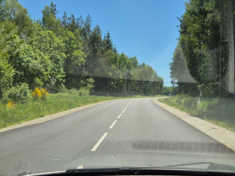
Then we hit the road again. Destination: the Creuse region, to visit another part of my family. Over there, the landscape slowly starts to fold, to undulate. Hills, forests, meadows, a foretaste of mountains. And precisely, @altheana and I have been talking about it for months. We need some relief. Some height. To take a big breath of fresh air.
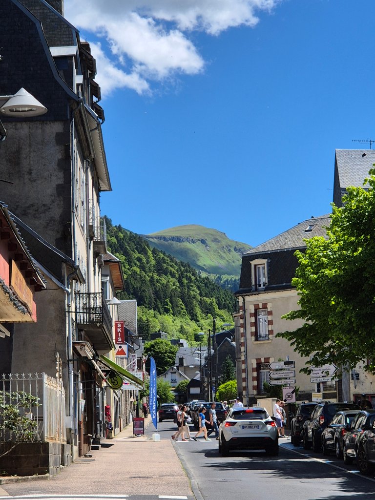
A few years ago, we went on a road trip in a car we had fitted out. Digging through old photos, we stumbled upon a village: Mont-Dore. A thermal resort nestled in the mountains. Only 2 hours' drive from where we were.
So, we spent one night with my family in the Creuse, and the next morning, we headed for Mont-Dore. We knew we wanted to hike, but we hadn’t decided on a trail yet. We just wanted to be up there. Just to see. Just to breathe.
I’ll take you with me.
It was Friday morning, last week. I say “morning,” but it was more like late morning.
We took our time because we had breakfast with this part of my Creuse family that we only see once every two years. Time to talk about our lives, take some photos, share some experiences.
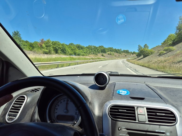
To set the scene: when we hit the road, it was already 28 degrees. The air was hot and dry. A preview of summer. We knew it wouldn’t last, as thunderstorms were expected at the end of the week across the country (and that turned out to be true).


(
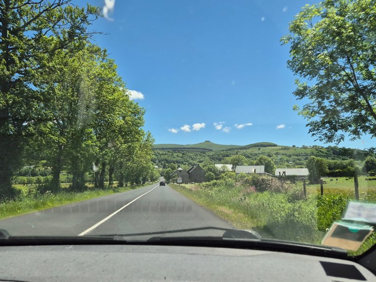
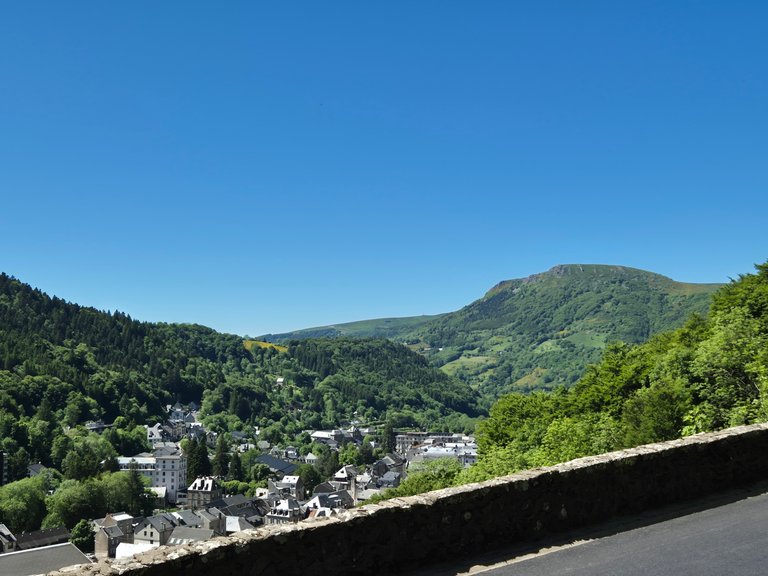
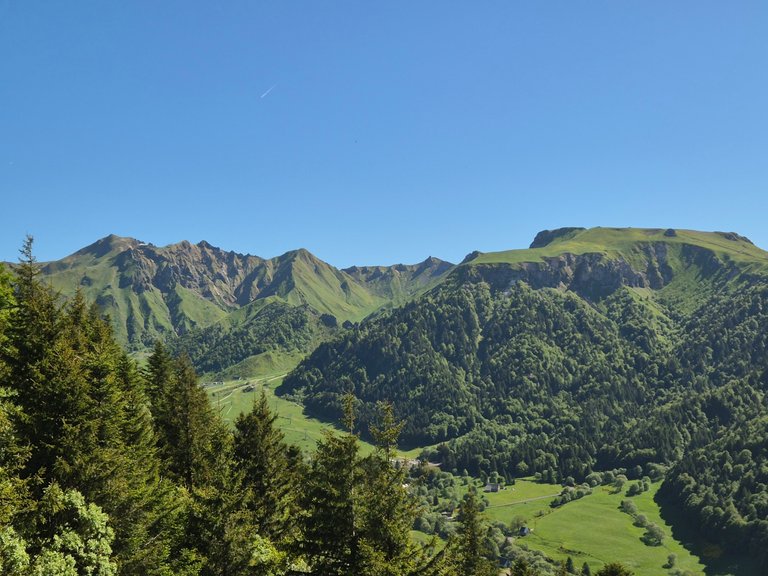
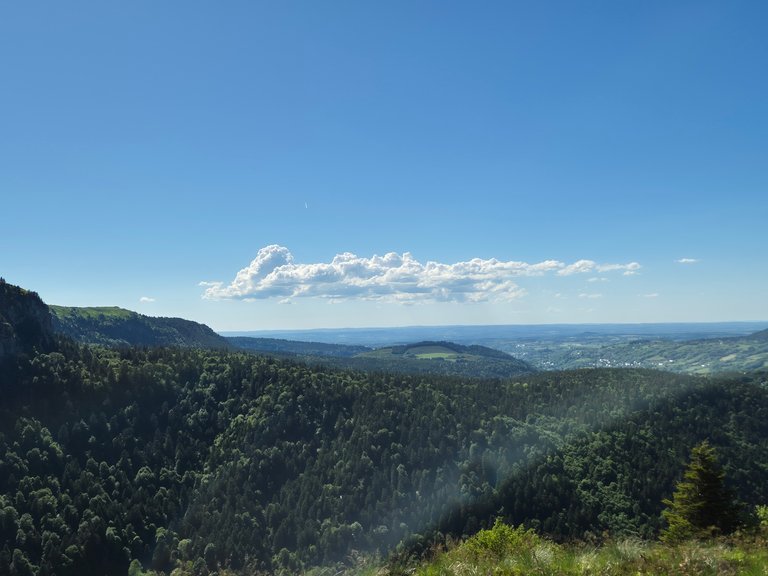
After only 50 minutes of driving, we saw the very first small mountains. Finally! We’re getting there!
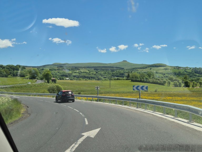

Auvergne is volcanic. Almost every mountain is a volcano. They’re just not very active anymore. They’re not extinct. Just in a deep sleep phase.
The last eruption was 7,000 years ago. Which is, from what I understood, very recent on a geological scale.
In my photo, you can see a little part of a volcano, and even though it looked close in the first pictures, we kept seeing it for many kilometers without actually getting much closer.
It was 1:00 p.m. when we arrived at the thermal resort. We hadn’t planned anything to eat, and we were starting to get hungry.
Since we were planning to hike, we thought it would be smarter to eat first. The thing is, all the shops in the town were closed. Which surprised us, as it was the Ascension long weekend.
So we got back in the car for about twenty minutes, looking for an open store. We eventually found a small shop where we bought strawberries, an avocado, wraps, salmon, and cream cheese.
While removing the avocado pit, @altheana stabbed her hand with my knife. Deeply.
At first, she didn’t want to show me the wound. She didn’t even dare look at it herself, for fear of what she’d see. When I finally got a look, I almost fainted. It was really deep.
I thought we would have to change our plans and head to the emergency room. But I made a bandage with whatever we had on hand. She gritted her teeth. We put the wraps in a backpack. Then… we went hiking.
Looking back, I’m still amazed by her mental strength. Or madness, I’m not sure. Especially since she didn’t feel part of her hand until the next morning.
Today, a week later, the wound still looks nasty, but it’s healed well.
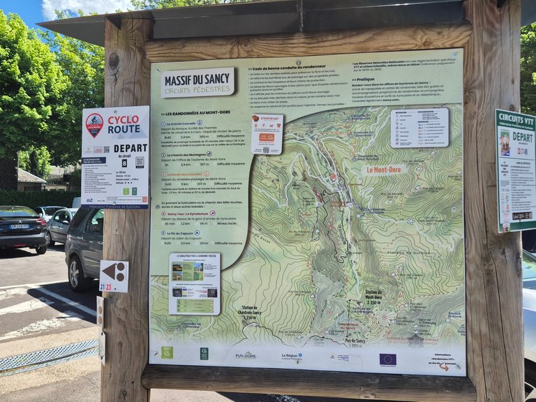
In the meantime, on the Visorando app, I had found a not-too-long loop. The day was already quite advanced, so we needed a hike that was accessible, but still nice. Something worthwhile.
I must admit, I was a bit disappointed not to have arrived earlier. I really wanted to climb to a summit and walk along the ridge. To be up there, with a clear view that puts you back in your place.
But despite that, I was happy to be there. We were in the middle of nature, far from everything. In a place I really love. That was already a lot. And we had been wanting to see mountains for a long time. Even low mountains. Some relief.

While crossing the Mont-Dore resort, @altheana kept repeating that we had already done this hike a few years ago.
I didn’t remember a thing. No memory. I knew we had already passed through here to go to the Puy de Sancy, but not that we had hiked starting from Mont-Dore. It’s funny how sometimes, memory chooses what it keeps.
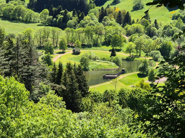
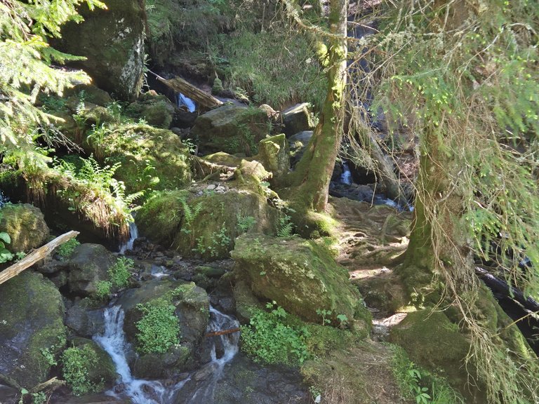
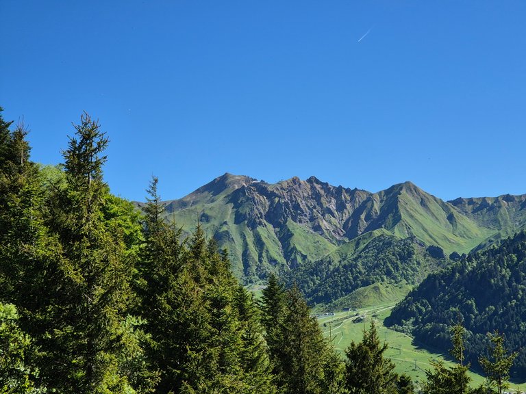
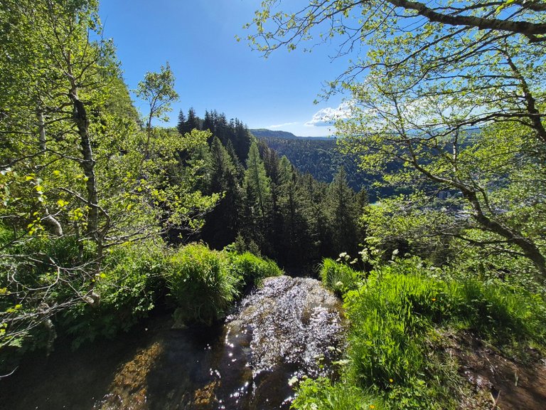
In the photo above, you can see the very beginning of the Dordogne. This little stream, surprisingly shy for the season, flows down from the slopes of the Puy de Sancy. A bit further on, it will become a 483-kilometer river.


The closer we got to the starting point, the more something came back to me. A feeling of déjà vu.
That said, in this area, there are so many trails, forests, and paths that I kept being skeptical.
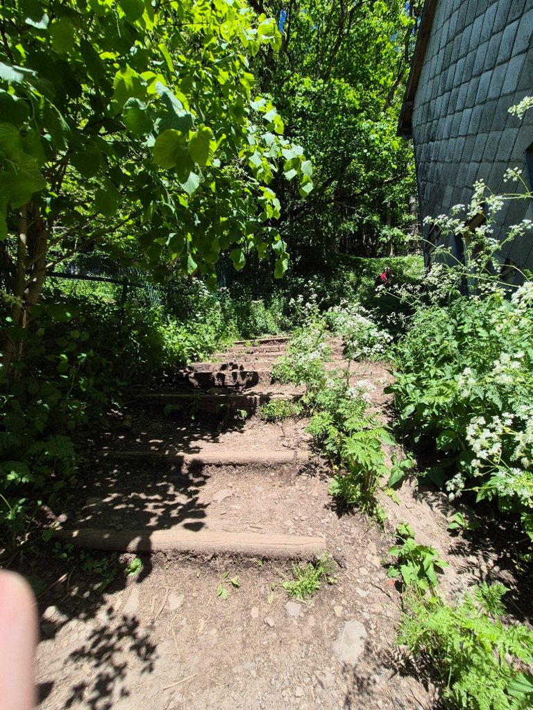
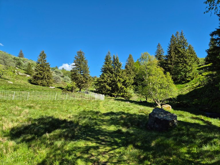
Then we arrived at the steps marking the beginning of the hike:
And indeed, @altheana was right. We had done it before.
In my mind, we had just stopped at Mont-Dore at the time to fill our water bottles and jugs. But apparently, we had also gone for a hike.
It’s not a big deal. If I chose it twice, it’s because it’s worth it!
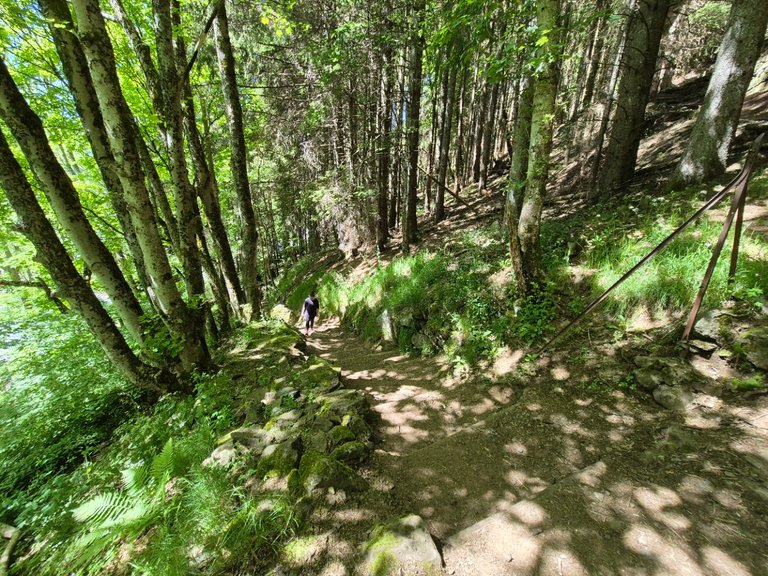
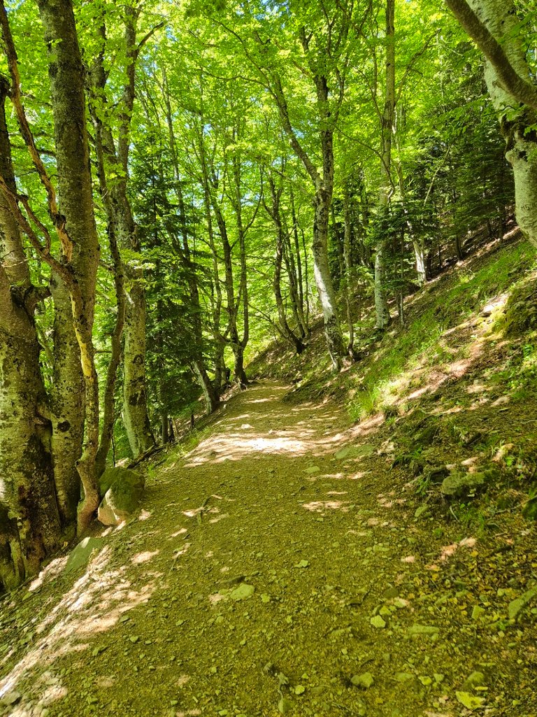
The start is quite steep. Fortunately, it’s shaded. But we had drunk a lot of alcohol the night before and also eaten a lot. All of that didn’t help.

We then arrived at a crossroads. We followed the path to the Grande Cascade. A much nicer path. It was much less steep, so we could chat and listen to the surrounding nature.
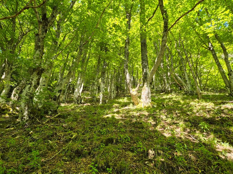
Along the mountainside, we climbed quietly.
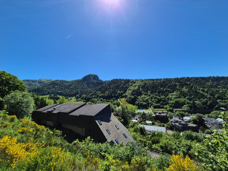
On our right, we could still see the last buildings of the Mont-Dore resort, climbing with us. A bit further in the photo, we spotted a summer sledding track. At least, we saw the climb and could guess the descent snaking down the slope, into the small forest.
We said that if we got down early enough, we might give it a try. But we didn’t really feel like rushing. The hike came before the sled.

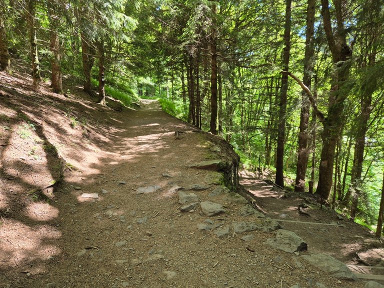
Then, we reached a road, which we simply crossed to change trails and finally leave Mont-Dore. The path went up a bit steeper, but nothing too difficult.
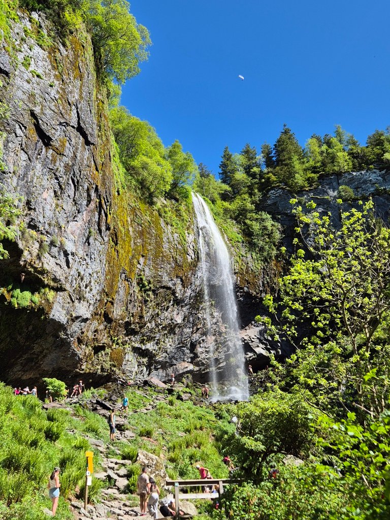
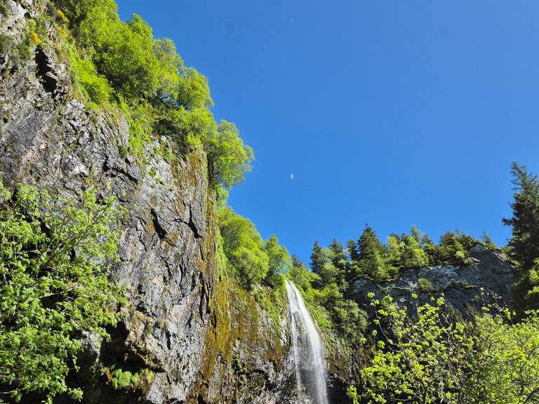
Finally, after an hour of walking, we saw the first signs of a waterfall.


Given the number of fallen trees across the stream and the rocks scattered all over, we thought it would be better not to hang around here in case of a storm or during snowmelt.


At this point, we only had about twenty minutes of walking left. But still 200 meters of elevation to climb. So yes, it was going to be steep.
The air had become much heavier. We were walking alongside a stream, and with all the moisture evaporating, it was stifling.
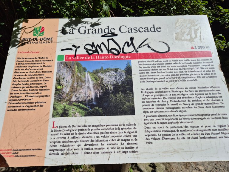
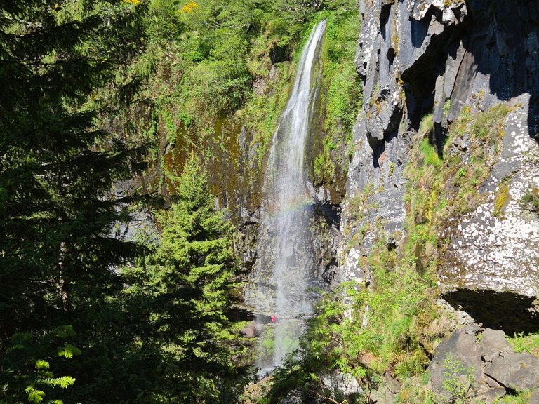
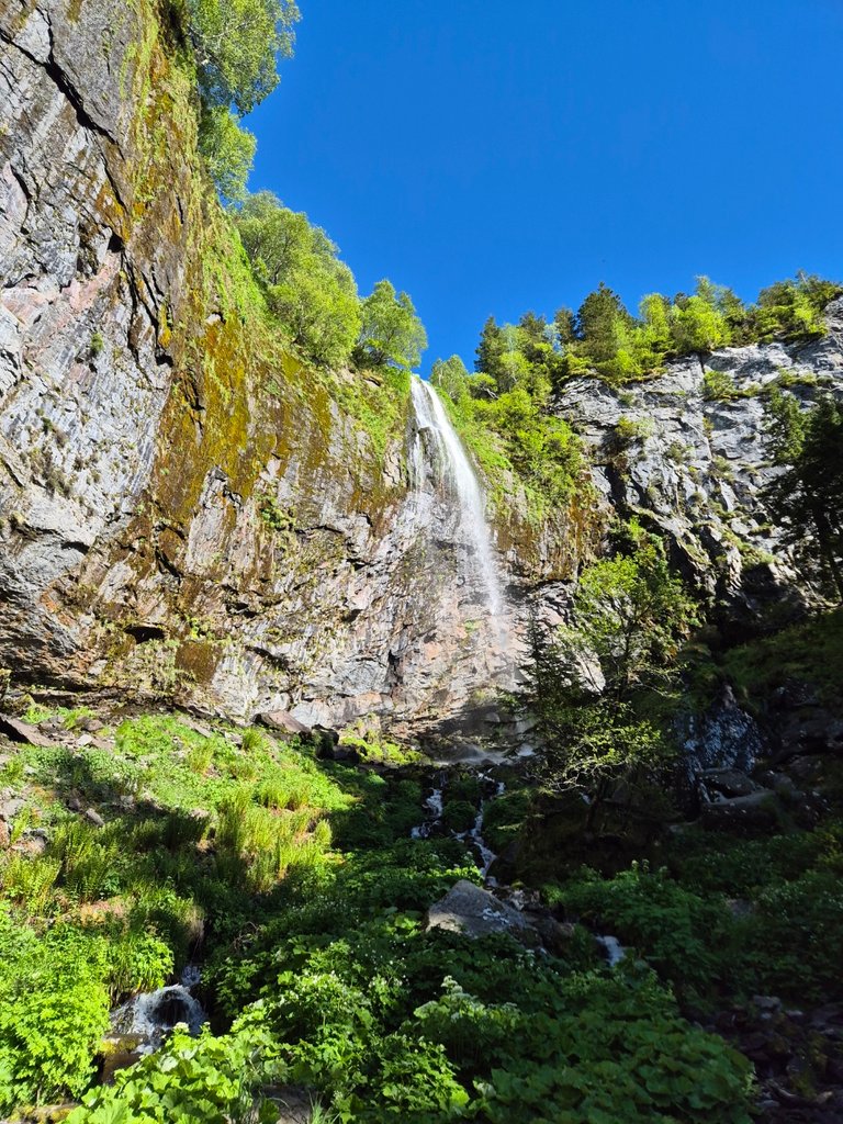
Finally, we reached the Grand Cascade. Here’s what the sign says:
Born from the “ruisseau de l’Enfer,” the Grand Cascade springs from 1450 meters above sea level at the confluence of the Durbise plateau and the Roc de Cuzeau before falling some thirty meters along the walls of ancient lava flows. As such, the Grand Cascade is one of the highest in Auvergne. The resulting stream, called Couze Saurins, eventually joins the tumultuous waters of the Dordogne… The story has continued for 300,000 years!
We ate our wraps here. But since there were a lot of people, we preferred to keep going. On Visorando, I saw that we could climb even higher to reach the GR4 (a much larger trail).
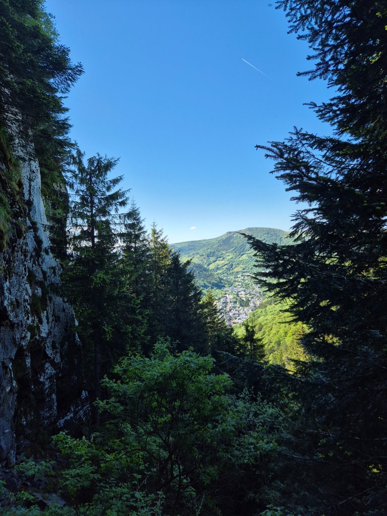
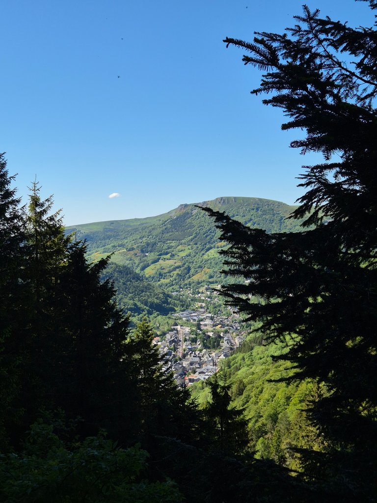
Climbing higher, we had a much more impressive view of the little Mont-Dore resort. This time, it looked much farther away.

We also had another angle on the waterfall. Then came a few steps to climb. I would have preferred to scramble. I hate steps. Especially when they have holes, like here.


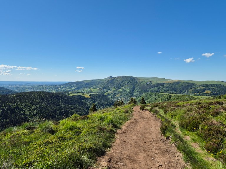
The view was much more interesting up there. I love this region; it's stunning. It’s not high mountain, but it’s more than enough.

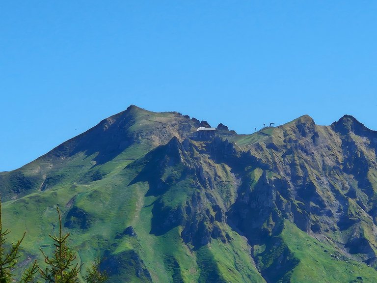
In the distance, you can see the Puy de Sancy. That one is much higher. We went to its summit a few years ago.


So we decided to continue along this small trail.
We clearly weren’t equipped for a big hike, but it made me want to come back. One day, when we're better prepared, I’d really like to hike the entire Chaîne des Puys. It takes several days. But it must be incredible!
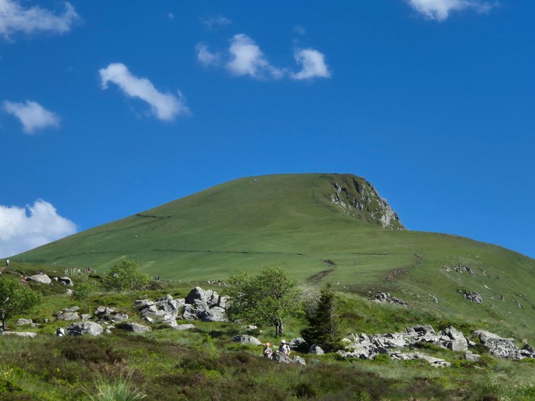
From where we were, we still had the option of climbing to the summit in this photo.
At the time, we didn’t fully realize, but there were still 200 meters of elevation to climb. And above all, we didn’t have a drop of water left. So we decided to turn back here.
It was the wisest choice. We had no equipment, no preparation, and it was nearly 7 p.m. On top of that, we didn’t even know where we’d sleep that night.
In our minds, the plan was to go back down, eat a nice meal in a restaurant, and then hit the road again. We had more than a two-hour drive to get back to my grandfather’s old house, so we couldn’t afford to arrive exhausted.

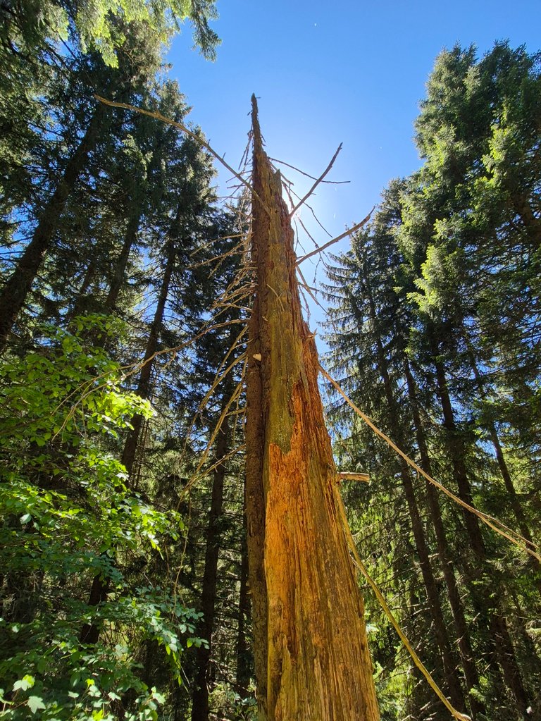
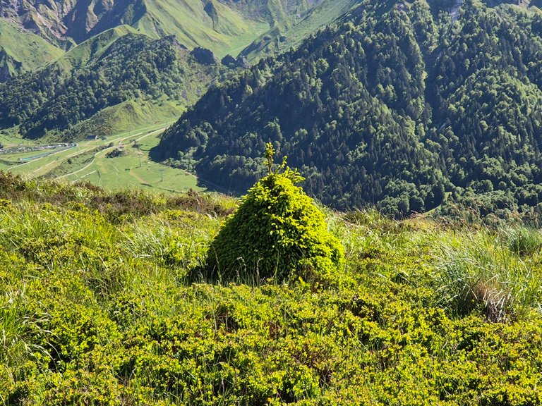
This little fir tree was quite funny:
Before taking the stairs back down to the Grand Cascade, we made a quick detour to its source.


We took the opportunity to dip our feet in the stream and refill our water bottles.
So yes, normally, you shouldn’t drink water from a stream. Even less so in a grazing area. But what I haven’t told you since the beginning is that we set out with very little water. And for two days, apart from alcohol, we hadn’t drunk much else.
Let’s just say it was that or nothing.
Travel shapes the youth.
A bit further, we saw that it was the beginning of the waterfall. We were just five minutes away. So of course, we went to see.
It’s not every day you get the chance to see the start of a waterfall. We’re used to admiring them from below, but never where it all begins.
I’m really afraid of heights, and it was very slippery. But I still tried to get close.
And finally, we went back down to the Grande Cascade. This time, there was almost no one left.

Some reckless people dared to go directly under the waterfall. But the water was falling with tremendous force, and the rocks were really treacherous. Too slippery.
As for us, we settled for the little water streams running along the cliffs. Less impressive, for sure, but more than enough to take a high-pressure, and very refreshing, shower.

Quietly, we began the descent. At the bottom, we passed by the thermal baths. One day, I’ll take @altheana there and we’ll do a cure.

People were already starting to have dinner. We didn’t want a touristy restaurant. So we looked for a more intimate place, higher up in the mountain. And we found it. But that’s another story.

Version Française
Petit retour sur notre tour de France familial de la semaine dernière. Il me reste un moment à vous partager. Un de ceux qu’on garde dans un coin de la tête. Un souvenir qui revient en boucle, parce qu’il fait du bien.
Avant-hier, je vous parlais de notre passage chez ma grand-mère, à Dijon. Après l’avoir quittée, @altheana et moi avons mis le cap sur l’Auvergne, pour voir mon grand-père en maison de retraite. La maison où il a vécu n'est pas encore vendue, nous y avons donc déposé nos affaires et y avons passé la nuit.
Le lendemain midi, on a mangé avec lui, pris le temps de discuter. Vraiment discuter... avant qu'il ne fasse sa sieste. Ces moments-là n’ont pas de prix tant ils sont rares.
Puis on a repris la route. Direction la Creuse, pour aller voir une autre partie de ma famille. Là-bas, le paysage commence doucement à se plier, à onduler. Des collines, des forêts, des prairies, un avant-goût de montagne. Et justement, avec @altheana, ça fait des mois qu’on en parle. On a besoin de relief. De hauteur. De prendre un grand bol d'air frais.
Il y a quelques années, nous avons fait un road trip dans une voiture que nous avions aménagé. En fouillant un peu dans nos anciennes photos, on retombe sur une village : Mont-Dore. Une station thermale nichée dans les montagnes. A seulement 2h de route d’où on est.
Ainsi, on dort une nuit chez ma famille dans la Creuse, et le lendemain matin, on file vers le Mont-Dore. On sait qu'on a envie de marcher, mais nous n'avons pas encore défini de tracé à suivre. Nous avons juste l’envie d’être là-haut. Juste pour voir. Juste pour respirer.
Je vous emmène.
C’était vendredi matin, la semaine dernière. Je dis "matin", mais c'était plutôt fin de matinée.
On a traîné un peu puisqu'on a pris le temps de partager le petit déjeuner avec ce bout de famille creusoise qu’on ne voit qu’une fois tous les deux ans. Le temps de discuter de nos vies, de prendre quelques photos, d'échanger des expériences.
Pour vous dresser le tableau, lorsque nous avons pris la route, il faisait déjà 28 degrés. L’air était chaud et sec. Un avant-goût d’été. On savait que ça serait temporaire puisque la fin de semaine s'annonçait orageuse sur le pays (et ça n'a pas loupé).
Au bout de seulement 50 minutes de route, nous avons aperçu les toutes première petites montagnes. Enfin ! On y arrive !
L'Auvergne est volcanique. Chaque montagne ou presque est un volcan. Simplement, ils ne sont plus très actifs. Ils ne sont pas éteints. Simplement dans une phase de sommeil profond.
La dernière éruption date d'il y a 7 000 ans. Ce qui est, de ce que j'ai compris, très récent à l'échelle géologique.
Sur ma photo, on y voit un petit bout de volcan, alors qu'il nous semblait proche sur les premières photos, nous l'avons vu encore pendant de nombreux kilomètres sans pour autant vraiment nous en rapprocher.
Il était 13h quand on est arrivés à la station thermale. On n’avait rien prévu à manger, et on commençait à avoir un petit creux.
Comme on comptait randonner, on s’est dit que ce serait plus malin de manger avant. Le truc, c’est que tous les magasins de la ville étaient fermés. Ce qui nous a bien surpris, vu que c’était le grand week-end de l’Ascension.
On a donc repris la voiture pour une vingtaine de minutes, à la recherche d’une boutique ouverte. On a fini par trouver un petit magasin où on a acheté des fraises, un avocat, des wraps, du saumon et du fromage frais.
En retirant le noyau de l’avocat, @altheana s’est plantée mon couteau dans la main. Profondément.
Au début, elle ne voulait pas me montrer la plaie. Elle-même n’osait pas regarder, de peur de ce qu’elle allait voir. Quand j’ai enfin pu jeter un œil, j’ai bien cru tourner de l'œil. C’était vraiment profond.
J’ai cru qu’on allait devoir changer nos plans et reprendre la route pour filer aux urgences. Mais j’ai fait un bandage avec ce qu’on avait sous la main. Elle a serré les dents. On a mis les wraps dans un sac à dos. Puis… on est partis randonner.
Avec du recul, je suis encore bluffé par sa force mentale. Ou sa folie, je sais pas trop. D'autant plus qu'elle n’a pas senti une partie de sa main jusqu’au lendemain matin.
Aujourd'hui, une semaine après, la plaie est encore méchante, mais s'est bien refermée.
Entre temps, sur l’application Visorando, j’avais repéré une boucle pas trop longue. La journée était déjà bien avancée, donc il fallait une rando accessible, mais quand même chouette. Un truc qui vaille le coup.
Je dois avouer, j’étais un peu déçu de ne pas être arrivé plus tôt. J’avais vraiment envie de grimper jusqu’à un sommet et de marcher sur la crête. De me retrouver là-haut, avec une vue dégagée qui te remet à ta place.
Mais malgré ça, j’étais heureux d’être là. On était en pleine nature, loin de tout. Dans un endroit que j'apprécie tout particulièrement. C’était déjà beaucoup. Et ça faisait vraiment longtemps que nous voulions voir de la montagne. Même de la basse montagne. Quelques reliefs.
En traversant la station de Mont-Dore, @altheana n’arrêtait pas de me répéter qu’on avait déjà fait cette randonnée, il y a quelques années.
Moi ça ne me disait rien. Aucun souvenir. Je savais que nous étions déjà passé ici pour aller au puy de Sancy, mais pas que nous avions fait une randonnée au départ de Mont-Dore. C’est drôle comme parfois, la mémoire choisit ce qu’elle garde.
Sur la photo ci-dessus, vous pouvez voir le tout début de la Dordogne. Ce petit filet d’eau, étonnamment timide pour la période de l'année, qui s’écoule depuis les flancs du puy de Sancy. Un peu plus loin, il deviendra un fleuve de 483 kilomètres.
Plus on s’approchait du point de départ, et plus quelque chose me revenait. Une impression de déjà-vu.
Cela dit dans ce coin, il y a tellement de sentiers, de forêts, de chemins, que j’ai continué à faire le sceptique.
Puis nous sommes arrivés au marches du début de la randonnée :
Et effectivement, @altheana avait raison. On l’avait déjà faite.
Dans ma tête, on s’était juste arrêtés au Mont-Dore à l’époque pour remplir nos gourdes et bidons d'eau. Mais apparemment, on avait aussi fait une rando.
C’est pas bien grave. Si je l’ai choisie deux fois, c’est qu’elle en vaut le coup !
Le début est assez raide. Heureusement, c'est ombragé. Mais nous avons bu beaucoup d'alcool la veille et avons aussi beaucoup mangé. Dans tout ça ne nous aide pas.
Nous arrivons ensuite à un carrefour. Nous, nous suivons le chemin de la Grande Cascade. Un chemin déjà beaucoup plus agréable. Il est beaucoup moins raide et on peu donc discuter et écouter la nature environnante.
À flanc de montagne, on monte tranquillement.
Sur notre droite, on voit encore les derniers bâtiments de la station du Mont-Dore, qui grimpent avec nous. Un peu plus loin sur la photo, on aperçoit une piste de luge d’été. Tout de moins, on voit la montée et on peut deviner la descente qui serpente dans la pente, dans la petite forêt.
On s’est dit que si on redescendait assez tôt, on se ferait peut-être un tour. Mais on n’avait pas non plus envie de se presser. La rando passait avant la luge.
Puis, nous arrivons sur une route, que nous traversons juste dans sa largeur pour changer de chemin et quitter pour de bon Mont-Dore. Le chemin monte un peu plus fort, mais sans grande difficulté.
Enfin, après 1h de marche, nous voyons les premiers signes d'une cascade.
Vu le nombre d’arbres couchés en travers du ruisseau et les rochers dispersés un peu partout, on s’est dit qu’il ne vaudrait mieux pas traîner ici en cas d’orage, ou lors de la fonte des neiges.
À ce stade, il ne nous restait qu’une vingtaine de minutes de marche. Mais encore 200 mètres de dénivelé à avaler. Donc oui, ça allait grimper assez fort.
L’air était devenu bien plus lourd. On longeait un ruisseau, et avec toute l’humidité qui s’évaporait, c’était étouffant.
Enfin, nous arrivons à la Grand Cascade. Voici ce qu'indique le panneau :
Née du ruisseau de l’Enfer, la Grande Cascade prend sa source à 1450 mètres d’altitude à la confluence du plateau de Durbise et du roc de Cuzeau avant d’entamer sa chute d’une trentaine de mètres le long des parois d’anciennes coulées de lave. De ce fait, la Grande Cascade est l’une des plus hautes d’Auvergne. Le ruisseau qui en découle, appelé Couze Saurins, finit par rejoindre les eaux tumultueuses de la Dordogne… L’histoire se perpétue depuis 300 000 ans !
Nous avons mangé nos wraps ici. Mais puisqu'il y avait beaucoup de monde, nous avons préféré continuer plus loin. Sur Visorando, j'ai vu que nous pouvions encore monter plus haut pour rejoindre le GR4 (un sentier beaucoup plus grand).
En montant, nous avions une vue beaucoup plus impressionnante sur la petite station du Mont-Dore. Cette fois-ci, elle paraissait beaucoup plus loin.
Nous avons également pu avoir un autre angle sur la cascade. Suite à quoi il y avait quelques marches à monter. J'aurais préféré escalader. J'ai horreur des marches. Surtout lorsqu'il y a des trous, comme ici.
La vue était beaucoup plus intéressante là-haut. J'adore cette région, elle est magnifique. Ce n'est pas de la haute montagne, mais c'est largement suffisant.
Au loin, il est possible de voir le puy de Sancy. Lui est beaucoup plus haut encore. Nous étions allés sur son sommet il y a quelques années.
On a donc décidé de continuer sur ce petit chemin.
On n’était clairement pas équipés pour une grosse rando, mais ça m’a donné envie d’y revenir. Un jour, quand on sera mieux préparés, j’aimerais vraiment faire toute la chaîne des Puys. Il faut prévoir plusieurs jours. Mais ça doit être incroyable !
De notre côté, on avait encore la possibilité de monter jusqu’au sommet de cette photo.
Sur le moment, on ne s’en rendait pas trop compte, mais il restait encore 200 mètres de dénivelé à grimper. Et surtout, on n’avait plus une goutte d’eau. Alors, on a pris la décision de faire demi-tour ici.
C'était beaucoup plus sage. Nous n'avions aucun équipement, pas de préparation et il était bientôt 19h. D'autant plus que nous ne savions pas encore où nous allions dormir le soir.
Dans notre tête, le plan c’était de redescendre, puis d’aller manger un bon plat dans un resto avant de reprendre la route. On avait plus de deux heures de trajet pour retourner dans l'ancienne maison de mon grand-père, alors il ne fallait pas non plus qu’on arrive épuisés.
Ce petit sapin était assez marrant :
Avant de reprendre les marches pour redescendre à la Grand Cascade, nous avons fait un petit crochet à sa source.
On en a profité pour tremper nos pieds dans le ruisseau, et remplir nos gourdes.
Alors oui, normalement, on ne boit pas l’eau d’un ruisseau. Encore moins dans une zone de pâturage. Mais ce que je ne vous ai pas dit depuis le début, c’est qu’on était partis avec très peu d’eau. Et que depuis deux jours, à part de l’alcool, on n’avait pas bu grand-chose d’autre.
Disons que c’était ça ou rien.
Les voyages forment la jeunesse.
Un peu plus loin, on a vu que c’était le début de la cascade. On était à cinq minutes à peine. Alors forcément, on y est allés, juste pour voir.
C’est pas tous les jours qu’on a l’occasion de voir le début d’une cascade. On a l’habitude de les admirer d’en bas, mais jamais là où tout commence.
J’ai vraiment le vertige, et c’était très glissant. Mais j’ai quand même essayé de m’approcher.
Et enfin, nous sommes redescendu à la Grande Cascade. Cette fois-ci, il n'y avait plus grand monde.
Certains inconscients se risquaient à aller directement sous la cascade. Mais l’eau y tombait avec une force énorme, et les rochers étaient vraiment traîtres. Trop glissants.
De notre côté, on s’est contentés des filets d’eau qui coulaient le long des falaises. Moins impressionnants, certes, mais largement suffisants pour prendre une bonne douche à haute pression. Et bien rafraîchissante.
Tranquillement, nous avons entamé la descente. Arrivés en bas, nous sommes passés devant les thermes. Un jour, j'y emmenait @altheana et nous y ferons une cure.
Les gens commençaient déjà à passer à table. Nous ne voulions pas un restaurant touristique. Nous avons donc cherché un restaurant plus intime, plus haut dans la montagne. Et nous l'avons trouvé. Mais ça sera une autre histoire.
The English translation was done using the DeepL API, and the images were taken with my smartphone.
Posted Using INLEO
You can check out this post and your own profile on the map. Be part of the Worldmappin Community and join our Discord Channel to get in touch with other travelers, ask questions or just be updated on our latest features.
I remember visiting Mont Dore a few years ago in summer.
Very cold, 14 degrees!
Nice, thorough post.. and incredibly beautiful views!
Not just the mountains but even the greenery and the little towns, everything looks nice there.
A real pity about the wound. Avocados can be extremely slippery 😌
Very nice! Definitely a new hike on my list! Thanks a lot for sharing!
Hiya, @lauramica here, just swinging by to let you know that this post made it into our Honorable Mentions in Travel Digest #2582.
Your post has been manually curated by the @worldmappin team. If you like what we're doing, please drop by to check out all the rest of today's great posts and consider supporting other authors like yourself and us so we can keep the project going!
Become part of our travel community:
!INDEED
!ALIVE
Your post has been manually reviewed for curation by the Principality of Bastion.
Principality of Bastion - Our Leit Motiv? Let's Grow Together.
Principality's site | Minava NFT Market | Discord | Our Twitch Channel
You may TRAIL this account (or @hive-143869) if you like the curation we do, or join our discord to know more about what we do.
Un petit cadeau supplémentaire, un HSBI arrivera d'ici peu.
Pour encourager les posts.
WOW, just WOW!
Merci Beaucoup!
I was totally enthralled by both your photos of this absolutely stunning landscape and your story too!
Merci Merci!
This spot is definitely on my travel list!