Hike to the Top of the Stowe Pinnacle, Vermont
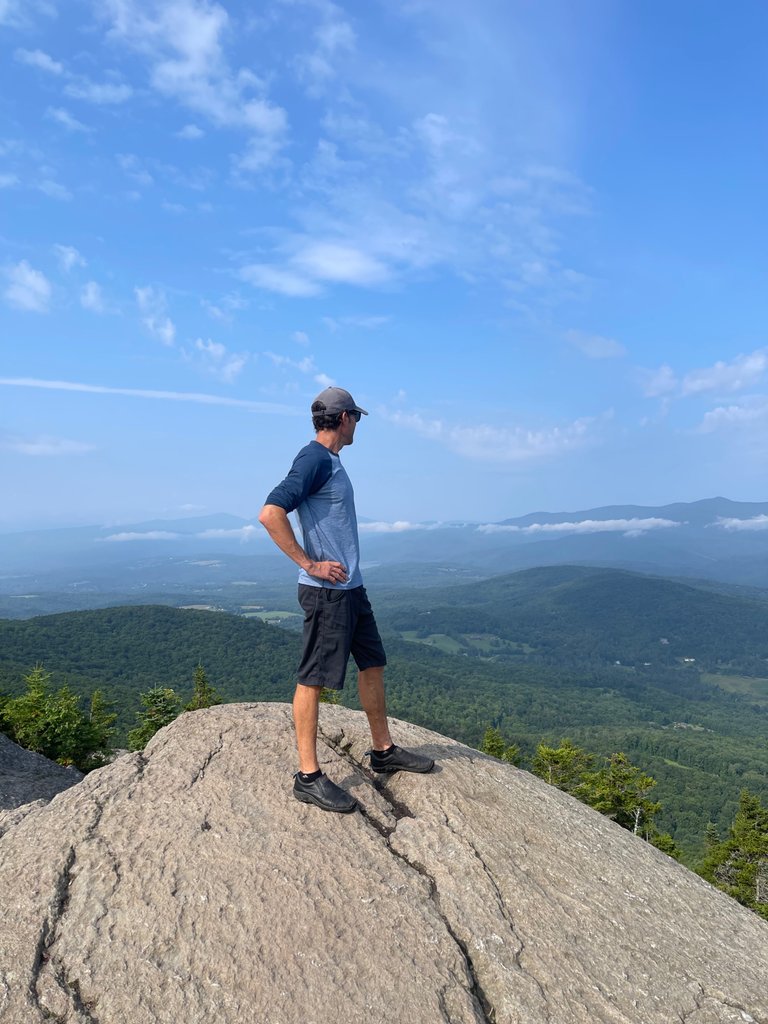
Standing on top of Stowe Pinnacle with amazing panoramic views.
Climbing the Stowe Pinnacle Trail from Pinnacle Meadows offers a quintessential Vermont hiking experience, filled with scenic beauty and a rewarding summit view. The trailhead at Pinnacle Meadows provided ample parking and a gentle introduction to the hike with well-maintained paths and lush greenery. As I began my ascent, the trail winded through a dense forest of maple, birch, and beech trees, creating a cool and shaded environment that is particularly refreshing on a warm summer day. The chirping of birds and the rustle of leaves underfoot accompanied me as I navigated the moderately steep incline, which became more challenging as I gained elevation.
As I approached the summit, the trees began to thin, and the rocky outcrops of the Stowe Pinnacle came into view. The final stretch required a bit of scrambling over rocks, but the effort was well worth it. Upon reaching the summit, I was greeted with a breathtaking panoramic view that stretches across the rolling hills and valleys of Vermont. Today was a clear day, so I could see the Green Mountains, Mount Mansfield, and the Worcester Range in the distance. The open rock face at the top provides an ideal spot to rest, enjoy a picnic, and take in the expansive vistas. The sense of accomplishment and the stunning natural beauty make climbing the Stowe Pinnacle Trail an unforgettable outdoor adventure.
Check out some of these pics from the adventure!
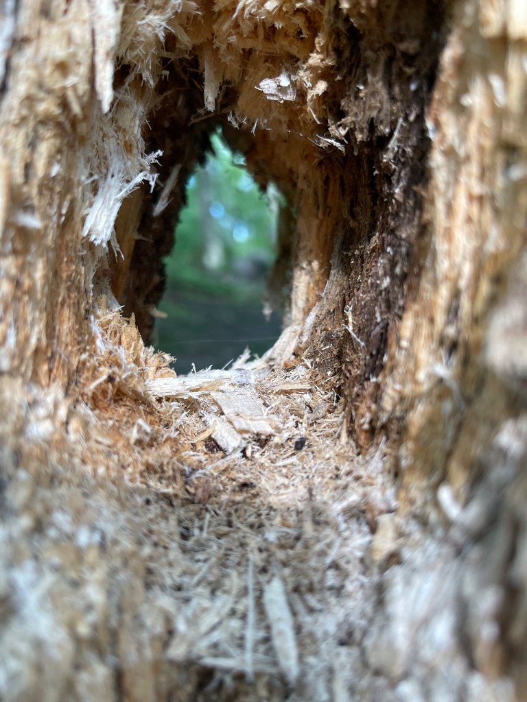
Evidence of a pileated woodpecker on the trail.
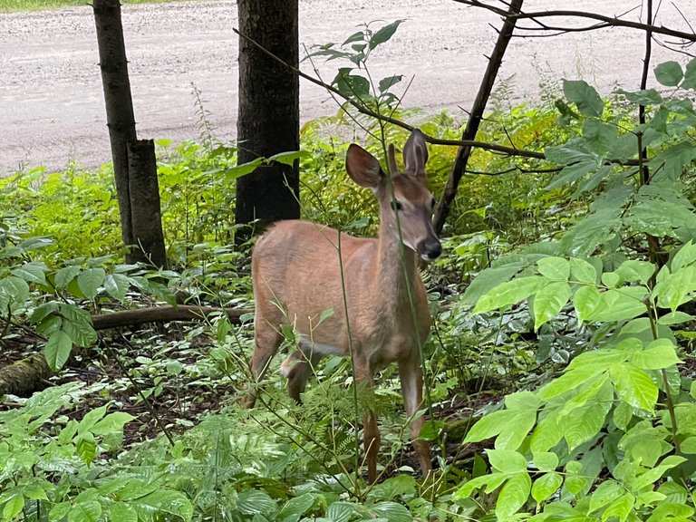
White tail deer checking me out on the way to the trail.
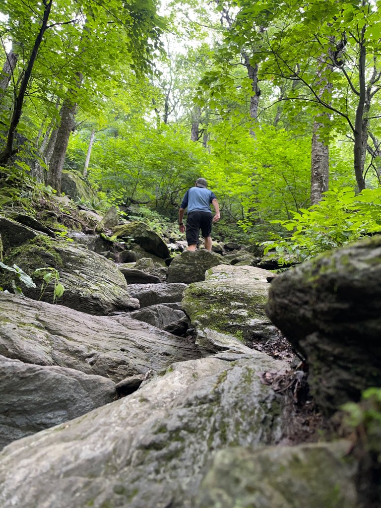
I set the camera on timer mode to get this shot of me hiking up a steeper part of the trail.
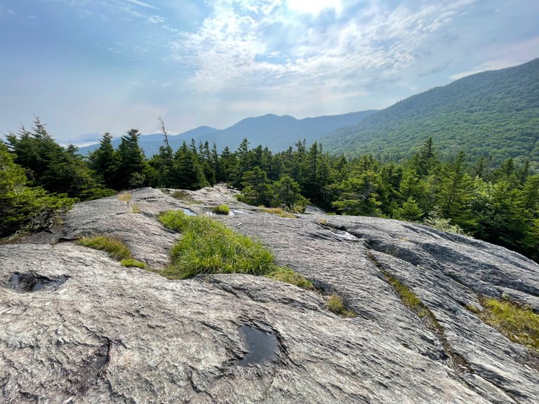
You don't really bust out of the forest until the absolute peak. Then there is this rocky area that gives you three hundred and sixty degree views.
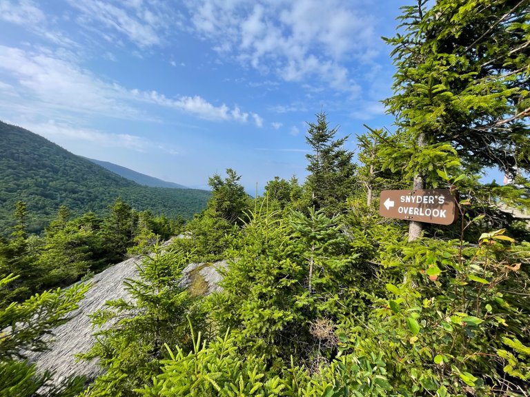
I'm not sure who Snyder is but this leads to a quiet corner of the summit.
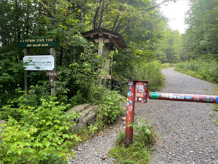
I started the hike at the old parking lot for the Pinnacle Meadows.
Rocky stairs lead the way up.
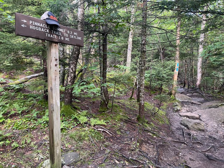
I'm not sure who left their hat, but this is the last trail marker before the summit! Almost there.
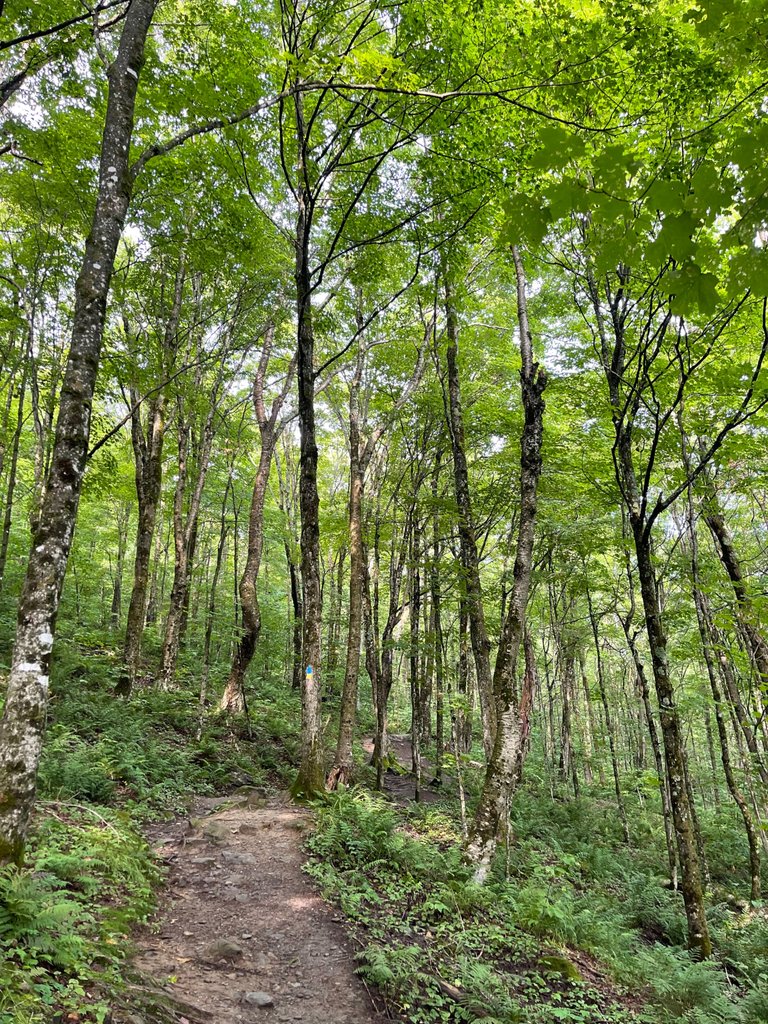
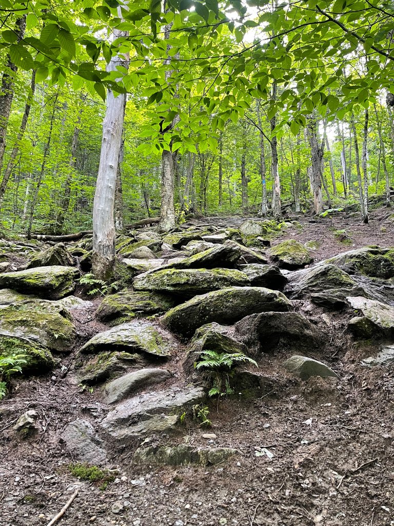
As you gain over 1,000ft in elevation, the forest starts to change and shift.
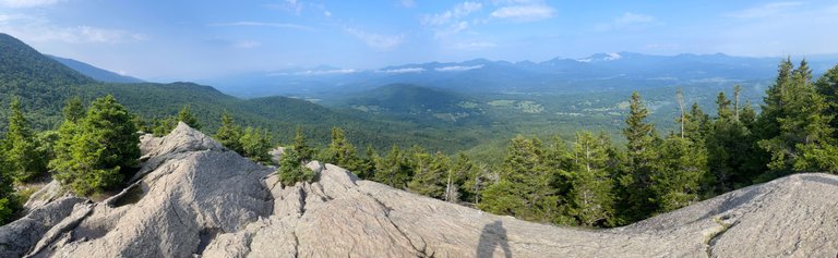
Panorama from the top!
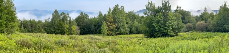
The early morning start meant some cool mist hugging the surrounding mountains.
Check out the location on WorldMappin's interactive blog map: [//]:# (!worldmappin 44.43041 lat -72.64954 long Stowe Pinnacle Summit d3scr)
And as always, keep traveling!
Dai Mar
Congratulations, your post has been added to WorldMapPin! 🎉
Did you know you have your own profile map?
And every post has their own map too!
Want to have your post on the map too?
This post has been manually curated by @steemflow from Indiaunited community. Join us on our Discord Server.
Do you know that you can earn a passive income by delegating to @indiaunited. We share more than 100 % of the curation rewards with the delegators in the form of IUC tokens. HP delegators and IUC token holders also get upto 20% additional vote weight.
Here are some handy links for delegations: 100HP, 250HP, 500HP, 1000HP.
100% of the rewards from this comment goes to the curator for their manual curation efforts. Please encourage the curator @steemflow by upvoting this comment and support the community by voting the posts made by @indiaunited.
WOW, that is absolutely STUNNING.
Truly sensational you lucky thing you!.
Thanks. I should have had my drone up there with me for some really epic shots. Won't make that mistake again!
Hiya, @glecerioberto here, just swinging by to let you know that this post made it into our Honorable Mentions in Travel Digest #2274.
Your post has been manually curated by the @worldmappin team. If you like what we're doing, please drop by to check out all the rest of today's great posts and consider supporting other authors like yourself and us so we can keep the project going!
Become part of our travel community: