Walking the second section of the Coastal Path in Kristiansand, Norway


The second (dark blue) part
On the map you can see the second part,which is marked in blue. My map might not be updated, as the trail is supposed to extend further on both sides of the city.


The first stage ends at the bridge connecting two areas of Kristiansand. It is my starting point today. As you might be able to see on the map, the trail follows the promenade along the city's edge towards the sea. Except for the island of Odderøya, I will be walking in the city.

This is where the river meets the sea


After crossing the bridge, I am in the city center of Kristiansand. The trail follows the river Otra to the point called Tangen, located in the corner of our quardrate shaped city center. At the time Kristiansand was founded in 1641, by King Christian IV, Tangen was just sand. This is where Otra meets the sea. Since the foundation, there has been fortifications and cannon positions, shipbuilding, gunboats during the Napoleonic War (1807-14). Now the whole area is residential area.
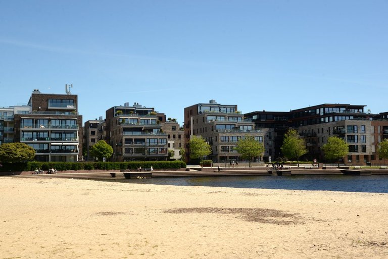
«Bystranda» / beach
"Bystranden" was probably part of the sandy point called Tangen. Definitly a popular beach for the residendents living here. It is not summer yet, so it's quite empty.

The guest harbor
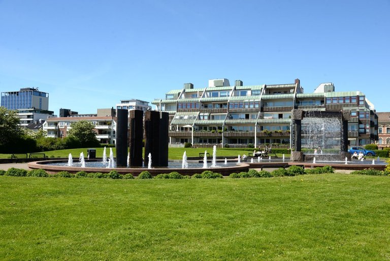
Since Kristansand is a coastal city, there are lots of natural harbours and anchorages, including the guestharbour. By walking along the promenade from Tangen to Odderøya, I pass all the harbours for small boats, including the fortress, parkareas and restaurants.


Christiansholm Fortress was built by king Christian IV. The fortress was part of his defense plan for Kristiansand, built between 1658 and 1672. Usually open during the summer to the public. But many events takes place here during the year.


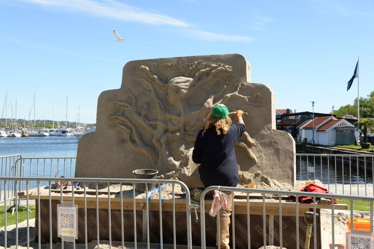
I continue along the beach promenade. Here I see an artist making a sculpture in sand.

Odderøya Museumshavn is my next stop. I pass it because the trail follows the northern side of the Odderøya Island. The museum is not completed yet. But you can see an exhibiton of boats from diferent era's. throughout the summer it's possible to rent a boat here. The plan is an aquarium, but I am not sure when.


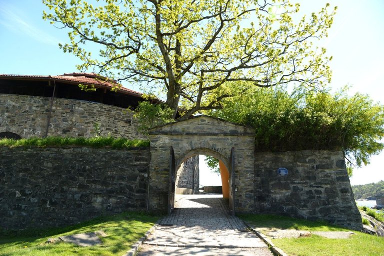
The island, called Odderøya is connected to the mainland with a bridge. Now I step away from the city and follow the route along the coast. The island was closed to the public for many years, because of being a military zone. This lasted from 1667 until late 1990s. The island is now a recreational area, but traces of military activity of some great wars like the Napoleonic Wars and WWII are still evident.

First time I saw a deer on the island

Along the trail, there are maps and information boards telling part of the history of the island. When the military closed down in 1992, the area became accesable and developed as a place where artists could establish themself. The history goes back to the 1796 when Kristiansand decided to erect a quarantine station on the island. Many ships that arrived brought Cholera along. To prevent spreding a quarantine station was established in 1804 and was operative until 1914.There is also a cholera burial ground on the island.


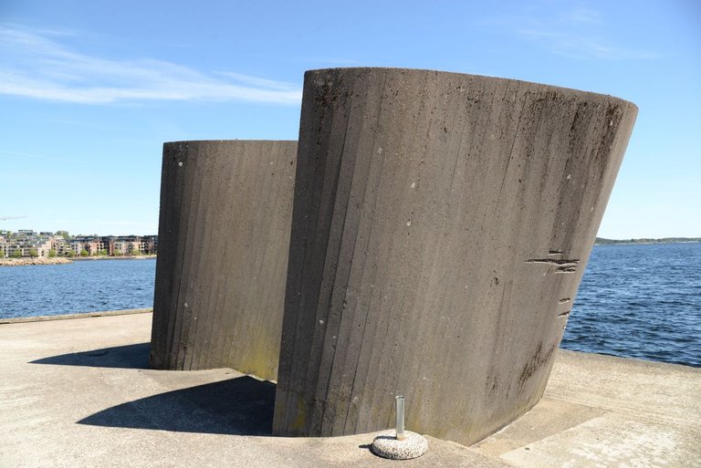
Then I come to the the southern most point. It is a good place to take a rest and enjoy the views. The old cannons dates back to the 1690s. As I continue, I saw the two ferries from "Fjordline" meet.


This is "Kunstsilo". In 2024 the old silos from 1935 was transformed into an art museum. At the time it was built, it was containing grains. After some years it was assumed that it was no longer nessesary to prepere for famine. The silos were left to stand here, until it was picked to house the private art collectiong belongen to Nicolai Tangen. It has already been noticed around the world. In 2025 it came on the New York Times list of 52 places to visit 2025. It has won an architectual prize among others. The building with the orange roof is placed next to Kunstsilo is our theatre called Kilden.

Popular restarant area

Container port

Trainstation

The new policestation
Kristiansand is a port city with a strategic location, often called "The Gateway to Europe". Since the city's establishment in the 17th century, Kristiansand has been an important port city. It has hosted the Tall Ship Race several times. Most recently in 2025. I walk past the Fish Bazaar, the container port and the cruise boat quay. Then on to the ferry terminal, the bus station and the train station. All are located next to each other. The policestation was built last year and localted opposite the old trainstation.

When I reach the bridge I am at the end. When I continue, it will be out of town.
First part of the trail:
https://ecency.com/hive-163772/@digi-me/a-small-section-of-the
Please do follow if you want to keep up with my next travel story. Any upvotes or reblogs are hugely appreciated!
Latest travel story, check out:
Beautiful Dravidian style temple with an amazing location on the island of Mauritius
U.J
Kristiansand, Norway
All the photoes are mine, Ulla Jensen (flickr, Instagram and facebook)
[//]:# (!worldmappin 58.14499 lat 8.00185 long Walking the second section of the Coastal Path in Kristiansand, Norway d3scr)Follow us for our street art contest and blogs about travel, art, photo, crypto & gaming

You can check out this post and your own profile on the map. Be part of the Worldmappin Community and join our Discord Channel to get in touch with other travelers, ask questions or just be updated on our latest features.
Hiya, @glecerioberto here, just swinging by to let you know that this post made it into our Top 3 in Travel Digest #2936.
Your post has been manually curated by the @worldmappin team. If you like what we're doing, please drop by to check out all the rest of today's great posts and consider supporting other authors like yourself and us so we can keep the project going!
Become part of our travel community:
Awesome trail! 👍Amazing nature 👍 Great pics!