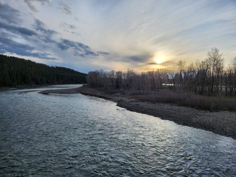
Stoney Trail ~ Bow River Crossing

Nothing beats an evening walk down by the river. The Stoney Trail is a ring road that was completed around the City of Calgary and the Bow River valley bisects the city. The river forms a wide valley in the prairies and originates in the Rocky Mountains just west of here. Since the river often floods, it is best that they built a system of parks and trails down here instead of housing. This photo was taken on the stairs leading up to the community of Valley Ridge.
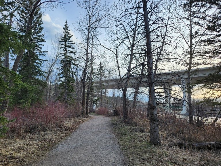
There are paths absolutely everywhere down here, you can walk for thousands of kilometers along paths with footbridges over the rivers and highways in the city. We take full advantage of this system although one day I would love to get some bikes. Many of these trails are mixed use and would be perfect for a hybrid bicycle.
The bridge was recently twinned across the river, now one can get around most of Calgary in 20 to 30 minutes because of this feat of engineering. The biggest challenge in building the highway wasn't this 476 meter causeway but acquiring land from a native reserve that involved some heavy negotiation between the city and the Tsuu T'ina Nation 145 a little south of here. There are also some impressive ridges the highway had to pass through on on the south side of the river.
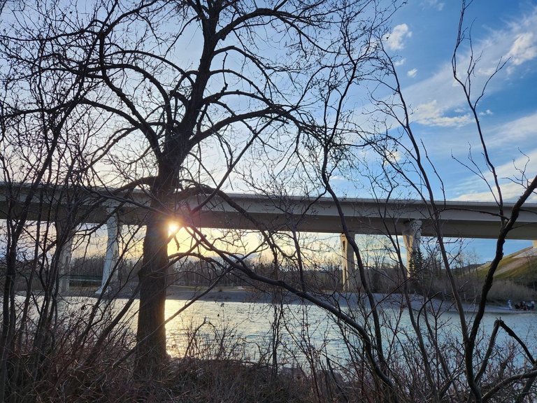
Recently I posted about the Bearspaw reservoir just upstream of this bridge that supplies the city of Calgary with water and controls the flow of the river. During heavy Spring melts, it often breaches its banks. These photos were taken in the fall when the river runs low. I'd like to go back here when the weather warms up a little, it was snowing this morning in Calgary.
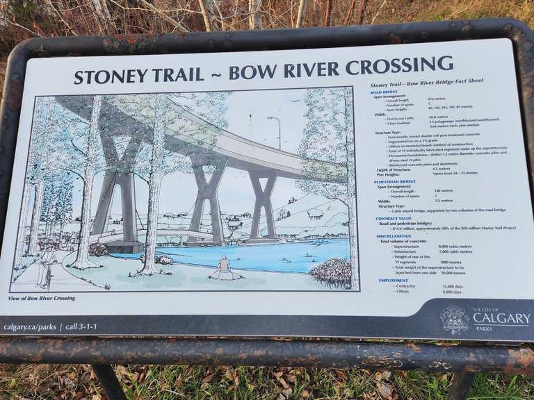
Here is a fact sheet about the bridge, this was from before they twinned the highway here. The new bridge was finished in early 2024 and this sign looks slightly older than that. The pedestrian bridge would have come after the roadway when the suburbs developed on the North and South bank of the river.
There is a good sized park in this part of Calgary called Bowness Park. There is a mini train for children, plenty of areas for picnics and barbequing and it gets very popular on a warm summer's night. People flock here to hang out and party. We enjoy walking around while others enjoy drinking beer and having fires down by the river.
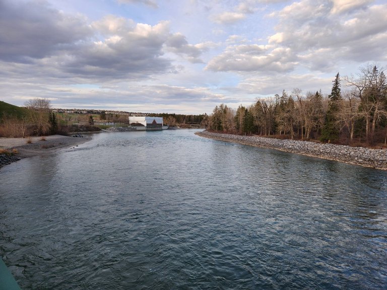
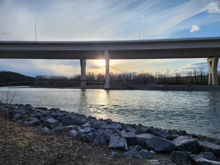
Here is a view of the pumping station downstream from the bridge. It is also where people start a rafting or tubing journey down the river from the North West Suburbs into the heart of Calgary. It is all class one rapids and takes a couple of hours to float into the city centre. That would be quite the day to walk up here and float back down, it gives me an idea for a future adventure.
Thank you for reading and enjoy the rest of your week. All photos were taken with an s24 and are unfiltered.
You can check out this post and your own profile on the map. Be part of the Worldmappin Community and join our Discord Channel to get in touch with other travelers, ask questions or just be updated on our latest features.
The paths are perfect for going on a walk with the beautiful view of the river. This vast area provides different sections where children and adults alike can enjoy some outdoor activities. Evening walk and daytime walk around this site is surely equally interesting. More people will be visiting this place especially that it's already Spring in Canada.
Yes they sure are!
such a beautiful area and a cool bridge
I would say nothing beats a walk byt he water any time of day :)
Thanks for joining the Wednesday walk
Have a great day
My pleasure, it's a little cool this week to be walking down by the river
Hiya, @lauramica here, just swinging by to let you know that this post made it into our Honorable Mentions in Travel Digest #2539.
Your post has been manually curated by the @worldmappin team. If you like what we're doing, please drop by to check out all the rest of today's great posts and consider supporting other authors like yourself and us so we can keep the project going!
Become part of our travel community:
Big thanks!
You are very welcome @crypticat! it was well deserved. ☀️
Keep up the great work 💪