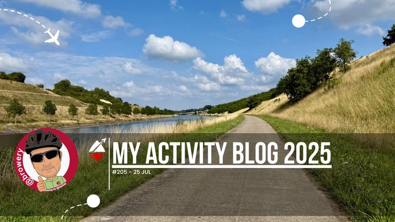
My Activity Blog 2025#205
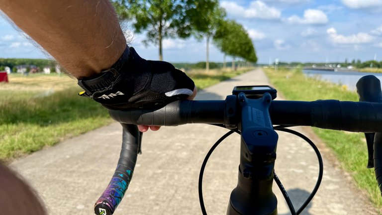
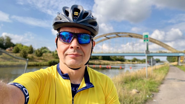
Miało być przełożone z poprzedniego dnia bieganie, a zamiast tego spontanicznie wybrałem się na rower. Całe to zamieszanie przez piekarza, który zrobił sobie urlop wcześniej, niż zapowiedział, i żona nie kupiła chleba na następny tydzień. Postanowiła sprawdzić jakość pieczywa w nowo otwartej piekarni, ale do tego potrzebowała kierowcy, który ją tam zawiezie. Piekarnię znaleźliśmy, ale pechowo znajdowała się tuż obok pizzerii, gdzie byliśmy na moje urodziny ze znajomymi. Mają tam pizzę, której nie można się oprzeć, dlatego miałem więcej kalorii do spalenia niż zwykle – stąd decyzja o rowerze.
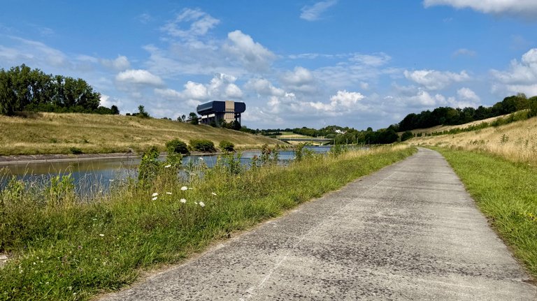
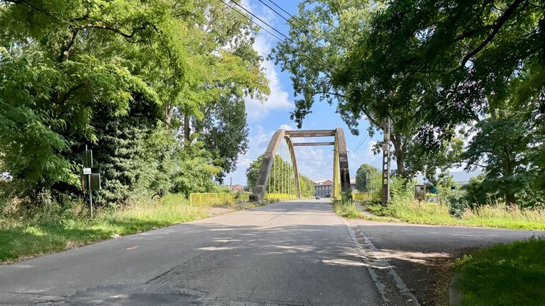
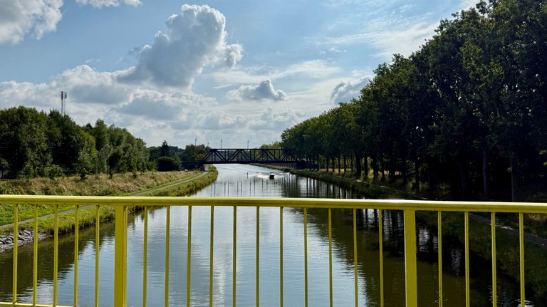
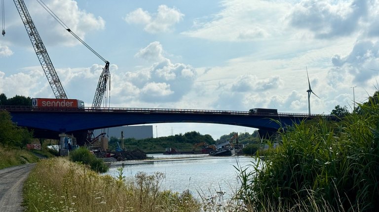
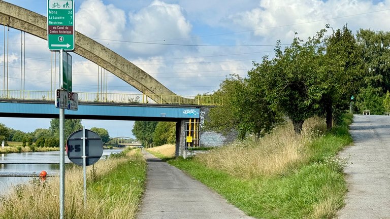
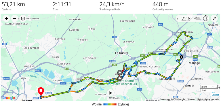
Wybrałem się w kierunku Seneffe, gdyż ciekawił mnie postęp prac na zawalonym moście. Ostatnio pojawiły się tam ogromne dźwigi, więc myślałem, że praca wre. Przecież od kilku miesięcy zablokowany jest kanał łączący Mons z Charleroi i Brukselą, a zwykle był tam duży ruch. Niestety, okazało się, że elementy jezdni zostały usunięte, ale nic poza tym. Z wody wciąż wystaje kadłub zatopionej barki, na którą zawalił się most. Nie wiem, czy akurat tam przepływała w momencie katastrofy, czy była wykorzystywana do prac z poziomu wody.
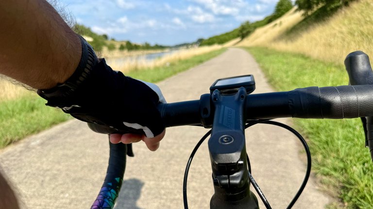
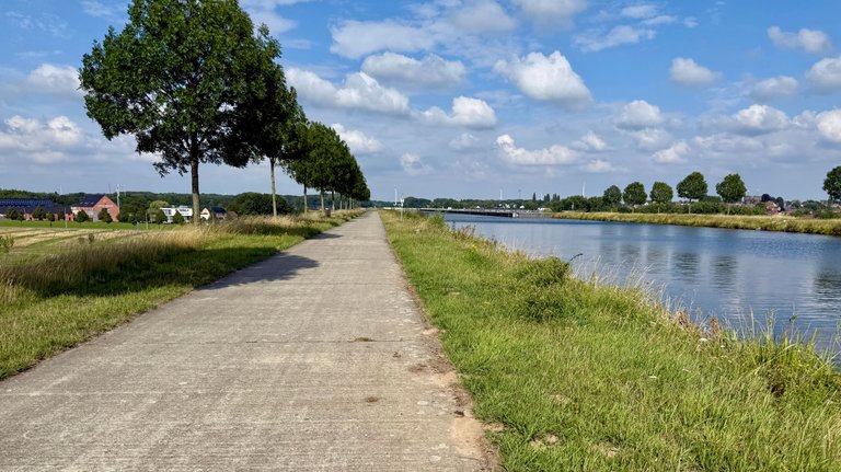
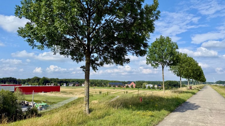
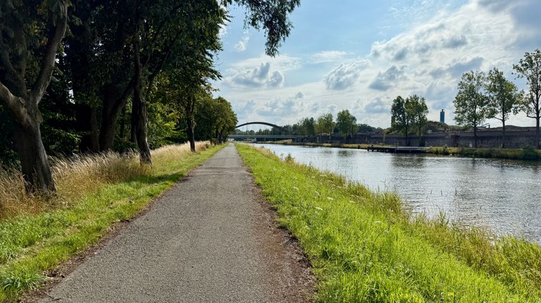
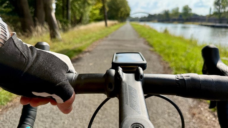
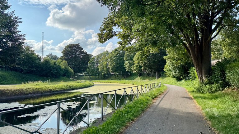
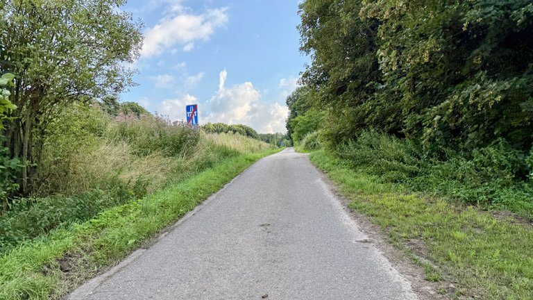
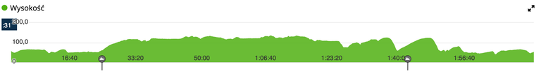
Jazda w tamtym kierunku oznacza konieczność pokonania różnicy wzniesień. Najlepiej to zrobić za jednym zamachem, dlatego zmierzyłem się z podjazdem przy dużej windzie w Strépy-Thieu. Do Seneffe nie dojechałem; odbiłem w stronę La Louvière, gdzie zjechałem na ścieżkę wzdłuż starego kanału. Mogłem spokojnie dojechać tym kanałem aż do Thieu, skąd jest już prosta droga do domu, ale zdecydowałem się na kilka dodatkowych podjazdów. Na pierwszym z nich, „Le Mur de Strépy”, wykręciłem nawet rekordowy wynik. Później zjechałem w dół, po lewej stronie windy i chyba mi odbiło, bo na rondzie zawróciłem i zacząłem się wspinać z powrotem – prawie kilometr o średnim nachyleniu 5% – na „Cote de l'ascenseur”. Ktoś, kto projektował tę drogę, chyba też był kolarzem, bo na początku i na końcu jest rondo. Tym razem zrobiłem tylko jeden podjazd i dwa zjazdy, ale kilka lat temu zrobiłem ich więcej. To doskonała okazja do ćwiczenia jazdy w górach, kiedy najbliższe porządne góry są setki kilometrów stąd.
[ENGLISH VERSION]
The plan was to go for a run postponed from the previous day, but instead, I spontaneously went for a bike ride. The whole mess was because of the baker, who went on vacation earlier than announced, so my wife didn't buy bread for the upcoming week. She decided to check out the quality of the bread at a newly opened bakery, but for that, she needed a driver to take her there. We found the bakery, but unfortunately, it was located right next to the pizzeria where we had been with friends for my birthday. They have a pizza there that you just can't resist, which meant I had more calories to burn than usual – hence the decision to go for a bike ride.
I headed towards Seneffe, as I was curious about the progress of the work on the collapsed bridge. Huge cranes had recently appeared there, so I thought the work was in full swing. After all, the canal connecting Mons with Charleroi and Brussels has been blocked for several months, and it's usually a busy waterway. Unfortunately, it turned out that the road sections had been removed, but nothing else. The hull of the sunken barge on which the bridge collapsed is still sticking out of the water. I don't know if it was just passing through at the moment of the disaster or if it was being used for work from the water level.
Riding in that direction means having to overcome elevation changes. It's best to do it all in one go, so I tackled the climb by the large boat lift in Strépy-Thieu. I didn't make it to Seneffe; I turned towards La Louvière, where I got onto the path along the old canal. I could have easily ridden along that canal all the way to Thieu, from where it's a straight road home, but I decided on a few extra climbs. On the first of them, "Le Mur de Strépy," I even set a personal record. Later, I descended on the left side of the lift and I must have lost my mind, because at the roundabout, I turned back and started climbing again – almost a kilometer with an average gradient of 5% – up the "Cote de l'ascenseur." Whoever designed this road must have been a cyclist too, because there's a roundabout at the beginning and the end. This time I only did one climb and two descents, but a few years ago, I did more. It's an excellent opportunity to practice mountain riding when the nearest proper mountains are hundreds of kilometers away.


Dystans pokonany w 2025 roku: 3214,80 km — z podziałem na dyscypliny:
| Dyscyplina | Dystans |
|---|---|
| Spacer / Marsz / Nordic Walking | 1773,09 km (+5,38 km) |
| Kolarstwo / Rower MTB | 518,71 km (+53,21 km) |
| Jogging / Bieganie | 771,03 km |
| Ergometr wioślarski | 19,52 km |
| Orbitrek | 185,66 km |
| wander.earth 2025 | 215,93 km (+7,67 km) |

_This report was published via Actifit app ([Android](https://bit.ly/actifit-app) | [iOS](https://bit.ly/actifit-ios)). Check out the original version [here on actifit.io](https://actifit.io/@browery/actifit-browery-20250726t070508974z)_


Congrats on providing Proof of Activity via your Actifit report!
You have been rewarded 408.9219 AFIT tokens for your effort in reaching 18601 activity, as well as your user rank and report quality!
You also received a 2.30% upvote via @actifit account.
Rewards Details
To improve your user rank, delegate more, pile up more AFIT and AFITX tokens, and post more.
To improve your post score, get to the max activity count, work on improving your post content, improve your user rank, engage with the community to get more upvotes and quality comments.
Niezłe statystyki :) i dobre zdjęcia z aktywności
Dziękuję i polecam się na przyszłość.
Napewno jeszcze tu zajrzę :)